General Central/Eastern Kansas Forecast
Short-Term (Friday-Saturday)
Scattered showers will be ongoing throughout the morning hours across southeast Kansas, as this weak upper-level low slowly departs off to the west towards Missouri. New rainfall totals from these showers may total to up to .25 inches with the heavier bands. Otherwise, the rest of the area will stay dry throughout the afternoon and evening hours. Temperatures will range from the upper 70s (in SE KS) to upper 80s (Central KS) throughout the day, with winds out of the east-southeast at around 5 mph. As mentioned in previous forecasts, moisture will continue to increase across the state, with dew point temperatures in the mid to upper 60s and relative humidity values between 50-75%. Low temperatures tonight will range between the mid 60s to low 70s.
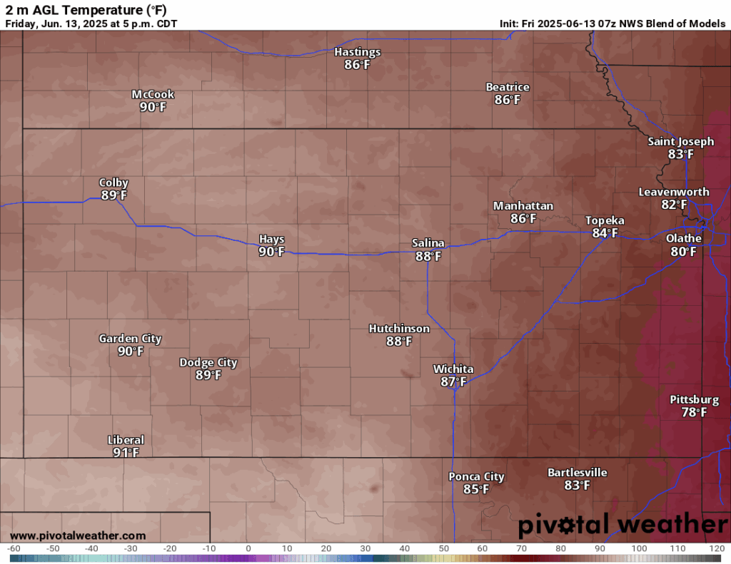
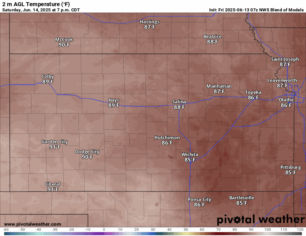
Rain chances will look to shut down on Saturday with high pressure moving back over the area, however, a stray shower or thunderstorm can’t be ruled out entirely in the afternoon. Temperatures will once again be back into the mid 80s to low 90s, with winds generally out of the southeast at 5 to 10 mph. Dew point temperatures will also look to increase somewhat to the upper 60s and low 70s. Relative humidity values due to the increasing moisture will continue to hover around 50-70%. Overnight lows will be quite balmy, being in the low 70s across the region. As the sun goes down, thunderstorm activity may increase in intensity, particularly in south-central Kansas.
Long-Term (Sunday-Thursday)
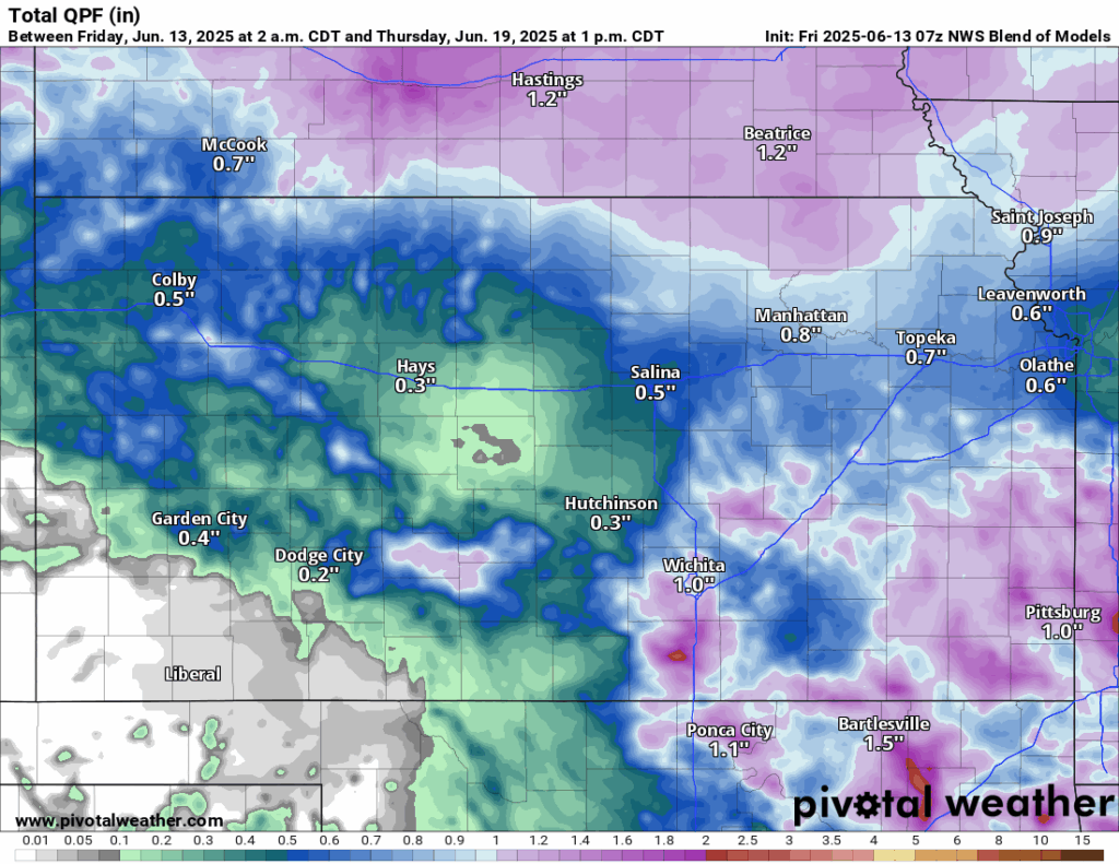
High pressure will meander over us heading into the early week before it breaks down and more zonal flow aloft overspreads us. This would open the door for periodic rain chances starting on Tuesday and lasting through most of next week. Temperatures next week will stay rather consistent in the upper 80s to low 90s, and higher heat indices may need to be monitored, especially if we get dew point temperatures approaching the mid 70s by mid next week. Relative humidity values during the daytimes look to stay consistently between 50% (closer to central Kansas) and ~70% (further towards east/southeast Kansas).
Regional Soil Moisture Forecast
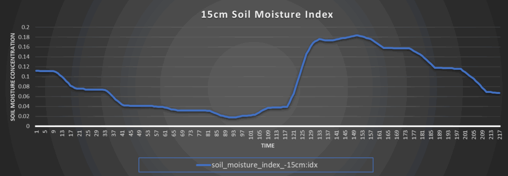
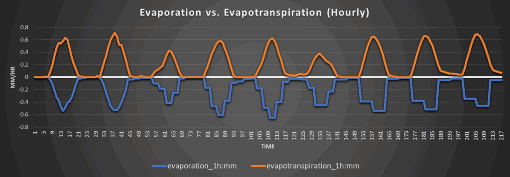
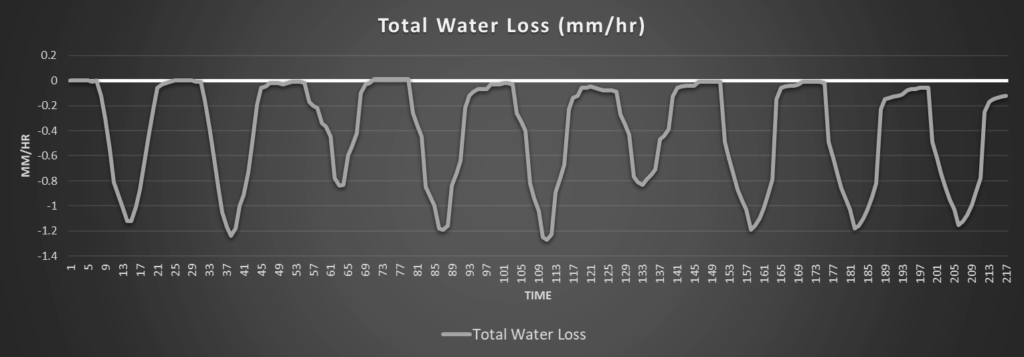
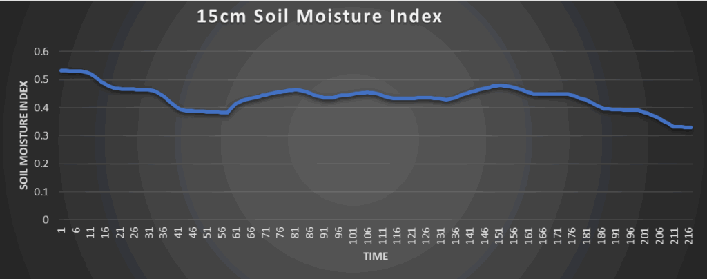
Around Westmoreland
Around Scranton
Around Burlington

Around Altoona