Yesterday, tropical depression Four-E in the East Pacific strengthened into a tropical storm, now named Dalila. Following Dalila’s tracks is another disturbance. Fortunately, there is still no tropical activity in the Atlantic Basin, and none is forecasted for the next week. Let’s take a closer look at Dalila and the disturbance, as well as what’s going on in the Atlantic.

Tropical Storm Dalila
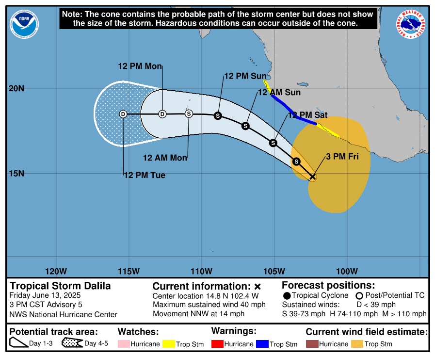
Tropical Storm Dalila is moving north-northwestward at around 14 mph, with peak sustained winds of 40 mph. It’s minimum central pressure is 1001 mb. Dalila is forecasted to travel along the southern coast of Mexico through Saturday and start to veer off westward deeper into the Pacific by Sunday.
The main concerns on land for Delila is heavy rainfall and tropical storm force winds for parts of Mexico, including the states of Guerrero, Michoacán, and Colima. Check out the precipitation forecast for the weekend:
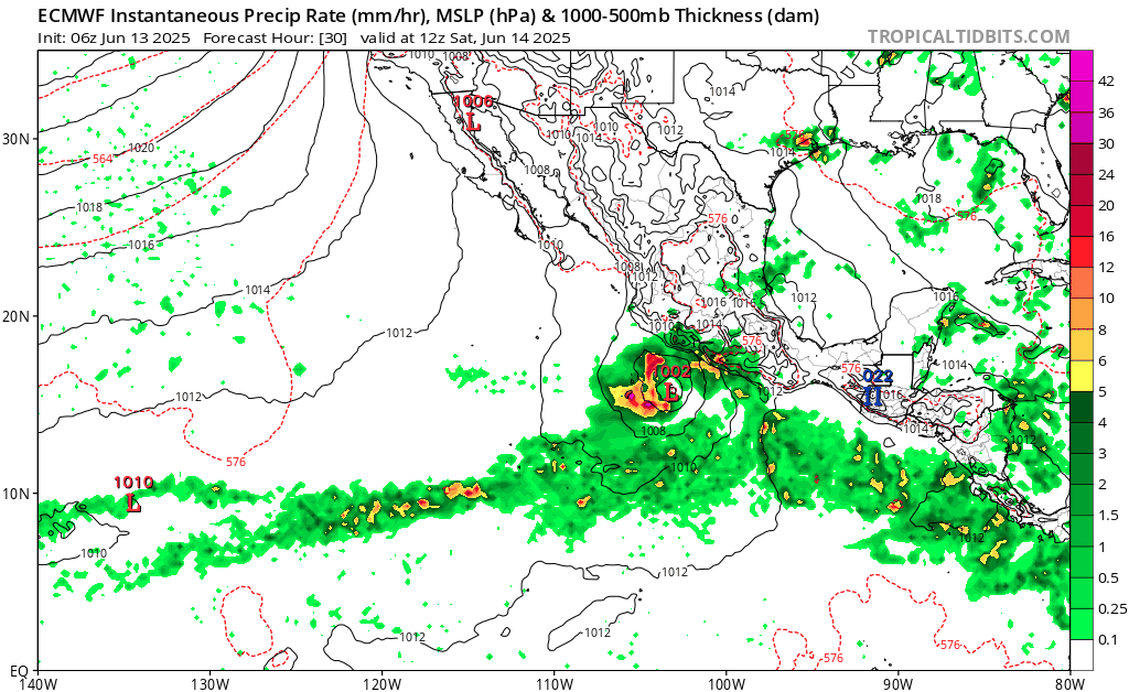
Heavy rainfall is forecasted for up to six inches in these areas. This large amount of rain in such a short time can lead to flooding and mudslides, especially in steeper areas, so that is definitely a concern to look out for.
The other main risk on land is tropical storm force winds blowing onto land today. These strong winds are forecasted from Playa Pérula down to Lázaro Cárdenas.
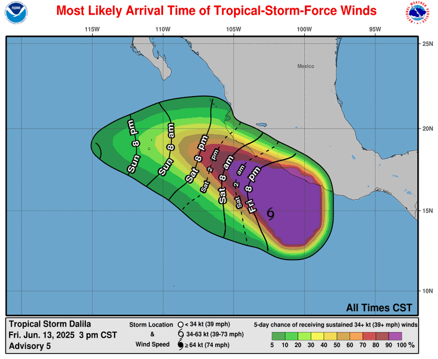
Here are the expected arrival times of the tropical-storm-force winds, we can see that they will continue to have impacts on land through Saturday evening. During these times it will be crucial to stay inside in a safe place and wait for these winds to pass.
Another Disturbance in the Pacific
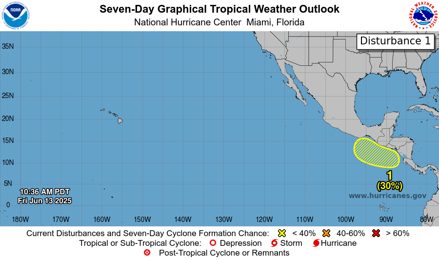
There is also another disturbance moving west-northwestward off the coast of Central America. This disturbance has a 30% chance of forming into a tropical cyclone in the next week. The chance of formation in the next couple of days is practically zero, though. There is an area of low pressure being forecasted to form by next week, and environmental conditions are looking good for tropical activity. Humidity remains high and is forecasted to stay high for now. Take a look at the sea surface temperatures below: ocean temperatures in the area of the disturbance are looking well above the threshold needed for tropical cyclones to develop.
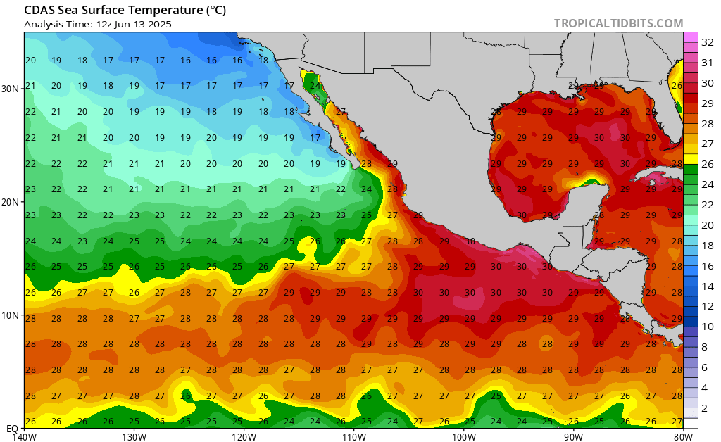
Wind shear will also remain relatively high in the area until around Monday morning, so the area of low pressure would have to develop early next week for this disturbance to also develop.
So, if this low pressure area ends up developing at the right time, this disturbance could definitely strengthen into a tropical cyclone of some sort, but this development would be slow and we probably wouldn’t see it until early next week.
Current Setup in the Atlantic:
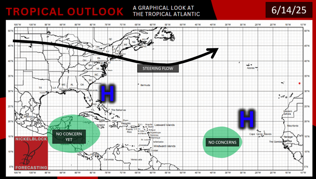
Here you can see what’s going on in the Atlantic today. We have a nice area of high pressure right over the Atlantic Basin that’s keeping any sort of tropical systems away. There is also another high pressure area across the pond west of the Sahara.
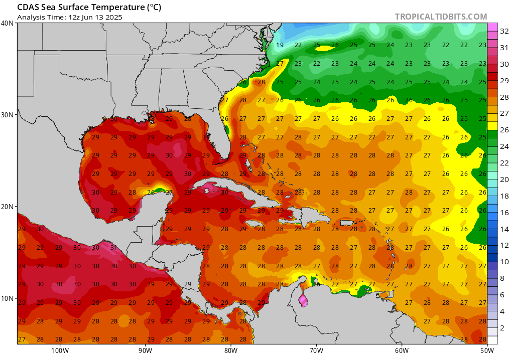
While sea surface temperatures in the Gulf are quite high, in the Atlantic Basin ocean temperatures are either not warm enough or just barely warm enough to encourage tropical activity. Relative humidity is also low, with the Saharan dust keeping the air dry. Wind shear in the area will start to calm down in the next day or so, which is something to look out for, but in combination with somewhat low sea surface temperatures and low humidity, shouldn’t be too much of a concern for now.
So, there’s not much to worry about in the Atlantic for now, and we will keep an eye on Tropical Storm Delila and the other disturbance in the East Pacific. Stay tuned to NickelBlock for more updates!


