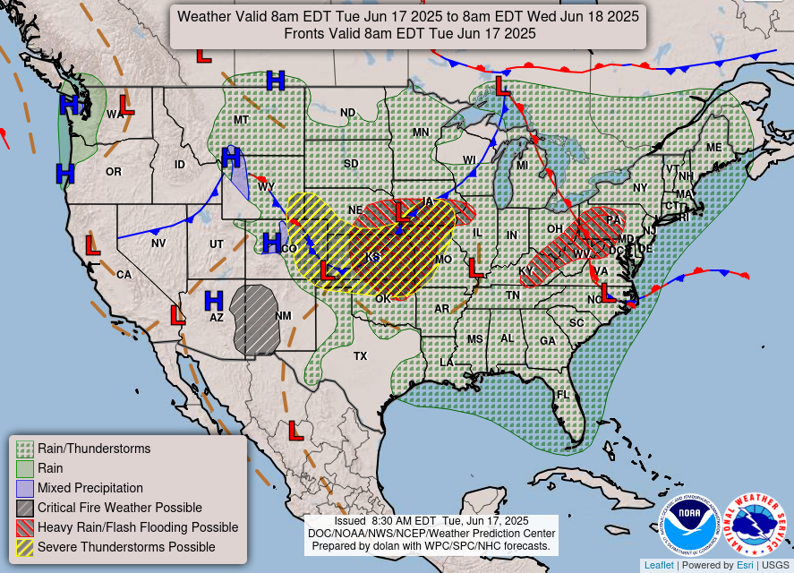
The weather pattern across the Southeast continues to be governed by intense solar heating near the summer solstice, a persistent Gulf moisture feed, and mesoscale convective processes. With no dominant synoptic-scale systems in place, the region remains under the influence of diurnally driven thunderstorms, high humidity, and dangerous heat indices. A strengthening Atlantic ridge will gradually suppress rain chances late in the week, but not before several rounds of convection and locally heavy rainfall.
Solar Insolation and Boundary Layer Instability
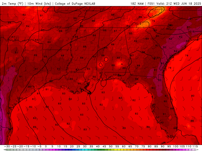
High temperatures for Wednesday from the NAM model. //Courtesy: College of DuPage
As the solar declination peaks near 23.5°N, the Gulf Coast receives maximum insolation, particularly during midday hours. Surface temperatures will climb into the low to mid-90s°F, with urban heat island effects pushing heat indices into the upper 90s to low 100s°F. This intense heating deepens the planetary boundary layer, enhancing CAPE values and promoting afternoon thunderstorm development, especially where sea breeze fronts and outflow boundaries intersect.
Gulf Moisture Advection and Saturated Profiles
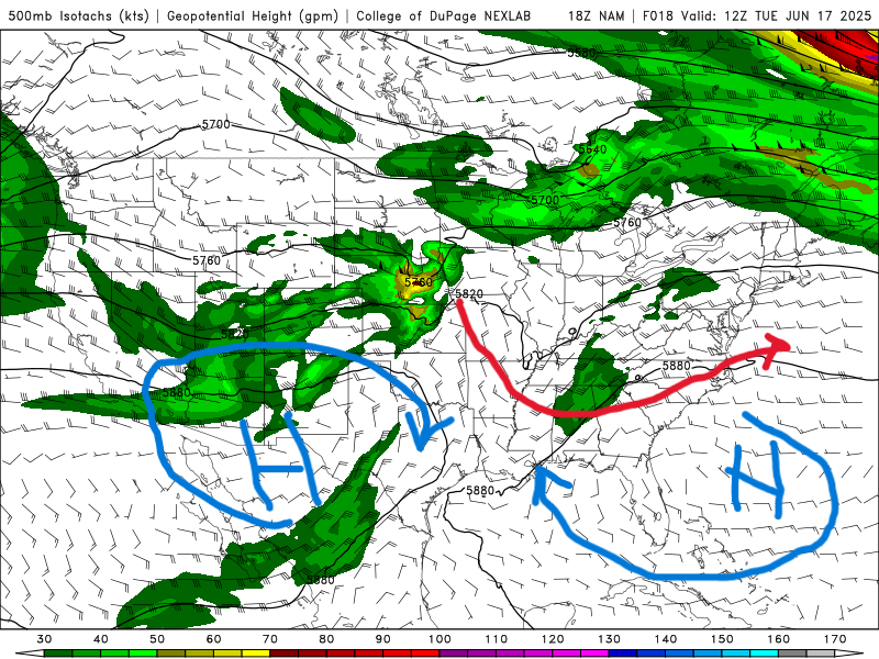
500mb map for Tuesday from the NAM model. //Courtesy: College of DuPage
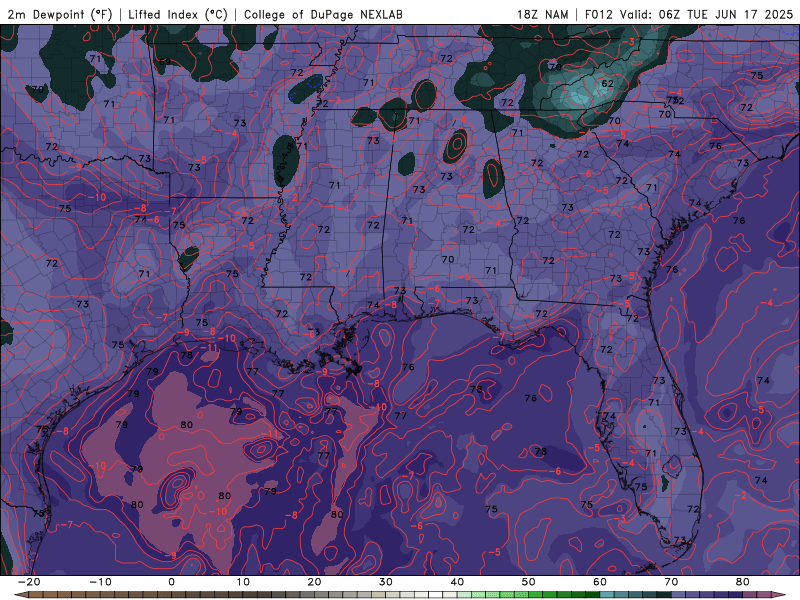
Dew Point temperatures for the next 3 days from the NAM model. //Courtesy: College of DuPage
A southerly low-level jet, anchored by a Bermuda High off the east coast of Florida, continues to funnel maritime tropical air into the region. Dew points in the mid-70s°F and PWAT values exceeding 2.0 inches will maintain a deeply saturated boundary layer, ideal for efficient rainfall production. This moisture-rich environment supports tall, moisture-laden convective towers, capable of producing torrential downpours, frequent lightning, and localized flooding.
Atmospheric Instability and Thunderstorm Dynamics
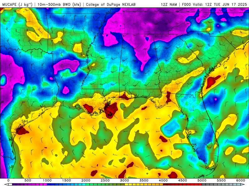
Most unstable CAPE/shear for the next 3 days from the NAM model. //Courtesy: College of DuPage
Forecast soundings reveal CAPE values between 2000–3000 J/kg, with steep lapse rates and minimal convective inhibition. While bulk shear remains weak, favoring pulse-type convection, mesoscale interactions, particularly outflow collisions and sea breeze convergence zones, will enhance storm organization. Expect scattered to numerous thunderstorms, especially during the afternoon and early evening hours, with locally strong wind gusts and brief heavy rainfall.
Upper-Level Features and Synoptic Overview
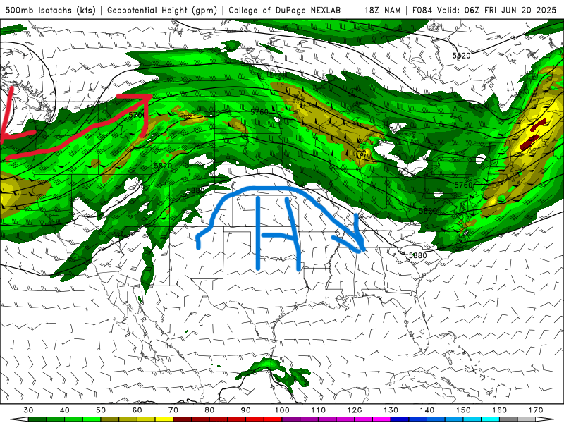
National Forecast Map for Tuesday. //Courtesy: NWS 500mb map for Friday. //Courtesy: College of Dupage
From today through the weekend, the mid-level atmospheric pattern over the Southeast will be defined by a weakly anticyclonic 500 mb flow, typical of early summer subtropical ridging. This setup promotes broad subsidence, which generally inhibits widespread convection. However, embedded within this flow are subtle shortwave troughs, small-scale ripples in the mid-level wind field, that can momentarily enhance upward motion. These shortwaves are not strong enough to produce organized severe weather, but they can locally erode convective inhibition (CIN), especially during peak heating hours when surface-based instability is maximized. On days like Thursday and Friday, this may result in isolated to scattered thunderstorms, particularly where mesoscale boundaries, like sea breezes or outflow collisions, provide additional lift. By Saturday and Sunday, the upper-level ridge begins to amplify, strengthening the cap and suppressing vertical motion across much of the region. This will lead to decreasing storm coverage, but also increasing heat stress, as subsidence warms the mid-levels and traps heat near the surface. Expect highs in the low to mid-90s°F, with heat indices pushing 100–105°F, especially in urban corridors and inland areas. In short, early in the period, minor disturbances may sneak in just enough lift for storms, but by the weekend, the ridge takes control, dialing back rain chances and turning up the heat.
Regional Day-to-Day Forecast
Tonight – Partly to mostly cloudy and warm with a few lingering showers or thunderstorms possible before dawn. Low near 77°F. Light southwest winds. Rain chance: 40%.
Wednesday – Partly sunny early, then scattered afternoon thunderstorms developing, especially inland. High near 89°F. Southwest winds at 10–15 mph. Rain chance: 50%.
Wednesday Night – Warm and muggy with a few evening storms possible. Low around 77°F. Light southwest winds. Rain chance: 30%.
Thursday – Mostly sunny with isolated afternoon thunderstorms. High near 90°F. Southwest winds at 10–15 mph. Rain chance: 30%.
Thursday Night – Partly cloudy and humid. Low around 77°F. Rain chance: 20%.
Friday – Summer solstice. Hot and mostly sunny with only a slight chance of a stray storm. High near 92°F. Heat index near 100°F. Southwest winds at 10–15 mph. Rain chance: 20%.
Friday Night – Mostly clear and warm. Low around 78°F. Rain chance: 10%.
Saturday – Mostly sunny and hot with isolated afternoon storms possible. High near 93°F. Southwest winds at 10–15 mph. Rain chance: 20%.
Saturday Night – Partly cloudy and warm. Low around 78°F. Rain chance: 20%.
Sunday – Increasing clouds with scattered afternoon thunderstorms returning. High near 91°F. Southwest winds at 10–15 mph. Rain chance: 40%.
Sunday Night – Mostly cloudy with a few showers or storms possible overnight. Low around 77°F. Rain chance: 30%.
Monday – Partly sunny with scattered thunderstorms, especially in the afternoon. High near 89°F. Rain chance: 50%.
Monday Night – Warm and humid with a chance of lingering storms. Low around 76°F. Rain chance: 40%.


