As suspected, the tropical depression known as five-E has strengthened to a tropical storm and received a new name – Erick. This tropical storm is forecasted to make landfall on the southern coast of Mexico, possibly as hurricane status, on Thursday morning. The main risks of Erick are localized heavy rainfall, mudslides, flash flooding, and tropical storm force winds . We will also get into the details of what’s going on in the Atlantic, and why it has been so quiet this hurricane season.
[wpcode id=”41149″]
Tropical Storm Erick:
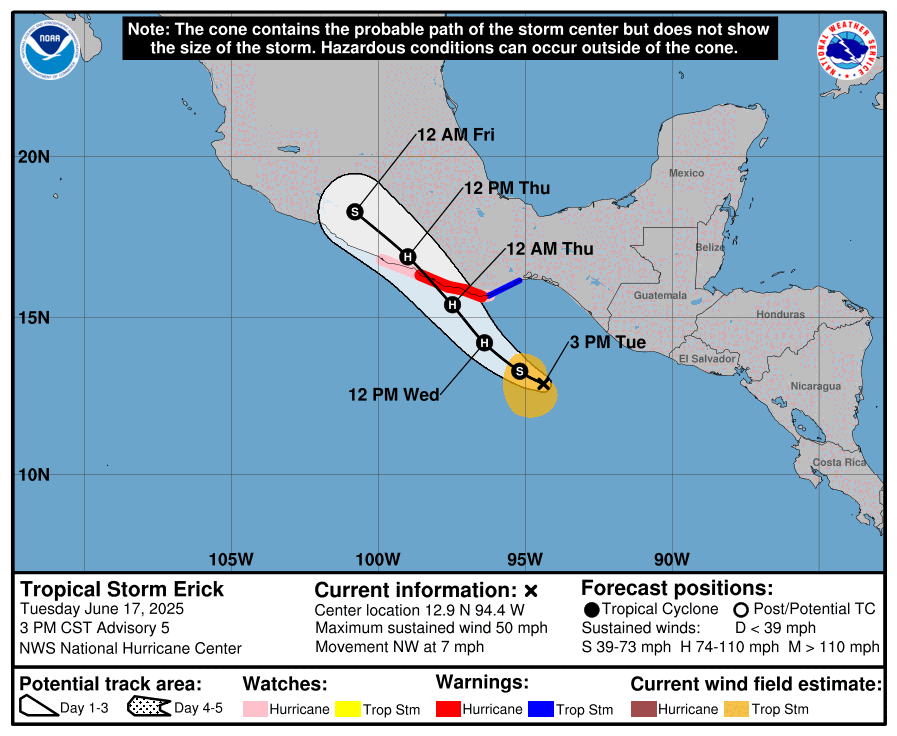
Erick is currently located off the coast of Guatemala, and is making its way toward Mexico at about nine mph. Its minimum central pressure is 1001 mb, and its peak sustained winds are 50 mph.
Erick is forecasted to make landfall on Mexico around Thursday morning, and it is important to note that Erick is still strengthening and doing so rapidly, so it is possible that it makes landfall as a major hurricane. In fact, there is already a hurricane warning posted for parts of the Oaxaca coast. This is due to the many environmental factors encouraging hurricane activity, such as warm ocean temperatures, high humidity, and low wind shear in Erick’s path.
Concerns on land from Erick:
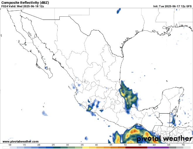
There are a couple different effects from Erick that could manifest on land, one risk being heavy rainfall. In parts of the coast of Oaxaca and Guerrero, 12-16 inches of rain have been forecasted, and even more than 16 inches of precipitation is possible in localized parts of these areas. The more inland parts of Oaxaca and Guerrero have 6-12 inches of rain forecasted. In surrounding regions of Mexico and even parts of Guatemala and El Salvador, 1- 6 inches of precipitation is possible. Check out the GFS model for the precipitation caused by Erick from today through the rest of the week:
Because rainfall will be so heavy, there is an associated risk of flash flooding and even mudslides in steeper terrain. Storm surge from Erick can cause flooding in coastal areas as well. It is also important to remember that Tropical Storm Delila just hit the same area in Mexico this past weekend, and they are still recovering from the flooding and mudslide effects from Delila.
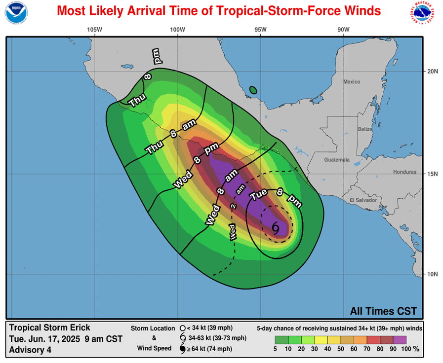
Another concern on landfall from Erick is some tropical storm force winds that could effect Mexico.
Erick is forecasted to weaken to a tropical storm, and then a depression once it makes landfall on Mexico’s rough terrain.
[wpcode id=”41149″]
Looking at the Atlantic:
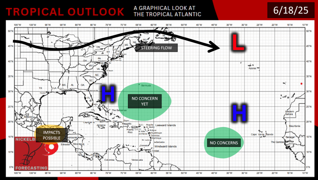
There is no tropical activity in the Atlantic Basin as of today, and there is none forecasted for the next week. This lack of activity is forecasted for a few reasons. Firstly, there is a large band of high pressure spanning the Atlantic from the Southeast in the US to the Sahara in Africa. Sea surface temperatures are high in the Gulf, but not so much in the Southeast Atlantic, as you can see in the model below:
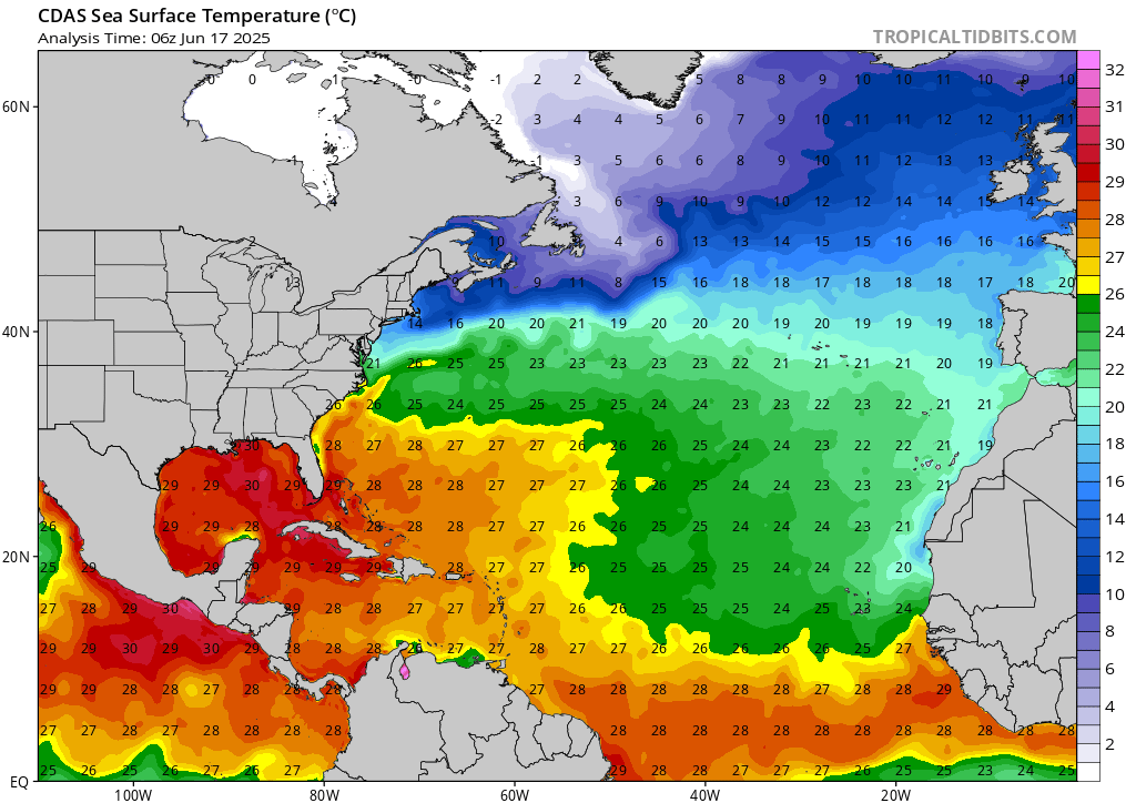
Currently there is some light moisture in the Southeast Atlantic, but the Saharan dust will soon be blowing towards the area, keeping the tropical Atlantic dry for a while. There are some areas of low wind shear, but these areas are pretty patchy and don’t persist for very long. CAPE, which is a measure of how unstable the atmosphere is, has been quite high which is something to watch out for, but in combination with all of these other conditions tropical action in the Atlantic is not a substantial concern for now.
We will continue to track Tropical Storm Erick and monitor the rest of the tropics, so stay tuned for more forecasts!


