The Gulf Coast remains in the grip of classic early summer dynamics, intense solar heating, deep tropical moisture, and weak steering currents. While the solstice marks the peak of daylight hours, the atmosphere is far from stable. Afternoon thunderstorms will continue to flare through the weekend, but a strengthening ridge aloft will gradually suppress convection and usher in a stretch of hotter, drier days by midweek.
Thermodynamic Forcing and Diurnal Convection
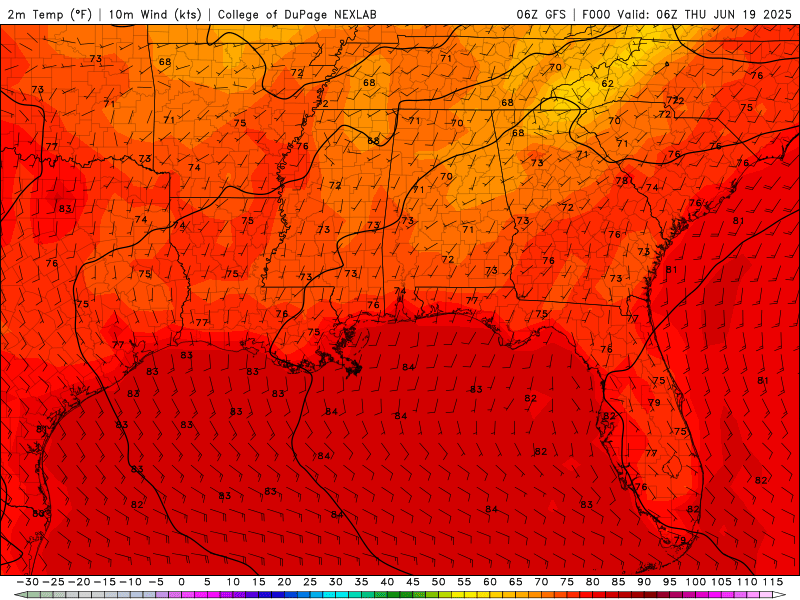
Diurnal Temperatures from Thursday to Wednesday of next week from the GFS model. //Courtesy: College of DuPage
With the sun nearly overhead at solar noon, surface heating is maximized. Highs will consistently reach the upper 80s to low 90s°F, with heat indices climbing into the 100–105°F range, especially in urban and inland areas. This heating destabilizes the boundary layer, with CAPE values exceeding 2000 J/kg, supporting robust afternoon convection. Expect scattered thunderstorms each afternoon through Sunday, particularly along sea breeze fronts and outflow boundaries.
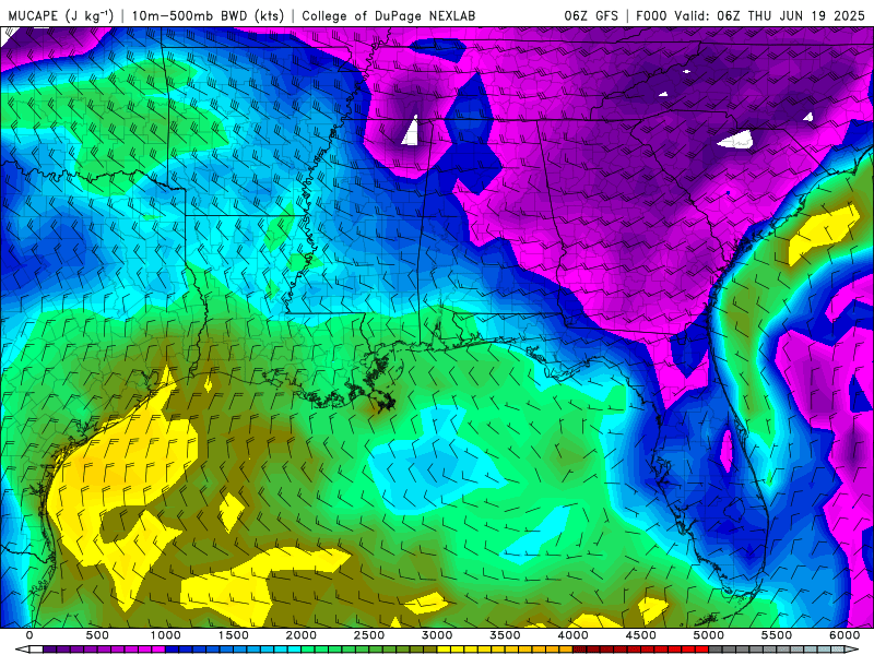
CAPE values from Thursday to Wednesday of next week from the GFS model. //Courtesy: College of DuPage
Moisture Transport and Rainfall Efficiency
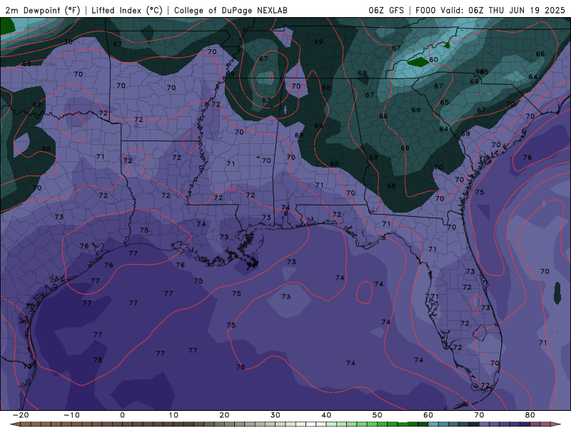
Dewpoint Temperatures from Thursday to Wednesday of next week from the GFS model. //Courtesy: College of DuPage
A persistent southerly flow continues to draw maritime tropical air into the region. Dew points in the mid-70s°F and precipitable water values near 2 inches will maintain a saturated profile, ideal for efficient rainfall production. Storms will be capable of brief torrential downpours, frequent lightning, and localized flooding, especially in low-lying or poorly drained areas.
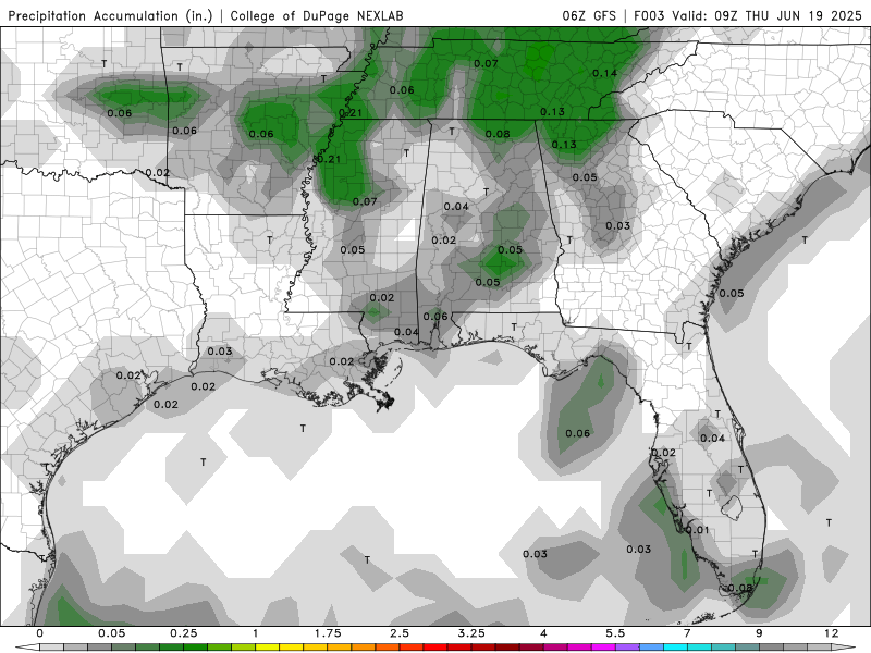
Total precip. accumulation from Thursday to Wednesday of next week from the GFS model. //Courtesy: College of DuPage
Storm Structure and Mesoscale Interactions
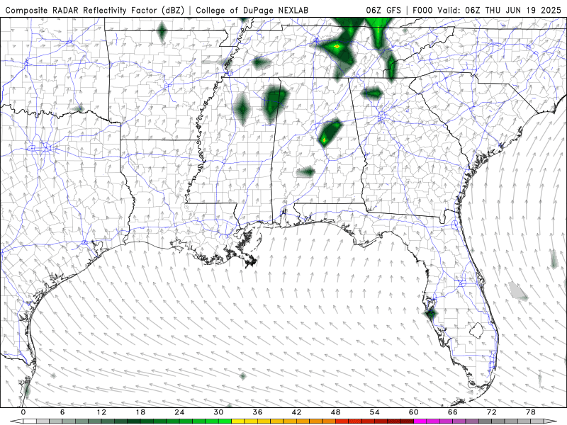
Simulated reflectivity from Thursday to Wednesday of next week from the GFS model. //Courtesy: College of DuPage
While bulk shear remains weak, favoring pulse-type convection, mesoscale boundaries will enhance storm organization. Outflow collisions and sea breeze convergence zones will be the primary triggers. Some storms may produce gusty winds and small hail, but severe weather is not expected to be widespread.
Synoptic Evolution and Ridge Amplification
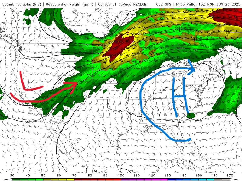
500 mb map for Monday, June 23rd, from the GFS model. //Courtesy: College of DuPage
By Monday, a mid-level ridge centered over the Southeast begins to amplify, promoting subsidence and capping. This will gradually reduce storm coverage, especially by Tuesday and Wednesday, when rain chances drop below 30%. However, this comes at a cost; temperatures will rise, and heat stress will increase, with highs in the low to mid-90s°F and heat indices peaking near 105°F.
Regional Day-to-Day Forecast
Thursday – Partly cloudy in the morning, then scattered thunderstorms in the afternoon. High near 91°F. Heat index up to 105°F. Winds WSW at 5–10 mph with a 40% chance of rain.
Thursday Night – Some clouds early, then mostly clear. A stray shower or thunderstorm is possible. Low around 73°F with a 20% chance of rain.
Friday – Mostly sunny in the morning, then scattered thunderstorms in the afternoon. High near 91°F. Winds light and variable with a 50% chance of rain.
Friday Night – Partly cloudy. Low around 75°F with a 20% chance of rain.
Saturday – Mostly sunny early, then increasing clouds with scattered thunderstorms later in the day. High near 91°F with a 50% chance of rain.
Saturday Night – Clear to partly cloudy. Low around 76°F with a 20% chance of rain.
Sunday – Mostly sunny early, then scattered thunderstorms in the afternoon. High near 90°F. Winds ESE at 5–10 mph with a 30% chance of rain.
Sunday Night – Partly cloudy. A stray shower or thunderstorm is possible. Low near 75°F with a 20% chance of rain.
Monday – Scattered showers and thunderstorms. High near 90°F. Winds ESE at 5–10 mph with a 40% chance of rain.
Monday Night – A few clouds. A stray storm is possible. Low around 74°F with a 20% chance of rain.
Tuesday – Mixed clouds and sun with scattered thunderstorms. High near 90°F. Winds ESE at 5–10 mph with a 40% chance of rain.
Tuesday Night – Partly cloudy skies. Low around 75°F with a 20% chance of rain.
Wednesday – Partly cloudy with a slight chance of a thunderstorm. High around 90°F. Winds ESE at 5–10 mph with a 20% chance of rain.
Wednesday Night – A few clouds from time to time. Low near 75°F. Winds light and variable with a 20% chance of rain.


