General Central/Eastern Kansas Forecast
Short-Term (Friday-Saturday)
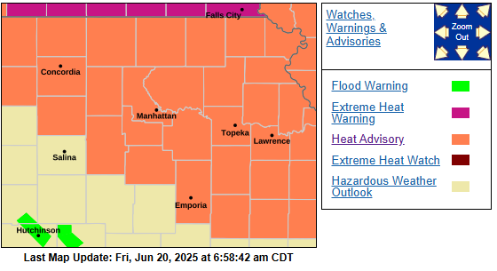
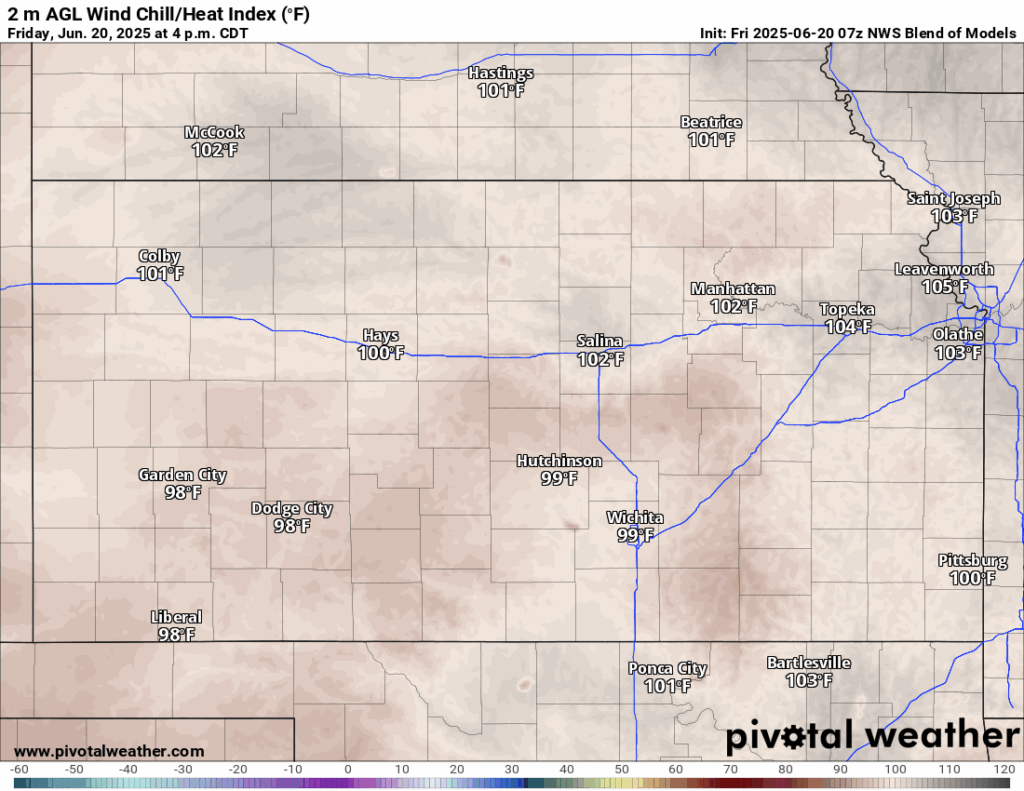
It will really feel like summer between today and tomorrow with the heat coming our way. A Heat Advisory is currently in effect for most of northeast Kansas from today at 12pm to tomorrow at 8pm, as heat indices are expected to reach between 100 to 105 degrees during this time. Expansion of the Heat Advisory could be possible towards southern Kansas depending on if temperatures tick up a degree or two than forecasted. Actual air temperatures during this time will range between the low/mid 90s in the south half of the region, while the northern half will see temperatures in the mid/upper 90s. Winds will be out of the southwest at 15-30 mph, with potential gusts reaching up to 45 mph (especially in northern Kansas) both today and tomorrow. It will feel very humid between today and tomorrow also, with dew point temperatures ranging from the upper 60s to mid 70s. Low temperatures overnight both nights will be very warm in the upper 70s to low 80s.
Long-Term (Sunday-Thursday)
Hot (although maybe not as hot as today and tomorrow), dry, and windy conditions will remain in place Sunday and Monday as high pressure hangs on over the area, with temperatures in the low 90s and southerly winds between 10-25 mph. Rain chances do make a return Monday night, as the high-pressure system weakens, and a front makes its way southeastward into north-central Kansas. This may provide a focus for scattered showers and thunderstorms during the overnight hours on Monday, mainly along and north of I-70. Tuesday-Thursday will see repeated nightly rain chances, mostly north, as several weak upper-level disturbances traverse overhead and may provide enough lift to spur scattered shower and thunderstorm development.

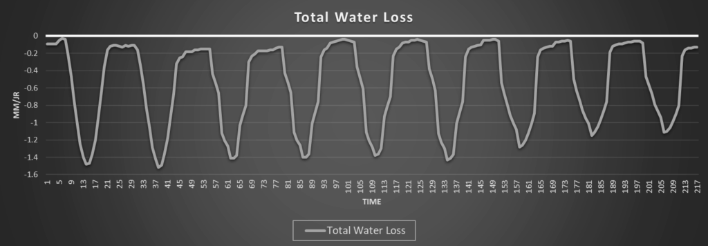
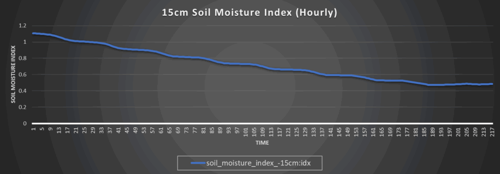
Regional Soil Moisture Forecast
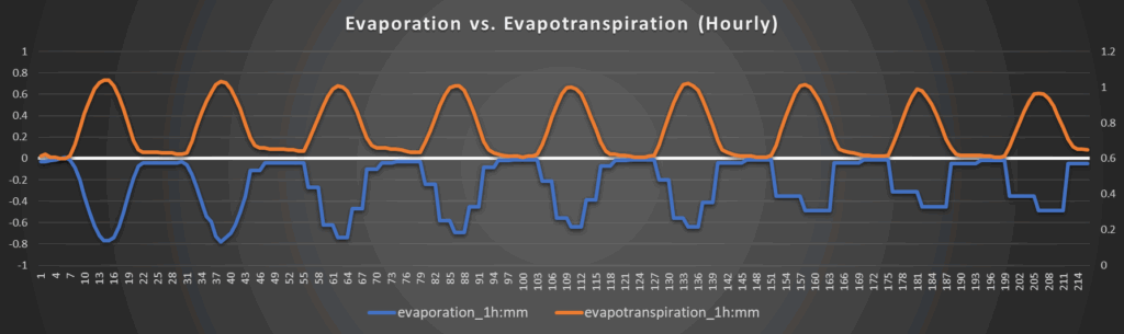
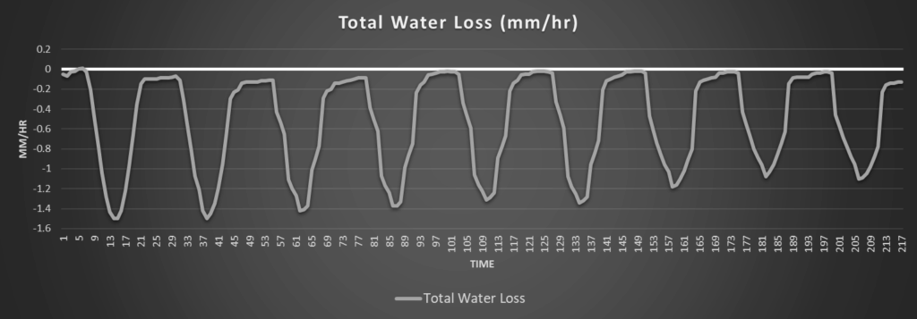
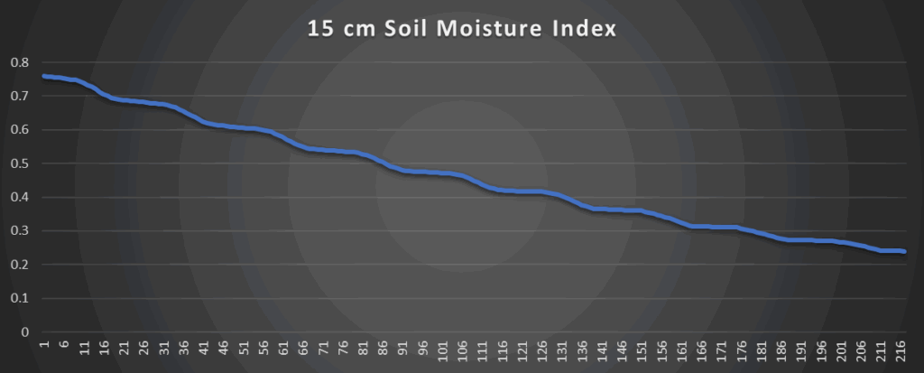
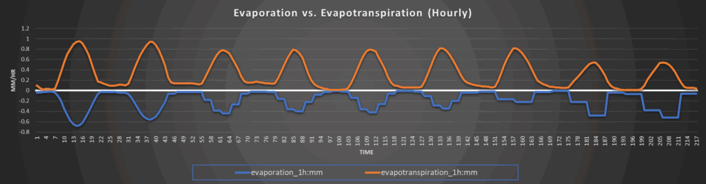
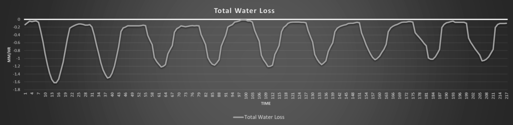
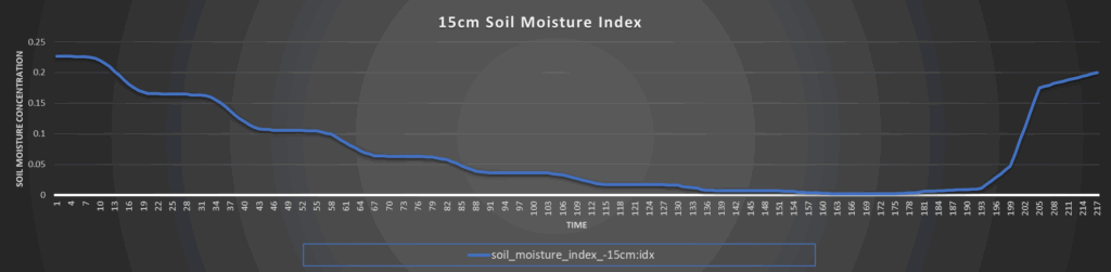
Soils in the northern half of the region will continue to be in rough shape with the heat and wind expected and overall lack of substantial moisture. The southern half of the region will still remain in better shape from last week’s rainfall, but even this will wear off and considerable drying is anticipated. Northern Kansas, although seeing the best odds at rainfall in the long-term period, will probably not see enough to improve soils by much.
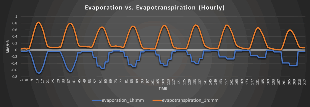
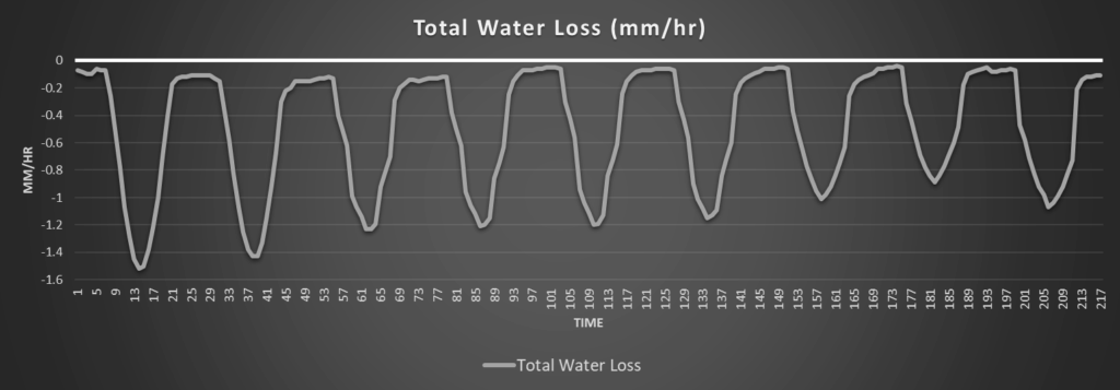
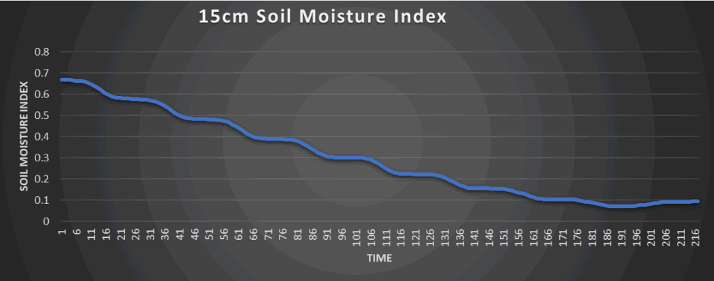
Around Westmoreland
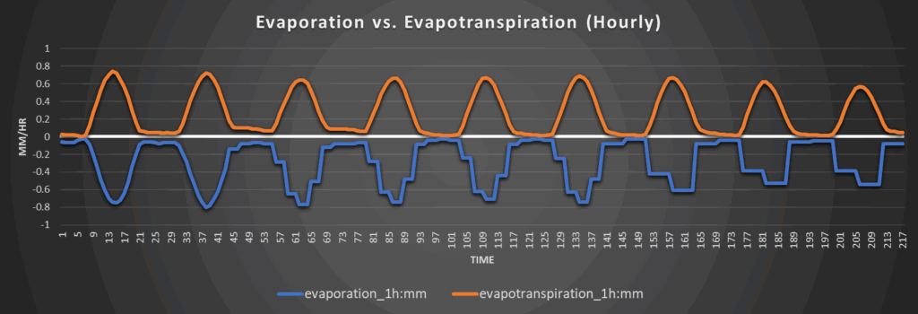
Around Scranton
Around Burlington
Around Altoona