Hurricane Erick has now run its course, but there is another disturbance brewing in the same spot where Erick and many of our other tropical disturbances from this hurricane season began to form. Currently, there is no tropical activity going on in the Atlantic, and we will take a look and see if there are any favorable environmental conditions to encourage tropical behavior in the future. We will also talk a bit about some of the effects from Erick and its significance.
[wpcode id=”41149″]
The Aftermath of Tropical Cyclone Erick
In its peak, Erick went through rapid intensification and reached Category 4 hurricane status on Thursday and made landfall as a Category 3 storm with winds at 125 mph. Erick brought over 10 inches of rain to the state of Oaxaca and caused major flooding, mudslides, and damage to the southern coast of Mexico. Erick was record breaking, being the first major hurricane originating from the East Pacific to make landfall on Mexico before the month of August. It was also surprising that Erick experienced rapid intensification so early on in the hurricane season, as well as the fact that there has already been 5 tropical cyclones when hurricane season in the East Pacific only began a little over a month ago. Many people in the affected areas of southern Mexico are still recovering from the effects of Erick.
Another Disturbance Following in Erick’s Footsteps
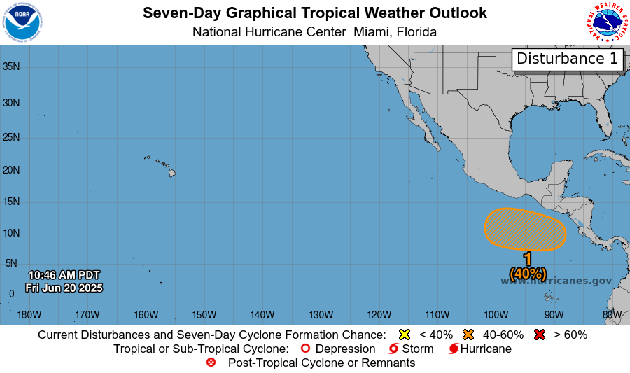
As you can see, another disturbance is forming in the East Pacific, just south of Southern Mexico and much of Central America. This disturbance has a 40% chance of developing into a tropical cyclone of some sort in the next week, but the chances of formation in the next 48 hours is next to none. Similar to Erick and many of the other tropical cyclones we’ve seen this hurricane season, it is moving in the west-northwestward direction along the coastline, and an area of low pressure is forecasted to form in the area early on next week, most likely Monday or Tuesday.
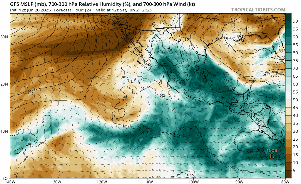
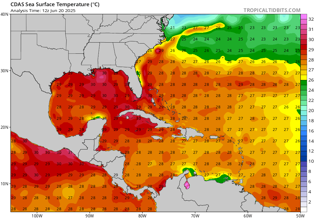
Looking at environmental conditions that may cause this disturbance to develop, we have seen how hot sea surface temperatures have been in this specific area of the East Pacific, and these scorching temperatures will remain, along with high humidity:
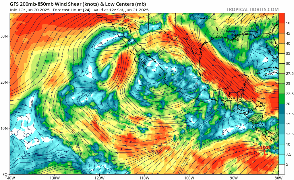
One thing that might cause this disturbance to crash and burn is wind shear being too high while the low pressure system forms. Wind shear in the East Pacific for the next few days will be high for the most part, with patches of low wind shear hanging around for a short time. This wind shear doesn’t really calm down until Tuesday or Wednesday, leaving smaller windows of time for a low pressure system to develop in completely favorable conditions.
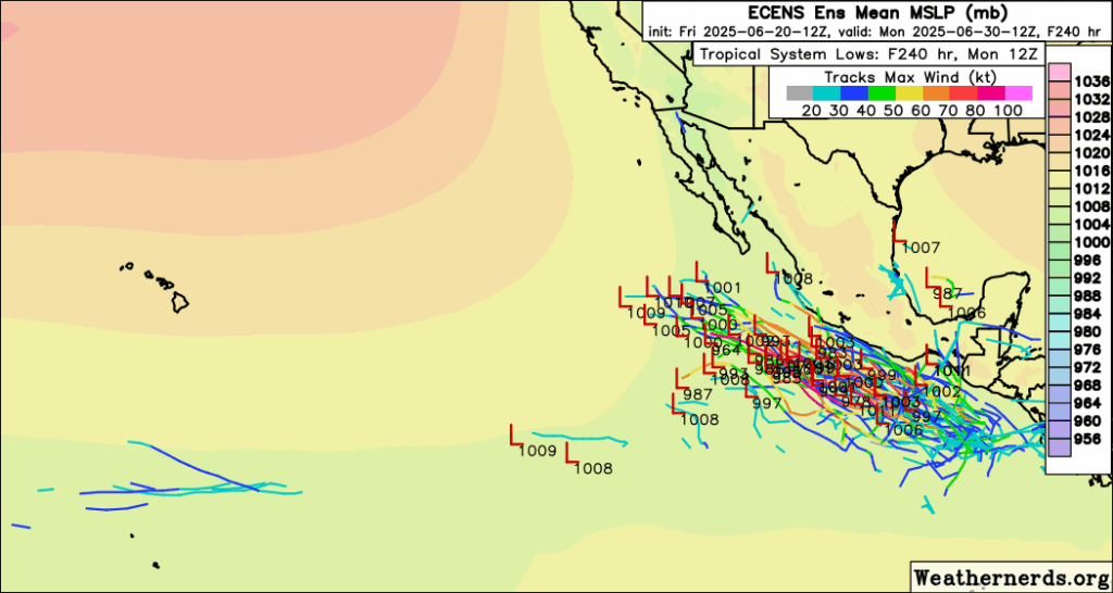
It is important to note that even though this disturbance’s early development looks similar to Erick, that does not mean that this disturbance will be a landfall Category 4 storm. It’s development looks similar to many other disturbances and cyclones that have dissipated off into the Pacific without making landfall, and in fact many models are showing this type of behavior for this disturbance:
[wpcode id=”41149″]
The Atlantic Remains Calm
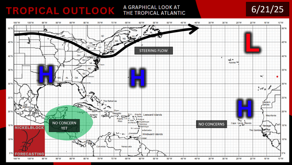
According to the National Hurricane Center, as of now there is no tropical cyclone activity in the Atlantic Basin, and none is forecasted for the next 7 days. In the graphic above we can see why: The Bermuda High is still staying strong, and there is also another area of high pressure off of the Western Sahara helping to discourage tropical activity in the Atlantic Ocean. There is yet another area of high pressure over much of the South and going into the Gulf, which is much needed to fend off any hurricane action as the Gulf waters are looking very warm:
Humidity in the Atlantic and Gulf is also looking pretty low as well, and there will likely be too much wind shear in the area for anything to form. So that’s why we shouldn’t expect any hurricane activity in the Atlantic for now!


