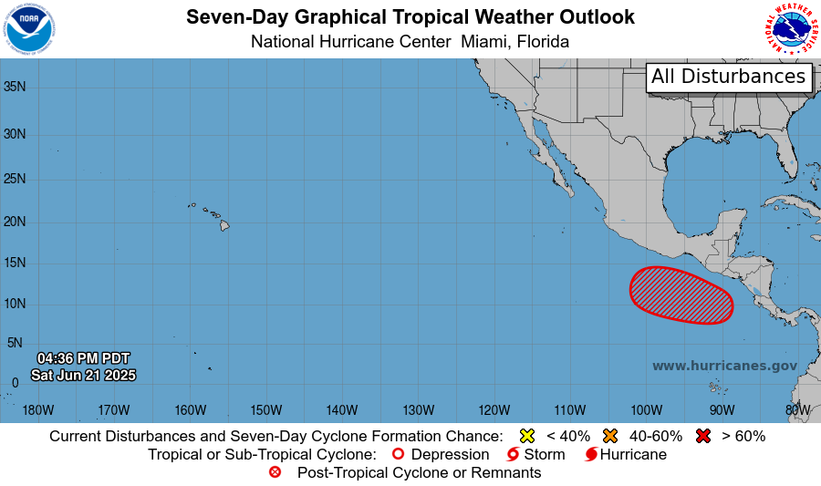
An area of showers and thunderstorms are firing up off the coast of Costa Rica. With converging winds, very low wind shear, warm ocean waters, and a semi-moist layer aloft, the odds are looking pretty good, as all the ingredients are in place. The NHC is giving the highlighted red area a 70% chance of producing a storm in the 2 to 7 day time frame. I might go a tad higher than that. The cluster of storms are still broad and disorganized, so it will take some time for a system, which would be named Tropical Storm Flossie, to form. Formation could come in the middle of this week, with Tuesday and Wednesday being the most likely dates, possibly Thursday.
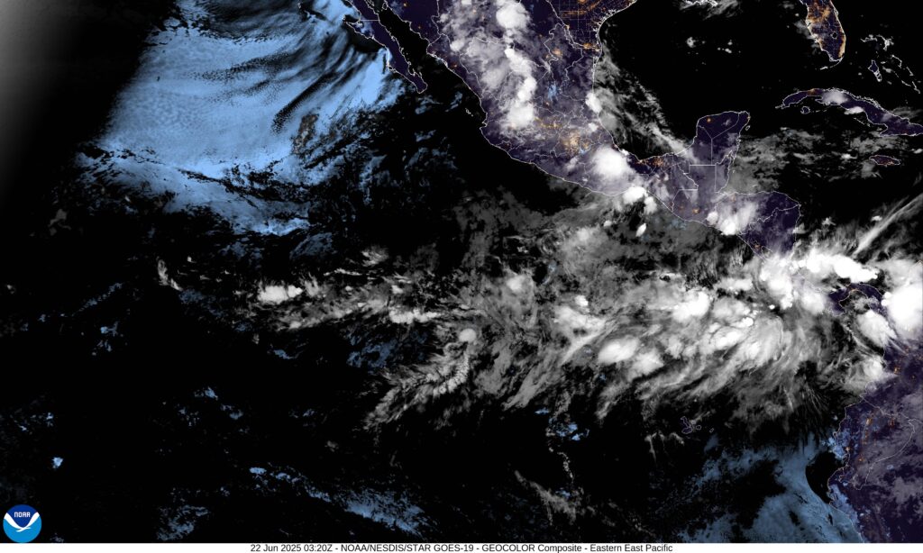
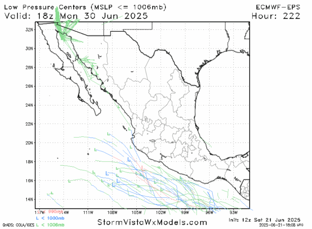
The good news is that the models are in greater agreement that the center of the storm will not impact mainland Mexico. The storm will, like most storms this year besides Erick, ride the trade winds out into the Pacific. There don’t appear to be any major steering mechanisms that could deflect the storm towards land. Due to the favorable environment and having the ocean to itself, this storm could easily reach hurricane status. The outer bands of this storm could clip southern Mexico, and/or the countries of Guatemala and El Salvador. Places in Oaxaca and Guerrero recovering from Erick should keep an eye on this one, any additional rain could re-invigorate flooding or mudslide concerns.
WHEN WILL THE ATLANTIC AWAKEN?
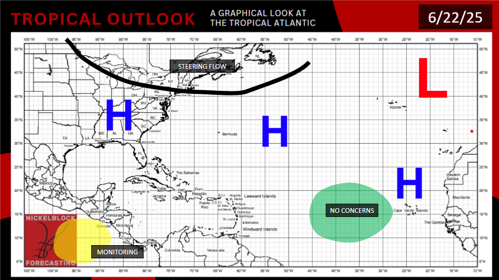
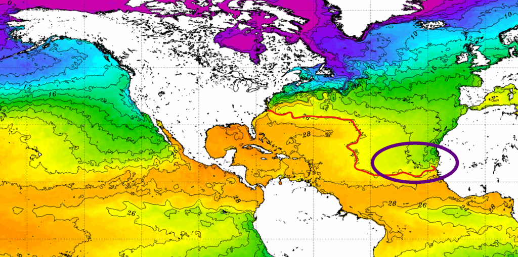
Parts of the Atlantic Ocean are above the 80 degree threshold typically needed for tropical development. This includes the Gulf of Mexico, which is well above this mark. The issue is that a persistent wind shear and dry air intrusions are making it tough for anything to form. The big ridge forming over the eastern United States this week may cause the wind shear to abate just a little. Both models do show a slight chance of activity in the western half of the Gulf before that, if we get a break from shear and dry air to occur at the same time. It’s not significant enough of a chance for me to mark it on the map, but if anything changes, you’ll hear it here at Nickelblock first.
The further away you get from the Gulf, the cooler it gets. Most of the area where Atlantic hurricanes typically originate from is still below the 80 degree threshold. Just observing general trends, my estimation is that it will take until early to mid July for the whole of the Atlantic basin to be warm enough for tropical development.
There’s also no reason to believe we won’t eventually get another storm in the Pacific off the coast of Central America. There’s little sign the current conditions, that are generating tropical storms like a factory, will change anytime soon. It will be interesting to see how far up the historical rankings 2025 will be, when it comes to the pure number of tropical systems in the West Pacific.
[wpcode id=”41149″]


