General Central/Eastern Kansas Forecast
Short-Term (Monday-Tuesday)
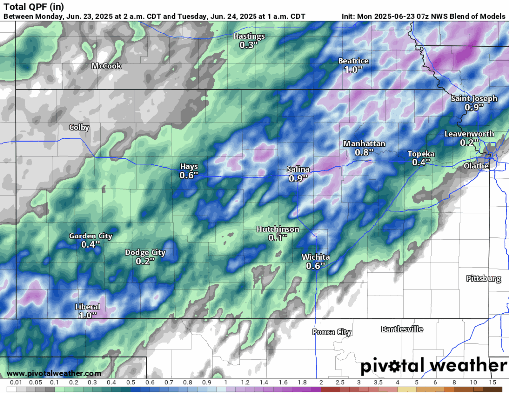
Chances for widely scattered showers and thunderstorms will return today and tonight, as a cold front approaches in from the northwest and stalls across north-central to northeast Kansas by this afternoon. These storms may be severe with damaging winds and large hail being the primary concern. Flooding may also be a concern from training thunderstorms along the front, with 1 to 2 inches possible mainly north of 1-70. Further south, storms may become more isolated in nature as we get more removed from the forcing than up north. Some storms still may be marginally severe, and a localized flooding risk can’t be discounted with heavier storms.
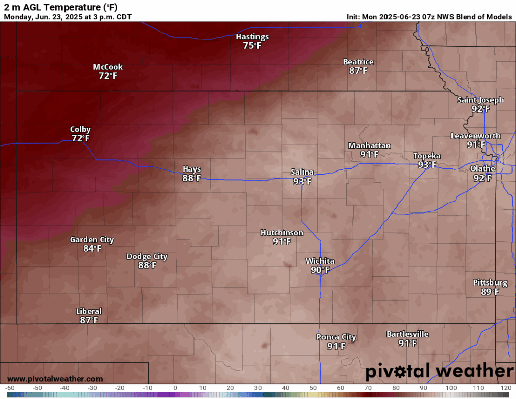
Temperatures today and tonight will be seasonal for the early days of summer, with highs in the low to mid 90s today, with heat indices in the upper 90s to low 100s. A Heat Advisory remains in effect today for mainly far eastern Kansas (counties along US-69 and US-73). By tonight, temperatures will fall to the low to mid 70s area wide, with the coolest spots being further north closer to the front and potential showers/thunderstorms. Winds today will be mainly out of the south-southwest at 15 to 25 mph, with gusts up to 35 mph possible.
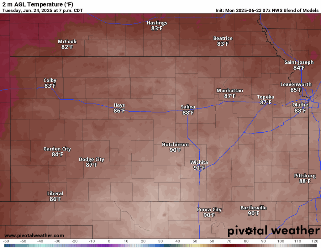
By tomorrow, the cold front will retreat northward, however, lingering chances for scattered showers and isolated thunderstorms will continue for the northern half of the state throughout the afternoon and evening. Temperatures again will reach the low to mid 90s, with heat indices in the mid 90s. Winds will continue to be southerly at 5 to 10 mph, with gusts up to 20 mph.
Long-Term (Wednesday-Sunday)
Wednesday looks to be largely dry across the area as high pressure pushes back in somewhat and keeps our rain chances in check. Another mid-level disturbance does come through by Thursday-Friday and will help return scattered shower and thunderstorm chances across much of central/eastern Kansas during the afternoon and overnight hours. Conditions then may quiet down a bit Saturday before more rain chances arrive again on Sunday. Temperatures throughout the long-term period will remain seasonal, with daily highs in the upper 80s to mid 90s. Heat indices don’t look to be that big of an issue just yet, with average heat indices in the mid to upper 90s, staying just below advisory criteria.
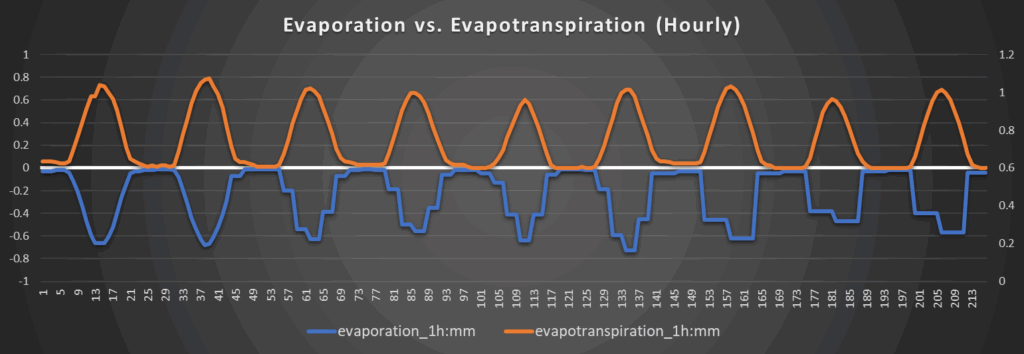
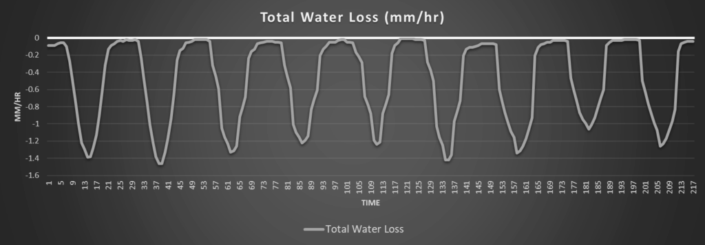
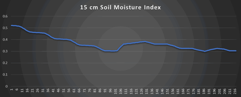
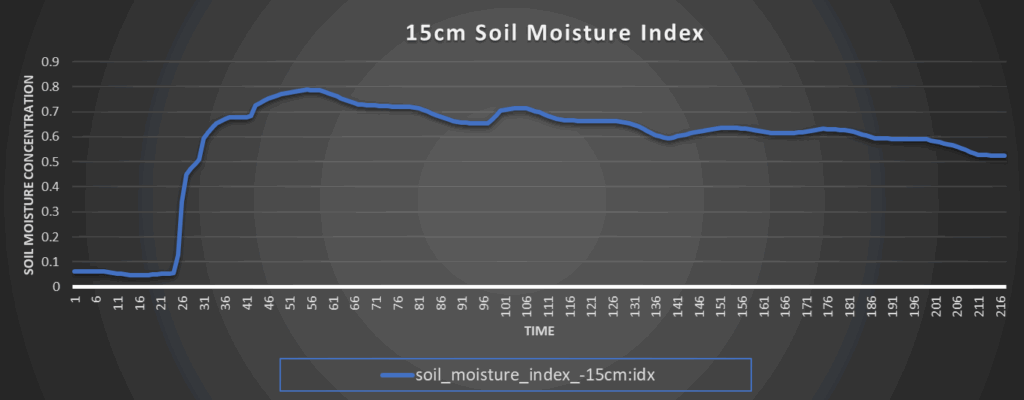
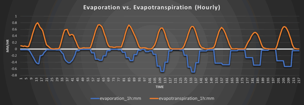
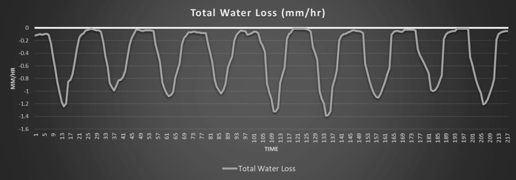
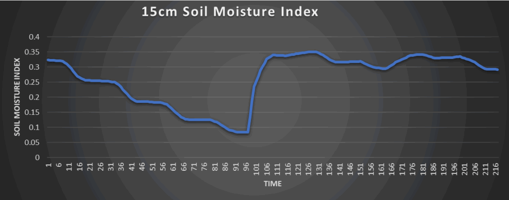
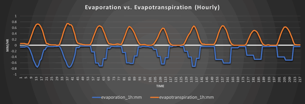
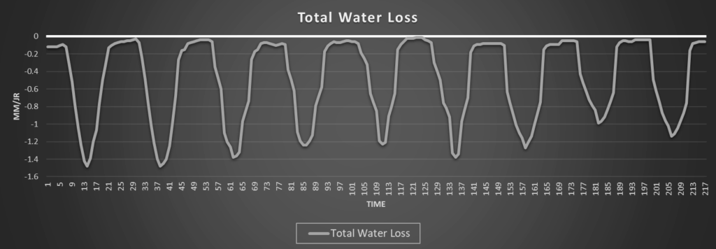
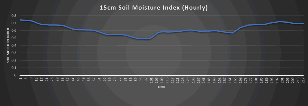
Regional Soil Moisture Outlook
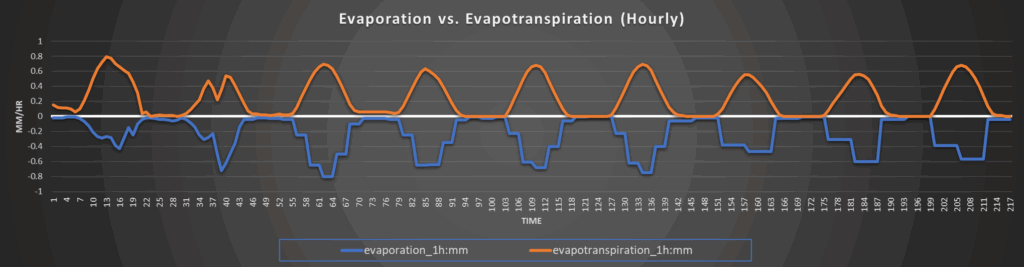
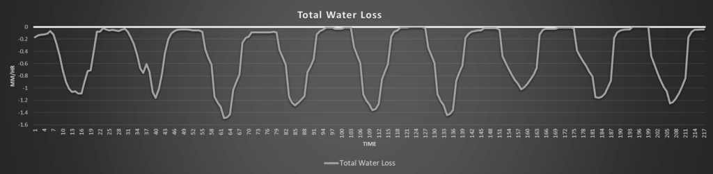
Soils look to recover from their period of dryness over the last few days, as scattered rain chances will appear throughout the week. Total water loss and evaporation/evapotranspiration rates will be greatest in south central and southeast Kansas where rain chances are the lowest and cloud cover is the most minimal. Otherwise, soils look to stay in relatively decent shape this week, but pockets of dryness are still to be expected.
Around Westmoreland
Around Scranton
Around Burlington
Around Altoona