
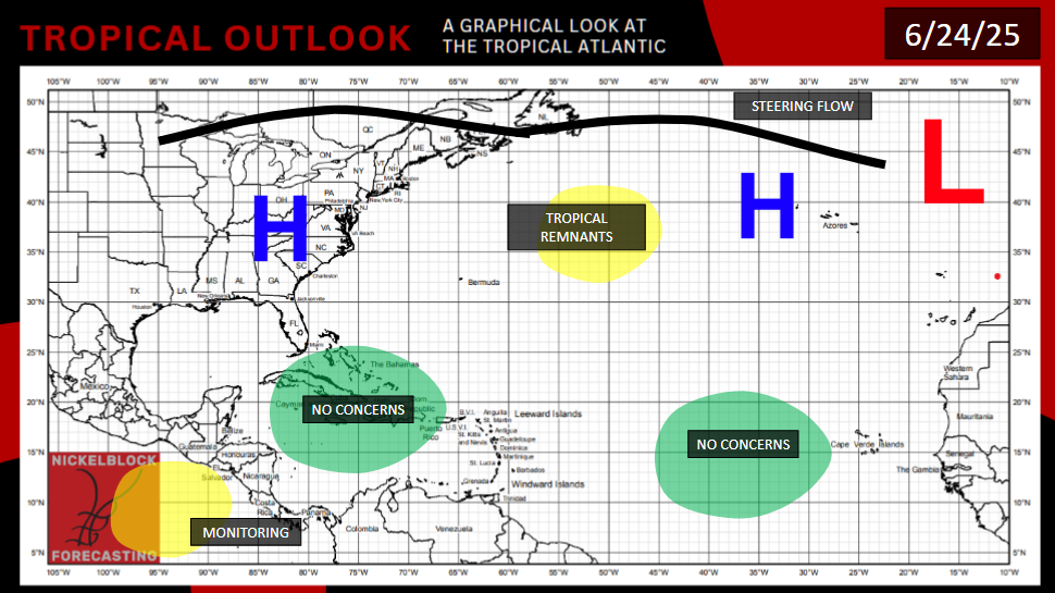
Over Sunday and Monday, a collection of thunderstorms associated with low pressure, several hundred miles east of Bermuda, is trying to organize. The NHC has designated it as Invest 90L. This defies the models expectations, as originally, no ensemble had anything forming here.
Today, however, is a different story. as it will enter an area of extreme shear near the jet stream, and colder water temperatures. It will probably have missed its opportunity for development.
Going forward, it has no immediate impacts to land.
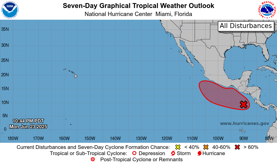
We are still monitoring an area in the Pacific to the south of Mexico. The rotation is still broad and disorganized, which will delay the formation of any potential tropical storm. Thursday-Saturday seems like a more likely time frame for the formation of what would be Tropical Storm/Hurricane Flossie.
But the expectations remain the same, that, besides some outer bands of rain in Honduras, El Salvador, and southern Mexico, the storm will ride the trade winds out into the Pacific once it forms, so few land impacts are expected.
EXTENDED OUTLOOK
Some long range models do suggest increasing shear and decreasing moisture in the long term in the West Pacific, so perhaps the “hurricane factory” will shut down for a little bit in early and mid July. I would still favor another tropical system forming off the West Coast of Central America around the turn of the month, before these less favorable conditions settle in.
As for the Atlantic, we have a situation where the only areas warm enough for tropical development are also the areas where wind shear is too oppressive. The events yesterday were but an exception to the overall picture. There is a remote possibility we could get a surprise storm in the western Gulf of Mexico in the 10-day time frame, if a low-shear high-moisture window is found. But it is likely going to take us until mid-July for the Atlantic hurricane season to really get going this year.
[wpcode id=”41149″]


