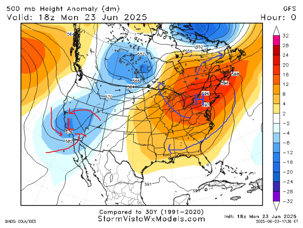
The ridge, or “heat dome”, that is currently plaguing the East Coast with record high temperatures is having a different effect for now in southern Mississippi. It is likely that, in any given location this week, you may have multiple days in a row without a late afternoon thunderstorm. Precipitation probabilities range from 15% to 30%. The ridge is providing subsidence, the sinking of air, not good for cloud formation.
While our area is far from the ridge center, it will still get pretty hot, particularly on Wednesday and Thursday, where we could get into the upper 90s, with high dew points boosting apparent temperatures near 110 degrees. Please take excessive heat precautions on these days. Winds will be light and variable throughout the week.
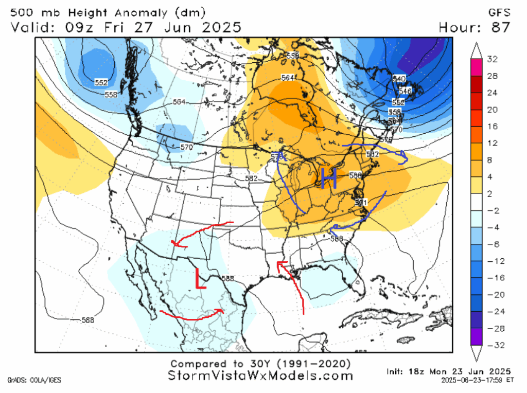
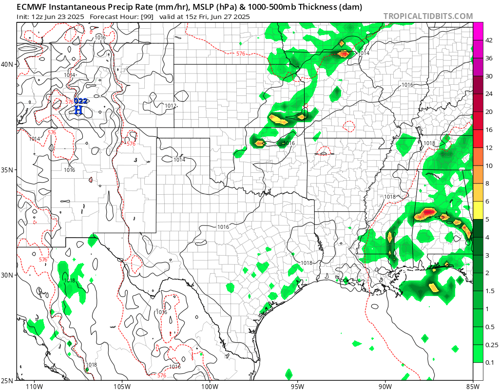
A shortwave will make its way through on Friday. The European Model does show a squall line (or MCS) moving through the area Friday morning. Interestingly enough, the MCS appears to be moving from east to west, opposing the traditional west to east motion of these systems.
Other models are more skeptical of a squall line, but agree that this weekend should be on the rainier side. In the weekend, we will have “morning high” temperatures. The warmest part of the day may be at a time with “A.M.” at the end of it, before temperatures decrease by 10 or so degrees rapidly in the afternoon as the clouds and rain move in. Examining the modeled Skew-T diagrams, I would expect most if not all of these storms will be below severe limits.
[wpcode id=”41149″]
LONG RANGE OUTLOOK
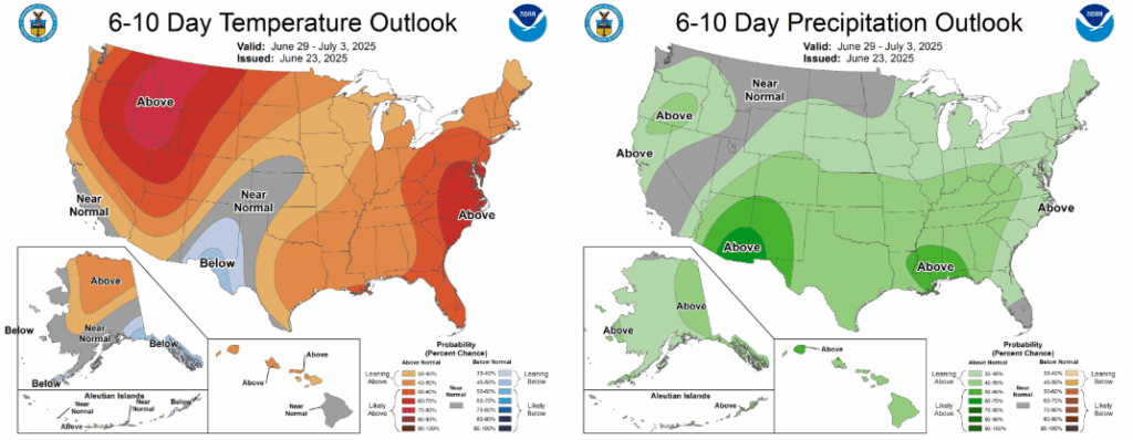
Temperatures should be overall seasonal in the 6-15 day time frame, with perhaps a warmer day or two mixed in. It does seem that this same time period will be wetter than average. This is due to a potential setup with a trough to our west and a ridge to our east. There could be rain for a few days in a row in certain locations. Two synoptic scale forces working together to advect moist air up from the Gulf of Mexico.
As the current ridge over the Northeast abates in the 11-15 day timeframe, the flow from the Gulf won’t be as intense, so conditions may get a little sunnier.
LOOKING AT THE TROPICS
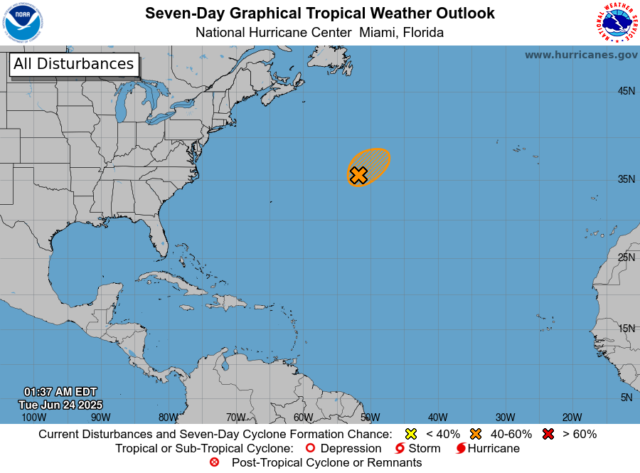
A surprise area of potential formation appeared Sunday in the Atlantic northeast of Bermuda. But just as soon as it arrived, it will soon be gone. It is entering an extremely hostile environment. Late this week we may see yet another tropical system form in the Pacific near Mexico, but it will likely go harmlessly out to sea, only grazing Mexico, Guatemala, and maybe El Salvador with some outer bands of rain.
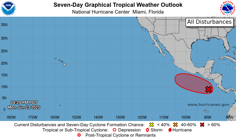
It looks like it will be until mid-July before the whole of the Atlantic Ocean will be at a temperature warm enough to allow tropical development.
[wpcode id=”41149″]
DAY-TO-DAY REGIONAL FORECAST
Today: Highs around 90. Partly cloudy.
Tonight: Lows in the mid 70s. Mostly clear.
Wednesday: Highs in the mid 90s. Experienced temperatures above 110 degrees. Mostly cloudy. Lows in the mid 70s.
Thursday: Highs in the mid 90s. Experienced temperatures above 110 degrees. Mostly cloudy. Lows in the mid 70s.
Friday: Highs around 90. The morning will be the warmest part of the day. Thunderstorms possible all day, but particularly lunchtime. Chance of rain 70%. Mostly cloudy. Lows in the high 70s.
Saturday: Highs around 90. The morning will be the warmest part of the day. An afternoon shower or thunderstorm is likely. Chance of rain 70%. Mostly cloudy. Lows in the mid 70s.
Sunday: Highs in the low 90s. The morning will be the warmest part of the day. An afternoon shower or thunderstorm is likely. Chance of rain 60%. Mostly cloudy. Lows in the mid 70s.
Monday: Highs in the low 90s. An afternoon shower or thunderstorm is possible. Chance of rain 50%. Lows in the mid 70s.
Tuesday: Highs in the low 90s. An afternoon shower or thunderstorm is possible. Chance of rain 50%. Lows in the mid 70s.
Wednesday: Highs around 90. Showers and thunderstorms likely. Chance of rain 80%. Lows in the low 70s.
Thursday (4th of July): Highs around 90. Showers and thunderstorms likely. Chance of rain 70%. Lows in the mid 70s.
Friday: Highs in the low 90s. An afternoon shower or thunderstorm is possible. Chance of rain 40%. Lows in the mid 70s.
[wpcode id=”41149″]


