General Central/Eastern Kansas Forecast
Short-Term (Tuesday-Wednesday)
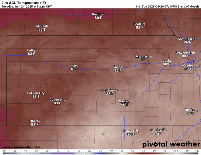
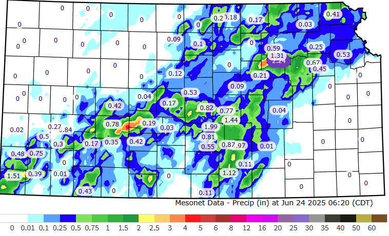
Areas mainly north and west of I-335 will continue to see a wet and soggy day this morning, as showers and thunderstorms continue to move through the area. Some of these storms may become marginally severe by this afternoon and this evening, particularly in central/north-central Kansas, where we could see some hail and a damaging wind gust or two (~60 mph). Otherwise, new rainfall totals will be around 1-2 inches with this round of showers and storms today. For those not seeing rain today, it looks to be another very warm and humid day, with temperatures in the low to mid 90s, with heat indices in the upper 90s to potentially low 100s. For those that are seeing rain today, temperatures look to reach the upper 80s to low 90s. Overnight tonight, temperatures will fall down into a more comfortable low to mid 70s. Winds throughout the day today will be southerly at 5 to 10 mph, with gusts up to 20 mph.

Showers should move out overnight tonight and leave us with drier conditions throughout the day tomorrow, as the cold front triggering our showers moves off back towards the north. Temperatures will vary between the upper 80s to low 90s in the afternoon, with winds out of the south at 10 to 15 mph and gusts up to 25 mph. Heat indices in the afternoon will reach between the mid to upper 90s once again with the humid air still in place. Overnight, low temperatures will largely be in the mid 70s across the area.
Long-Term (Thursday-Monday)
Looking ahead, chances for scattered to widespread showers and thunderstorms will be evident across multiple days in the long-term period, particularly Thursday-Friday, Sunday, and Monday-Tuesday. Several disturbances aloft in the upper-level flow will provide a trigger for showers and thunderstorms within the conditionally unstable airmass we will be residing under. Some of these storms may be marginally severe, with damaging winds and hail being the primary threat, but widespread severe thunderstorm activity is not anticipated at this time with these storms. Temperatures will continue to fluctuate between the upper 80s to mid 90s every day, with heat indices approaching the 100s again by the weekend.
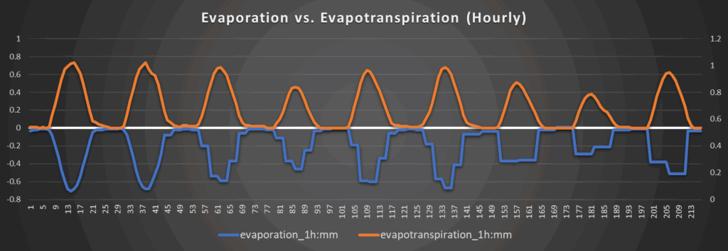
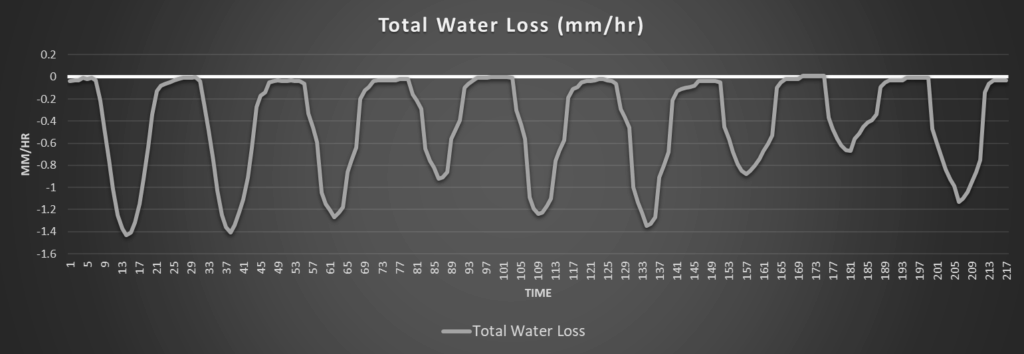
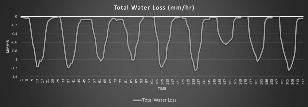
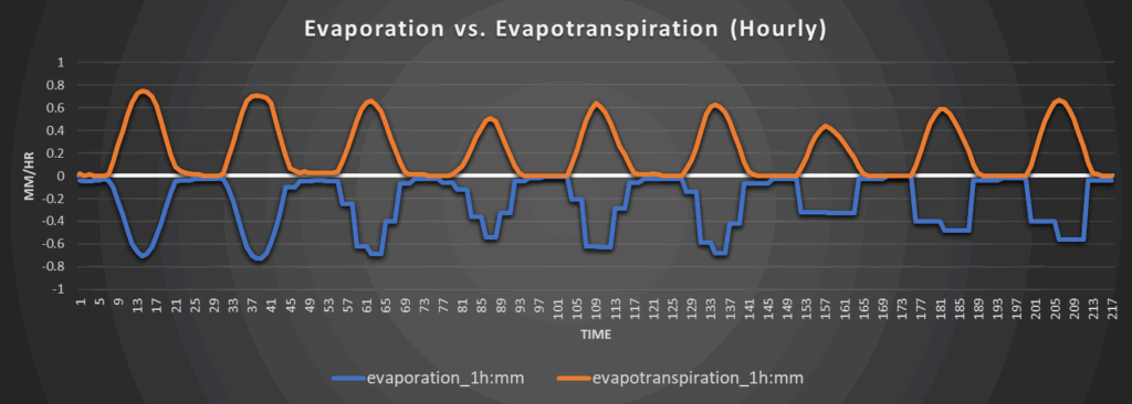
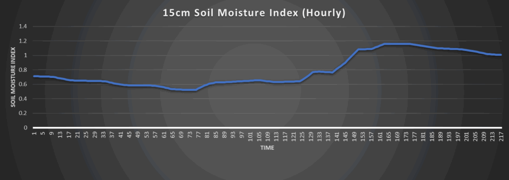
Regional Soil Moisture Update
Last night’s and this morning’s rain showers have given us new totals of around 1 to 1.5 inches across central and northern Kansas, with isolated pockets of 2 inches having fallen. An additional 1 to 2 inches is expected today as these showers and thunderstorms continue to move through. Moisture loss will be low towards central and northern Kansas with the rainfall but will stay consistently higher (especially south of I-70) where areas will remain largely dry. Soil moisture recovery may become possible towards the end of the week and into the weekend with the increase in thunderstorm potential, but to what extent this recovery may be is still uncertain at this range.
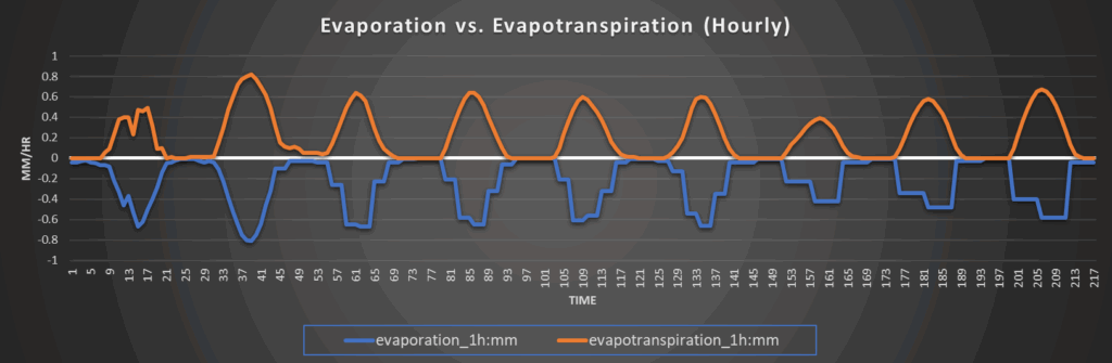
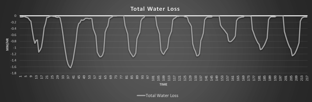
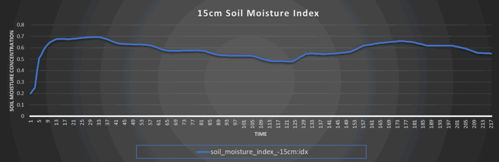
Around Westmoreland
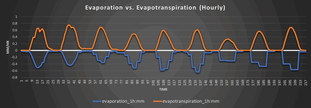
Around Scranton

Around Burlington
Around Altoona