Temperatures are still very warm this week, but will not be as intense since the record breaking ridge is sliding east. Afternoon thunderstorms are in the forecast for each day, but good news – no day looks to be a washout! Let’s dive into the detailed forecast:
[wpcode id=”41149″]
Today’s Overall Setup
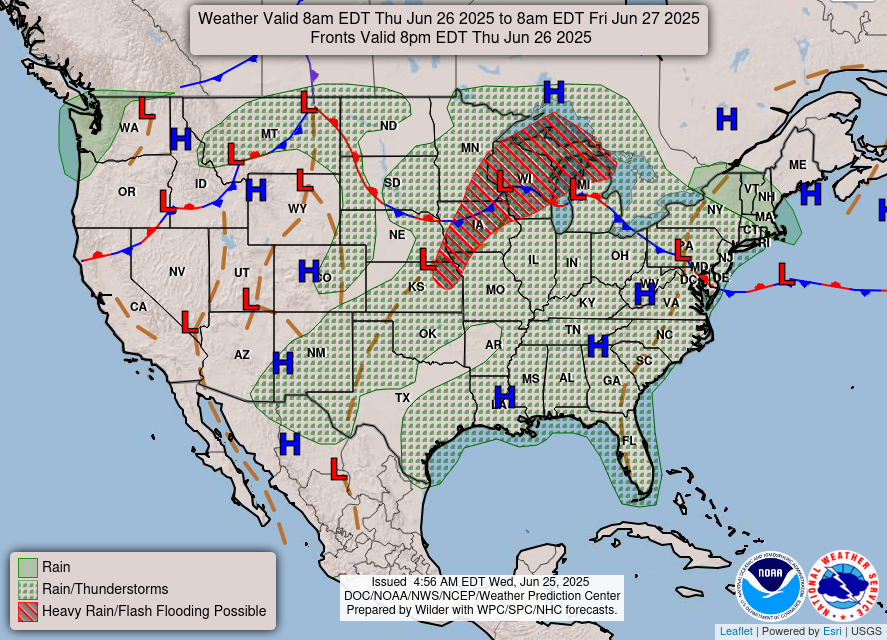
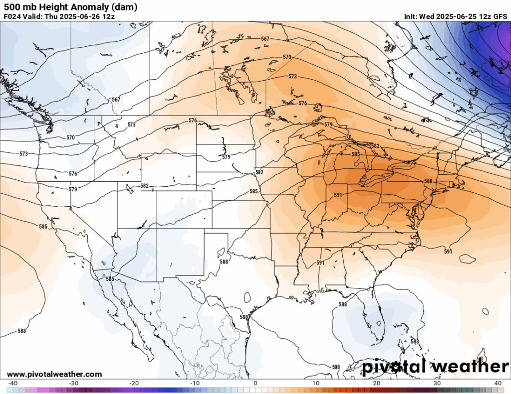
The “heat dome” ridge is finally weakening which will bring relief from the past fews days of record breaking temperatures. Our area is seeing the ridging moving out and being replaced by some troughing which is currently over the southeast Atlantic coast into Florida. This will bring a round of rain and thunderstorms into our area today and hopefully set back our high temperatures this week just a little.
[wpcode id=”41149″]
Today’s Local Forecast
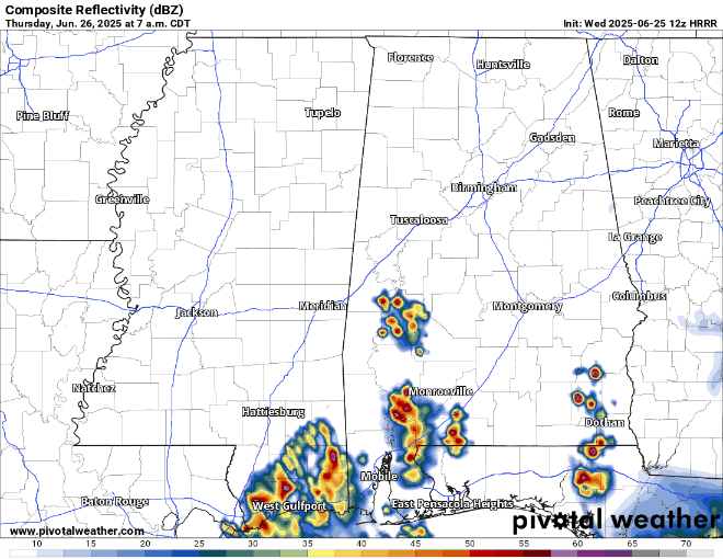
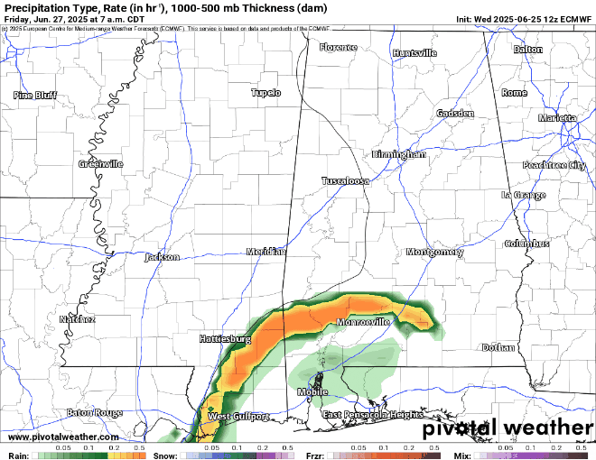
A morning shot of showers and thunderstorms will come through the area, primarily affecting southern MS/AL/LA by 7 am, moving northwest throughout the day and filling in during the afternoon hours – which is when more frequent lighting and thunder will occur. Gusty winds could be possible along with the heavy downpours, so keep an eye out for these storms today! There is a Marginal (1/5) overall risk of any of these storms becoming severe today, but if any were to become severe, a wind threat would be the most probable one. Hail is also possible, but mostly for central and northeast Mississippi into northern Alabama.

Here’s an hourly look at the forecast for today for the region.
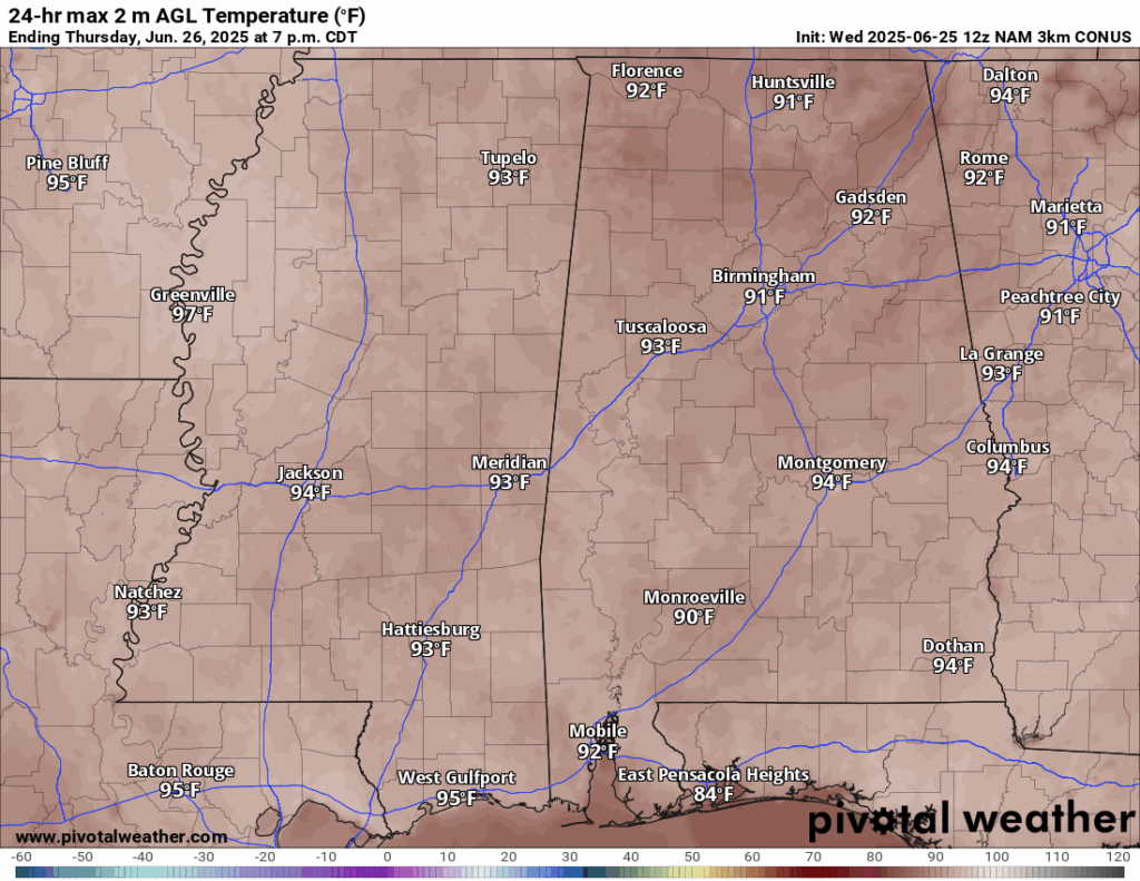
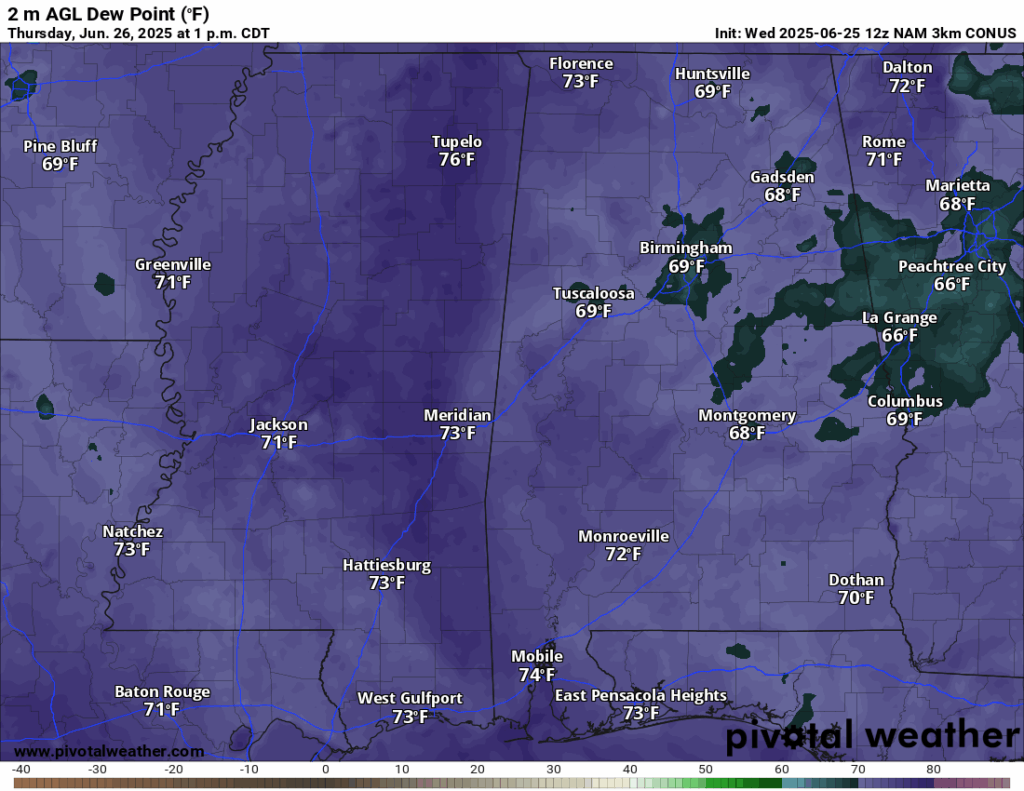
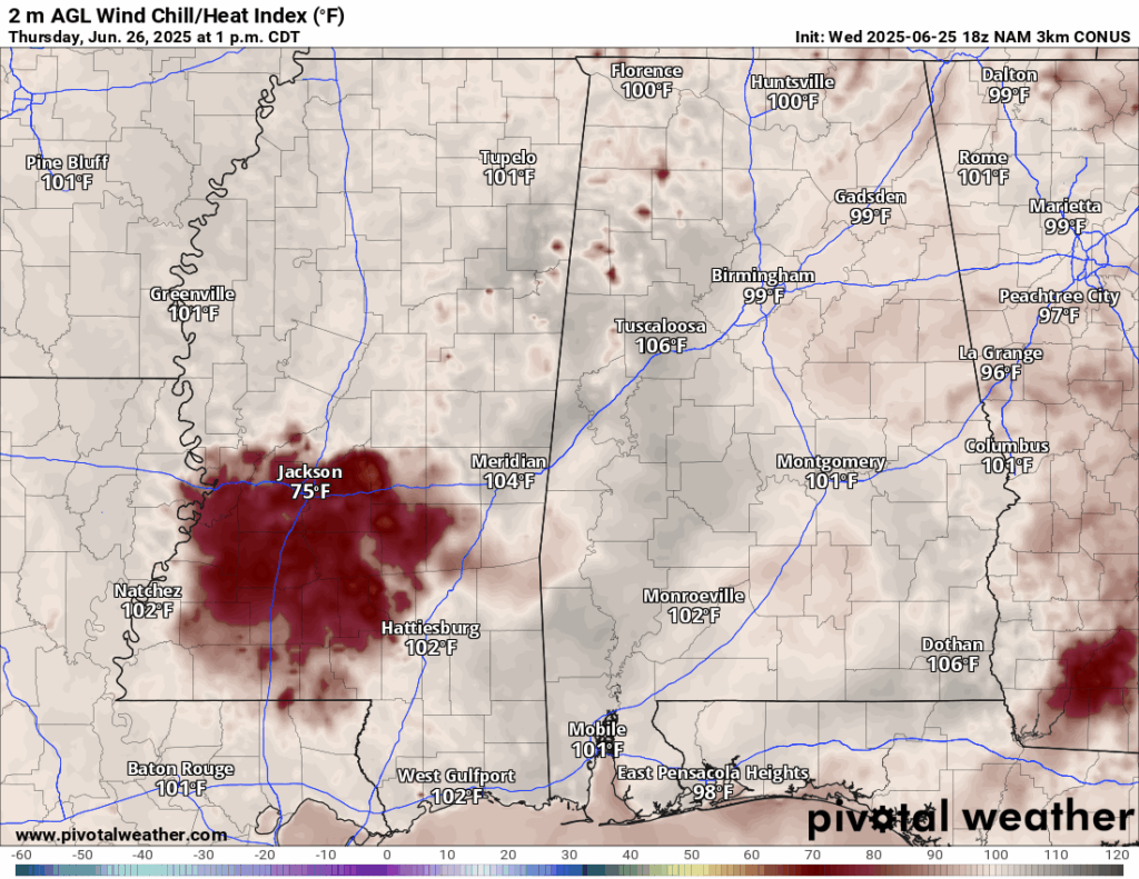
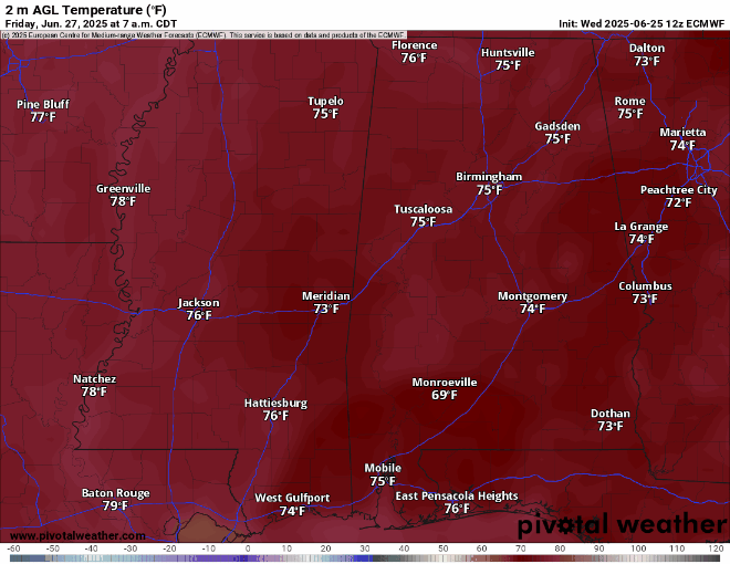
High temperatures today are still toasty in the low-to-mid 90s. With dew points still in the 70s during peak afternoon hours, the heat index will be into the 100s in most locations! When the rain comes through, temperatures will drop and it will feel less humid slightly after the rain – this is why some locations, such as Jackson, will feel close to 80 degrees at 1 pm. The rain will be a relief from the heat!
[wpcode id=”41149″]
Friday-Sunday’s Forecast
Friday will be the coolest day of the weekend with some areas seeing high 80s and very low 90s. Saturday and Sunday will be in the low-mid 90s, with dew points in the 70s, making it feel like over 100 during the day! Stay hydrated during this summer weekend!
Friday morning we will see a round of rain come through and exit by the afternoon, leaving a beautiful late afternoon and evening! Saturday will be mostly sunny with a chance of thunderstorms at around 4 pm. Sunday will have more of a chance for thunderstorms in the late morning and early afternoon than Saturday, exiting by the evening hours. These will be scattered and not everyone will see it!
[wpcode id=”41149″]
Extended Local Outlook

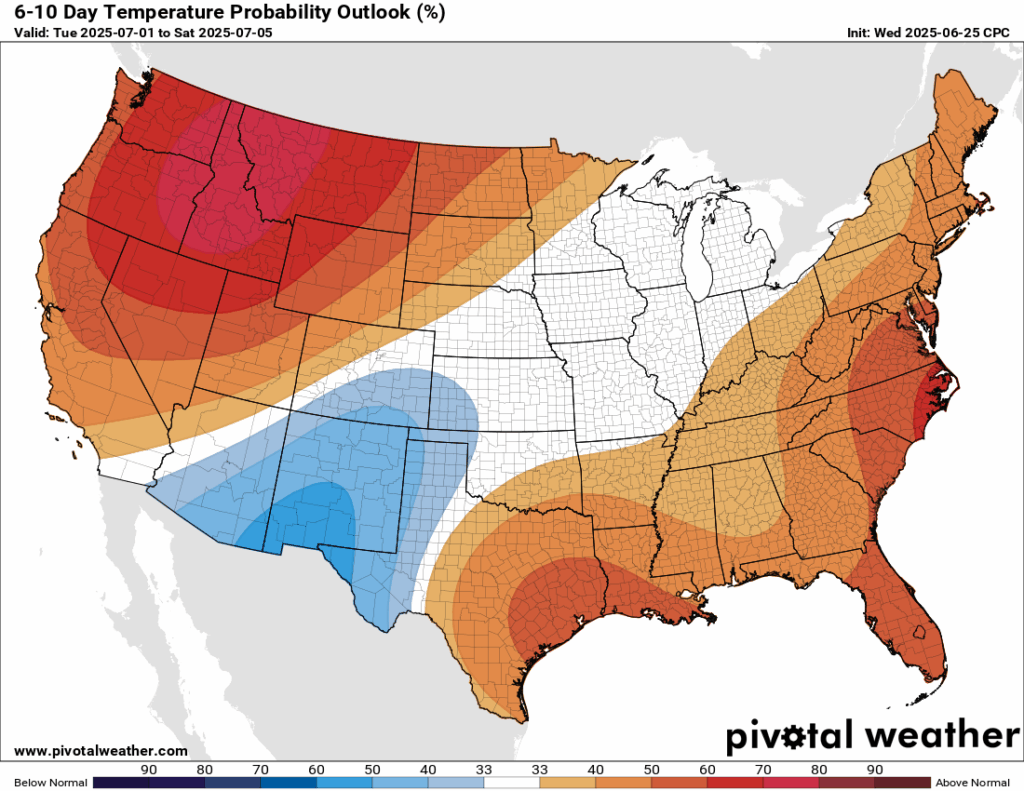
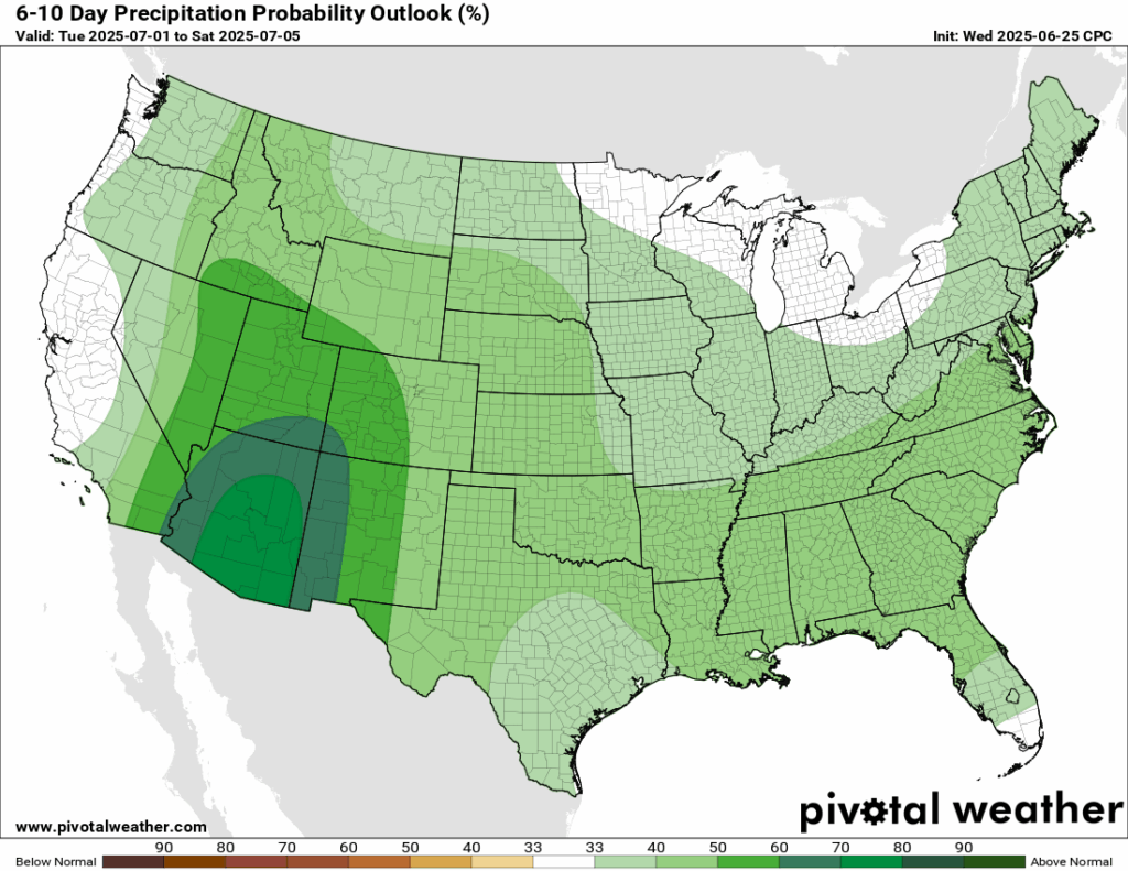
Looking ahead into next week, temperatures are trending warmer than average and rainfall is trending slightly higher than average. More ridging is expected to take shape and a few shortwave troughs are expected to pass by. We have plenty of moisture supply to our south, so it’s hard not to get storms fired up during the late afternoon hours each day … and with warmer temperatures, it makes the atmosphere even more unstable.
[wpcode id=”41149″]
Latest Tropical Update
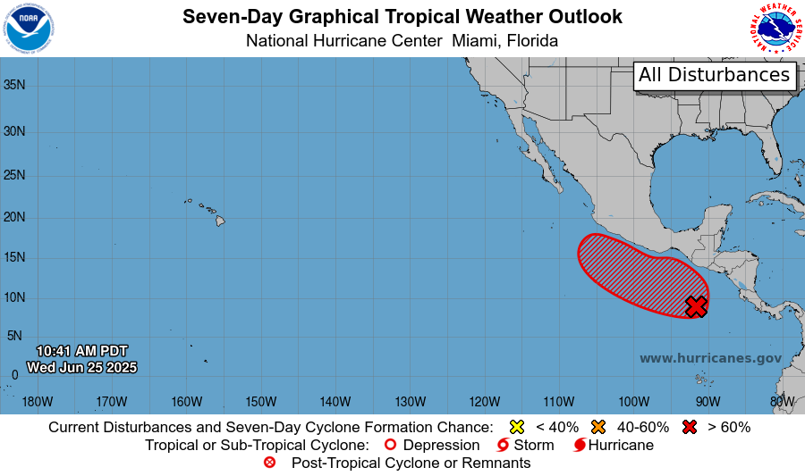
Tropical Storm Andrea came and left very quickly and is now a remnant low pressure system in the northeast Atlantic. In the eastern Pacific, there is still an area to watch, named Invest 95E.
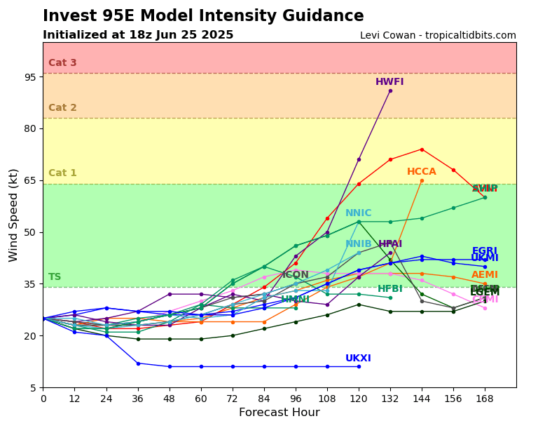
Most models are in agreement that this will become a tropical storm within the next week, with some going for a cat 1 or cat 2. We are too far out for an official forecast, but we will keep our eyes on this.
Want the latest details on these systems? Check out our daily tropical updates for more in-depth information on the tropics!
REGIONAL DAY TO DAY FORECAST
Today: Mostly sunny, scattered thunderstorms in the morning and afternoon. Highs in the mid 90s. Calm winds becoming north northeast around 5 mph. Chance of rain 70 percent.
Tonight: Partly cloudy, chance of showers between 1am and 4am. Lows in the low 70s. Calm winds. Chance of rain 30 percent.
Friday: Mostly sunny. Scattered showers and thunderstorms in the afternoon. Highs in the low 90s. Calm winds. Chance of rain 60 percent.
Friday Night: Partly cloudy. Chance of showers. Lows in the low 70s. Calm winds. Chance of rain 20 percent.
Saturday: Mostly sunny. Chance of thunderstorms in the afternoon. Highs in the mid 90s. Calm winds becoming south southwest around 5 mph. Chance of rain 50 percent.
Saturday Night: Partly cloudy. Lows in the low 70s. Calm winds.
Sunday: Mostly sunny. Showers and thunderstorms in the afternoon. Highs in the mid 90s. Calm winds becoming west around 5 mph in the afternoon. Chance of rain 60 percent.
Sunday Night: Partly cloudy. Lows in the low 70s. West northwest winds around 5 mph becoming calm.
Monday: Mostly sunny. Showers and thunderstorms in the afternoon. Highs in the mid 90s. Chance of rain 70 percent.
Monday Night: Partly cloudy. Chance of showers and thunderstorms. Lows in the low 70s.
Tuesday: Partly sunny. Showers and thunderstorms in the afternoon. Highs in the low 90s. Chance of rain 70 percent.
Tuesday Night: Mostly cloudy. Chance of showers and thunderstorms. Lows in the mid 70s. Chance of rain 40 percen.
Wednesday: Showers and thunderstorms. Highs in the low 90s. Chance of rain 80 percent.


After today, the rain chance ‘does’ go up, but not quite sure where you’re getting the 70% chance for today. I enjoy looking and reading through your analysis and forecast … rivals even the ones put out by Nick. However, the animation videos, without any way of controlling them, such as being able to pause them, makes them virtually useless.