General Central/Eastern Kansas Forecast
Short-Term (Thursday-Friday)
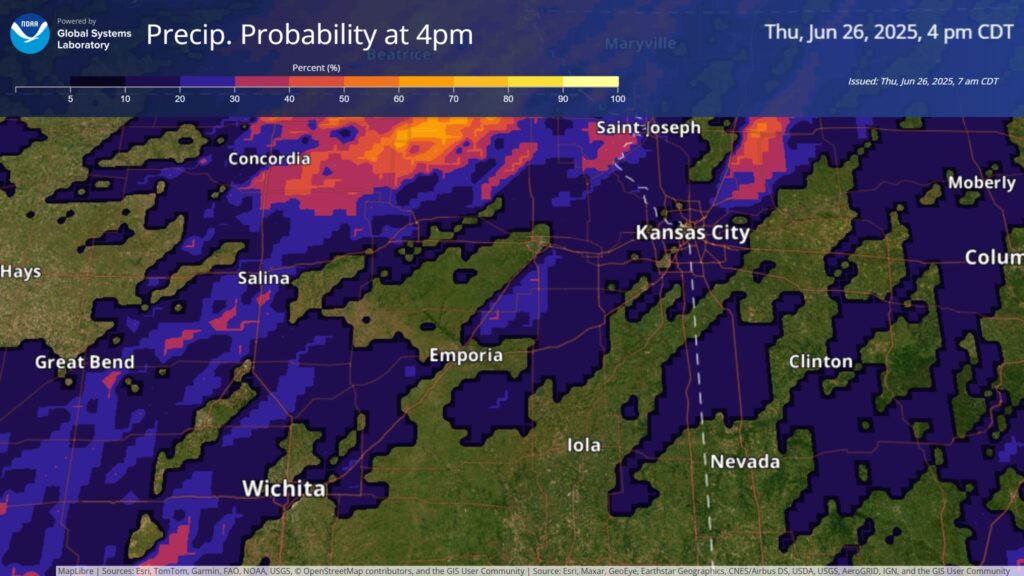
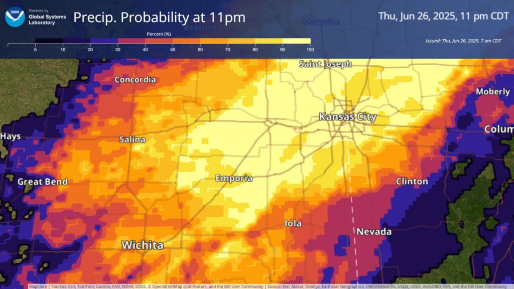
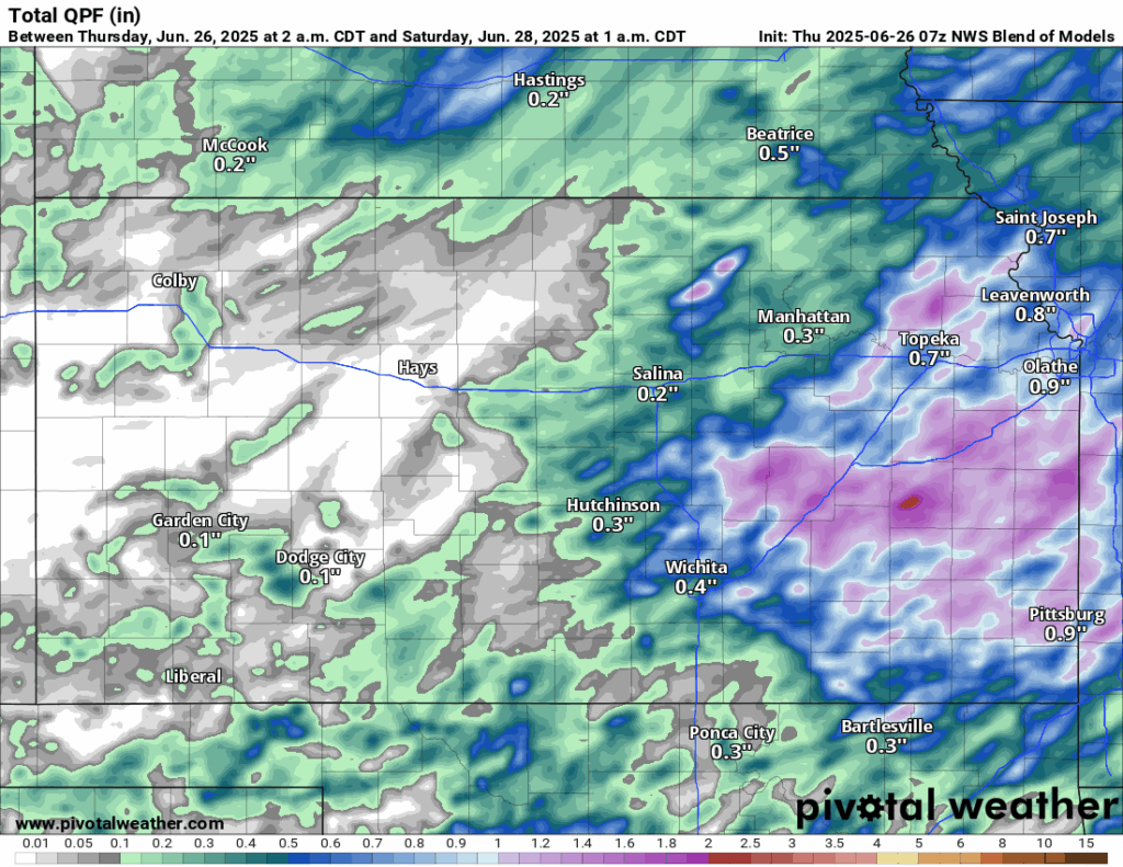
Starting to sound like a broken record at this point, today will be another hot and humid day across central/eastern Kansas, but substantial chances for rain do return today. A weak cold front will slowly come in from the northwest in the afternoon hours and will trigger scattered thunderstorms across the area (roughly around 4pm, but could be earlier than this). Some of these storms may be marginally severe, with damaging winds being the primary hazard, but the greatest concern will be the water. Heavy to possibly torrential rainfall will be very possible in these storms, especially given the slower motion of these storms, so as a result, flash flooding will be a concern going into tonight. Generally, rain totals will be between 0.5 to 1.5 inches, but the more intense thunderstorms may produce rain totals approaching 3+ inches. It is important to note, not everyone may see these thunderstorms this afternoon/tonight, due to the scattered nature of these storms, so the gradient of where people do see storms and don’t may be very sharp.
Temperatures throughout the day today will again be in the upper 80s to low 90s, with winds out of the south at 10 to 20 mph and gusts up to 25 mph. Relative humidity values will remain between 55-65% in the afternoon, keeping our heat index temperatures in the mid to upper 90s. Overnight lows will be in the low to mid 70s.
Thunderstorm activity will continue through the overnight hours and extend into tomorrow, shifting to eastern Kansas throughout the day tomorrow before tapering off by tomorrow night. Some of these storms may still be marginally severe, with damaging winds being the primary hazard, and the heavy rainfall potential will continue on as well. New rainfall totals tomorrow will generally be approaching an inch, with high pockets of 2-3 inches again possible. Temperatures again tomorrow (for those not under any rain/thunderstorms) will be in the upper 80s to low 90s, with winds out of the south at 5 to 15 mph. Heat indices will continue to be in the upper 90s, and our relative humidity stays between 50-65%.
Long-Term (Saturday-Wednesday)
Long-term offers more of the same as the short-term does. Isolated showers and thunderstorms will continue to be possible through the weekend, until a cold front comes through Sunday and increases the precipitation potential more. Temperatures over the Saturday and Sunday timeframe will continue to be very similar to the short-term period, being in the low to mid 90s, with heat indices in the upper 90s to potentially low 100s. Behind the front, precipitation chances will drop off again to favor more isolated potential than anything widespread heading into next week. Temperatures and conditions will also be somewhat cooler and drier behind the front (down into the mid to upper 80s), which will lead to a more comfortable week as we get closer to the Fourth of July.
Regional Soil Moisture Forecast
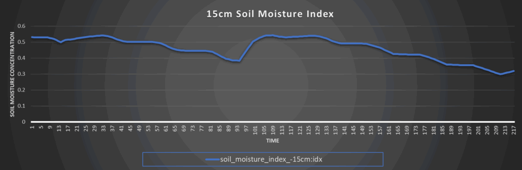
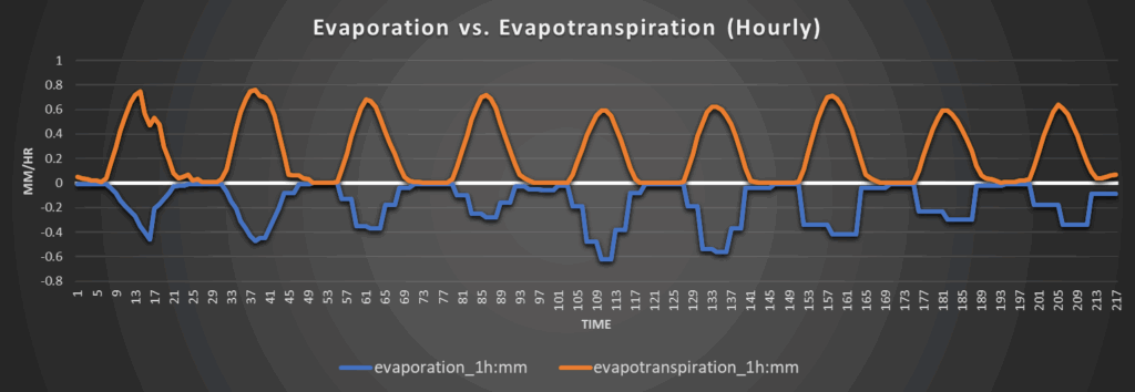
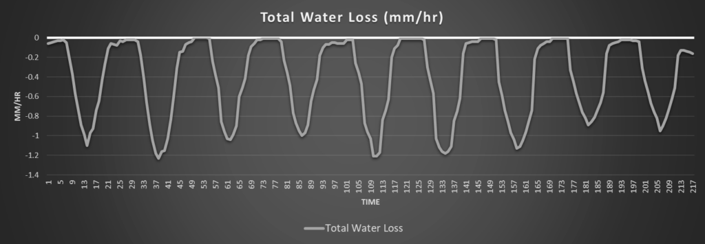
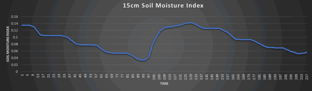
Around Westmoreland
Around Scranton
Around Burlington
Around Altoona