The region will experience a typical summer pattern with hot, humid conditions and daily chances of thunderstorms, especially during the afternoon and evening hours. A weak upper-level disturbance and abundant Gulf moisture will enhance rain chances through the weekend, followed by a slight drying trend midweek.
Scattered PM Storms with Gulf Moisture
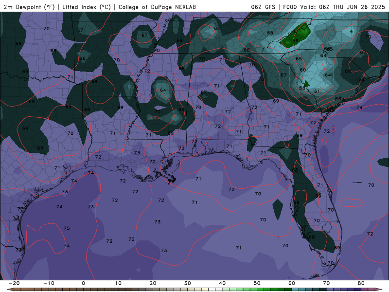
Dewpoint temperatures from Thursday to Wednesday of next week from the GFS model. //Courtesy: College of DuPage
For Thursday and Friday, a moist and unstable airmass remains in place with precipitable water values (PWATs) exceeding 2.0 inches. Surface-based instability will be enhanced by strong daytime heating, promoting isolated to scattered convection each afternoon. Sea breeze boundaries will serve as the primary focus for storm development. Rain chances increase slightly Friday as a weak upper-level disturbance approaches from the east.
Enhanced Storms; Flooding Risk Rises
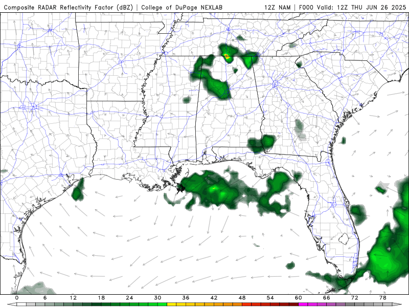
Composite Reflectivity from Friday to Sunday from the NAM model. //Courtesy: College of DuPage
From Saturday through Monday, a more active convective period is expected as a weak upper-level disturbance moves across the region. This feature will enhance atmospheric lift and increase storm coverage, with numerous showers and thunderstorms likely each afternoon and evening. Due to weak steering flow, storms will be slow-moving, elevating the risk of localized flooding, particularly in urban and low-lying areas. Rainfall rates may exceed 1–2 inches per hour in the strongest cells.
Storms Continue with Slight Drying Trend
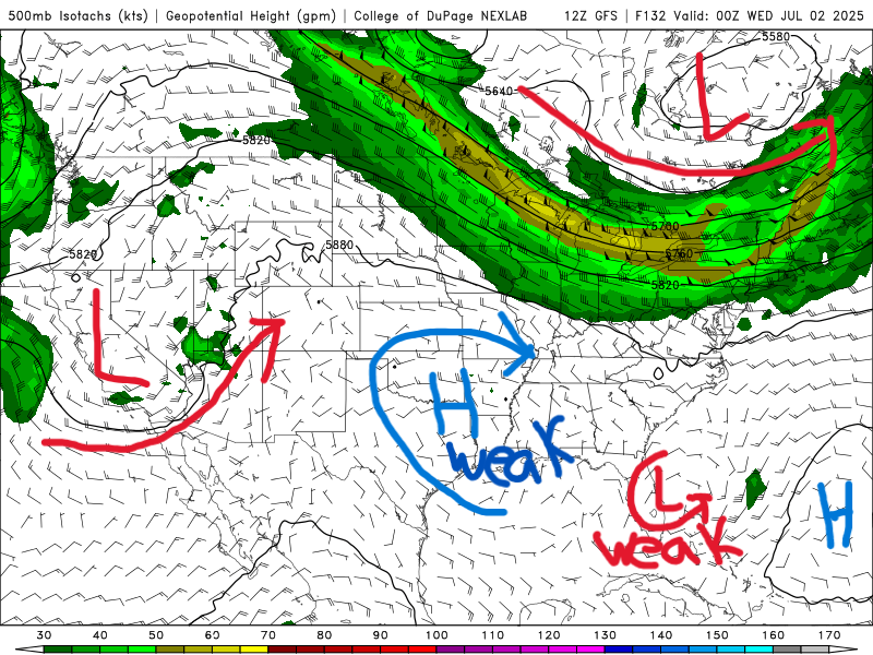
500 mb map for Tuesday of next week from the GFS model. //Courtesy: College of DuPage
From Tuesday through Wednesday, the weak upper-level disturbance that enhanced convection over the weekend will begin to weaken and shift eastward, reducing its influence on the region. However, ample Gulf moisture and residual instability will persist, maintaining support for scattered afternoon and evening thunderstorms, primarily driven by surface heating and mesoscale boundaries such as sea breezes and outflow interactions. While rain chances remain elevated, they will be slightly lower than during the peak activity over the weekend. With less cloud cover in some areas, temperatures will trend marginally warmer, and heat indices may climb to 100–105°F, especially where storms are more isolated.
Regional Day-to-Day Forecast
Thursday – Partly cloudy skies. High near 90°F. Winds SSE at 10–15 mph with a 20% chance of rain.
Thursday Night – Mostly clear to partly cloudy. Low around 78°F with a 20% chance of rain.
Friday – Scattered thunderstorms in the morning, then partly cloudy late. High near 89°F. Winds S at 10–15 mph with a 40% chance of rain.
Friday Night – Variably cloudy with scattered thunderstorms. Low around 78°F with a 50% chance of rain.
Saturday – Scattered showers and thunderstorms. High near 87°F. Winds SSW at 10–15 mph with a 60% chance of rain.
Saturday Night – Variably cloudy with scattered thunderstorms. Low around 78°F with a 50% chance of rain.
Sunday – Scattered thunderstorms. High near 89°F. Winds SW at 5–10 mph with a 60% chance of rain.
Sunday Night – Partial cloudiness early, with scattered showers and thunderstorms later during the night. Low around 79°F with a 40% chance of rain.
Monday – Scattered showers and thunderstorms. High around 90°F. Winds SW at 10–15 mph with a 50% chance of rain.
Monday Night – Partly cloudy with late night showers or thunderstorms. Low around 79°F with a 50% chance of rain.
Tuesday – Partly to mostly cloudy skies with scattered thunderstorms in the morning. High around 90°F. Winds SE at 10–15 mph with a 40% chance of rain.
Tuesday Night – A few clouds from time to time. A stray shower or thunderstorm is possible. Low around 77°F with a 20% chance of rain.
Wednesday – Intervals of clouds and sunshine. High near 91°F. Winds SE at 5–10 mph with a 20% chance of rain.
Wednesday Night – A few clouds from time to time. Low near 77°F. Winds WSW at 5–10 mph with a 20% chance of rain.


