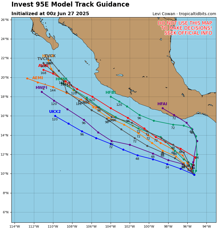
The area of interest to the south of Mexico is slowly but surely organizing. It is in an area of low shear, high humidity, warm ocean waters, and converging winds. It seems on track to develop sometime this weekend or early next week. The storm’s name would be Flossie. Once it forms, it is expected to move essentially parallel to the Mexican coastline, with the center of circulation anywhere between 200 and 250 miles offshore. The storm will pass close enough to bring some rain to regions along the Pacific coast of Mexico.
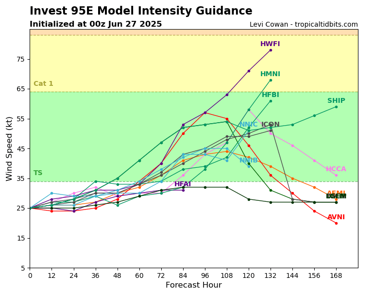
With any storm in this part of the world, rapid intensification is a concern. While not completely off the table, I find it much less likely this storm will rapidly intensify, as it is headed towards a relatively dry environment with wind shear present.
TROUBLE IN THE GULF?
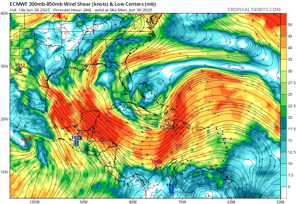
The NHC has highlighted an area associated with a tropical wave adjacent to the Yucatan Peninsula. The wave actually has to cross the Yucatan before entering the theoretical development area. If you can get a break in the wind shear and a moist environment, it is certainly warm enough for tropical development in the southwestern Gulf of Mexico. The moisture is there. The wind shear, thankfully, is also there. And that shear, I believe, will keep this system from becoming truly concerning. Still, moisture from this system may head north and impact our local forecast area in the Pine Belt of Mississippi, so it bears watching this one.
LONGER RANGE
The last 3 runs of the GFS all show a potentially powerful storm forming in the Pacific next weekend (as in 8 days from now), that would also move parallel to the coast of Mexico, but a bit further away. One of the model runs in particular does show this storm likely reaching major hurricane status. The GFS is known to be on occasion schizophrenic as it relates to long term hurricane forecasting, but given current oceanic conditions, this wouldn’t surprise me at all. It is likely we’ll get at least one more tropical storm of some kind in the East Pacific, before wind shear enters the area in mid-July and inhibits tropical development.
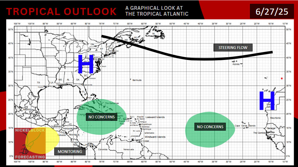
As for the Atlantic basin, there is a preliminary signal from both the GFS and European Model about some activity off the coast of the Mid-Atlantic around the July 4th holiday. But anything that forms here will be steered away from land by the Bermuda High. The GFS also shows a signal for a storm impacting the Gulf coast around this time period, but without a corroborating signal from the European model this far out, that should be viewed with some skepticism. Ocean waters are warm enough in the Gulf, so if there’s a window of time where both wind shear and dry air are limited, you could get storm formation. But it’s not too likely at this point.
While the Central Atlantic is not warm enough yet, it is slowly but surely warming up. And when it is is finally ready, due to a near-neutral ENSO phase that could reduce wind shear, we could still be looking at an above average hurricane season numerically.
[wpcode id=”41149″]


