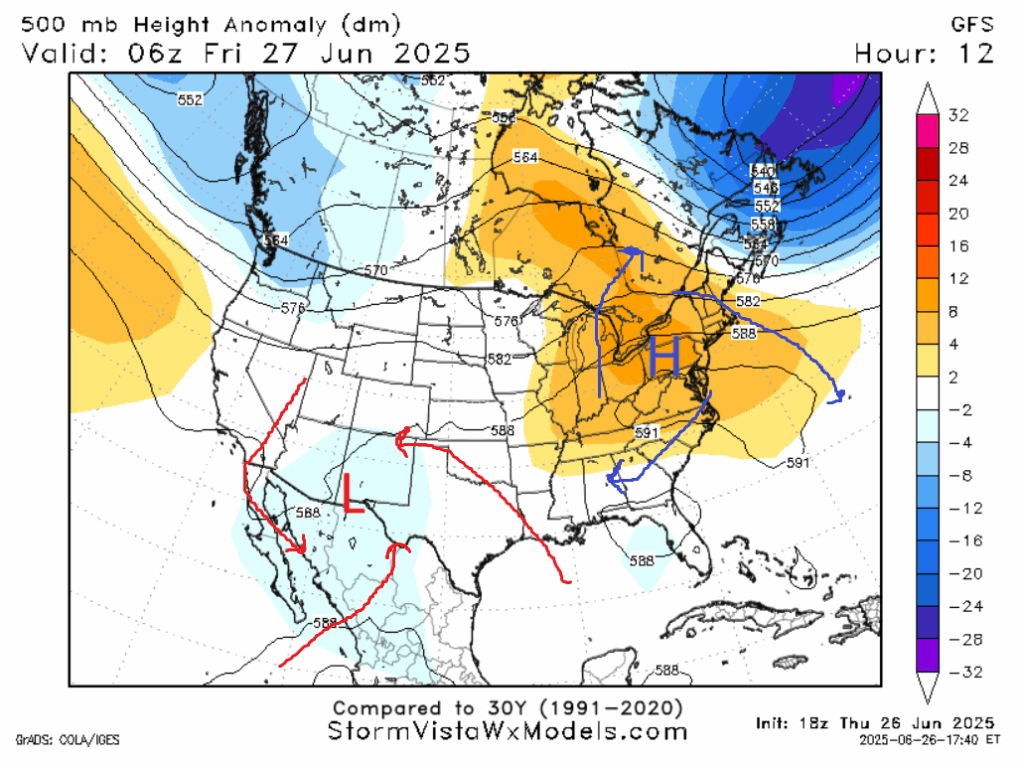
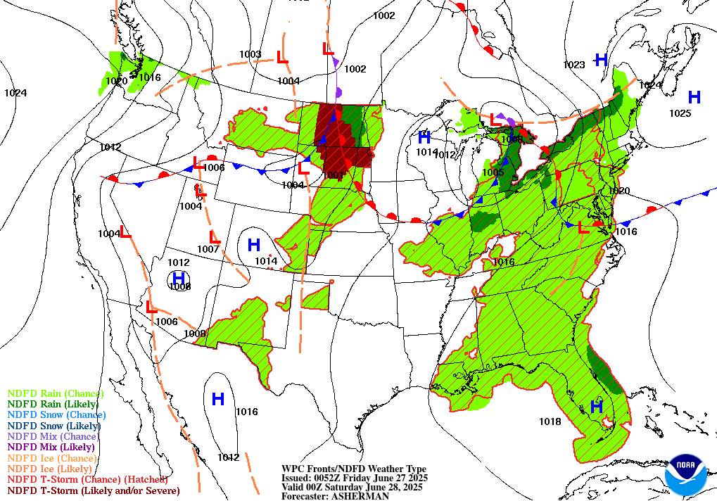
Today will be a pretty seasonable day for this area. The trough to our west will rotate moist air up from the Gulf of Mexico, heightening chances of an afternoon shower or thunderstorm in our area. There is a marginal risk of severe thunderstorms, with damaging wind gusts, potentially associated with downbursts, being the primary threat. But the recent runs of convective allowing models are bearish on any severe threat. Due to the ridge to our northeast, upper-level winds may cause the storms to propagate backwards, moving from east to west instead of the usual east to west, as was the case yesterday. Regardless, when thunder roars, go indoors. Temperatures will be seasonable, with highs in the low 90s and lows in the mid 70s. Winds will be light, and will likely be blowing from the south.
The ridge that has been plaguing the eastern half of the United States with record-high temperatures will finally abate this weekend. A frontal boundary that will settle into our north on Saturday will make that the wetter day this weekend, with rain chances likely north of 70%.
This weekend, we will experience “morning highs” in the ballpark of 90 degrees, where the peak temperature is actually in the morning hours, before rain and clouds move in during the afternoon (when the high temperature “should” be) and will instead cool things down. Sunday will have a similar setup. Evening conditions could be quite pleasant in areas that received afternoon rain that then moves out of the area.
NEXT WEEK
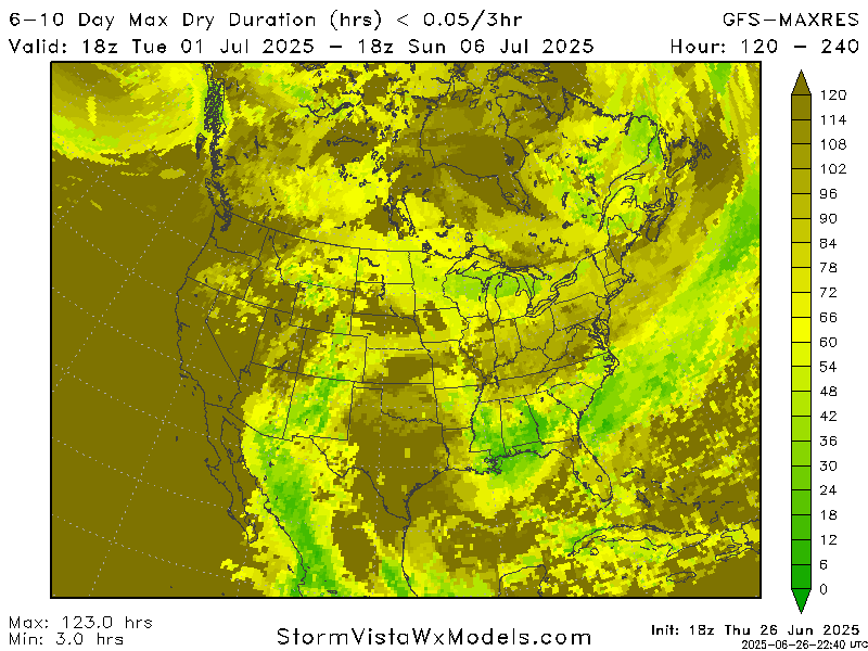
As a trough builds in the north-central United States, a series of shortwaves will move through our forecast area, each one potentially setting off convection leading to thunderstorms. The later into next week you get, the lesser the storm chance gets as the trough to the north abates.
I’m pleased to say that the 4th of July holiday looks to be a classic summer day, that is hot and sunny save for scattered afternoon thunderstorms. But it’ll be as good barbecuing, pool party, and fireworks weather as you could ask for.
LOOKING TO THE TROPICS
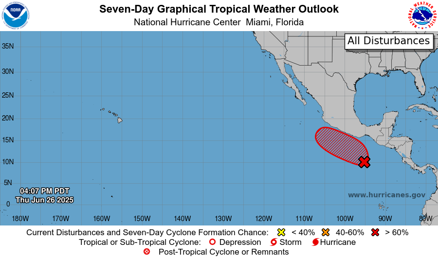
Late this week or early next week, Tropical Storm Flossie will likely form off the coast of Mexico. Flossie will move parallel to the shore of Mexico as a strong tropical storm, before dissipating 5 to 7 days after it formed. A tropical wave has formed adjacent to the Yucatan peninsula, which has a small chance of becoming a tropical depression as well. It is possible moisture from this system may impact our forecast area, so it is worth keeping an eye on. We may potentially a storm off the coast of the Mid-Atlantic coast after the 4th of July, but it should avoid land. The Atlantic basin is warming up, but it will likely not be until mid-July until the basin is ready for development.
DAY-BY-DAY FORECAST
Today: Highs in the low 90s. Afternoon showers and thunderstorms likely. Marginal severe threat. Chance of rain 40%.
Tonight: Mostly clear. Lows in the mid 70s.
Saturday: Morning highs around 90. Showers and thunderstorms likely. Chance of rain 70%. Lows in the low 70s.
Sunday: Morning highs around 90. Showers and thunderstorms likely. Chance of rain 60%. Lows in the mid 70s.
Monday: Highs in the low 90s. Showers and thunderstorms possible, most likely in afternoon. Chance of rain 60%. Lows in the mid 70s.
Tuesday: Highs in the low 90s. Showers and thunderstorms possible, most likely in the afternoon. Chance of rain 60%. Lows in the low 70s.
Wednesday: Highs in the low 90s. Showers and thunderstorms possible. Chance of rain 50%. Lows in the low 70s.
Thursday: Highs in the low 90s. Showers and thunderstorms possible. Chance of rain 40%. Lows in the mid 70s.
Friday (4th of July): Highs in the low 90s. Chance of rain 30%. Lows in the mid 70s.
Saturday: Highs in the mid 90s. Chance of rain 30%. Lows in the mid 70s.
Sunday: Highs in the mid 90s. An afternoon thunderstorm is possible. Chance of rain 50%. Lows in the low 70s.
[wpcode id=”41149″]


