General Central/Eastern Kansas Forecast
Short-Term (Monday-Tuesday)
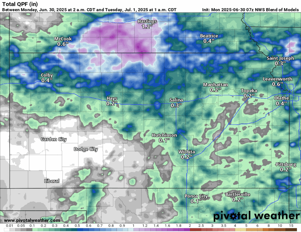
Chances for precipitation will increase again across the region as a cold front shoves in scattered showers and thunderstorms from the northwest during the morning and early afternoon hours. An isolated damaging wind gust can’t be ruled out with these storms, but most of the activity looks to be sub-severe. Some further isolated redevelopment may be possible during the afternoon hours, particularly in eastern and southeastern Kansas, as the cold front moves through throughout the afternoon and evening. Some of these storms may be locally severe, with the primary hazard being large hail. Thunderstorm activity will depart the area once the cold front moves completely through at around 10pm to 12am. Total rainfall amounts throughout the day and evening hours today will largely be between 0.1 to 0.5 inches, but pockets of over 1 inch may be possible in heavier thunderstorms.
Temperatures during the day will be slightly less than in previous days, being in the mid to upper 80s with winds out of the north at 5 to 10 mph. Some pockets of low 90s temperatures may be possible, especially if the morning round of showers and thunderstorms ends up being weaker and the sun is allowed to heat the air for longer. General feeling of the air will still be on the more humid side, with relative humidity ranging between 60-70%. Low temperatures tonight will be very comfortable and get down into the mid to upper 60s.

By tomorrow, rain chances look to fully shut down as a surface high moves in over the state and sits over eastern Kansas. This will also help to drop our relative humidity (down to between 25-50%), as drier air will move in and make conditions at least somewhat more comfortable during the daytime. Temperatures during the day will be in the mid 80s with light and variable winds.

Long-Term (Wednesday-Sunday)
Dry conditions will persist at least until Thursday or so, where then we will see moisture fully surge back into the state and we return to weak southwesterly flow aloft, which would increase daily thunderstorm chances with any impulses that pass within the flow. Details are a little but muddy this far out, but the best chance of precipitation may be this weekend, as an upper-level shortwave passes through, which would increase thunderstorm chances more than just the pop-up showers and thunderstorms we have been receiving. Temperatures throughout the week will stay consistently between the upper 80s to low 90s throughout the days.
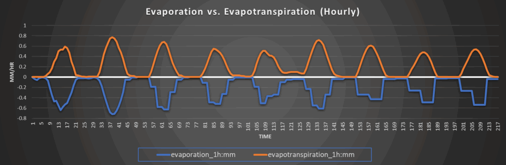
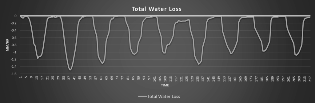
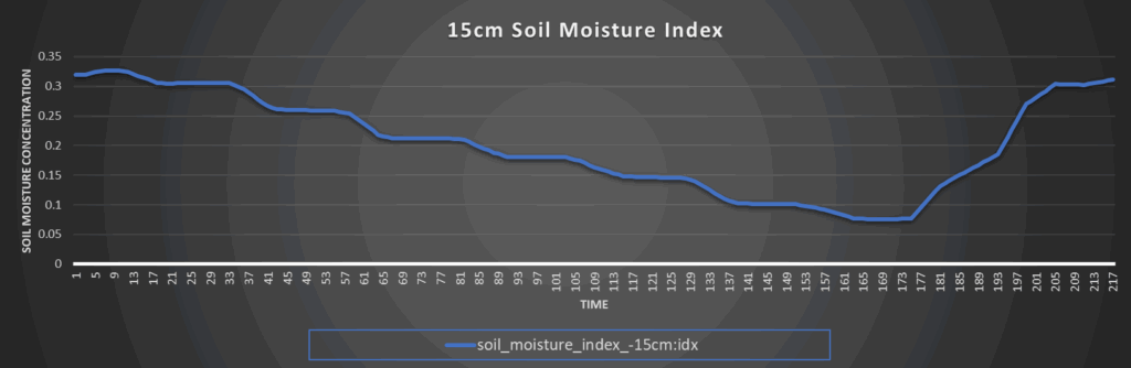
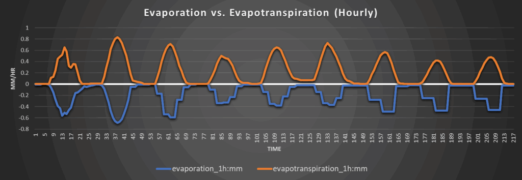
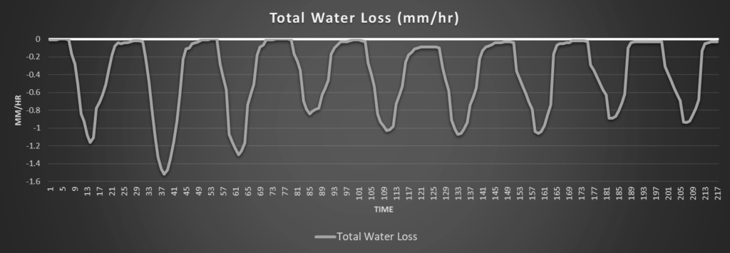
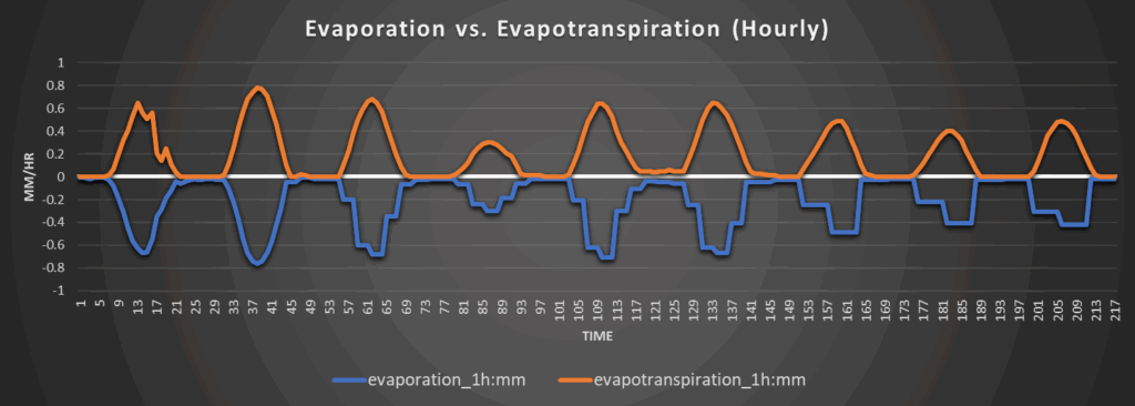
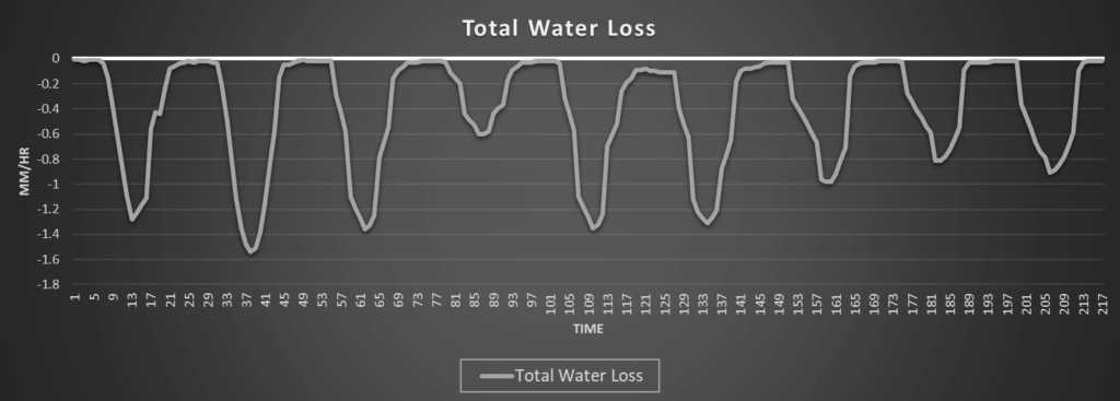
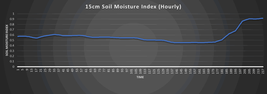
Regional Soil Moisture Forecast
Around Westmoreland
Around Scranton

Around Burlington
Around Altoona