General Central/Eastern Kansas Forecast
Short-Term (Wednesday-Thursday)
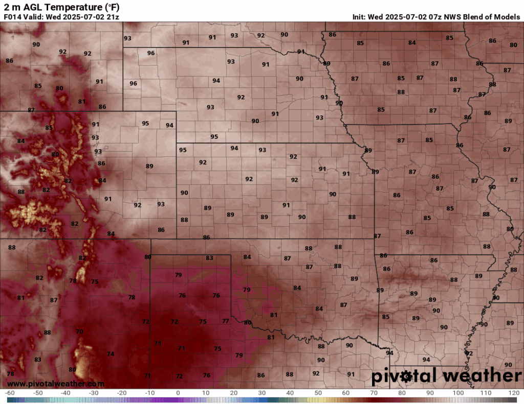
Today will remain fairly warm and dry across the region, as high pressure will begin to move away from the area, but hang around long enough to suppress any thunderstorm development. Temperatures again today will be fairly seasonal in the upper 80s to low 90s, with a southerly wind of 5 to 10 mph. Our humid airmass will begin its movement northward towards us beginning today but today should remain dry enough (with relative humidity values still between 40-50%) that heat indices are not too big of a concern. By tonight, the increase in moisture in the air will help raise our low temperatures a bit into the upper 60s to low 70s.
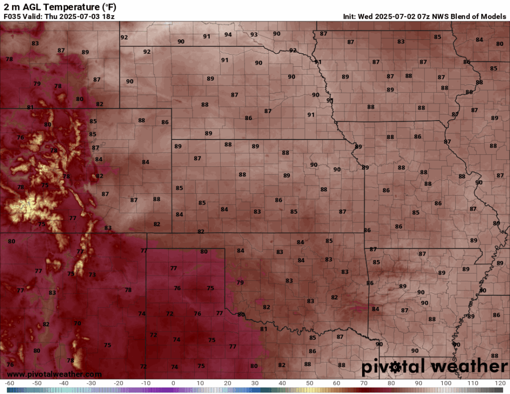
Tomorrow may see some isolated pockets of shower activity during the day, especially in southern to southeast Kansas, but the rest of us will still be relatively devoid of precipitation from lingering high pressure. Temperatures will be near the same as today, with highs in the upper 80s to low 90s and southerly winds of 5 to 10 mph. The humidity will return as our moist airmass keeps surging forward, with relative humidity during the day between 50-65%. Heat indices tomorrow will reach the low to mid 90s as a result.
Long-Term (Friday-Tuesday)
Friday sees a return of daily rain chances, as our high pressure fully moves away from our area and we see a return to weak east-west flow aloft, allowing multiple disturbances to potentially pass through and spur thunderstorm activity. The first of these disturbances will arrive Friday, where an incoming shortwave will traverse the state and spur scattered thunderstorm activity during the afternoon and evening hours and continue all the way through Saturday morning. As this round departs, more small-scale disturbances will pass through all the way through to early next week, allowing for daily chances at precipitation. Temperatures over this period will go back to being warm and humid, with highs in the mid 80s to upper 80s and heat indices in the low to mid 90s.
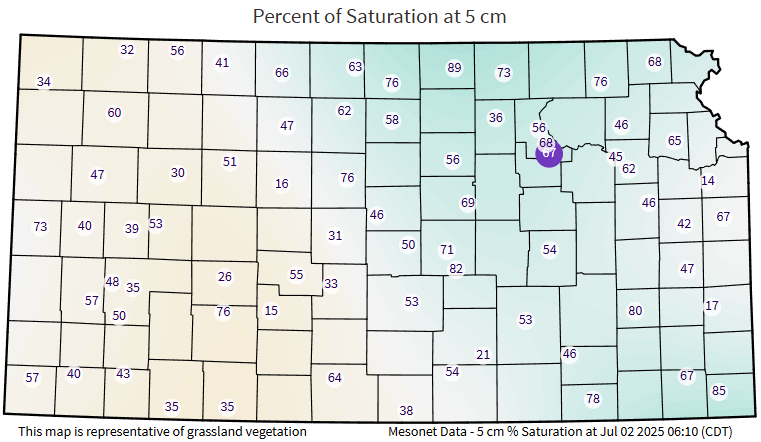
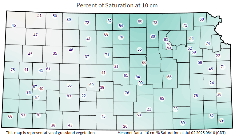
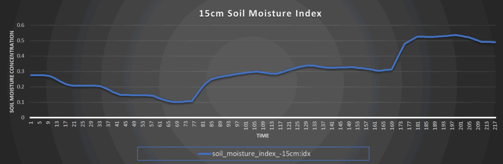
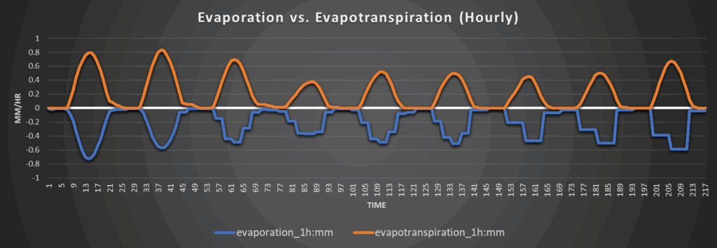
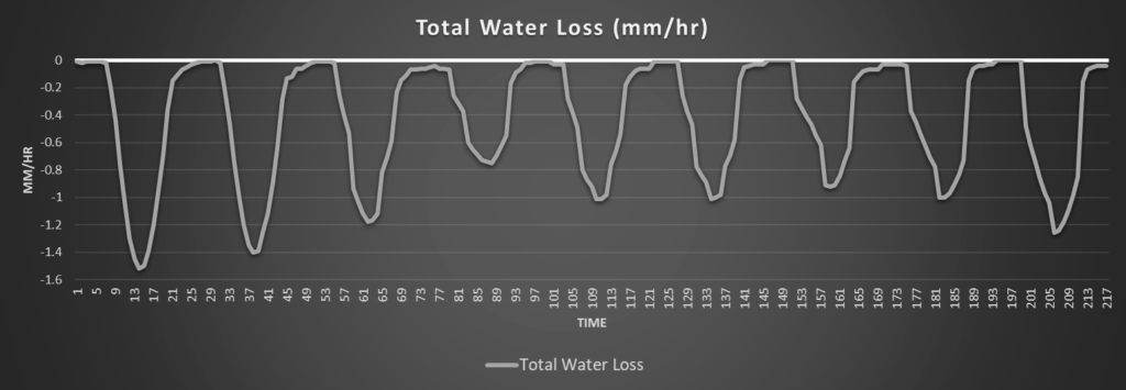
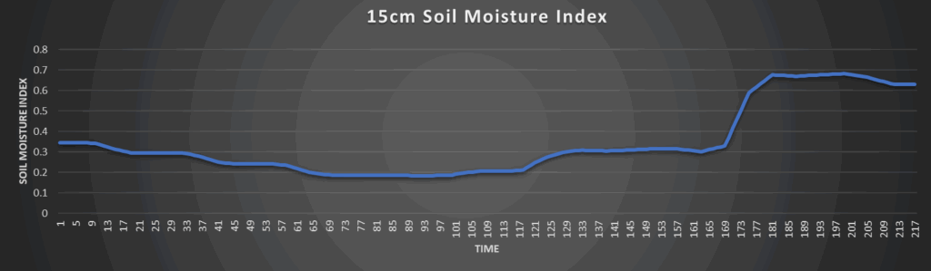
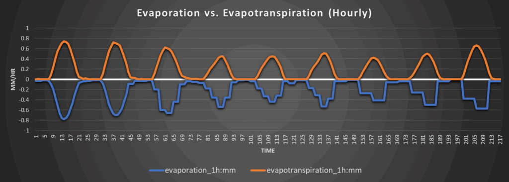
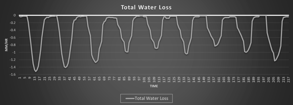
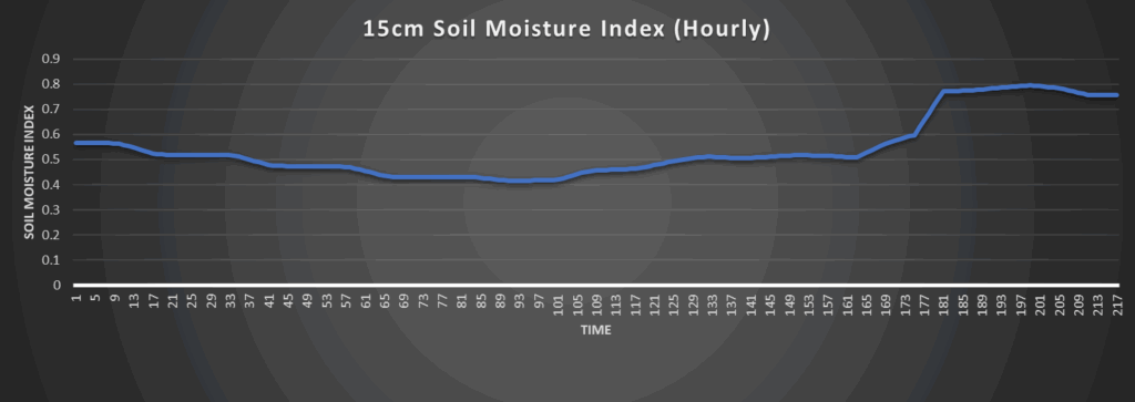
Regional Soil Moisture Forecast
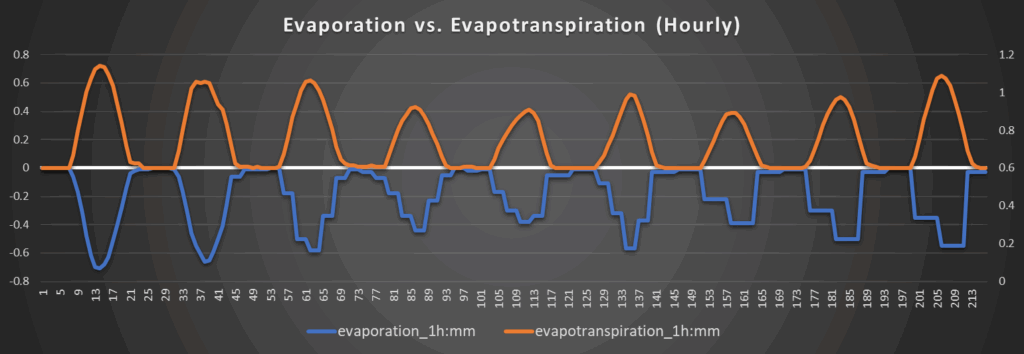
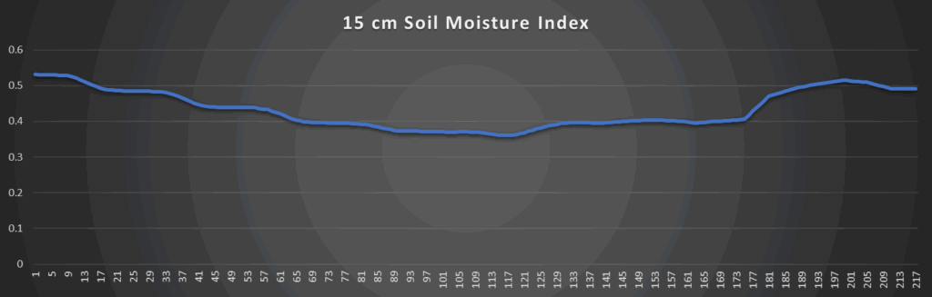
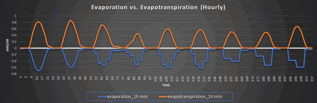
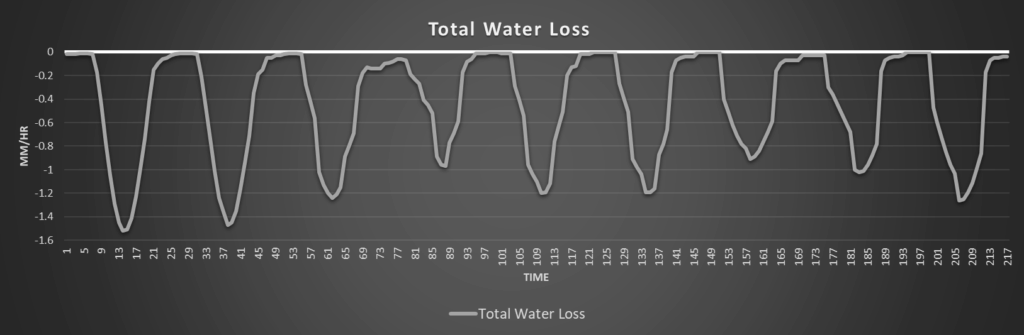
Soils will continue to dry out today and tomorrow with the warm and quieter weather conditions in place. By Friday, we will gradually see less and less drying and water loss as evaporation and evapotranspiration rates and total water loss rates decrease due to increased chances for rain. Soils will slowly but steadily increase in overall water content in response to this upcoming trend.
Around Westmoreland
Around Scranton
Around Burlington
Around Altoona