There is a 40 percent chance of tropical development off the northeast Florida coast, bringing a heavy rain and a flood threat with or without official development. Hurricane Flossie is churning up the eastern Pacific after soaring as a Cat 3 earlier this week. Another area to watch exists just behind Flossie. Let’s look at the forecast:
[wpcode id=”41149″]
Atlantic Basin Setup

Currently in the Atlantic Basin, there is an area of low pressure along a frontal boundary in the northeastern Gulf, which currently has a 40 percent chance of tropical development within the next 7 days. If it were to form into a tropical storm, it should do so off the Georgia or South Carolina coast, near the area highlighted in yellow above. The primary threat type is heavy rain and flooding for the southeast, particularly the northern half of Florida and surrounding coastal states.
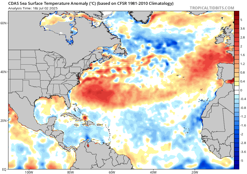
Very warm water is currently sitting over the possible development region. If a system were to form, the warmer than average sea surface temperatures would be to blame. We will keep an eye out for the latest developments and report them to you!
[wpcode id=”41149″]
Eastern Pacific Setup
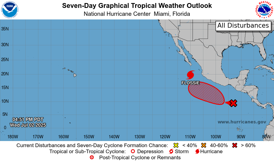
Currently in the eastern Pacific Basin, we have Hurricane Flossie, which is weakening significantly after peaking as a category 3 hurricane earlier this week. We also have an area to watch just behind Flossie, which is expected to form into something possibly this weekend or early next week.
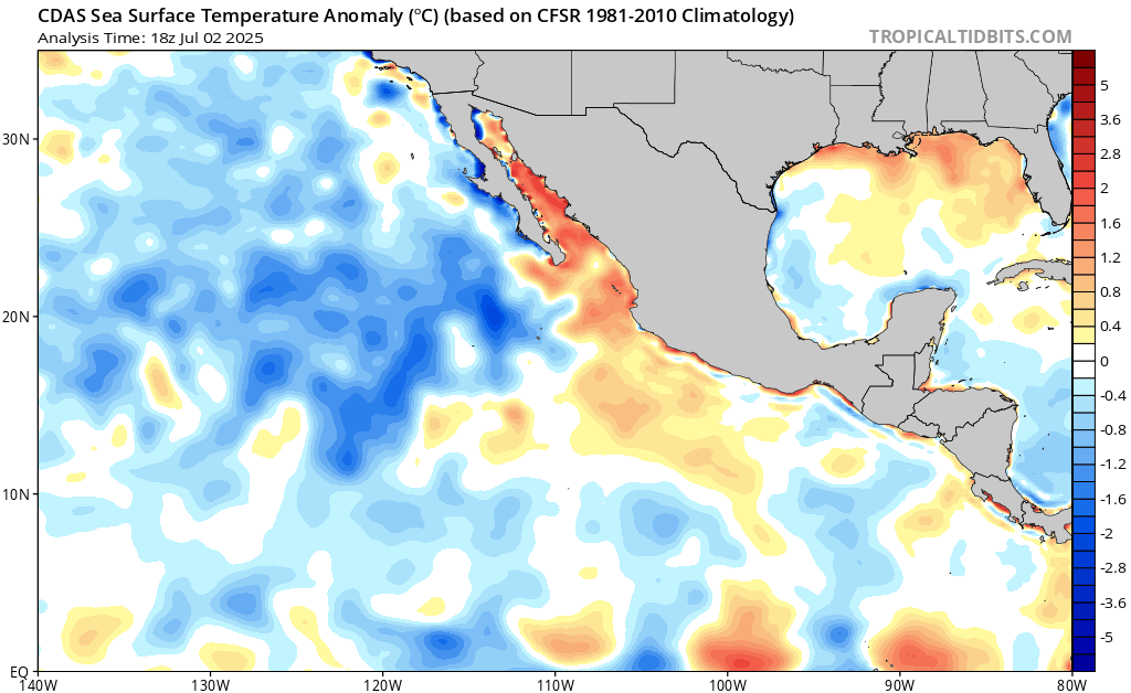
Sea surface temperatures are very warm and are warmer than average off the coast of Mexico, but each one of these storms have moved to the northwest where ocean temperatures are much cooler than average, which weakens the storms very quickly. Let’s look at the details:
[wpcode id=”41149″]
Eastern Pacific: Hurricane Flossie
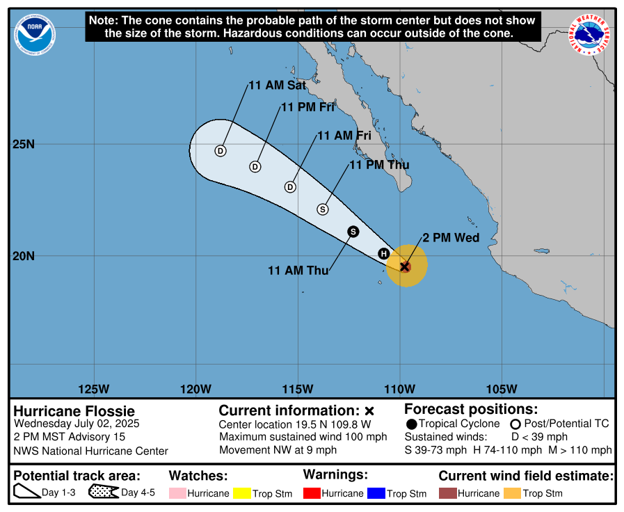
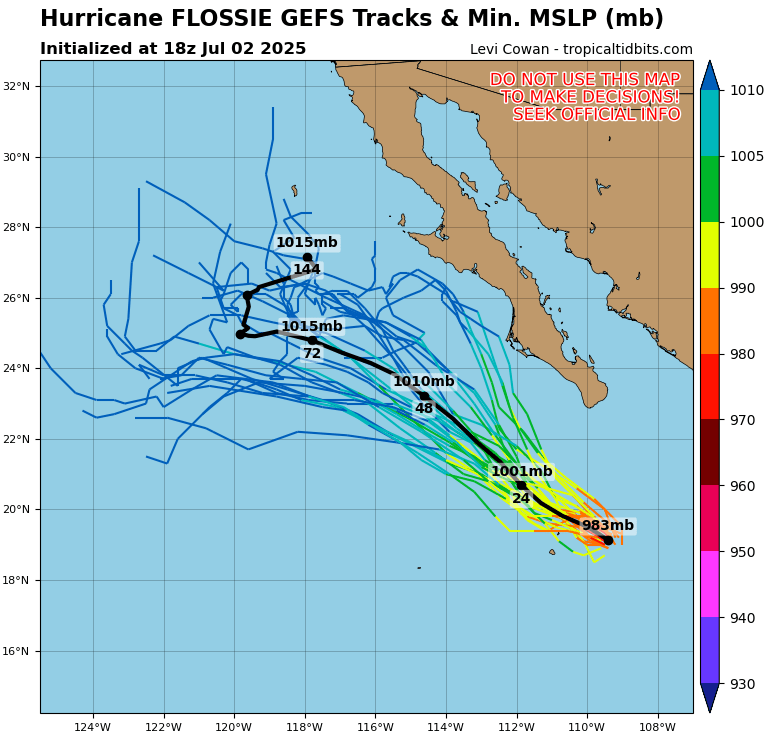
As of the latest update, Hurricane Flossie is a category 1 hurricane with sustained winds at 100 mph. It is expected to downgrade to a tropical storm early today and become a depression early Friday. The GEFS ensembles are in agreement of a northwest, then west track when weakening. Much cooler than average sea surface temperatures are under the storm as it moves forward in time, weakening it significantly.
[wpcode id=”41149″]
Eastern Pacific: Disturbance behind Flossie
A cluster of showers and thunderstorms to the south of Hurricane Flossie has an increased chance of tropical development in the next 7 days – 70 percent. It is expected to move to the north northwest and become a tropical depression by this weekend or early next week. Sea surface temperatures in the development region are very warm, but as it moves to the northwest, such as Flossie, it should weaken fairly quickly.
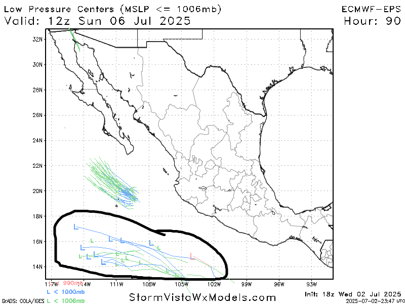
As you can see above, the European Ensemble members are mostly in agreement that if a storm were to form, it would track to the west northwest out to sea, and will not make a landfall in Mexico.
[wpcode id=”41149″]
Continue to check back for the latest updates!


