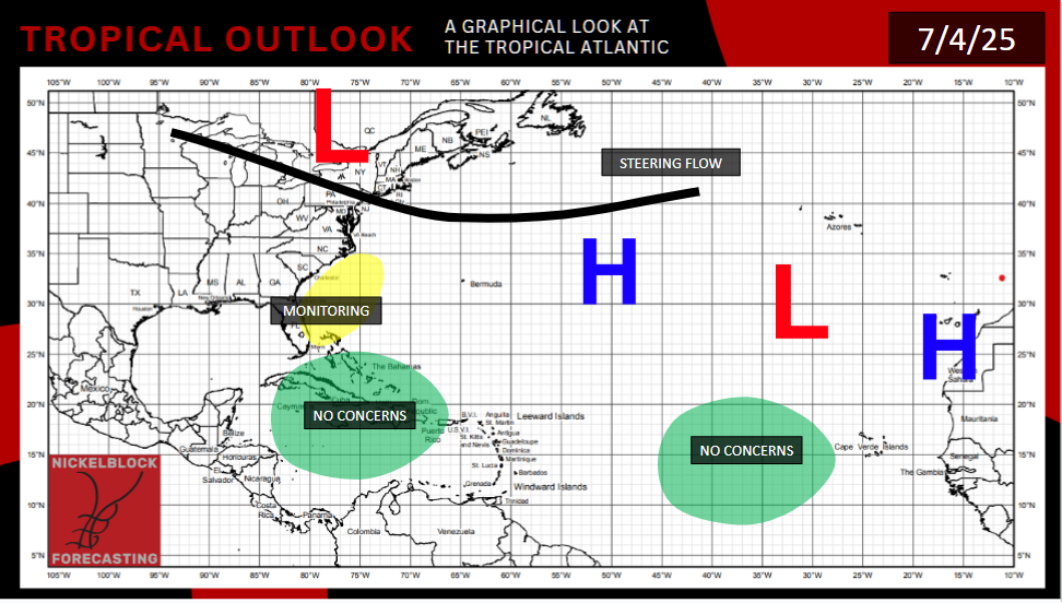
The area of interest that was over Florida yesterday has moved, now encompassing an area off the Southeast US coast. The area of interest remains disorganized. If anything forms, it will likely be early next week. Depending on timing, a ridge in the northeast could steer the storm northeast over the ocean, or due north, where it may impact the Carolina coast. Recent guidance is favoring a track that will directly go over land.
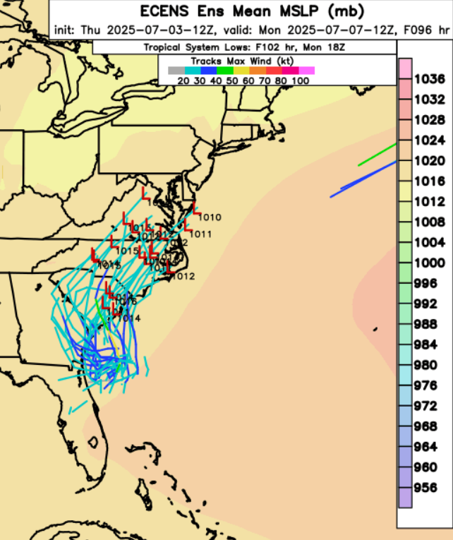
Regardless of where it’s headed, I expect a messy early week for the Southeast, with flooding possible. The wind and surge threat will be more conditional, but will be higher the closer the storm center gets to land. I’d expect any system to be a strong tropical storm or Category 1 hurricane when it’s closest to land. It would be named Chantal.
Meanwhile, Flossie has weakened to a post-tropical system, and appears to be on its last legs as it enters cooler ocean waters.
But it’s likely another storm will form behind Flossie, in a seemingly never ending cycle of tropical development. This storm will be named Gil if it reaches tropical storm status. When it forms, it will be further from mainland Mexico, avoiding land impacts, but it may be more intense. In the likely event Gil forms, the GFS would have correctly predicted it much sooner than other models. The GFS model also shows another storm forming behind Gil in the 10-15 day time frame that would travel over the same area. It is the GFS, which often overdoes storm severity in the long term, but just given the conditions and recent history, I think it is on to something here.
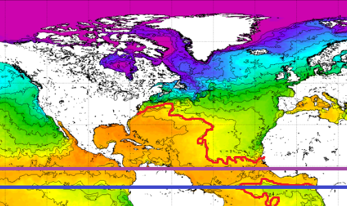
Looking to the map above, the red line refers to the 80 degree oceanic isotherm, while the purple line represents the line to the north of which there is enough Coriolis force for a hurricane to form. (The blue line is the Equator.) Any location south of the red line and north of the purple line is “eligible” for hurricane formation.
Some European ensembles are suggesting a storm could form in the 5-8 day time frame that could threaten Bermuda. It is also worth it to continue to watch the Gulf of Mexico. The Caribbean is being guarded by a persistent layer of wind shear. This makes the environment unfavorable for any tropical storms.
[wpcode id=”41149″]


