General Central/Eastern Kansas Forecast
Short-Term (Monday-Tuesday)
Pretty much the same song and dance we have been doing continues over today and tomorrow; hot, muggy conditions punctuated by scattered chances for showers and thunderstorms. Currently, we are residing under an extremely weak westerly to northwesterly flow pattern, which due to relatively strong trough ejections in the northern US have kept high pressure off to our southwest and allowed for rain to hang around virtually every day. Scattered showers and thunderstorms look to develop during the afternoon and evening hours across central and eastern Kansas under a moist and unstable atmosphere, with some of these storms perhaps being severe with damaging winds being the most likely hazard. Localized heavy rainfall is possible with these storms given their relatively slow movement. The exact location or focus for these storms today will be very ambiguous and unknown, mainly due to the lack of any surface boundary or upper-level disturbance.
Conditions today will feel quite hot and extremely humid. High temperatures today across the area will largely be in the upper 80s to low 90s, with east-southeasterly winds of around 5 to 10 mph. Heat index temperatures today will make it into the mid 90s, owing to relative humidity values of around 50%. Overnight low temperatures will be similar to last night, reaching down into the upper 60s to low 70s.
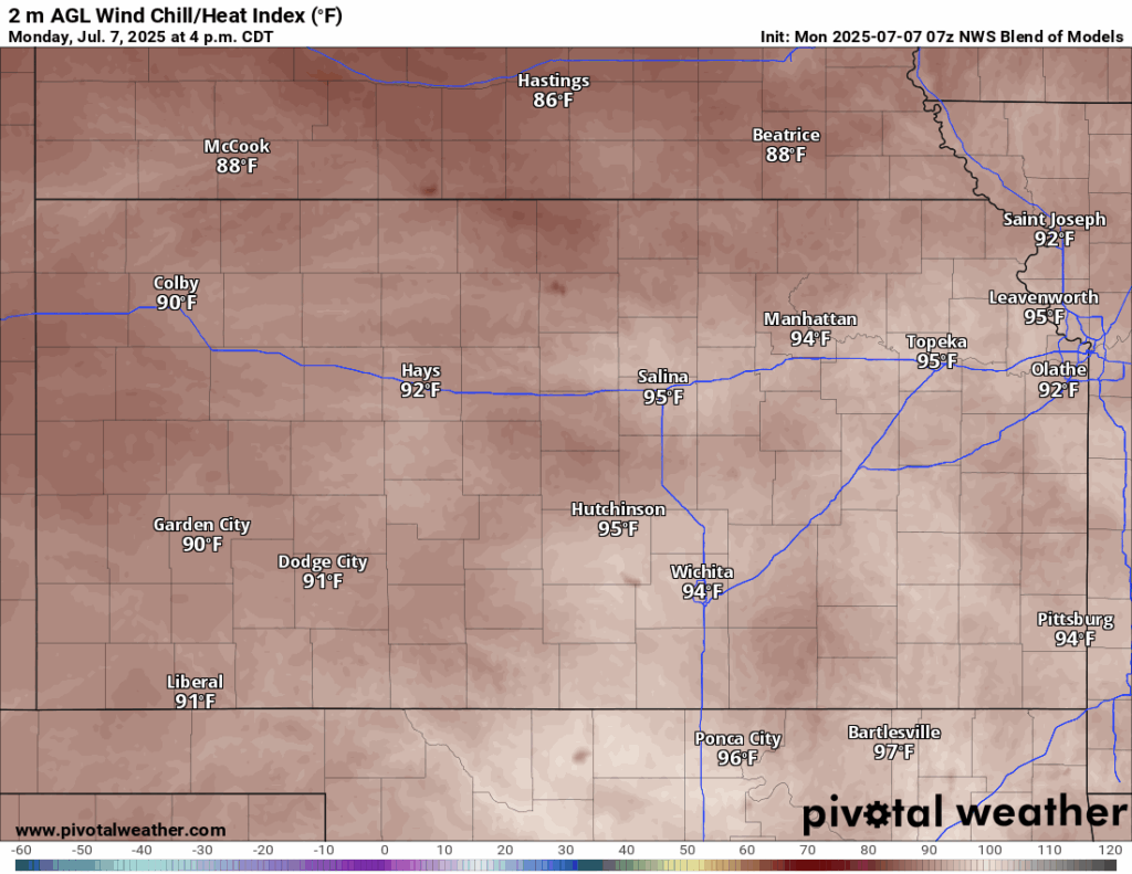
Tomorrow will essentially be the same as today, with the addition of rain chances through the morning hours as a potential system works its way through from Nebraska. Areas most likely to see rain from this round will be in northeast Kansas close to the border. This system may also leave behind an outflow boundary to help trigger further development of showers and thunderstorms in the afternoon hours, with the areas of greatest focus for these storms being across eastern and southeast Kansas (generally anywhere east of US-77). Temperatures will be relatively unchanged, hanging in the mid 80s to low 90s during the afternoon with light and variable winds. Heat indices throughout the afternoon will reach the low to mid 90s (and possibly some isolated pockets of upper 90s).


Long-Term (Wednesday-Sunday)
Wednesday may see somewhat of a break in the rain, as high pressure builds in from the southwest and will help put the lid on rain potential across the area. This break may not last for long, as the high pressure is again broken down by a couple upper-level trough ejections across the central/northern tier of the country, opening the door for daily rain chances once again from Thursday-Sunday. Temperatures over the long-term period will stary pretty consistently in the upper 80s to low 90s all across the region.
Drought Update
Small improvements to drought conditions between last week and this week have been made, particularly across northern Kansas due to all of the latest rain and thunderstorm activity. Further localized improvement should keep occurring through this week with the continued scattered rain chances.


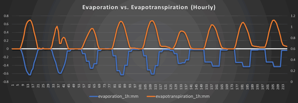
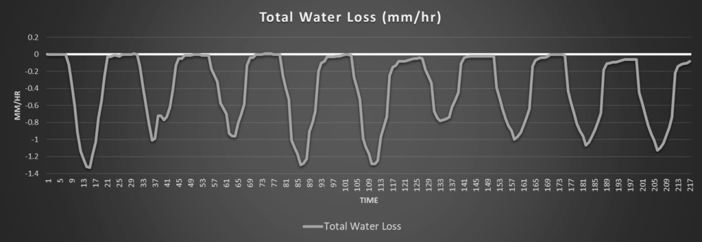
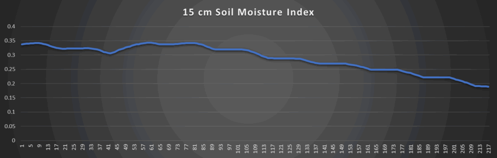
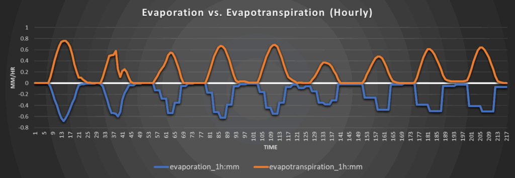
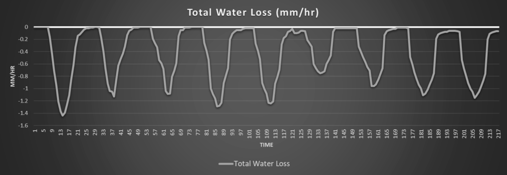
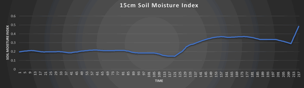
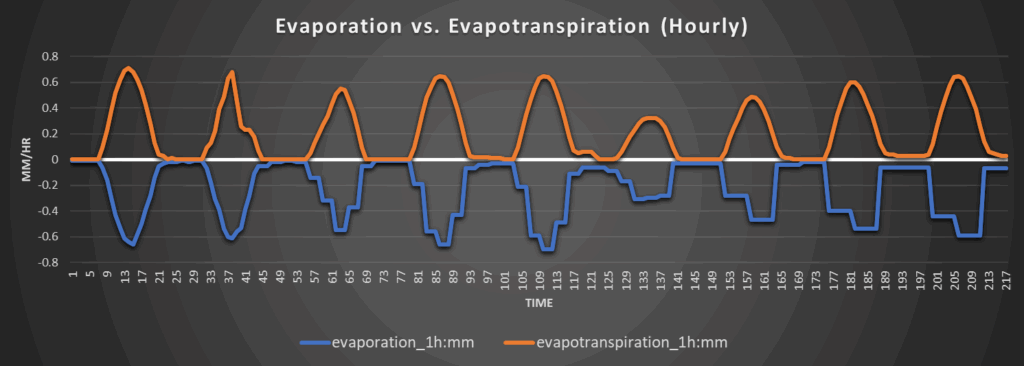
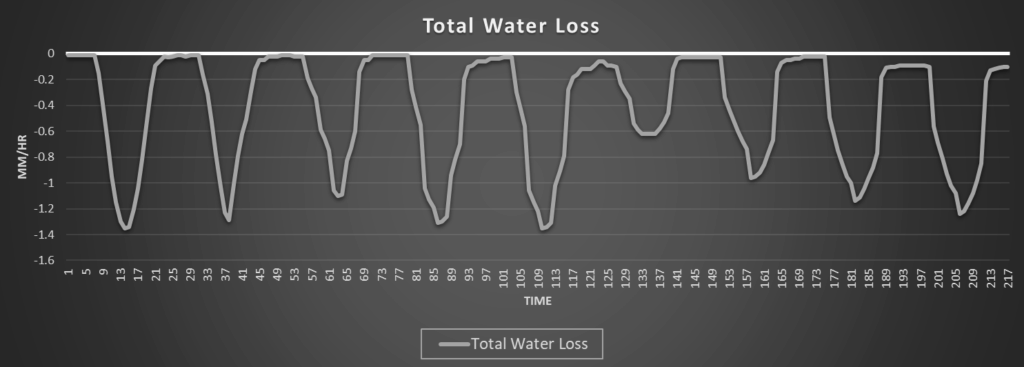
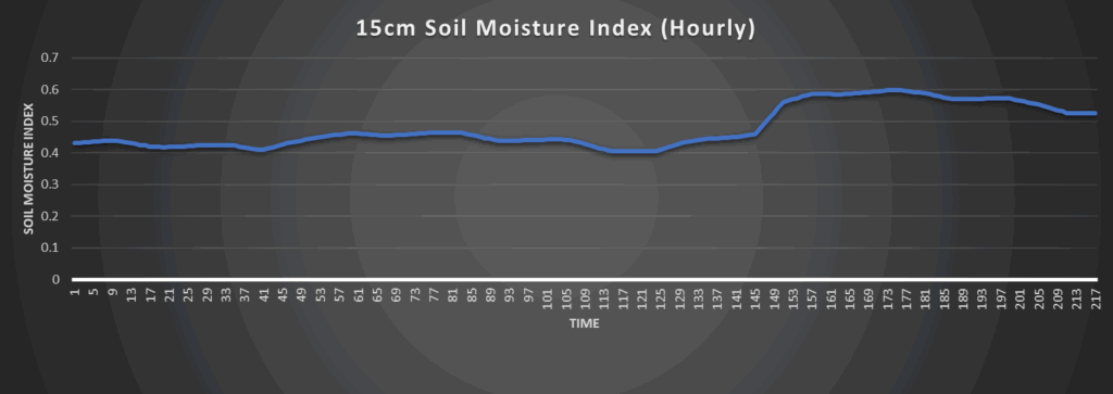
Regional Soil Moisture Outlook
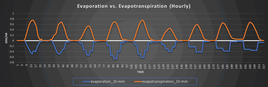
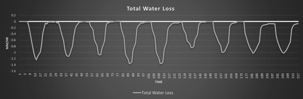
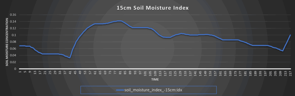
General soil moisture conditions across central/eastern Kansas will be relatively unchanging and consistent throughout the week. Overall total water loss will be on the modest side with the rain and evaporation/evapotranspiration effectively balancing each other out, leaving soil conditions to generally stay the same. Any soil moisture replenishment will be very localized and dependent on who sees the most thunderstorm activity across the forecast period.
Around Westmoreland
Around Scranton
Around Burlington
Around Altoona