Hello everyone! I am back with your weekly CONUS weather forecast! Severe weather is the main story today for the southern plains and the mid-Atlantic. Let’s take a look at all of the details:
[wpcode id=”41149″]
Today’s Overall Setup
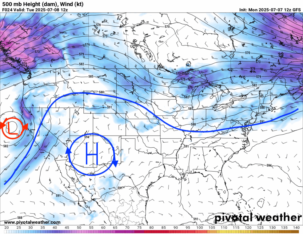
A large ridge in the desert southwest is bringing dry conditions for the majority of the western CONUS. On the edge of the ridge, there is some enhanced mid-level flow that will bring severe weather to the southern Plains. A deepening trough is draped down over the eastern CONUS, bringing a severe weather threat to the mid-Atlantic as well today. Most of those east of the Rockies will see some rain today, those to the west of them – not so much at all.
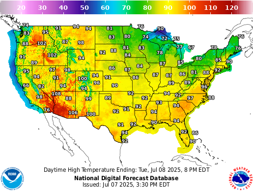
Here’s a look at the forecasted high temperatures for today. It is HOT for a majority of the country on this summer day with a widespread 90 degrees plus in the southeast, lower plains, and into the mountinous northwest. Cooler temperatures will be felt in the northern plains, upper midwest, and interior northeast given the cooler airmass brought down from the trough.
[wpcode id=”41149″]
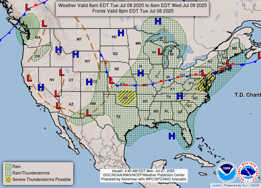
Today’s Severe Weather Threat
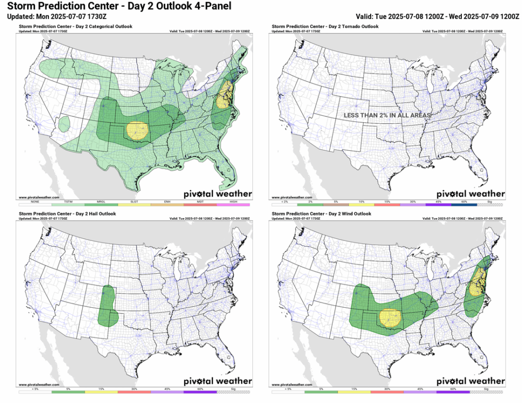
It wouldn’t be a summer day without some severe weather to talk about. Today, the Storm Prediction Center (SPC) has two Slight (2/5) risk zones for severe weather – one in the lower plains centered on Oklahoma, and one in the mid-Atlantic. Marginal (1/5) risks exists around each of the risk zones. The primary risk will be damaging severe winds for both the lower plains and the mid-Atlantic, though an isolated tornado is never out of the question. Some severe hail could be possible in eastern Colorado into northeastern New Mexico and extreme northwest Texas and Oklahoma.
Lower Plains Severe Weather
The CAM’s (Convection Allowing Models) are not in much agreement with the exact placement of the storms in the lower plains. The high-resolution NAM model is going for a more organized setup, showing a bow-echo north-south type structure from around 3-9pm, moving into northern Texas overnight. Damaging winds look to be the most probable threat, along with soakingly heavy rain and an isolated tornado.
[wpcode id=”41149″]
Mid-Atlantic Severe Weather
The models are in more of an agreement of the timing and setup for the severe threat in the mid-Atlantic. Storms will begin to fire up in a segment at around 3-4pm in Virginia and will move east into the Del-Mar-Va and eastern PA and NJ areas in the evening into the overnight. The SPC is concerned for severe storms because of the following: “Forecast soundings indicate tall, moist CAPE profiles with MUCAPE of 2000-3000 J/kg and precipitable water values over 2.00 inches. This should foster robust storms with heavy water loading and severe downdraft potential.” A flash flood threat is also possible with these heavy rain producing storms. A 15 percent chance of excessive rainfall/flash flooding exists from the Weather Prediction Center (WPC) today. Take these watches and warnings seriously when you receive them – there is a lot of water in the atmosphere to work with.
[wpcode id=”41149″]
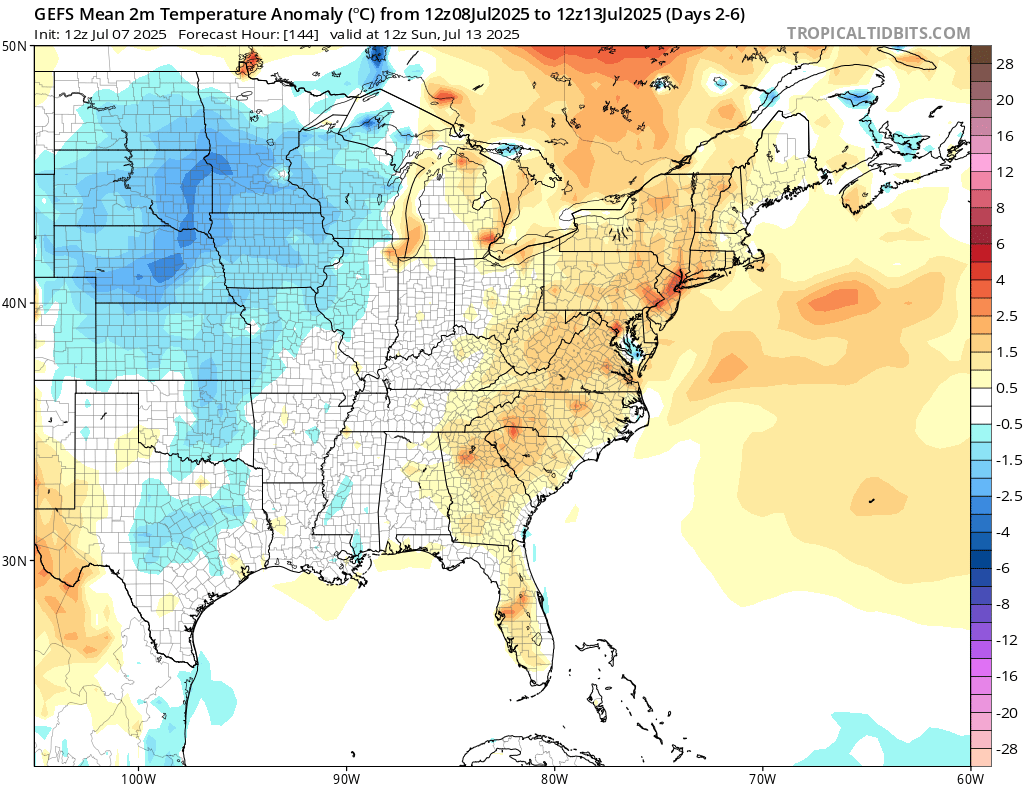
CONUS Weekly Precipitation Outlook
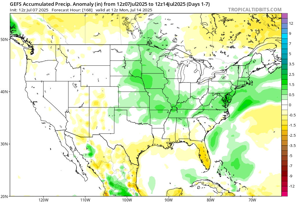
Here’s a look at the GEFS modeled precipitation anomalies through Monday 12z. Green indicates above average precipitation, white indicates average precipitation, and yellow indicates below average precipitation. Let’s look into the details by region:
[wpcode id=”41149″]
Weekly Outlook: Western United States
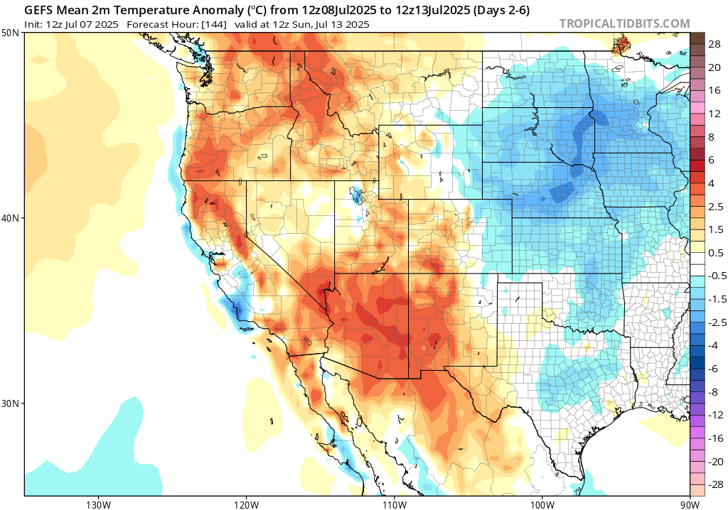
Looking ahead at the weather this week, the west will see above normal temperatures and very little rainfall due to the aforementioned high pressure ridge that is in place. Be especially on top of hydrating yourself this week in the desert southwest, as above normal temperatures means scortching heat.
[wpcode id=”41149″]
Weekly Outlook: Central United States
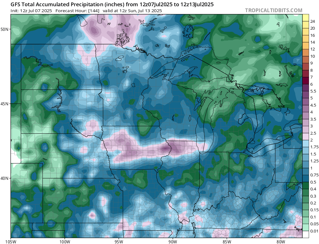
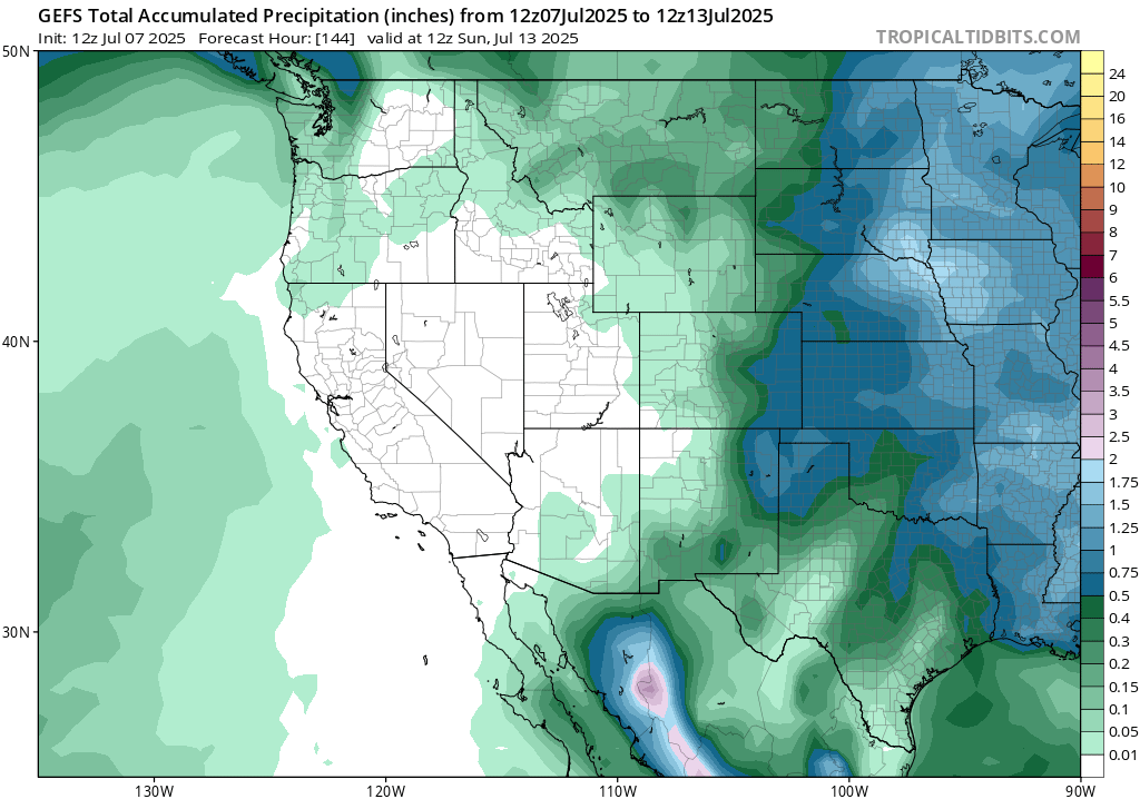
A shortwave trough will bring 1-5 inches + of rain to the northern plains this weekend. A 5-15 percent risk of excessive rainfall and flash flooding is currently in the forecast for this weekend for the region from the WPC.
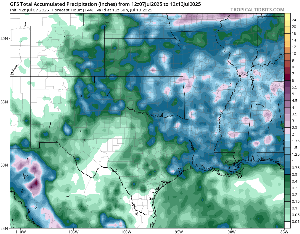
The southern plains into Texas will see most of their rain today and a chance on Thursday, but the rest of the week is looking mainly dry.
[wpcode id=”41149″]
Weekly Outlook: Eastern United States
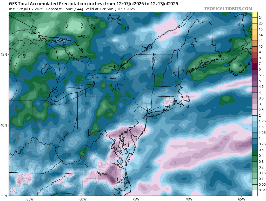
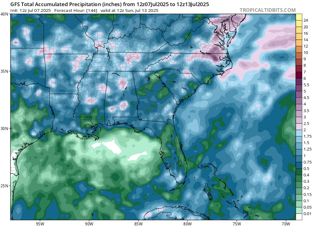
The troughing mid-to-late week in the eastern CONUS will bring up the rain chances and soak a good amount of the northeast and southeast. Today through Thursday looks to be the biggest soaker for both regions.
After the trough slides east, it will be replaced by a ridge which will bring the eastern CONUS warmer than average temperatures by the end of the week.
[wpcode id=”41149″]
Travel Outlook
Southern Plains Risk:
The severe weather threat in the lower plains could make travel hazardous this afternoon into this evening. Watch out for gusty winds and torrential rainfall.
Proceed with caution if planning on traveling on:
- I-35 from Oklahoma City to Wichita
- I-44 through central Oklahoma
- I-40 through western and central Oklahoma
Mid-Atlantic Risk:
Another round of storms is expected to develop from northern Virginia through the Del-Mar-Va into eastern PA and NJ later in the afternoon and into the evening/overnight. A similar threat of gusty winds and heavy rain/flash floods exists.
Main interstates impacted include:
- I-95 from DC through Baltimore, Philadelphia, and into southern NJ
- I-70 from MD into south-central PA
- I-83 in Maryland and Pennsylvania
[wpcode id=”41149″]
Extended Outlook
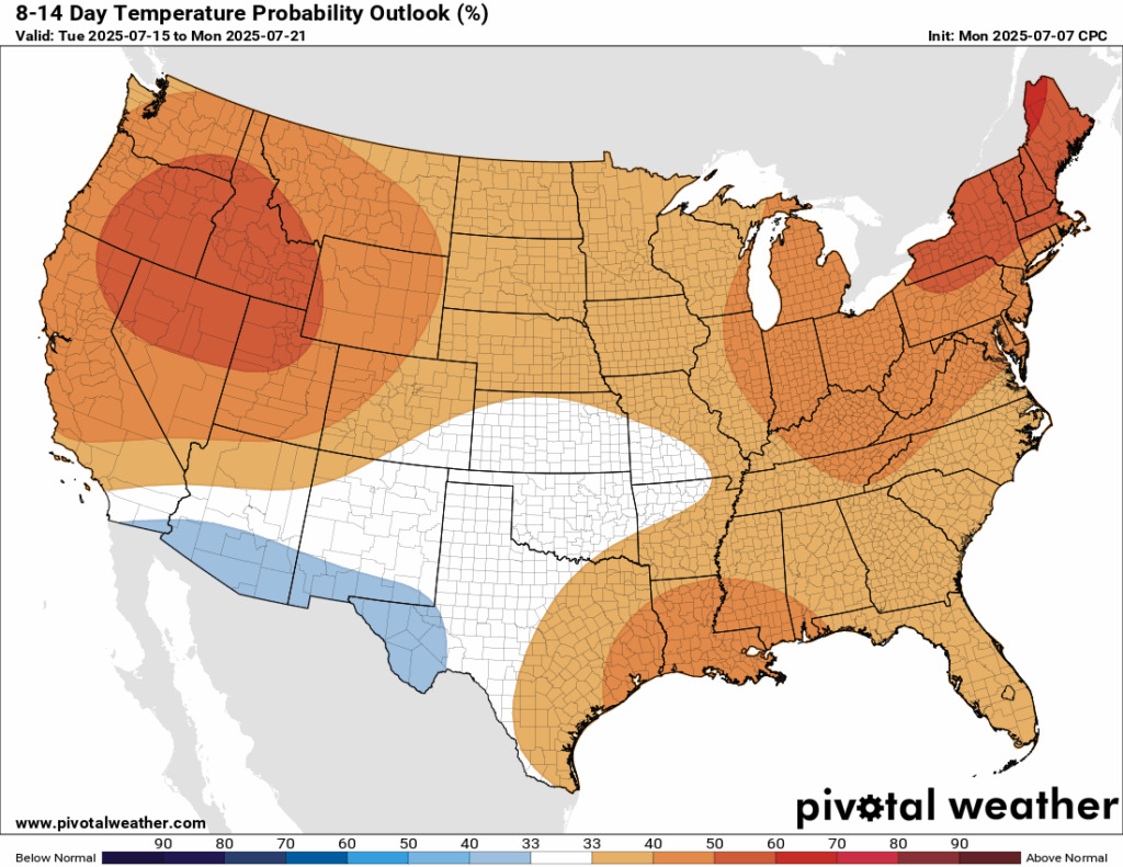
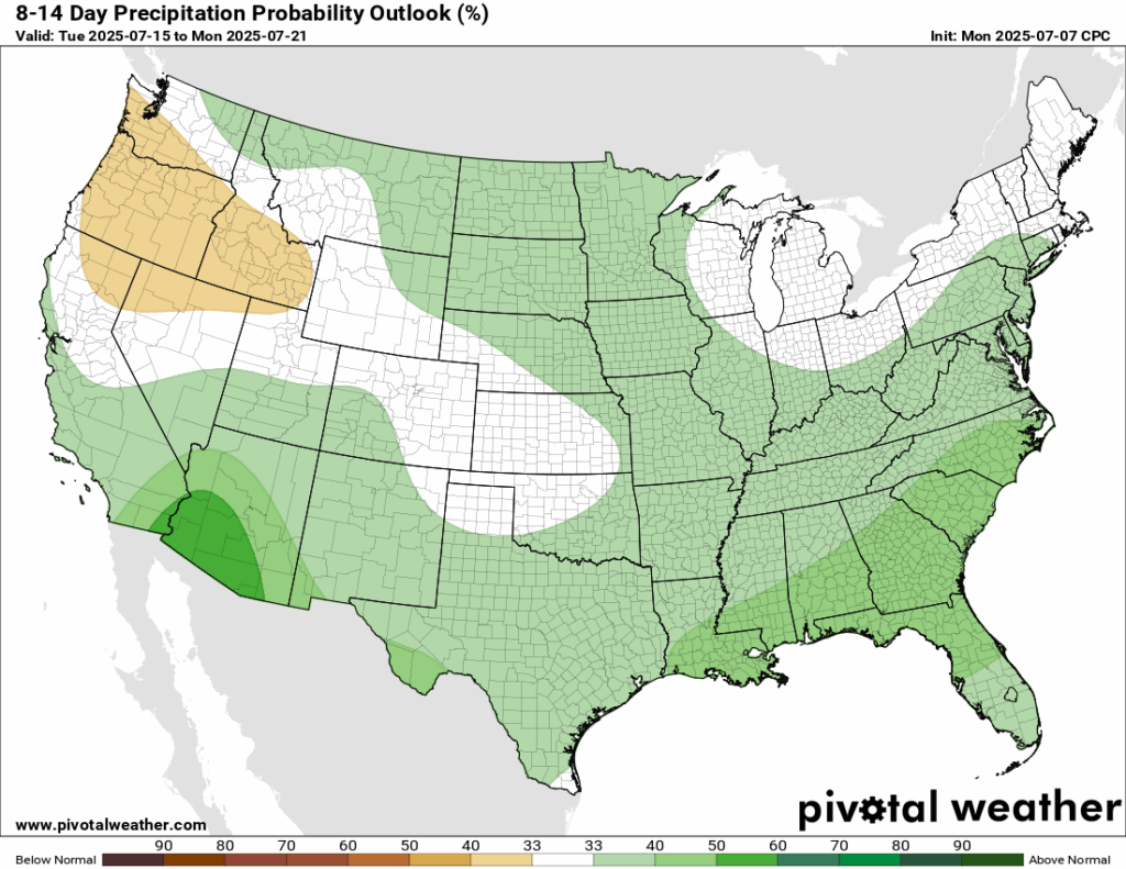
Looking ahead to next week, expect warmer than average temperatures for the majority of the country, except a slight cool down for the desert southwest. You can also expect a chance of more rain than average, again, especially in the desert southwest – which is in a severe drought. Some drier than normal conditions are possible in the Pacific northwest.
[wpcode id=”41149″]
Thanks for tuning in to this National Forecast! Tune in to our local, tropical, and regional forecasts to stay updated on the latest!


