General Central/Eastern Kansas Forecast
Short-Term (Tuesday-Wednesday)
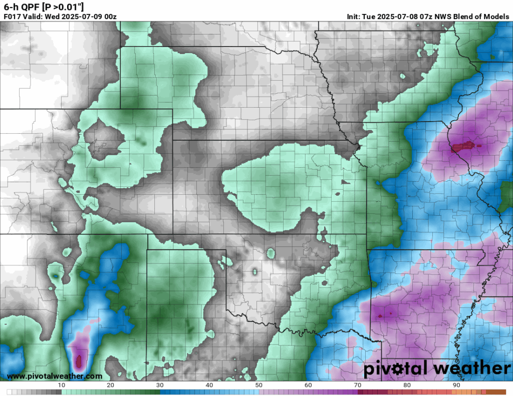
Scattered shower activity will continue to slowly die off the rest of this morning as it advances southward across central/eastern Kansas before clearing out by the afternoon. This will then be followed by a day much like yesterday, with conditions staying mostly clear throughout the afternoon before isolated thunderstorm chances arise once again in the afternoon/evening hours. Areas with the highest chances of seeing precipitation later this afternoon will be along where any potential outflow boundaries lie, with those in eastern to southeast Kansas having the greatest potential for storms later. Like yesterday, storms will be slow moving in nature so localized heavy rainfall is a possibility as well as a damaging wind gust or two may be possible. Any showers and thunderstorms that do form today will then die off by the overnight hours as diurnal heating shuts off and storms have no upper-level support to keep them going.
Temperatures across the region today will be near identical to yesterday, with highs this afternoon in the upper 80s to low 90s, with light and variable winds. Relative humidity will hover between 50-60%, which paired with our air temperature will keep the heat index today in the mid to upper 90s. Overnight tonight, temperatures will fall back into the upper 60s to low 70s.

Drier conditions are expected tomorrow as high pressure tries to build in over the area. Even though chances are extremely low, a stray shower or thunderstorm could be possible in the afternoon hours, but otherwise a dry day will be in store across central and eastern Kansas tomorrow. Temperatures again will reach back into the upper 80s to low 90s with light and variable winds. Heat indices again will be in the mid to upper 90s throughout the afternoon with relative humidity at 50-60%.

Long-Term (Thursday-Monday)
The ridge will break down by Thursday and allow for discrete disturbances to pass through the area during the afternoon hours. This will help increase rain chances once again and even bring the potential for strong to severe thunderstorms by the afternoon and evening hours. Areas that have the best chances of seeing severe activity will be those in north-central Kansas, where damaging winds and some large hail may be possible. By Friday, a stronger signal for a shortwave to pass north of the area is evident across both the GFS and Euro. This will be associated with a “cold front” that will enter the state and may increase the potential for scattered showers and thunderstorms. Beyond Friday, a return to lower, more discrete thunderstorm potential will last all the way through early next week as our main upper-level disturbance departs. Temperatures will remain fairly steady through the long-term period, with the exception of behind the front on Saturday, where temperatures will dip down into the mid to upper 80s.
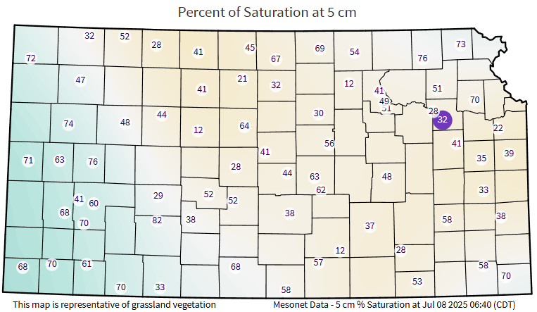
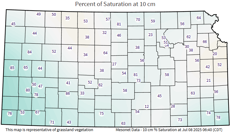
Regional Soil Moisture Outlook
Soil moisture will slowly continue remain steady/slowly dry out over the next couple of days with our current high temperatures and lack of consistent soaking rainfall. Some saturation and soil moisture replenishment may occur when the cold front comes and the potential for scattered showers and thunderstorms becomes possible by Friday before soils return to holding steady to slowly drying out over the long-term period. Some pockets of increased dryness may be evident across the region given the hit/miss nature of these storms, but overall widespread heavy drying of soils is not anticipated at this time.