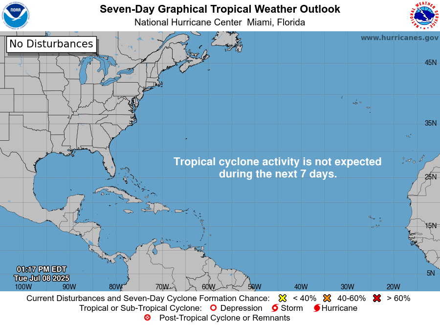
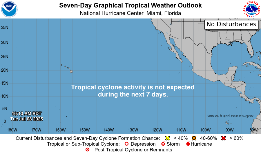
There are no active disturbances or tropical cyclones of any sort in the Atlantic or Pacific. The National Hurricane Center (NHC) recognized one disturbance with a 10% chance of formation earlier Tuesday morning, but has since decided that environmental conditions were too unfavorable for this disturbance to have a significant chance of formation.
Tropical Storm Chantal has also ran its course, so let’s take a look at what happened with Chantal, and also the conditions in each ocean to see if tropical storm development could be imminent.
Tropical Storm Chantal
Chantal formed into a tropical depression in the afternoon of July 4th, became a tropical storm on July 5th, and then made landfall in South Carolina around 4:00 am on July 6th.
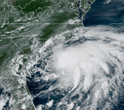
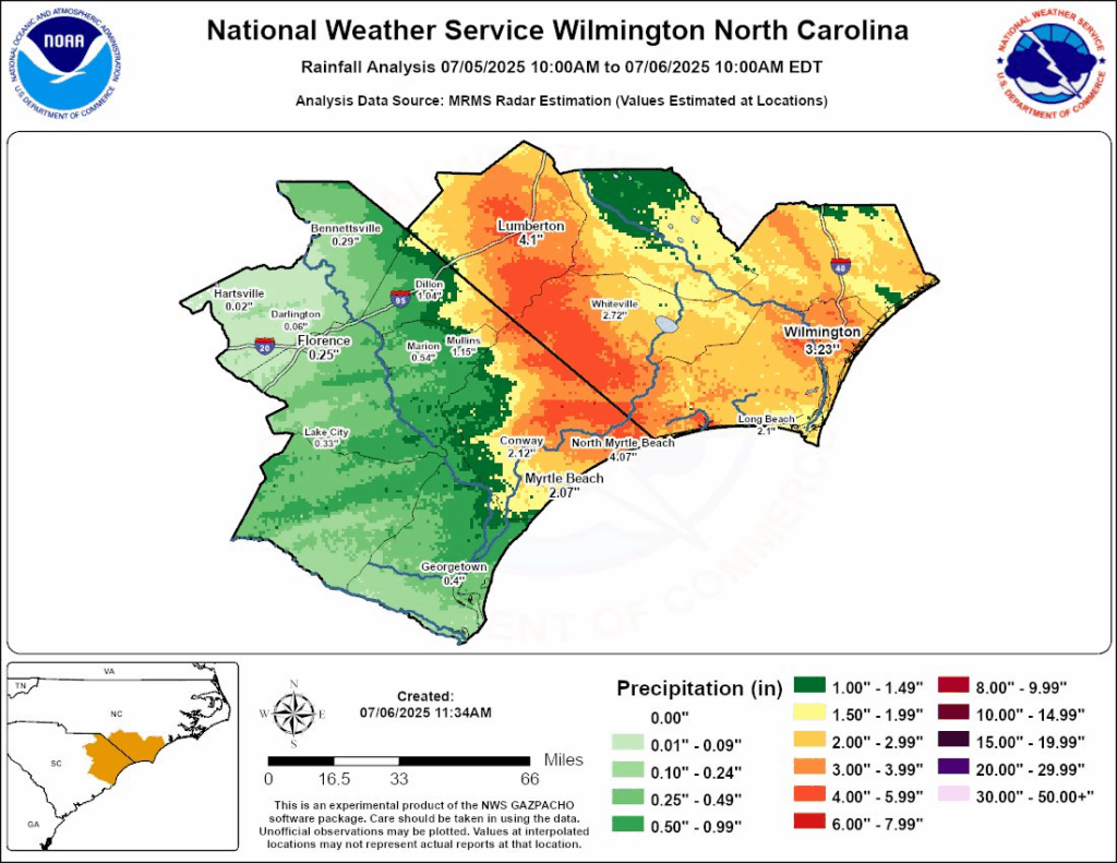
Chantal was short-lived and not a very strong storm, but it’s landfall on South Carolina still affected much of the Carolinas. Heavy rain and wind was the main concern, and according to the rainfall analysis done by the NWS Wilmington office, a lot of the heaviest rainfall occurred along the border between North and South Carolina, dumping over 4 inches of rain in 24 hours.
Also along the coast, wind gusts from Chantal reached 56 mph. One EF-0 tornado even touched down near Wilmington, North Carolina around 4:30 in the morning on Sunday. With peak estimated winds of 70 mph, this tornado caused some tree damage in the area, fortunately with minimal property damages.
Current Situation in the Atlantic Basin
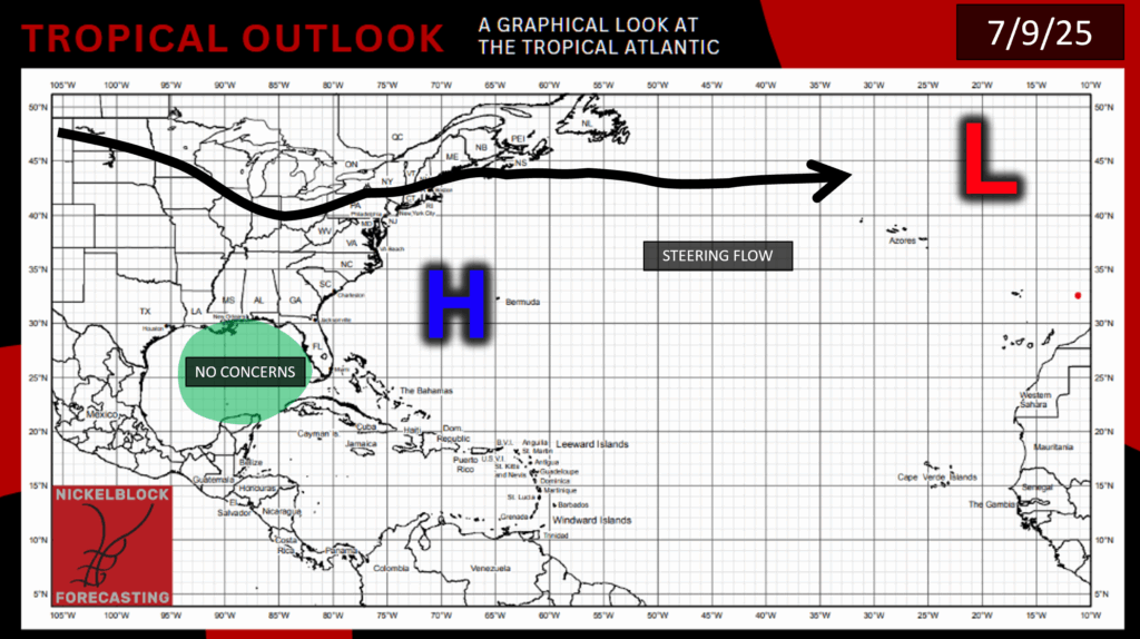
There are no more concerns in the Atlantic as of right now, and we have our Bermuda High over much of the Atlantic.
We are now starting to get to the point in the summer where sea surface temperatures in the Atlantic are warming up enough to encourage and sustain tropical storms.
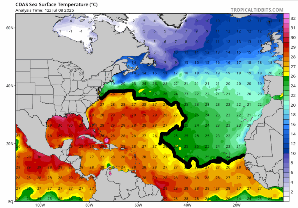
Below the black line that I drew shows where the ocean is warm enough for tropical development, and above the line is where it is still just too cold.
In the next week, the Gulf will remain pretty dry, but there will be some moisture persisting over Florida and along the Southeast Atlantic coast. There will be a short window of time where wind shear will die down over the Gulf and Southeast Atlantic later in the week, but by the weekend the wind shear will pick back up again. So based on environmental conditions currently and for the rest of the week, I can see why the NHC does not suspect any tropical activity in the Atlantic for the next 7 days.
Current Situation in the Pacific
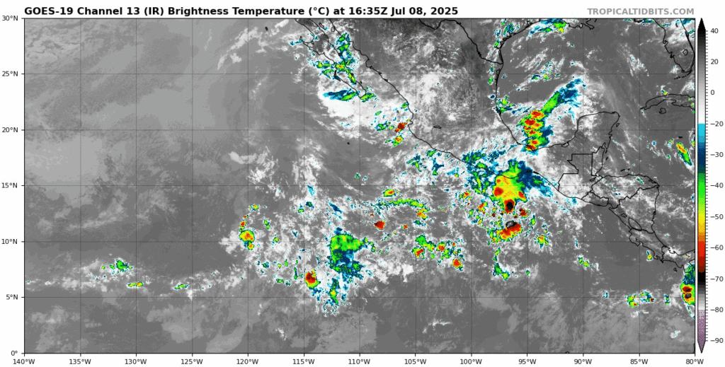
As I mentioned at the beginning of this post, there was a disturbance with a 10% chance of development in the next week, but is no longer a concern. I wouldn’t be surprised if we saw this disturbance pop back up on the NHC’s radar in the next couple of days, since wind shear in the area looks low enough, and sea surface temperatures and mid-level relative humidity high enough for this disturbance to form if the showers and thunderstorms in the area get themselves organized around an area of low pressure. Whether this disturbance comes back and develops or not, it most likely would go off into the Pacific without making landfall.
Stay tuned for more updates!


