General Central/Eastern Kansas Forecast
Short-Term (Wednesday-Thursday)
Today looks to be mostly a dry day across central and eastern Kansas, as warmer temperatures aloft will help keep a lid on daytime shower and thunderstorm activity and no strong mechanisms to force thunderstorm development are evident. Some isolated rain chances do return by the evening hours tonight from storms entering northern Kansas from Nebraska, but exact progression and just how far they will make it through Kansas during the overnight hours is a bit ambiguous. The best chances for rainfall this evening and into tonight would be closer to I-135 and along and north of I-70, with the potential falling off south and east of that area. An isolated damaging wind gust may be possible closer towards central Kansas when these storms would be most mature.

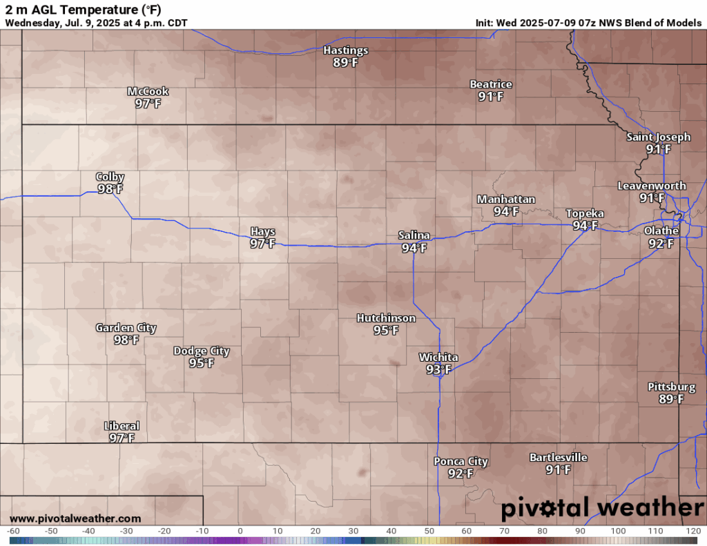
Temperatures today will be somewhat warmer than yesterday across the area, with highs in the low to mid 90s and a southerly wind of 5 to 10 mph. Relative humidity will largely be between 45-55% and dew point temperatures will still hover in the upper 60s to low 70s, keeping us hot and muggy for today once again. By tonight, temperatures across the area will fall to the low 70s.
Some ongoing showers may be possible through tomorrow morning from tonight’s activity before clearing out once again by the afternoon hours. As we get into tomorrow afternoon/evening, an incoming shortwave will enter into western Kansas and help trigger scattered thunderstorm development across western and central Kansas. These storms will move eastward with time and may support a risk for hail and damaging winds, particularly in central to north central Kansas along and west of I-135 and US-81. This activity will lessen through tomorrow night as they advance east due to increasing stability in the atmosphere, but a lingering shower or two could still be possible across eastern Kansas tomorrow night.

Long-Term (Friday-Tuesday)
On Friday, a cold front will begin to move its way through the state by the afternoon hours and increase the potential for scattered showers and thunderstorms across the area. Some localized heavy rainfall/flooding may be a concern with the heavier storms given a very moist atmosphere and high instability. Past Friday, daily chances for isolated to scattered showers and thunderstorms will be possible every day across the area from transient disturbances within the relatively weak upper-air pattern. Another cold front may be on the way by Tuesday, which would increase widespread rain potential again, but exact timing of this front is a bit ambiguous at this time. Overall temperatures during this period will be in the upper 80s to low 90s by Friday in front of the cold front, then dropping down to the mid to upper 80s over the weekend and into early next week behind the front.
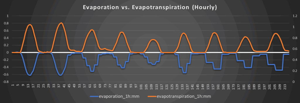
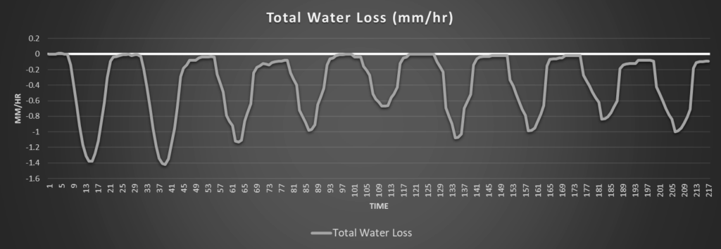
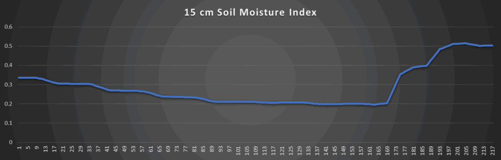
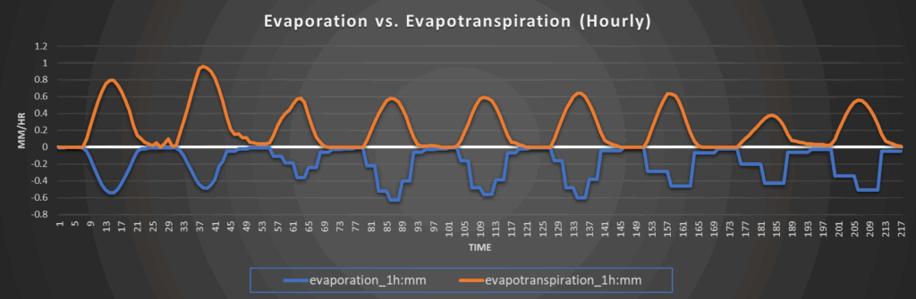
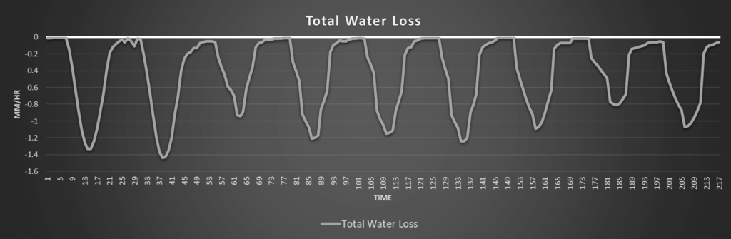
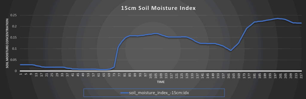
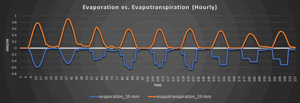
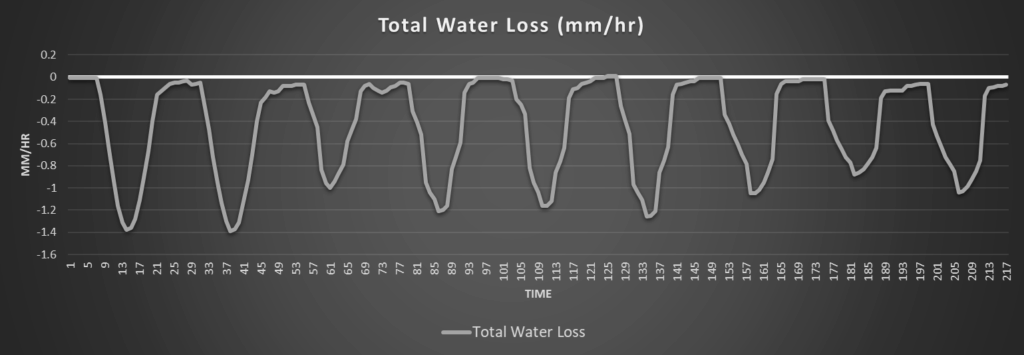
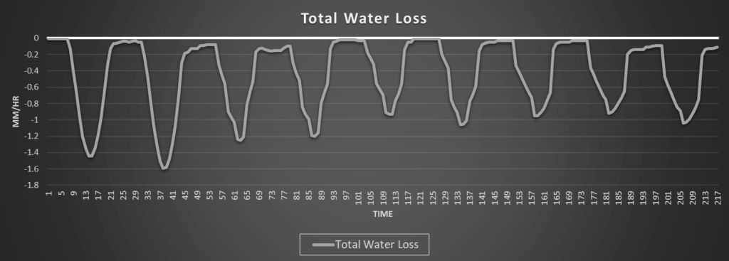
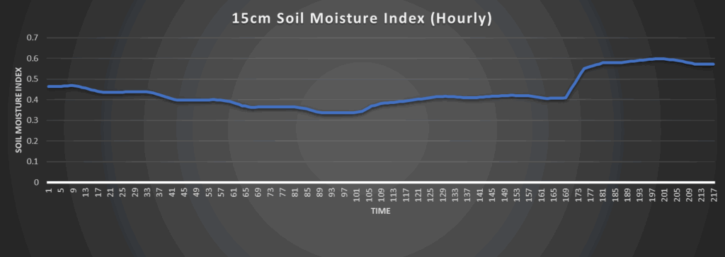
Regional Soil Moisture Outlook
Today and tomorrow will be the days where water loss will be the greatest due to the overall calm weather pattern over us presently. Daily water loss rates will be quite steep at 1.4 to 1.6 mm/hr, but help looks to be on the way by Friday with the arrival of this cold front. This cold front will help trigger scattered thunderstorms and bring a much better chance for widespread soil moisture replenishment across most of the area. Continued moisture replenishment may last through the weekend and into early next week from widely scattered showers and thunderstorms daily and from another incoming cold front by next Tuesday. This will help knock down persistent drought conditions even more across far northern Kansas where it has lingered on the longest.
Around Westmoreland
Around Scranton
Around Burlington
Around Altoona