General Central/Eastern Kansas Forecast
Short-Term (Thursday-Friday)
Another hot and dry day will be in store for us throughout the rest of the morning and afternoon today across central/eastern Kansas, as high pressure continues to sit over us and suppress thunderstorm development for most of the day. This will be broken down by the evening hours though from a shortwave trough coming in from the west and displacing our high pressure off to our south and east. This shortwave will also bring back the chance for scattered showers and thunderstorms across central and north-central Kansas. Some of these storms, particularly closer to the Nebraska border, may be severe with damaging winds (60-70 mph) and hail possible. Timing of these storms will begin with perhaps a window of isolated storms around 7-8pm before the main line of storms begins to encroach on the I-135/US-81 corridor by 10-11pm. New rainfall totals may reach up to half an inch, but locally higher amounts are possible within heavier storms. These storms will generally weaken as they move eastward throughout the night before falling apart by early tomorrow morning.


As the trough moves eastward over Kansas, a surface low and cold front will begin to make its way through the northern portion of the state tomorrow and help trigger storms across eastern Kansas by tomorrow afternoon and evening. Light showers from the previous round of storms may try to linger across eastern Kansas through the morning hours, but these should all dissipate by the afternoon. Further redevelopment of isolated thunderstorms may begin by 4-7pm across northeast to north-central Kansas, before potentially becoming more scattered by 8pm across eastern Kansas. Some of these storms in northeast Kansas may again be severe, with damaging winds and some hail being the most likely hazards. This thunderstorm activity will last through the night tomorrow night as it makes its way off to the east/southeast.


Temperatures today will be on the warmer side similar to yesterday, with highs in the mid to upper 90s and winds out of the south at 10-20 mph. Heat indices today will mainly be in the upper 90s to low 100s as a result of these higher temperatures. Relative humidity values do come down today compared to yesterday, with values around 30% expected in central Kansas to around 50% in eastern Kansas. By tomorrow, temperatures will be back in the upper 80s to low 90s from thunderstorm activity. Winds south of the surface low pressure system will be out of the southwest at 5 to 15 mph, while winds north of the surface low will be northerly at 5 to 10 mph. Relative humidity will increase again tomorrow somewhat to between 45-55%. Heat indices may reach the mid to upper 90s, especially across eastern Kansas where the humidity is higher.

Long-Term (Saturday-Wednesday)
By Saturday, the cold front will eventually slow down and stall out overhead us. As such, scattered showers and thunderstorms will be possible across the region Saturday evening/night. Once the cold front gets lifted back to the north by Sunday, we will be under very weak flow aloft again through Monday, which will leave us with no obvious features for organized thunderstorm development. So as such, daily isolated thunderstorm chances will return with specific locations being ambiguous at this range. By Tuesday-Wednesday, another cold front (and perhaps a stronger one) will move into the state from the north. Consequently, this should increase widespread rain chances across the area, but by how much remains to be seen as more details become evident as we get closer to this time period.
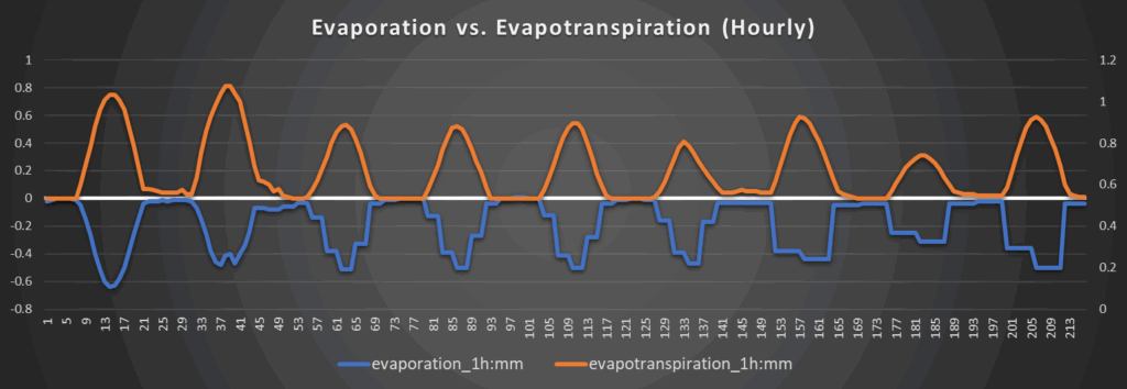
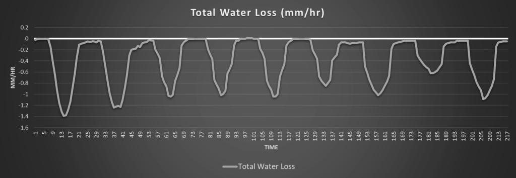
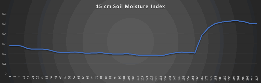
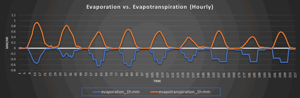
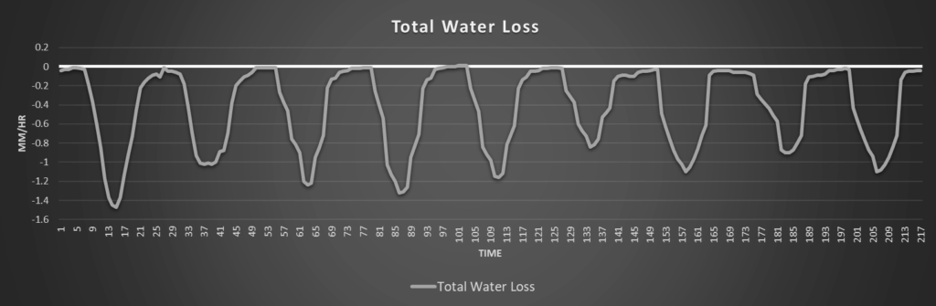
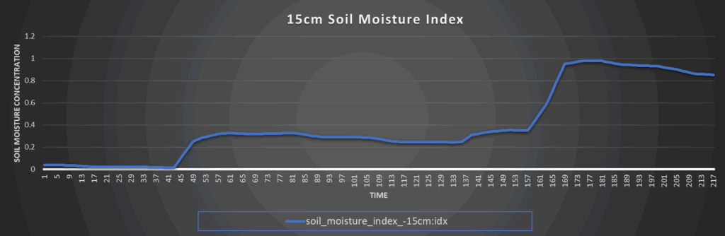
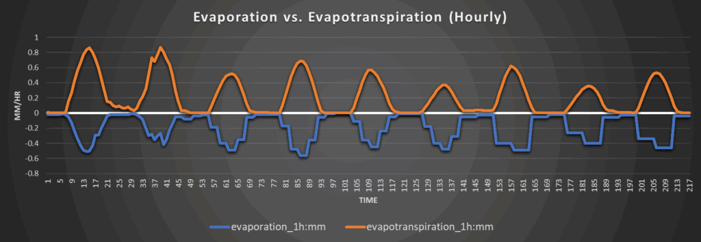
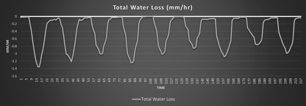
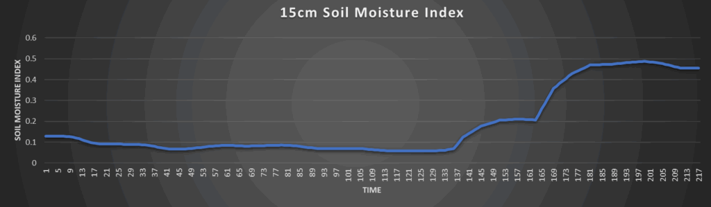
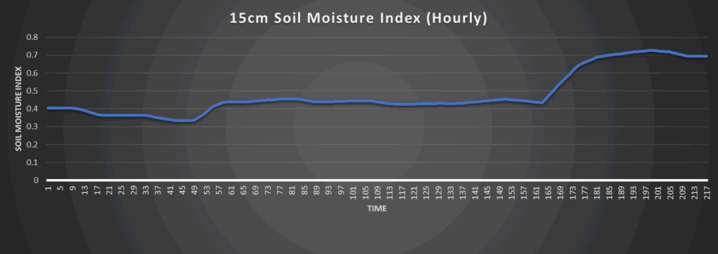
Regional Soil Moisture Outlook
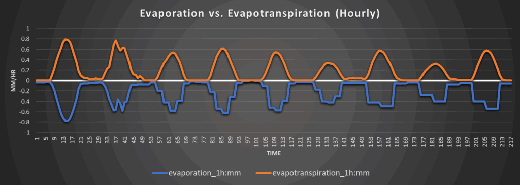
Another hot and dry day today will see soil moisture losses be the worst through the forecast period, consistently losing around 1.4 to 1.5 mm/hr of water throughout the day today. Overall water loss will lessen after today with the introduction of more rain chances each day beginning tomorrow, but consistent soil moisture recovery may take a bit to occur until we get more solid chances for widespread rainfall. In the meantime, soil moisture content will more or less be holding steady over the next 5 or so days, although models have been picking up on some replenishment by the day 6 to 7 timeframe, which would coincide with the cold front coming through next week.
Around Westmoreland
Around Scranton
Around Burlington

Around Altoona