General Central/Eastern Kansas Forecast
Short-Term (Monday-Tuesday)
Today looks to be very similar to how yesterday was across the area. Warm, summer-like conditions and isolated, hit and miss showers/thunderstorms during the afternoon and evening hours. Extremely weak and varied flow aloft us from higher pressure aloft will make pinpointing exact locations for rainfall unknown, but generally areas along and southeast of I-335 and I-70 have the greatest chance of seeing precipitation, as this area will sit within more rich moisture and thus a more unstable airmass. Locally heavy downpours may be possible with the larger storms, but overall, these will be your average garden-variety summertime thunderstorms. This activity will shut down as we lose daytime heating and the air becomes more stable by the evening and overnight hours.

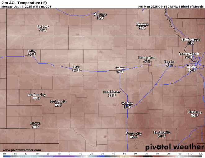
Temperatures today will be right around average for this time of year, with highs in the afternoon ranging in the upper 80s across southeast Kansas to low 90s in central and northern Kansas. Heat indices across the board will vary between the low to mid 90s, so while not overly hot yet, it’ll still feel plenty warm for outdoor activities. Winds will remain relatively weak throughout the day, staying southeasterly at 5 to 10 mph. Relative humidity will range between 45-65% within the richer moisture, while being drier at 35-45% north of the main moisture plume. Overnight, low temperatures will reach down into the upper 60s to low 70s.
Tuesday will basically be wash, rinse, and repeat of today, with isolated showers possible mainly along and southeast of I-335 and drier conditions everywhere else. High temperatures look to be a touch warmer across the region, with highs in the upper 80s to mid 90s.
Long-Term (Wednesday-Sunday)
Westerly flow aloft will look to return by Wednesday and at least give us somewhat more consistent rain chances all the way through the weekend. Another cold front or boundary of sorts does look to enter the area by Thursday-Friday, which may help with overall rain chances, but will push out the moisture towards the southeast and keep it along and south of I-35. Under this scenario, southern and southeast Kansas would have the best chance at seeing rainfall over the weekend, while central and northern Kansas will stay on the drier side, with more isolated and sparse rain chances. Temperatures throughout the week will steadily climb into the low to mid 90s until the cold front comes, where they may briefly drop back into the upper 80s to low 90s.
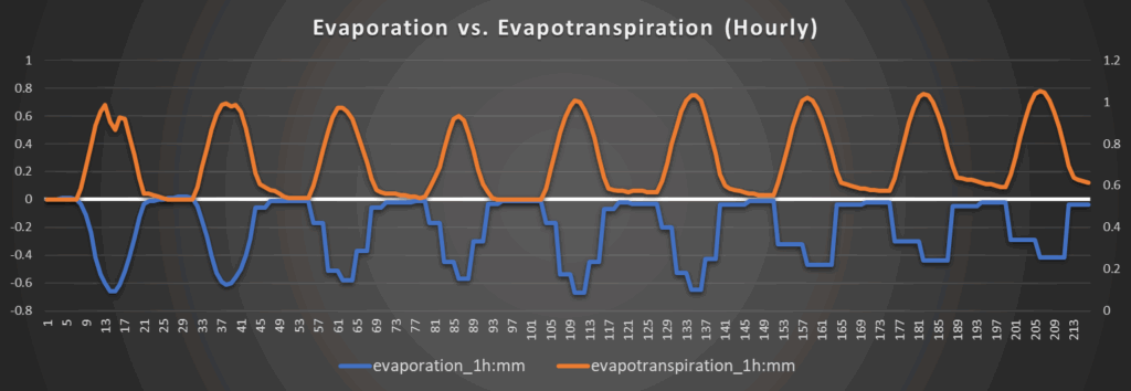
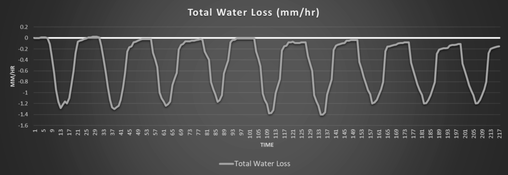
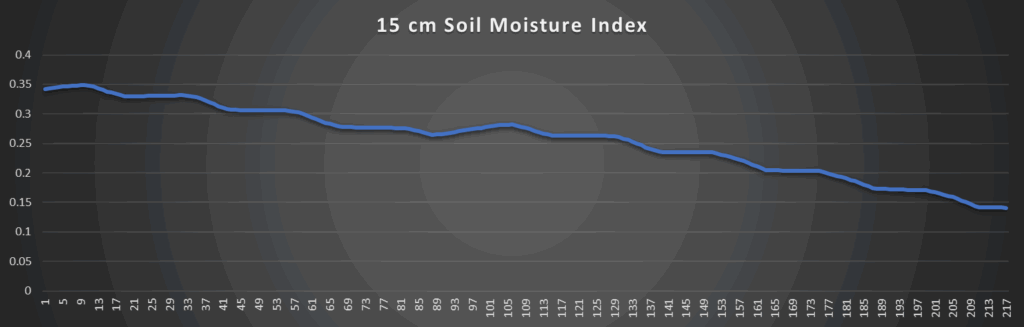
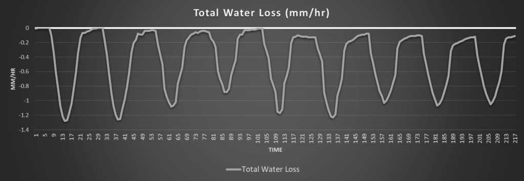
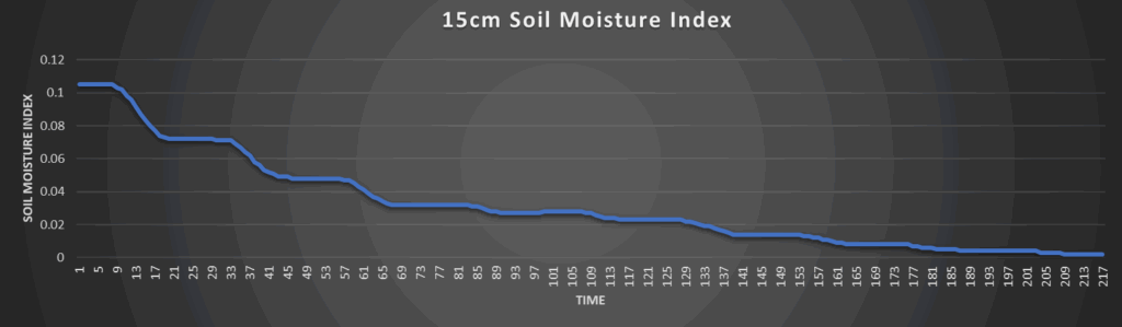
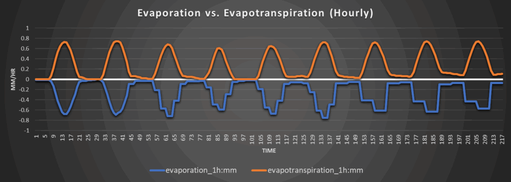
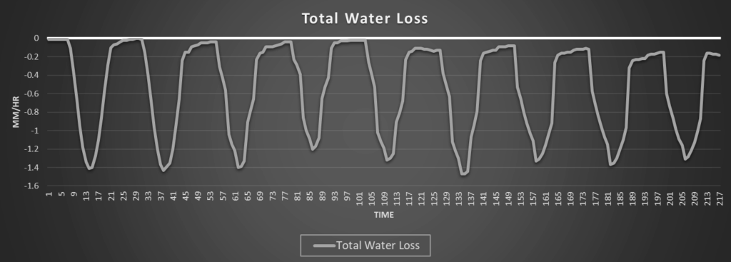
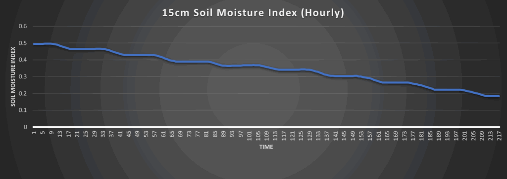
Regional Soil Moisture Outlook
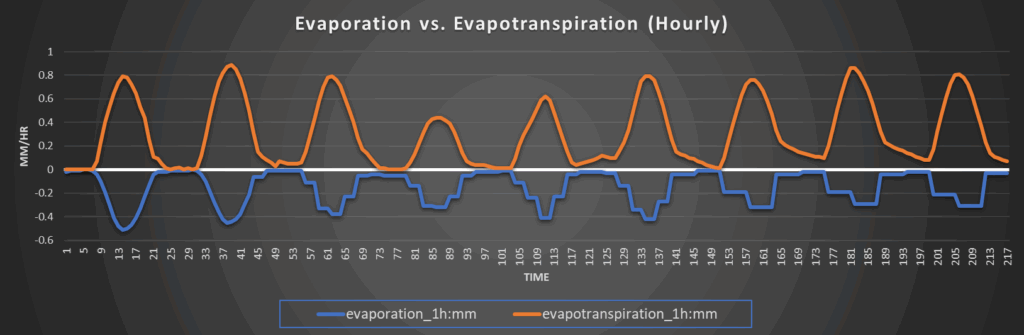
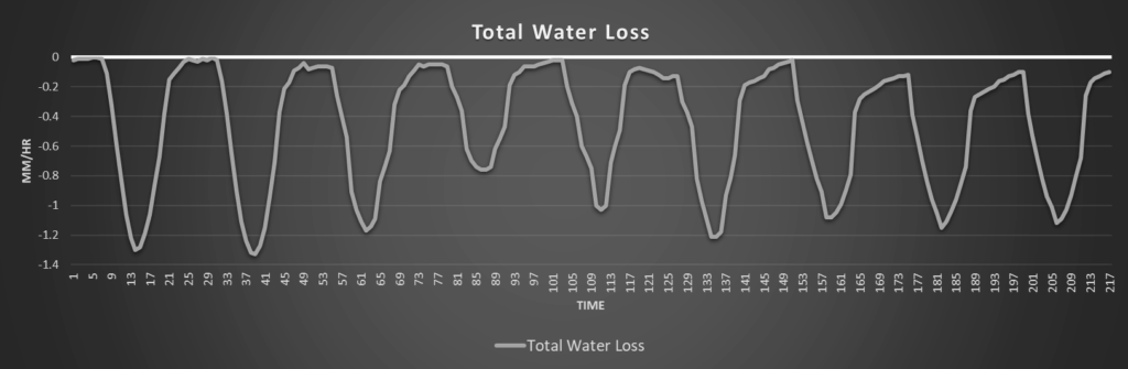
Overall widespread drying of soils will continue with the lack of consistent rainfall. Daily water loss rates will range from 1.2 to 1.5 mm/hr over the next week, with perhaps a but of a slowdown when the cold front does come through. This drying of soils may cause some more areas of abnormal dryness to manifest, which could lead to drought conditions later in the summer, especially in central Kansas where some abnormal dryness has recently developed.
Around Westmoreland

Around Scranton
Around Burlington
Around Altoona