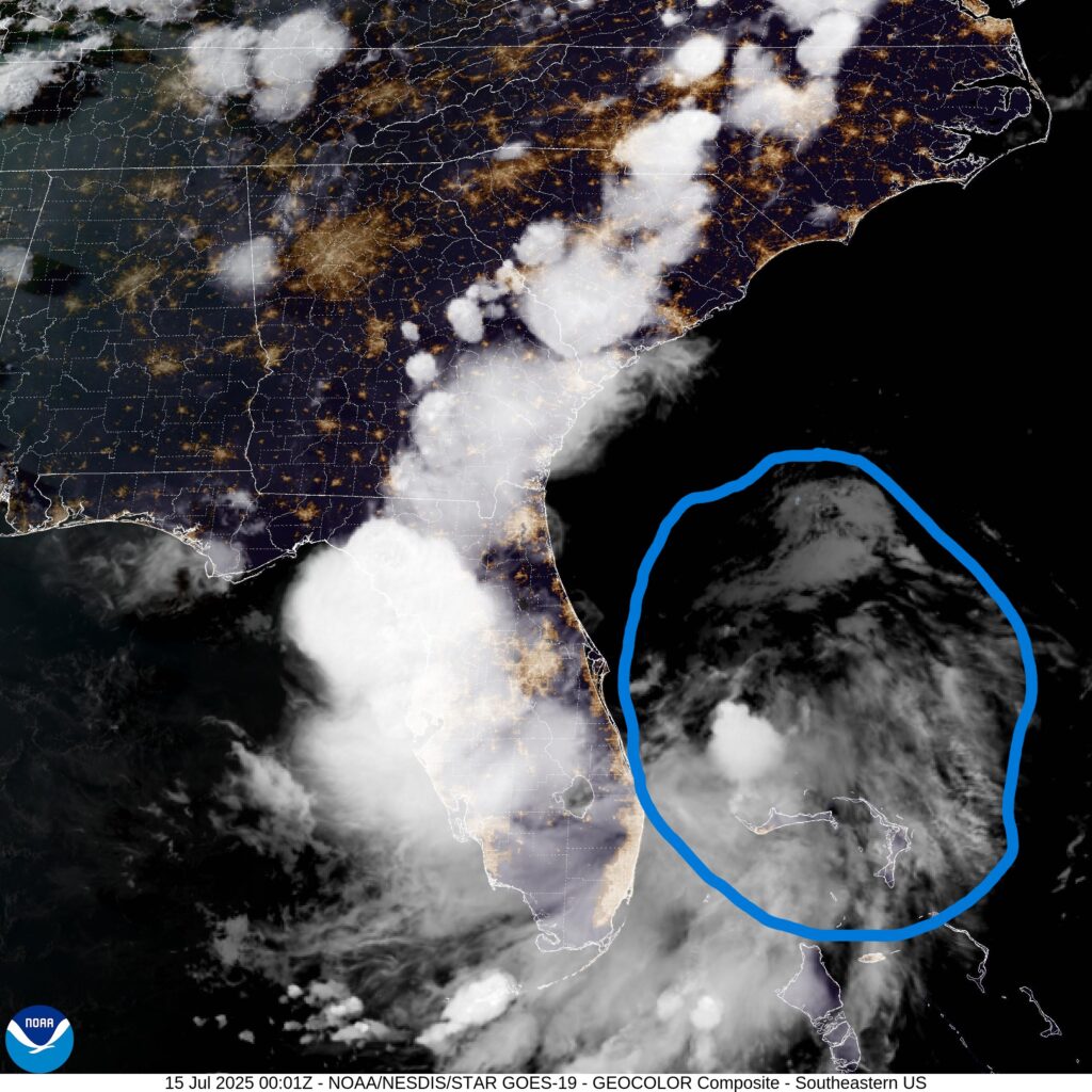
A surface low will bisect the Florida Peninsula today, bringing rain and flooding to the state. From there, it will ride a ridge into the Gulf of Mexico, where it could develop into a tropical storm before turning towards Louisiana.
FLORIDA
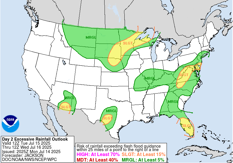
Most of the Florida peninsula, especially the I-4 corridor, will receive at least an inch and a half of rain the rest of this week as the low pressure moves through. Some locally higher amounts are possible, especially today. The Weather Prediction Center has outlined an area, that includes central and south Florida, as having a slight risk of excessive rainfall (threat level 2 out of 4, marking a 15% chance of a flash flood within 25 miles of a point). Localized convection could support rainfall rates of 2 to 3 inches of rain per hour, where flash flooding will become a concern. Parts of Florida are already saturated thanks to the almost daily thunderstorms that the state is known for.
WHAT’S NEXT?
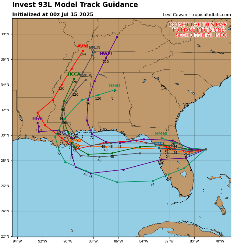
The surface low is being steered primarily by a ridge over the eastern United States, and will move into the Gulf of Mexico. The ocean water here is plenty warm enough and the air sufficiently moist for the low to develop into a tropical depression or storm. But, there will be some wind shear that interferes with development. There is also a small chance that the low is farther north than expected, putting it over land where nothing tropical would form. If this occurs, the only threat to the rest of the Gulf states would be a heavy rainfall and flooding event similar to that of Florida. As the models suggest, that isn’t the most likely scenario at this point.
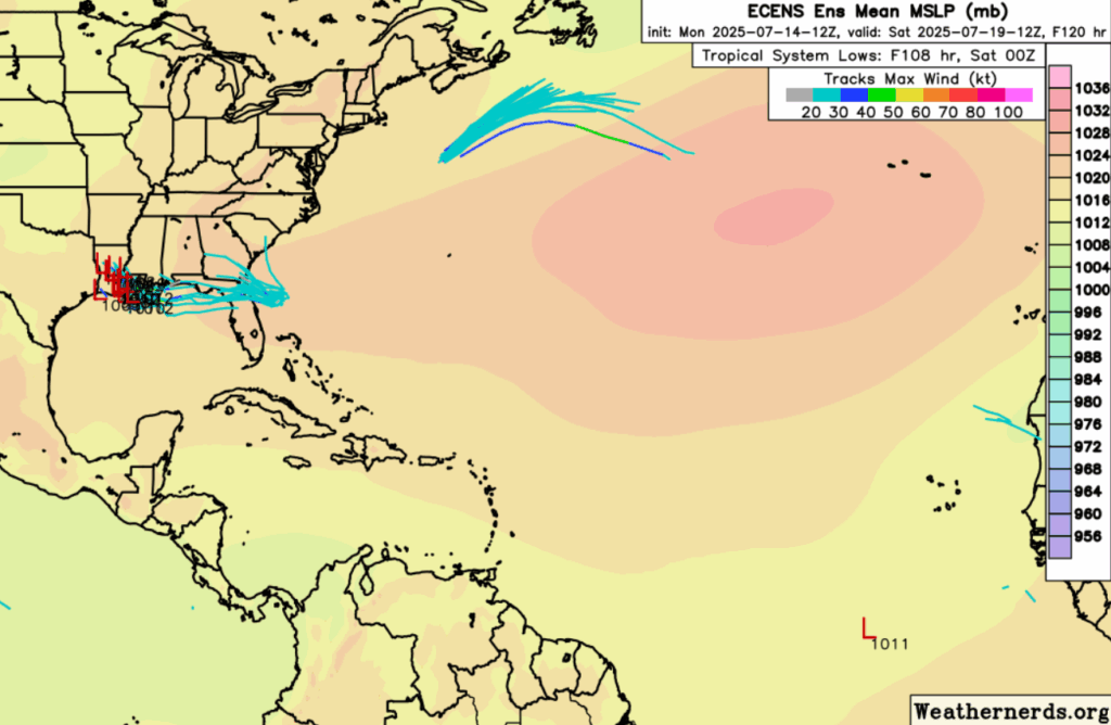
The NHC is giving the area of formation a 40% chance of development. It’s name would be Dexter. ECENS model members agree that, if a depression or storm forms despite the wind shear, it will be steered into Louisiana, landfalling anytime between Friday afternoon and Saturday morning. It would first impact the marshland of the southeastern part of the state, a very easily floodable area. It may then bring tropical storm force winds to the New Orleans area. Some modest shear and instability will be present at landfall, causing a tornado threat to potentially form in the rain bands of the upper-right quadrant of the storm, which would be over southern Mississippi and Alabama, if the models are to be believed. Due to the limited time frame this storm has to work with, I wouldn’t expect the size, storm surge, or wind from this storm to be particularly destructive or noteworthy. Localized rainfall amounts could be significant in areas that get unlucky enough to be under a rain band for multiple hours, but the storm will be too small and too fast for an extreme flooding event.
EXTENDED OUTLOOK
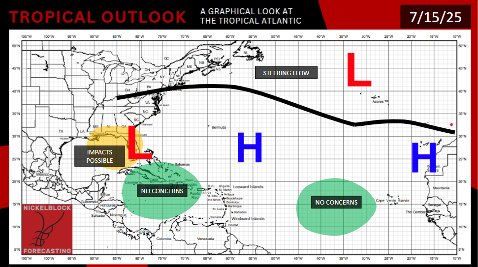
Not much has changed from my last outlook. Off the coast of the Southern U.S. East Coast and the Gulf of Mexico remain the areas most favorable for tropical development. Wind shear remains too severe in the Caribbean, and water too cold in the Mid-Atlantic.
In the Pacific, the waters south of Mexico that have produced so many storms already this year currently have a sheared environment above them. If an area of thunderstorms can find a break in the shear, development is possible in the 7-14 day time frame.
Gulf of Mexico shores may get their first taste of the tropics soon. Stay tuned to NickelBlock Forecasting for more information regarding tropical weather.


