Hey all! Today will be a bit of an abbreviated forecast due to me traveling for a few days. The only change to the forecast today will be the lack of an updated regional soil moisture outlook since I will not have the ability to access the latest model data. Good news is the general forecast in that department should remain largely the same so if you missed it, check out the post from yesterday for that information. Okay on with the weather!
General Central/Eastern Kansas Forecast
Short-Term (Friday-Saturday)
Weak zonal flow aloft will allow for some sporadic rain chances through the morning hours this morning before clearing out by the afternoon. Widespread heavy rainfall like as was the case yesterday is not anticipated this time, with new rainfall amounts generally staying below an inch, but some locally higher amounts are possible. Some further redevelopment of isolated showers and thunderstorms may occur during the late afternoon and evening hours given continued advection of warm, moist air into the region. If this activity does materialize, the main area of focus would be closer towards I-70, but generally the northern half of Kansas would see this increased chance. This round of rain will dissipate late into the overnight and early morning hours tomorrow.
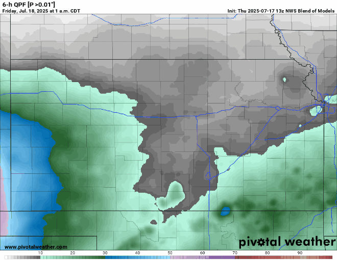
By tomorrow morning, some isolated to scattered showers and thunderstorms may develop across the northern half of Kansas again with the possible intrusion of another weak cold front before again clearing out by the afternoon. More rain showers along the front may be possible during the overnight hours tomorrow night, but currently the chances of this remains fairly low.
Temperatures will be back to seasonal for today across the region, with high temperatures expected to reach the upper 80s to low 90s this afternoon. Winds will be southerly for the most part at around 5 to 10 mph. By tonight, temperatures will continue to be on the mild side, falling to the low to mid 70s. Tomorrow the heat will start to be felt across the area, as high pressure tries to build in across the state. High temperatures will reach the mid to upper 90s by tomorrow afternoon, with continued light southerly winds at 5 to 10 mph. Heat indices will start to reach increasingly uncomfortable territory through the afternoon, with peak heat indices in the upper 90s to low 100s expected.


Long-Term (Sunday-Thursday)
Starting Sunday will see the trend of high pressure building over us that will look to persist through the coming week. This will continue to push our temperatures higher and shut down widespread rain chances throughout the coming days. High temperatures will consistently reach the upper 90s to low 100s in the afternoon hours, with heat indices regularly pushing Heat Advisory criteria, reaching the low to mid 100s. Heat stress will become a concern throughout the long-term period and more areas of abnormal soil dryness look to become more evident.
Drought Update
More areas of abnormally dry conditions have been observed across northeast Kansas over the past week and even saw the addition of severe drought conditions across Clay County. More areas of abnormally dry conditions and expanding moderate to potentially pockets of severe drought conditions may be realized through the coming week with the soaring heat and overall lack of consistent rainfall chances.


