Hi everyone! We are looking at an area to watch in the eastern Atlantic which has a low chance of development as well as an increasing chance of development here in the Gulf. Any development would come later next weekend, but we are keeping an eye on it very closely and will report any offical area to watch from the NHC when it comes in. Let’s look at what’s going on:
[wpcode id=”41149″]
Atlantic Basin Setup
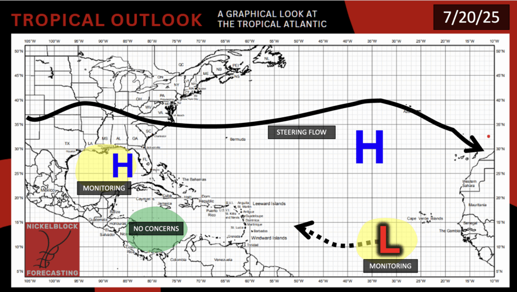
In the Atlantic, we have an offical area to watch from the National Hurricane Center (NHC), which is currently 1000 miles to the west southwest of the Cabo Verdes Islands. While the NHC is not currently outlining an area to watch in the Gulf, models have recently been hinting on a possible tropical depression or storm forming as a result of the moisture loop-the-loop from the storm we saw just a few days ago.
[wpcode id=”41149″]
Invest – Eastern Atlantic
The invest in the eastern Atlantic has been given a low 10 percent chance of tropical development in the next 48 hours and a 20 percent chance in the next 7 days. Conditions are more favorable in the early week for development, but will move into an area unfavorable for development by later in the week. While sea surface temperatures are leaning above average in the potential development region, there is some intense wind shear that will likely break the storm apart.
[wpcode id=”41149″]
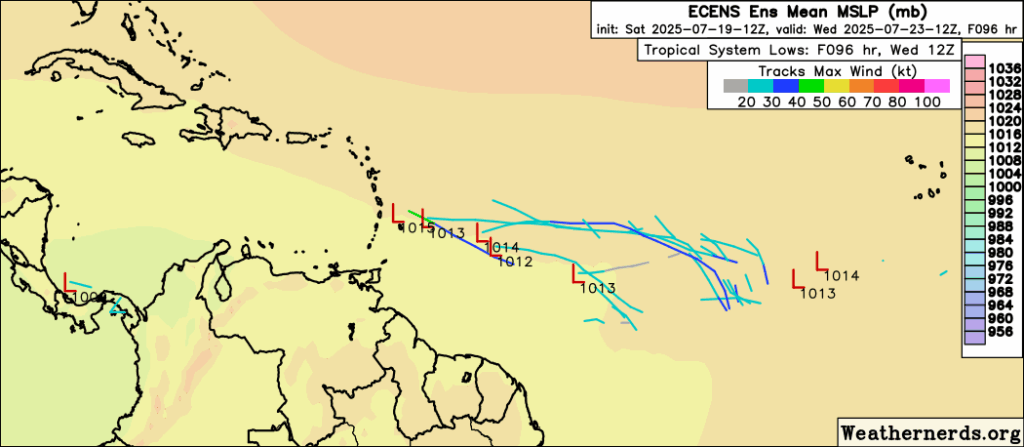
Area to Watch – Gulf
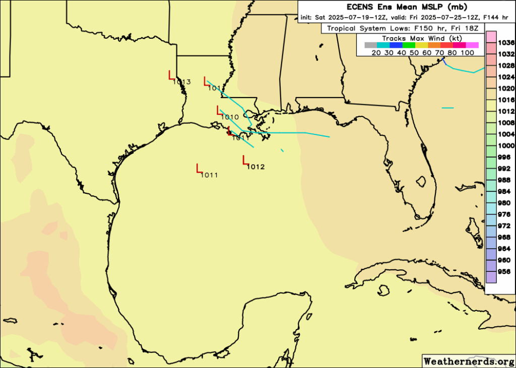
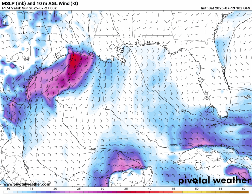

The area we are watching is the northern Gulf, with model ensembles currently bringing the moisture from a potential system into Louisiana or eastern Texas. While this is 5-6 days out from now, we are keeping an eye out on this early. Sea surface temperatures are well warm enough for a system to tap into, but an increased amount of wind shear by later in the week should suppress any serious development. The GFS and the Euro-AI models are both showing something in the same general area by next Sunday 7/27, with the GFS going for a stronger storm (no shock there). Other models, such as the ICON or the Canadian model do not show anything at all, just a plume of moisture.
Remember, we do use these model runs as a forecast, but rather a guidance on the latest trends given the environment in the potential development region. Whether something does form, or not, it’s important to know that later this week into next weekend will see an increased chance of rain regardless.
[wpcode id=”41149″]
Eastern Pacific Setup
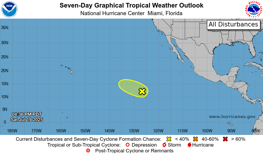
Currently in the Pacific, there is an area to watch from the NHC that has a 20 percent chance of development in the next 48 hours and a 30 percent chance in the next 7 days. Conditions are moderately favorable for development in the next few days, but by mid-to-late week, conditions become more unfavorable. It will be moving into an environment with cooler than average sea surface temperatures as well as into an environment of very high shear. If it does develop, it is not expected to impact any land.
[wpcode id=”41149″]
Continue to check back for the latest updates!


