General Central/Eastern Kansas Forecast
Short-Term (Thursday-Friday)
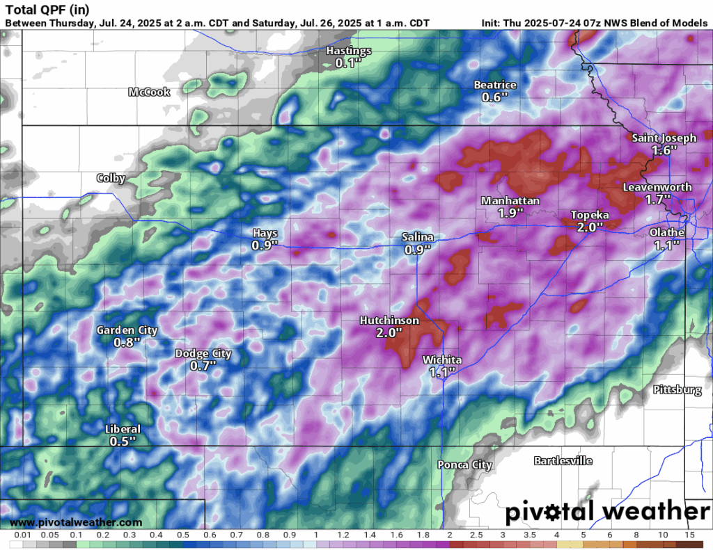
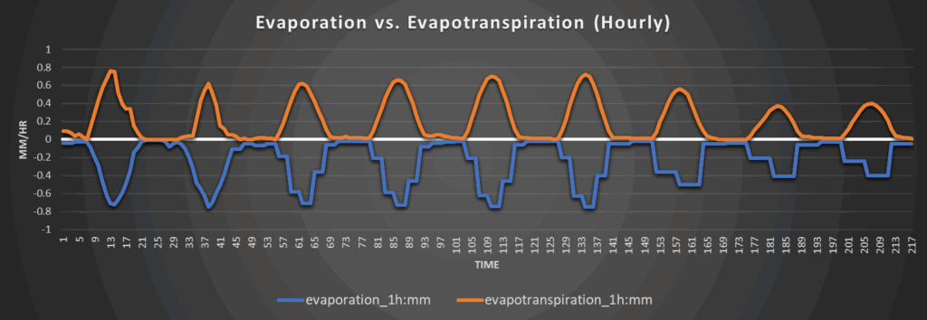
In contrast to the heat, today and tomorrow’s conditions look to be quite aquatic across central and eastern Kansas. A weak cold front will begin to move through the state from the northwest this afternoon before stalling out along a line from central Kansas to northeast Kansas, roughly paralleling just north of I-335. This will be coupled with several mid-level disturbances that will help trigger scattered to numerous showers and thunderstorms, particularly across north central and northeast Kansas, in the afternoon hours. No widespread severe activity is expected with these storms, although an isolated damaging wind gust can’t entirely be ruled out. These storms will last all the way through the overnight hours and into tomorrow afternoon, hitting the same areas repeatedly, increasing the flooding risk substantially from training thunderstorms and overall ground saturation. Flash flooding is a notable concern with heavier showers being very efficient rainmakers. New rainfall totals over the next 48 hours will see widespread 1-2 inches of rain, with isolated pockets of 4+ inches certainly possible. As such, a Flood Watch is currently in effect for counties east of I-135 from this afternoon to tomorrow afternoon.
Temperatures today will be on the “cooler” side due to the cold front and the rain-cooled air, with high temperatures in the mid 80s to low 90s, although some areas could be cooler if they see more constant rainfall. Winds south of the front will be out of the south at around 5 to 10 mph and winds north of the front will be more light and variable. Overnight lows look to get down into the low to mid 70s tonight. For tomorrow, temperatures will be similar to today, ranging from the low 80s to low 90s in the afternoon hours. Winds will be southerly at around 5 to 15 mph. Low temperatures tomorrow night will range from the low to upper 70s.
Long-Term (Saturday-Wednesday)
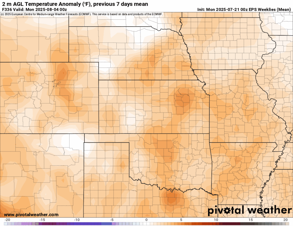
The cold front that is draped over us will lift out of here by tomorrow night or Saturday morning and high pressure will start to take its place once again. An upper-level high pressure system will move in from the southeast and plant itself over the state by early next week and hang around through the week, driving our temperatures higher once again. Temperatures will steadily climb into the mid 90s to potentially low 100s by the middle of next week, with heat indices constantly threatening or regularly breaching the century mark from Sunday onwards. Reintroduction of Extreme Heat Watches and Warnings will be on the table once again during this time.
Climate Outlook
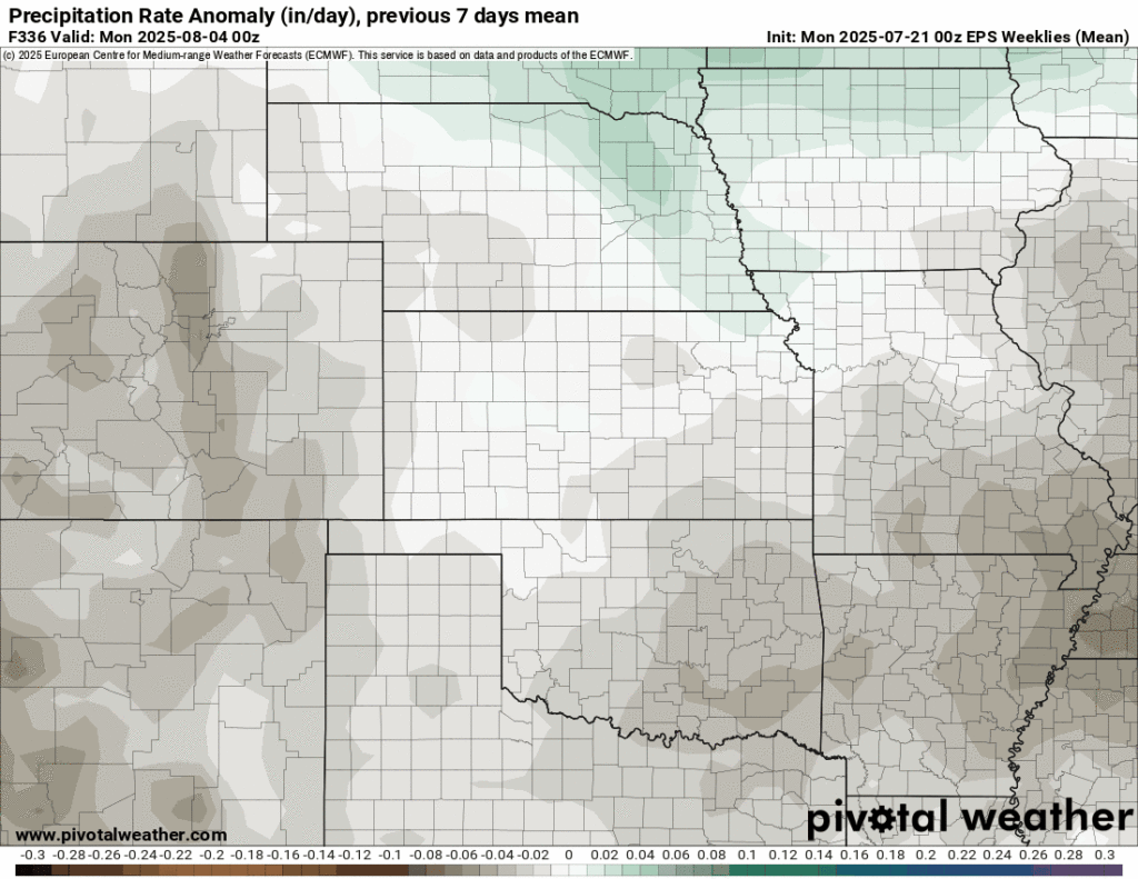
Our typical seasonal summer upper-air pattern is still slated to set in over the next month, with high pressure building off to our west allowing for slightly above average temperatures and slightly below average rainfall for our area. Rain chances won’t look to fully shut off though, as the main core of the high will be displaced off enough that we will reside under some northwest flow, which would allow for somewhat continued rain chances throughout the weeks. Widespread rainfall will buy and large not be anticipated under this regime however, mainly staying more sporadic and isolated in nature.
Regional Soil Moisture Outlook
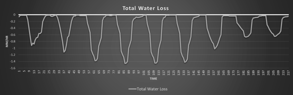
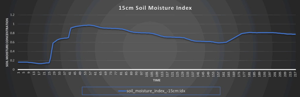
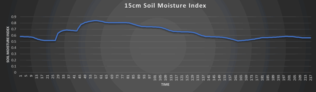
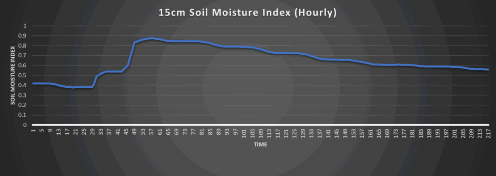
Substantial soil moisture recovery looks to take place across most of the region over the next couple of days, save for potentially southern Kansas where rain chances are generally lower. Persistent rainfall over the coming two days will help resaturate soils and fight off abnormally dry conditions. However, due to the potential for heavy to sometimes torrential rainfall, washing out of soils will be a concern with repeated rounds of storms. Once this system passes, a gradual drying trend will set in next week but soils should be in good enough shape that no concerns are noted at this time. The only exception to this may be in southern Kansas, where soil conditions have remained the driest over the last week or so.
Around Westmoreland
Around Scranton
Around Burlington
Around Altoona