General Central/Eastern Kansas Forecast
Today
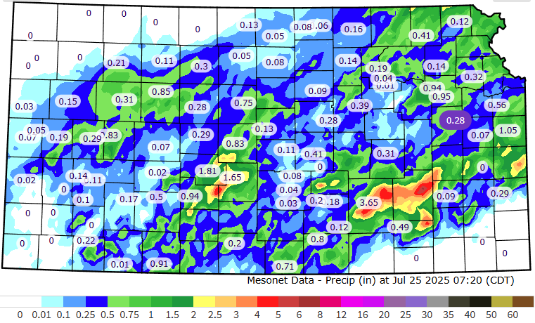
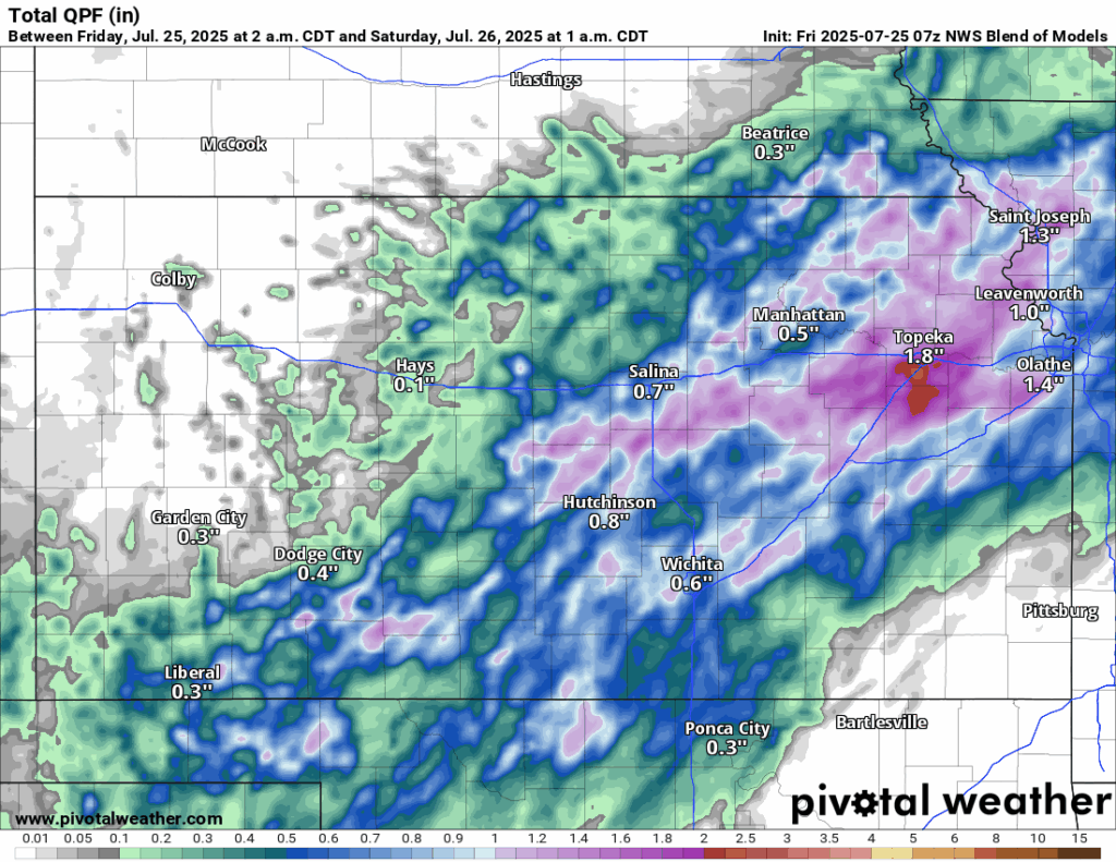
Scattered showers and thunderstorms will continue throughout the state today and last all the way through the overnight hours. Most counties in central/eastern Kansas so far have received up to an inch of rainfall, but localized hotspots in Butler and Greenwood counties have received over 4 inches of rain already with more to come. The focus for the heavier rain looks to be further north (closer to I-70) as a surface low and warm front lift northward, with continued widespread 1-2 inches likely and isolated pockets of up to 4+ inches possible. Flooding will continue to be a hazard throughout the day with the ground being mostly saturated and very efficient rainfall rates of 1 to 2 inches per hour possible.
Due to the rain and cloud cover, temperatures will be cooler than normal for this time of year, with highs ranging from the mid 70s to mid 80s (although southeast Kansas may reach into the mid 90s with reduced rain activity). Winds will be southeasterly at 10 to 15 mph throughout the day before becoming light and variable overnight. Low temperatures tonight look to get down into the low to mid 70s.
Saturday
Showers and thunderstorms from today will persist through the early morning hours tomorrow before fully exiting the state by around 7am. Some further isolated showers and thunderstorms may be possible again in the afternoon (3-7pm), but overall chances will be lower than compared to Thursday and Friday. Flooding will be less of a concern as well, as the overall moisture content in the atmosphere will decrease as the previous front moves out of the way.

Temperatures tomorrow will range from the upper 80s to low 90s across the region, with southerly winds at around 5 to 10 mph. By tomorrow night, temperatures will feel slightly warmer, falling to the mid to upper 70s overnight.
Long-Term (Sunday-Friday)
High pressure will build in across the state beginning on Sunday and bring back the hot and humid temperatures that we had previously dealt with earlier this week. High temperatures will incrementally climb back into the mid to upper 90s (to potentially low 100s) throughout the early and middle part of next week, with heat indices again regularly reaching the upper 90s to mid 100s. Heat advisories and warnings are likely to return with this heat, so caution should be taken when doing any outdoor activities next week. The heat and dryness does not look to be completely permanent though, as the high pressure does try to break down and some disturbances may pass through around the Thursday-Friday period. This may allow for rain chances to increase again but chances are low at this time due to model uncertainty.
Drought Update
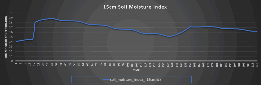
Substantial drought improvement has taken place across northern Kansas between last week and this week due to the recent persistent rains. Continued drought improvement is likely to occur with this latest round of heavy rainfall across central and eastern Kansa, and even though the heat does look to return, drought conditions should not worsen by much given very high soil saturation and the potentially shorter window for dryness given more precipitation chances by late next week.


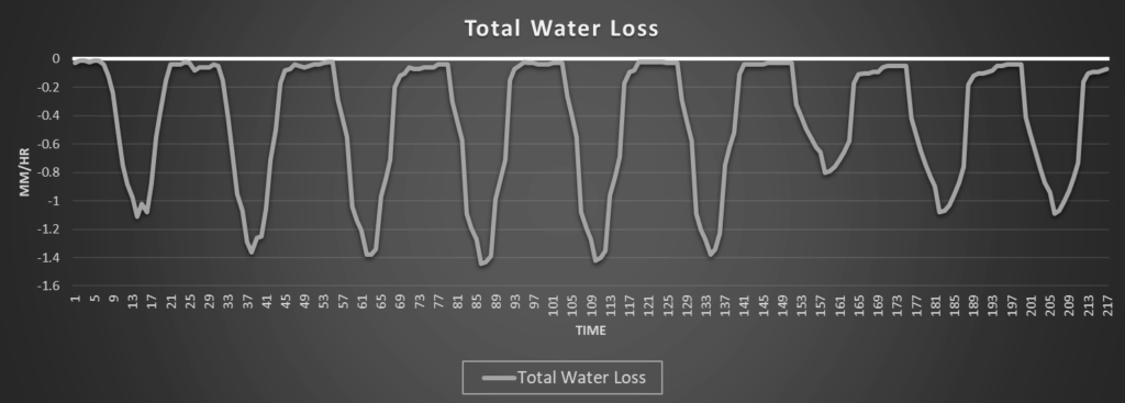
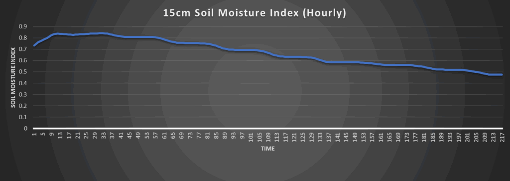
Regional Soil Moisture Outlook
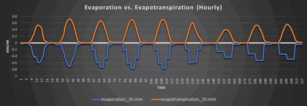
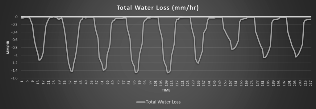
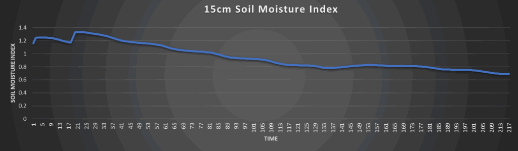
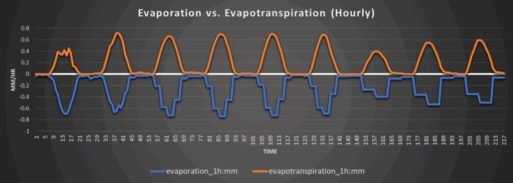
Around Westmoreland
Around Scranton
Around Burlington
Around Altoona