We have a disturbance in the Gulf that will bring some rain our way today, but will subside by Sunday. This system now has zero chance at development after making landfall on the Gulf Coast. There are two disturbances in the Pacific: one off the coast of Mexico and another southeast of Hawaii. Let’s take a closer look at each:
The Situation in the Atlantic:
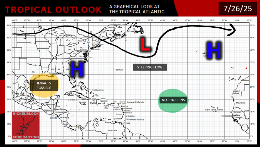
Currently, we have areas over high pressure over the Southeast and the Azores, and a low pressure in the North Atlantic, shaping our overall flow. The disturbance in the Gulf no longer has a chance of development as it moves over land today:
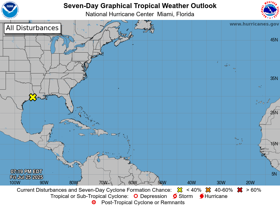
The NHC has now put this disturbance’s chance of development at 0% because of its landfall on the Texas/Louisiana coast. As these tropical systems move onto land, they tend to weaken rapidly. So although this system won’t develop into any sort of tropical cyclone, it still may bring some heavy rainfall to localized areas in the northwestern Gulf Coast, but not particularly in our area.

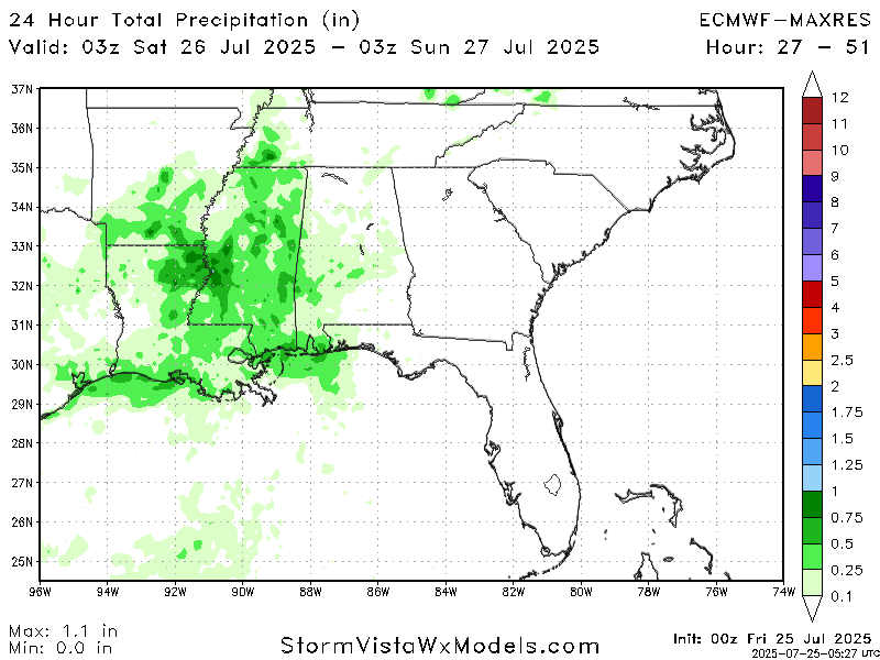
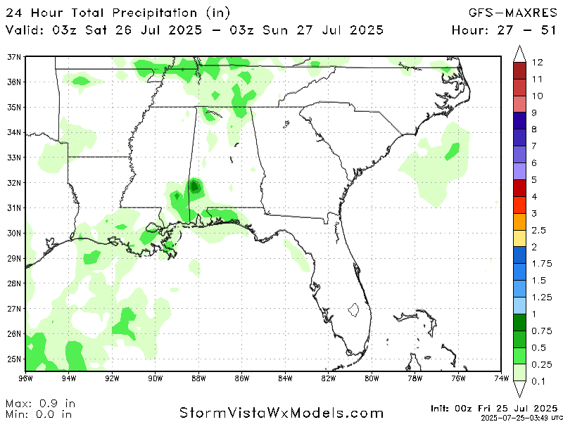
Each model has different outcomes for exactly how much rain we will get from this tropical system. Comparing the GFS, ECMWF, and other models, how much rain in an exact location is hard to pinpoint when each model shows a different outcome, but it is safe to say that across our forecast region, any given location could receive somewhere between no rain at all to an inch of rain today. With these messy tropical systems, the models tend to be all over the place when it comes to exact precipitation measurements.
The Situation in the Pacific: Disturbance 1
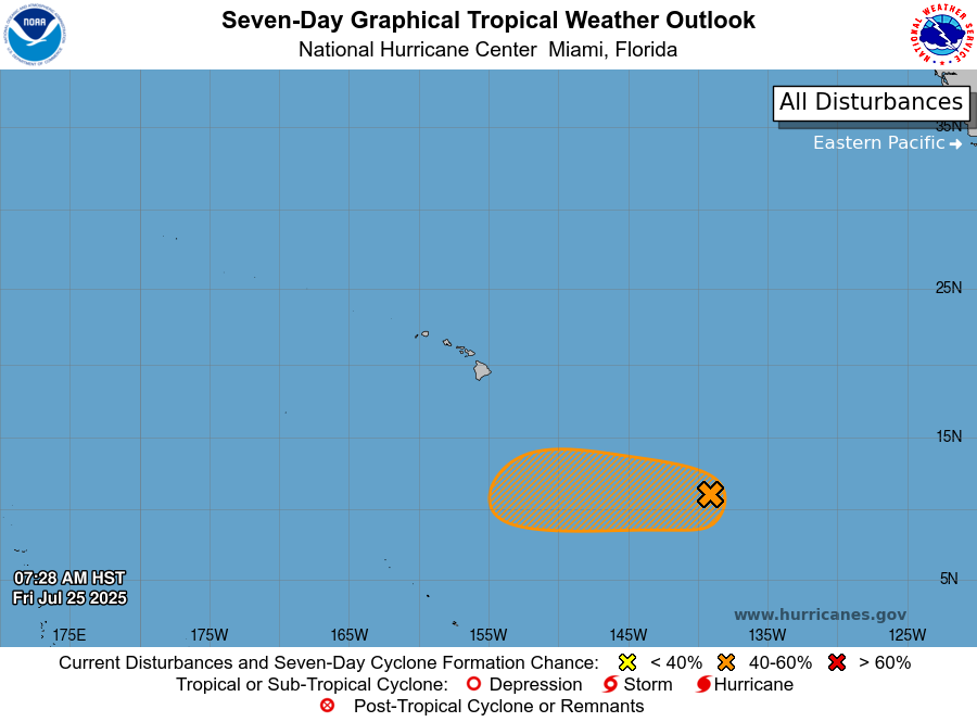
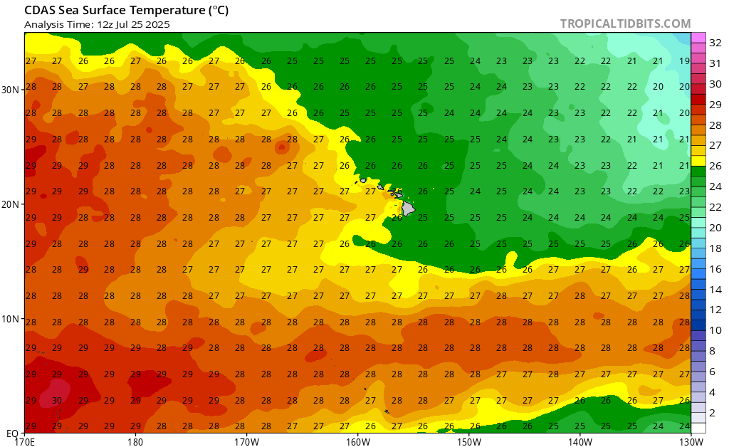
This first Pacific disturbance is located southeast of the Hawaiian Islands and is moving westward around 10-15 mph. The system has a 60% chance of developing into a tropical cyclone of some sort in the next 7 days, and a 40% chance of development in the next 48 hours. The air around Hawaii is pretty dry, but further south there is sufficient moisture to fuel the storm’s development. Wind shear around Hawaii is quite high, but again, far south of Hawaii shear does calm down for a bit.
The potential track of this system is following the warm waters of the Pacific, and much of the ocean surrounding Hawaii is cold enough to deter tropical activity.
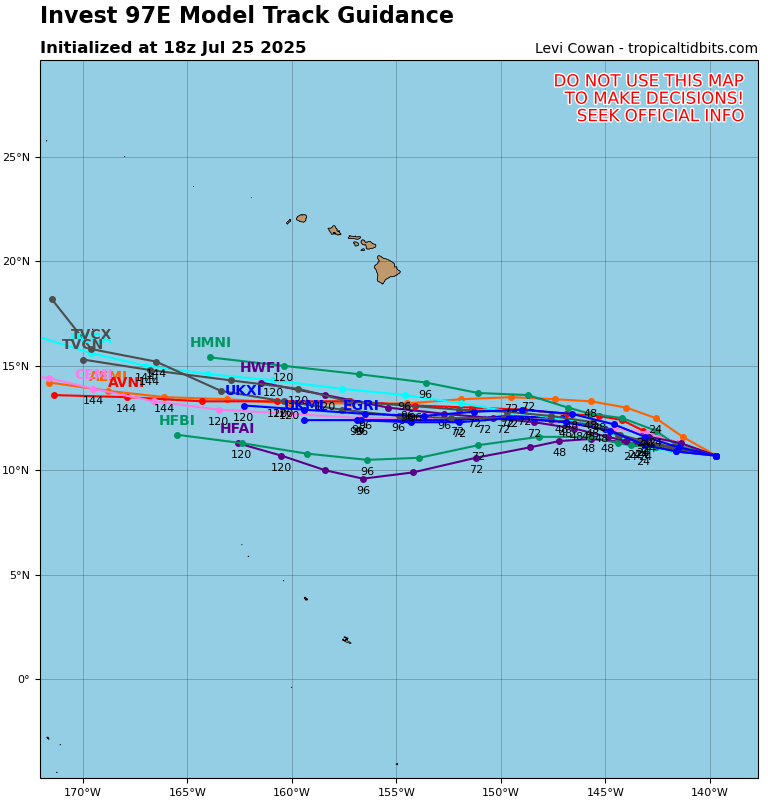
Regardless of how this system’s development ends up, the likelihood of this storm making landfall on Hawaii is luckily slim to none. Looking at various ensemble models, none of them point toward landfall.
The Situation in the Pacific: Disturbance 2
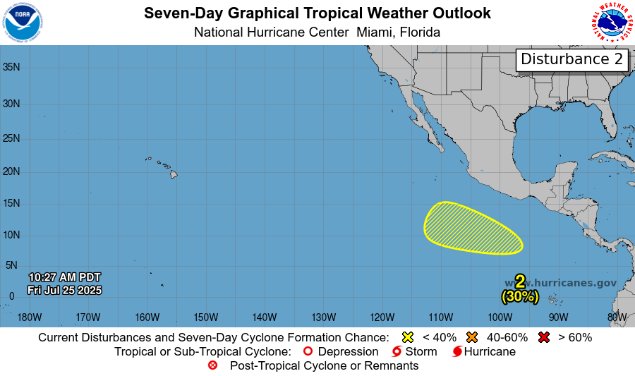
The disturbance in the East Pacific currently has a 30% chance of development in the next 7 days, and practically no chance of development in the next 48 hours. This system is moving west-northwestward around 10-15 mph. This area is being watched for tropical development because a low pressure area is forecast to form by next week, and at that point, environmental conditions are looking good for tropical development. The area is looking very moist for the foreseeable future, and large patches of low wind shear will be present as well. These conditions will help to feed this system’s development. This disturbance’s development will likely be a slow one, and is highly dependent on whether or not the area of low pressure forms in the next few days.
We will continue to keep you updated on all of these areas and the rest of the tropics, so stay tuned for more NickelBlock tropical updates!


