Hi everyone! For your tropical update, we have one unoffical area to watch in the Atlantic, and three official areas to watch in the Pacific. Let’s look into the details:
Atlantic Basin Setup
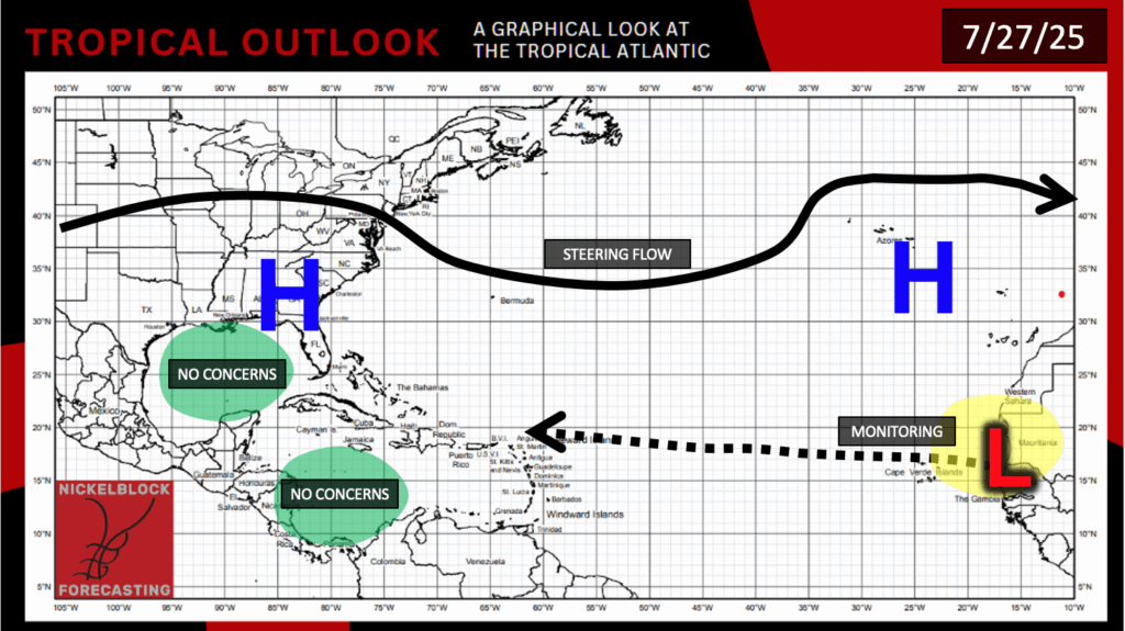
The tropical Atlantic doesn’t currently have any officical areas to watch from the NHC, but we are keeping an eye out on the Main Development Region for a potential tropical wave to make its way to the west by next week.
Area to Watch – Atlantic
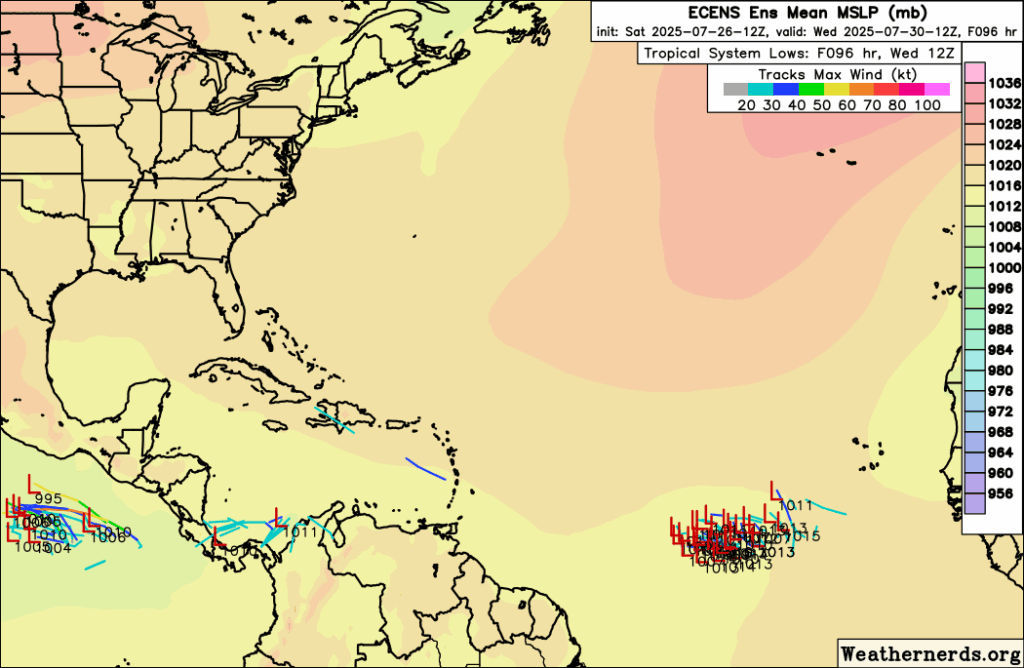
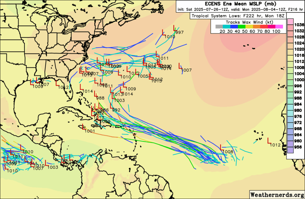
The spaghetti models have been pretty consistent with an area of low pressure forming off of Africa in the Main Development Region (MDR) by mid-week and moving to the west northwest through the weekend into early next week. Some of the ensembles have it turning around an area of high pressure bringing it out to sea by early next week, but others keep it on more of a northwest trajectory. This is more than a week out at this point, and the low pressure has not even formed yet – so it’s important to know that any given model run could change the course of the low pressure system due to a multitude of factors.
We know that ocean temperatures will be very warm when it tracks near the eastern Carribean, but wind shear and dry Saharan air will be the biggest antagonists for the storm.

Eastern/Central Pacific Setup
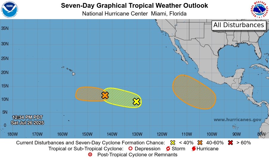
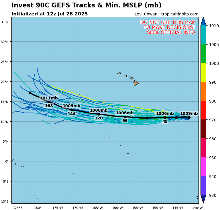
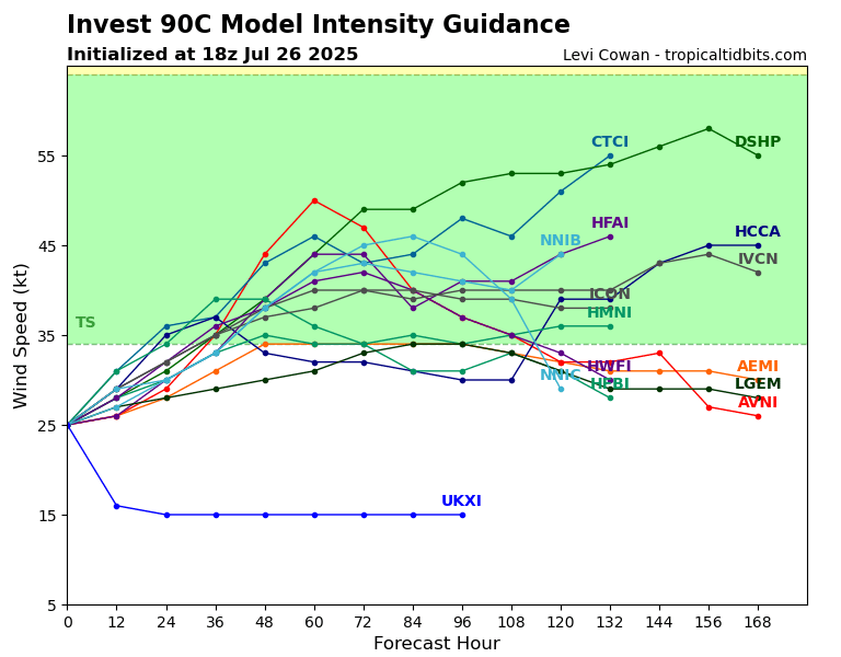
The Pacific basin is becoming more active after a little bit of a lull in activity recently. There are 3 areas to watch from the NHC. Starting from the west-most one – this one is officially named Invest 90C and has a medium chance of developing into a tropical system, with a 50 percent chance in the next 2 days and a 60 percent chance in the next 7 days.
The next one to the right of it has a low chance of developing, only 10 percent in the next 2 days and 20 percent in the next 7 days. It will track almost the same path as Invest 90C with no impact to the Hawaiian islands.
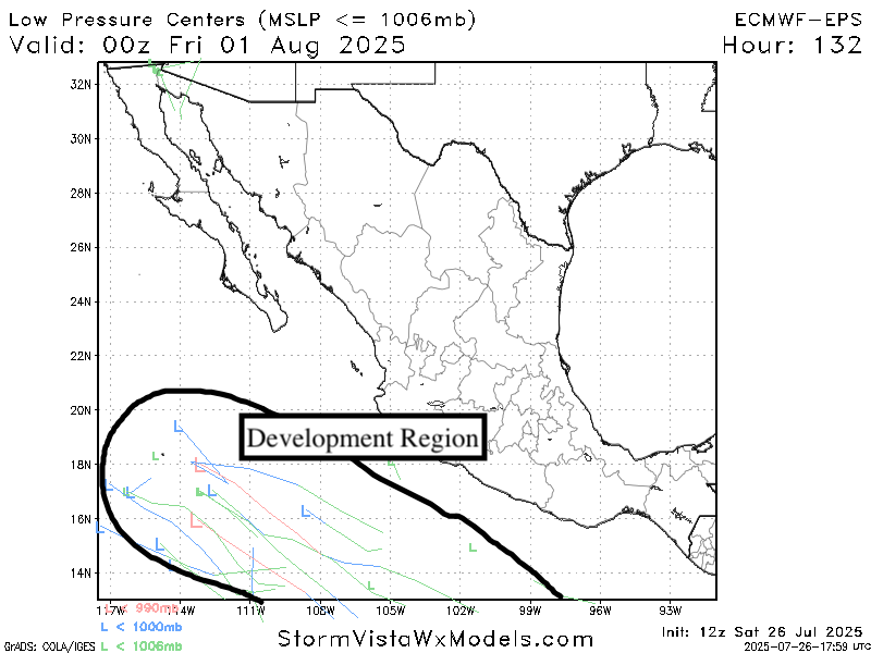
The next one has a medium chance of development, with a 40 percent chance in the next 7 days. This one I am keeping a close look on for two reasons: There’s lot’s of moisture for it to work with and sea surface temperatures are plentiful warm and above average. Also, this could impact the western Mexican coast if it were to track close enough. Current guidance does have the low moving out to sea after scraping the coastline, but it’s something to watch carefully.
Continue to check back for the latest updates!


