Hey everyone! We are discussing severe weather today as well as the dangerous heat that’s affecting millions across the country. We are looking at a change in the flow for most of the eastern CONUS from a hot and moist airmass to a cooler one. We also have a look at the weekly outlook outlined by region! Let’s take a look at all of the details:
Today’s Overall Setup
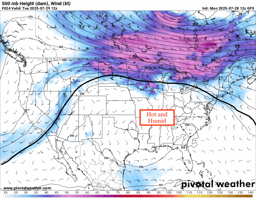
The eastern US will see the max of the “heat dome” today, as shown in the 500 mb analysis. It’s dangerously hot out there, with much of the map covered in extreme heat warnings or heat advisories. It’s not just hot, it’s brutally humid, making heat indicies soar into the 100s. As the mid-level flow breaks up the hot airmass from the cooler Canadian airmass in the extreme northern tier, temperatures could be seen dropping off into just the 70s and 80s.
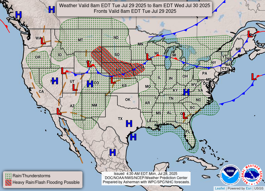
There is a chance of some severe weather today in the Upper/Middle Plains as well as the chance of some flash flooding as a result. 1-2 inches could fall in a short period of time, which is why the WPC has issued a Slight (at least 15 percent chance) risk of flash flooding for the area hatched in red in the National Forecast Chart above.
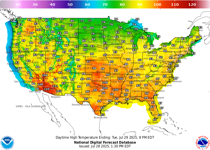
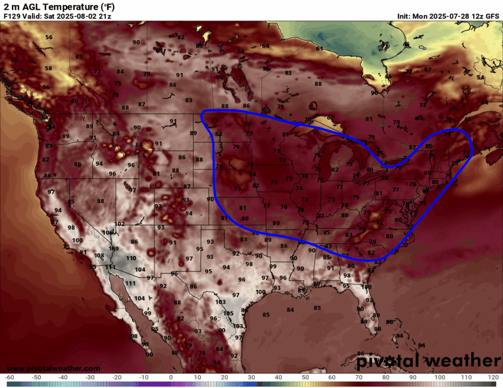
Yes, we are expecting a little bit of a cool down for much of the east, but it all depends where you live. For those in the Gulf coast, you will still see temperatures soaring in the 90s on Saturday, but if you live in the midwest or northeast, your high temperature might only get into the 70s or 80s.
Today’s Severe Weather Threat
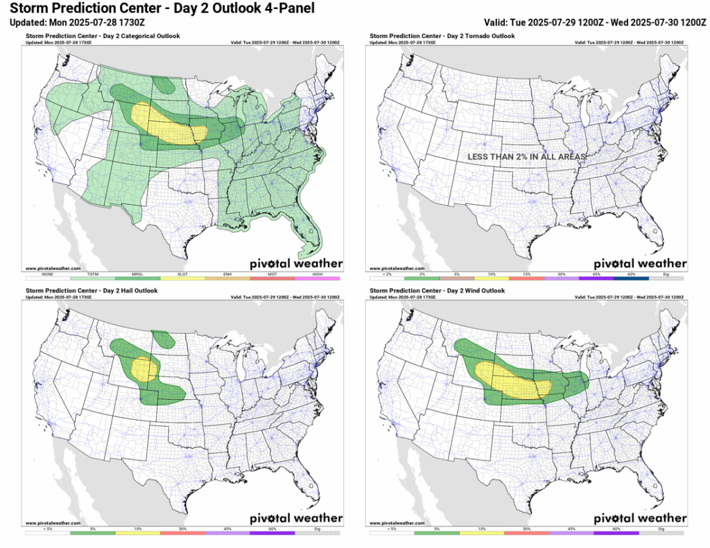
There’s a Slight (level 2/5) risk for severe storms Tuesday from parts of Montana and Wyoming through Nebraska into Iowa and northern Missouri. The setup features a warm, moist airmass and a front moving through, which will help storms fire up in the afternoon. Strong wind shear will support some organized storms, possibly even a few supercells early on. The main threat looks to be damaging wind gusts, especially from eastern Nebraska into central Iowa, but some hail can’t be ruled out either. Out west, places like eastern Wyoming and the Nebraska Panhandle could also see strong storms thanks to upslope flow and decent instability.
Upper/Middle Plains Severe Weather
The main severe threat will start to fire up in eastern Wyoming at around dinner time, moving to the east and looking more impressive by around midnight in Nebraska and Iowa. You can see the reflectivity almost “bowing” out and spinning around the low pressure, so ensure you are prepared for some gusty or severe winds in the evening and overnight hours tonight. Hail is also definitely a possibility, with the biggest hail threat located in eastern Wyoming. Stay weather aware and keep updated for any upgrades as we get closer.
Tomorrow’s Severe Weather
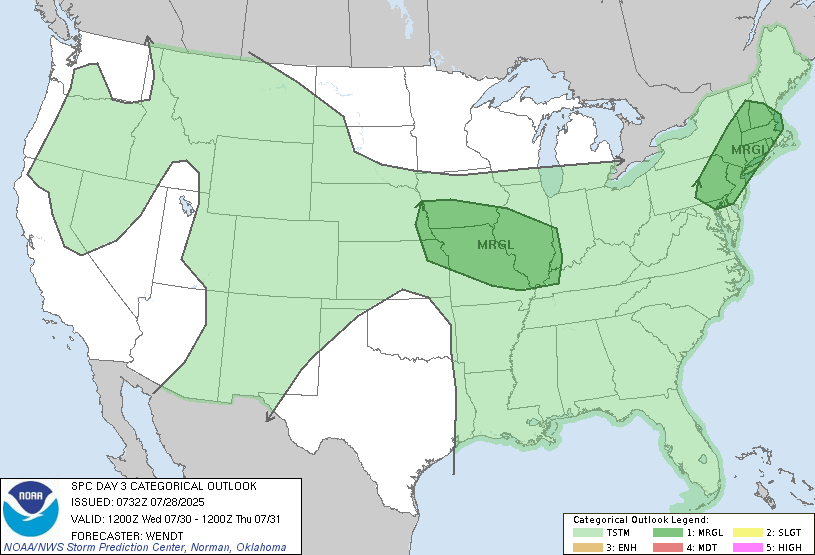
Severe weather continues tomorrow, with two Marginal (1/5) risk zones highlighted by the SPC. The first one in the Mid-Mississippi Valley region. As of right now, the most likely threat, if there was one, would be for damaging winds from a leftover Mesoscale Convective Vortex (MCV), or essentially a small-scale low pressure system that almost looks like a hurricane on satellite imagery! Predictability is too low at this time to get into the specifics, but we know that there will be plenty of surface heating and some wind shear to help support the severe threat. Timing is looking to be in the evening into the overnight.
In the northeast, there will be a cold front passing through tomorrow, that could bring some severe storms with it. Wind shear is fairly high, so some supercells are possible early on, but weak lapse rates will prohibit them from becoming too strong. A wind threat here is also the most probable. Timing will also likely be in the evening into the overnight hours.
CONUS Weekly Precipitation Outlook
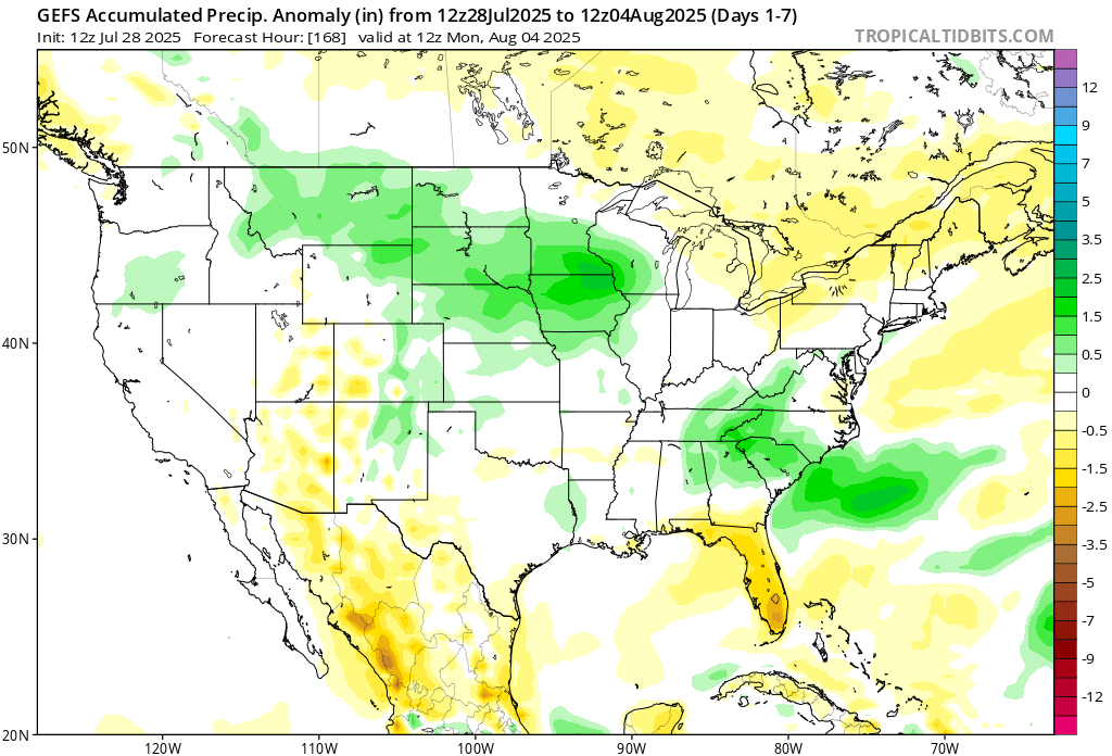
Here’s a look at the GEFS modeled precipitation anomalies through Monday 12z. Green indicates above average precipitation, white indicates average precipitation, and yellow indicates below average precipitation. Let’s look into the details by region:
Weekly Outlook: Western United States
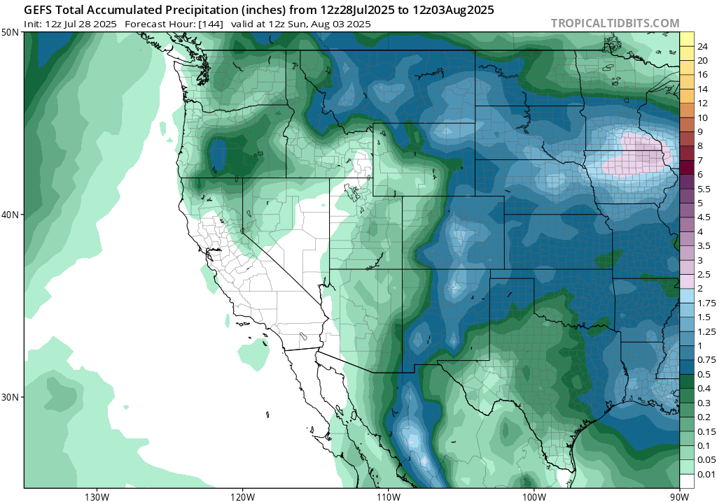
Yet again another trough of low pressure, a dry one at that, will spin like a bowling ball into the west coast and bring with it some cooler than average temperatures, but no rain. Most of California will see little to no rain in the next 7 days, which is perfectly normal for this time of year.
On the other side of the trough of low pressure, a ridge will sneak to the Pacific Northwest, bringing warmer than average temperatures this week from Arizona and New Mexico up to Washington. Slightly below average rainfall is expected for the deserts, but some above average rain will fall in the northern Rockies – due to many shortwaves passing through this week.
Weekly Outlook: Central United States
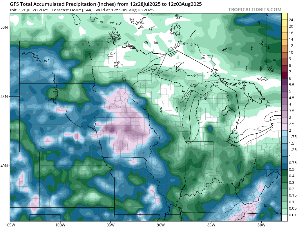
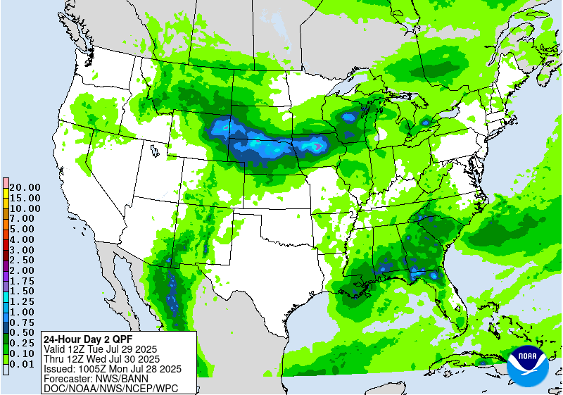
Much above average rainfall is expected in the northern Plains and Upper Midwest this week, with today and Wednesday bringing most of this rainfall. As much as 3-6 inches plus is possible, and flash flooding is certainly possible. The WPC has issued a Slight (at least 15 percent) chance of flash flooding for tomorrow through Wednessday for the region.
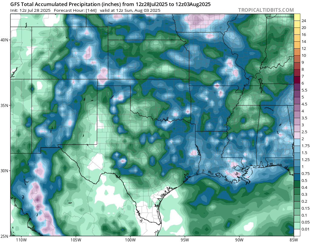
Some above normal rainfall is expected in the south central region, with some areas possibly seeing flash flooding. A Slight flash flood risk has been issued for Thursday for northern Texas, eastern Colorado, western Kansas, and the panhandle of Oklahoma. Be very cautious through the week, as each day will see some rain this week.
Weekly Outlook: Eastern United States
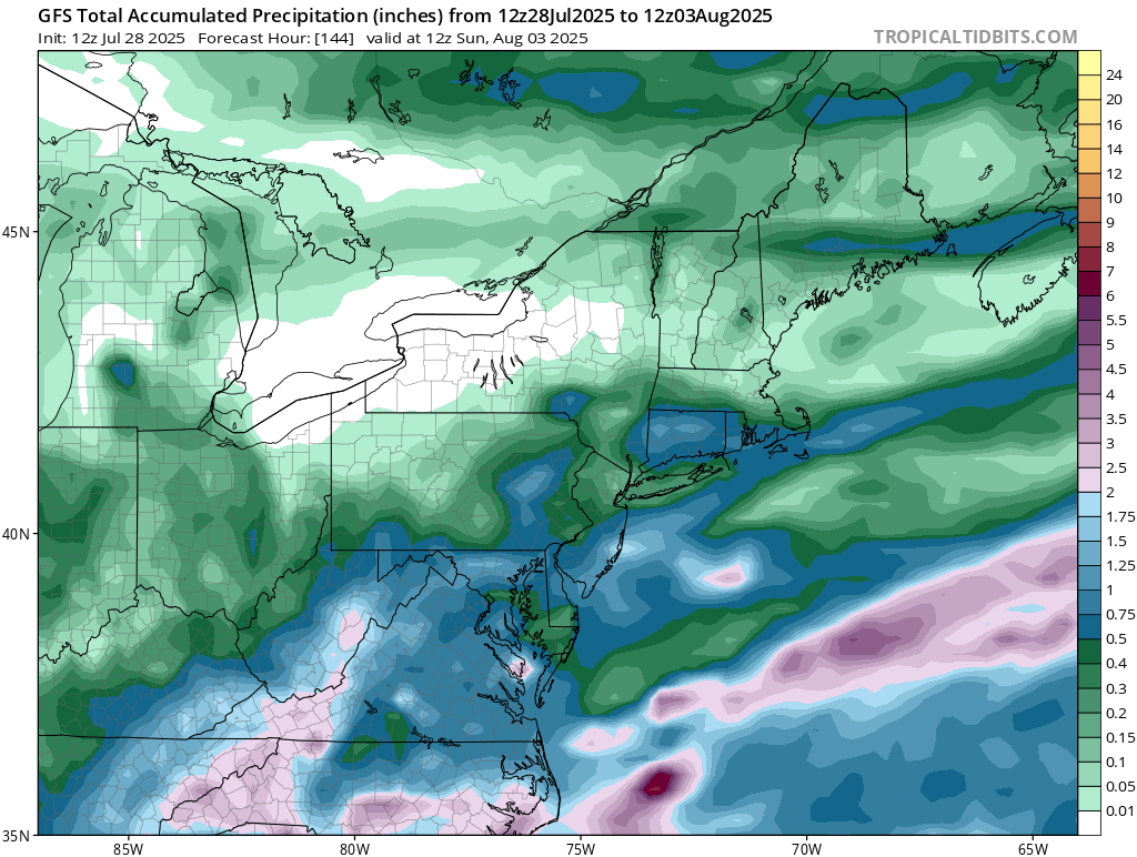
Much of the northeast will see below normal rainfall through Sunday, but those in the southern Appalachians in southwestern Virginia or western North Carolina will see much above normal rainfall. Most of this rain will fall on Thursday, when a front stalls out in the region.
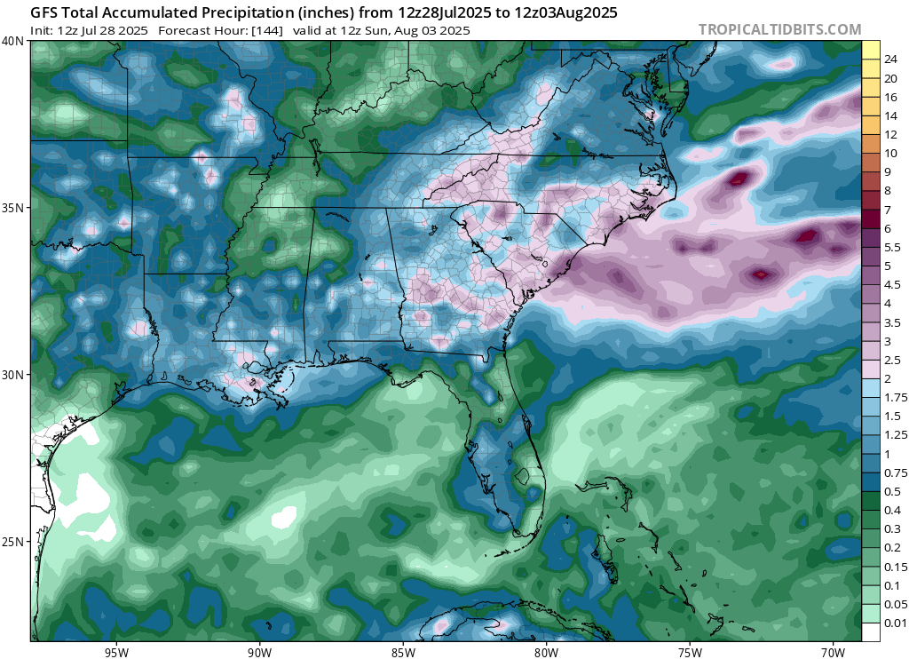
That same stalled out front and associated low pressure will stick around and dump a good amount of rain on the Atlantic coastal southeast. The NickelBlock region, southern MS/AL/LA, will see near average or slightly above average rainfall, with the end of the week seeing a good chance of a soaker for each day.
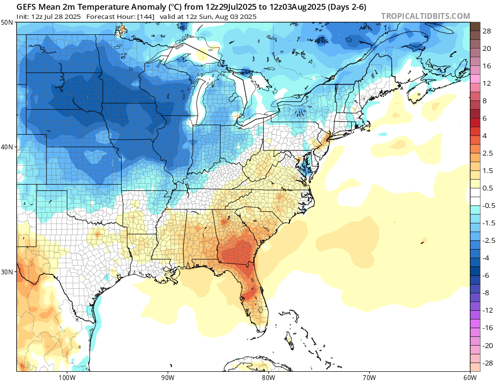
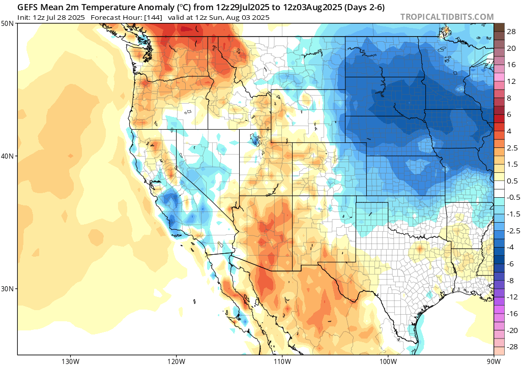
As a result of the ridge moving to the west in the coming days, the overall flow for much of the central and northern regions of the country will be from the northwest, which is a cooler airmass. Temperatures could be 5-10 degrees below normal overall by the end of the week, which will bring maybe a little bit of relief from the intense heat we’ve been seeing all summer.
Travel Outlook
If you’re hitting the road today, expect storms to fire up around dinnertime near eastern Wyoming, especially along I-25 and I-80 heading into Nebraska. Conditions may quickly change around Cheyenne and Scottsbluff.
Further east, storms will push into central and eastern Nebraska, Iowa, and parts of Missouri later in the evening and overnight. Key roads to watch include I-80 through Lincoln and Des Moines, I-70 from Salina to Kansas City, I-35 north of Wichita, and I-29 near Omaha and Sioux City. Be alert for strong winds and heavy rain if you’re traveling at night through these areas.
Extended Outlook
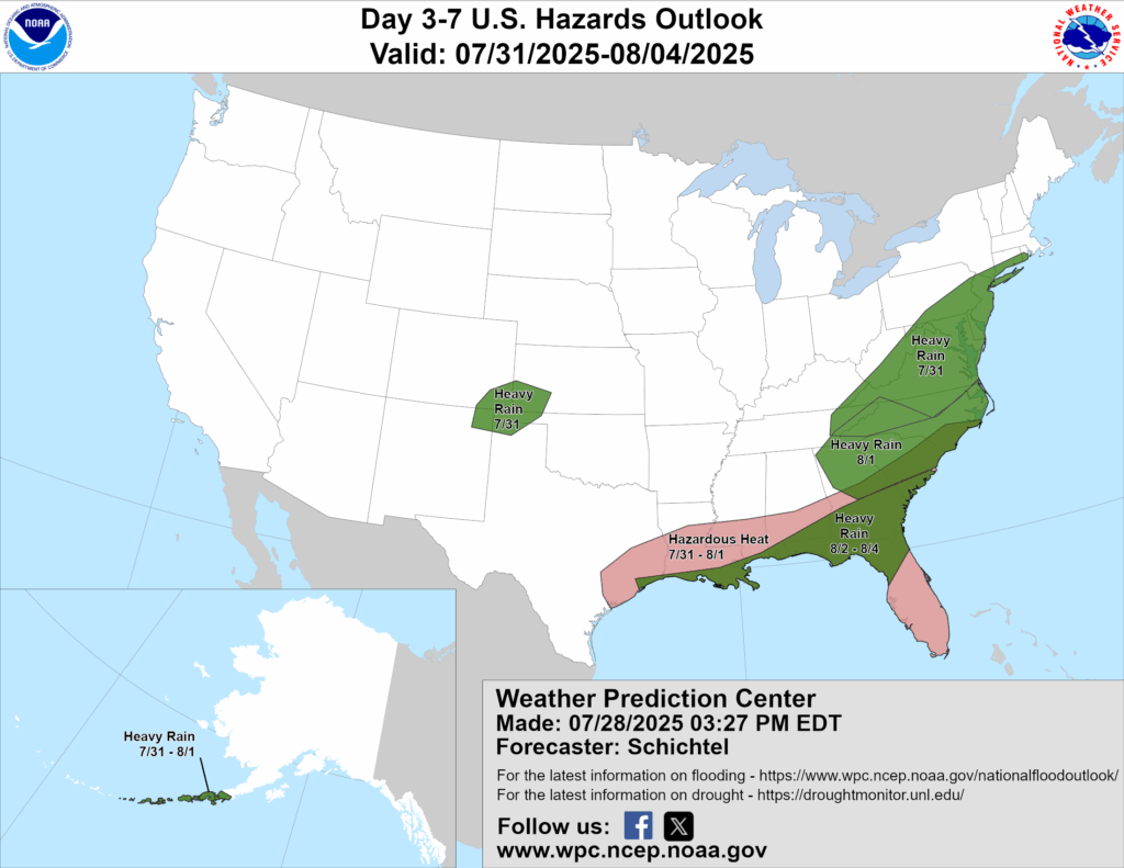
Above is a look at the U.S Hazards Outlook from NOAA, highlighting areas of extreme weather to be aware of for the next 3-7 days.
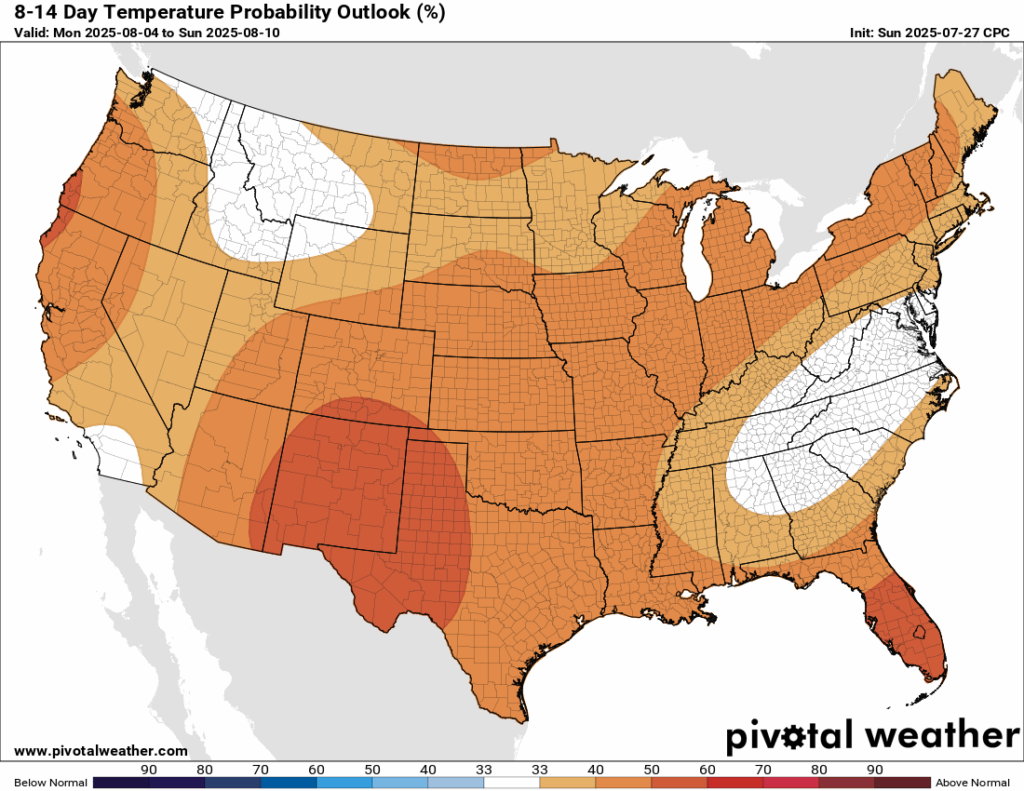
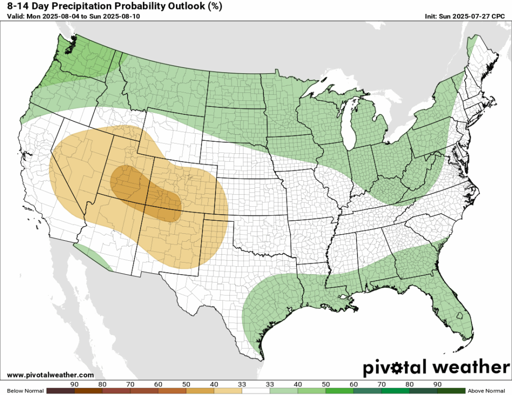
Well, after all of the hype about the summer cold front, temperatures will rebound back to above normal for not just some, but ALL of the country in the 8-14 day timeframe. Some may stay near their normal, but the overwhelmingly majority will see above. As for rainfall, there’s an increased chance of below average rain in the southwest, but a small chance at above normal rainfall is possible for the northern tier and the coastal southeast.
Thanks for tuning in to this National Forecast! Tune in to our local, tropical, and regional forecasts to stay updated on the latest!


