General Central/Eastern Kansas Forecast
Short-Term (Tuesday-Wednesday)
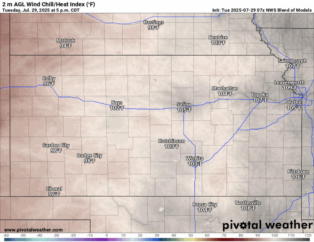
Heat advisories will continue across the state today until 8pm, as high temperatures and heat indices persist across all of central and eastern Kansas. High temperatures today will again be in the mid to upper 90s, with heat indices ranging from the mid to upper 100s. Winds will be mainly southerly at around 5 to 10 mph throughout the day today. Contributing to the heat index, relative humidity values will range around 40-60% with dew point temperatures in the upper 60s to mid 70s, making for another oppressive day. Precautions should again be made to prevent heat-related illnesses if one must be outside today. Low temperatures tonight will be similar to last night, dipping to the mid to upper 70s.
Relief from the heat is on the way, as a cold front will begin to move through the state tomorrow morning/afternoon and traverse all the way through by the overnight hours. This looks to be a more powerful cold front for this time of year, with temperatures behind the front reaching the upper 70s to upper 80s. Temperatures in front of the front will still be quite toasty in the low to mid 90s but will be marginally better than the past couple of days. Discrepancies in timing of this front are still noted though, with the GFS bringing the front through quicker into the morning and afternoon hours, while the Euro is a touch slower, waiting till the afternoon and evening hours to advance it through.
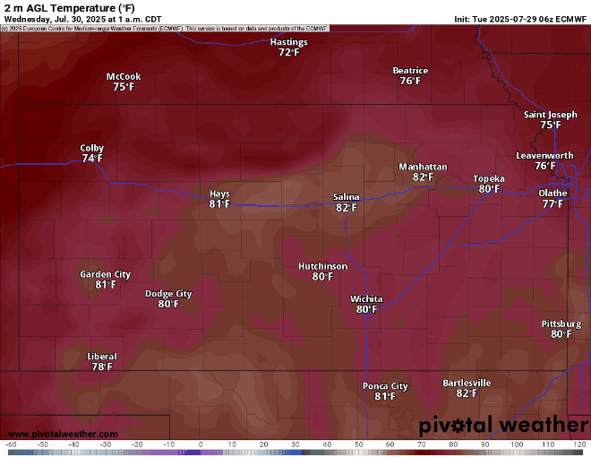
This cold front will help to trigger some scattered showers and thunderstorms across northern Kansas along US-36 early in the morning (beginning at 3am) before popping more storms further south towards I-35 in the afternoon/evening hours (around 4pm and later). Overall new rain totals from these showers will generally stay under an inch, but some pockets of locally heavy rainfall (exceeding 1 inch) is possible given an extremely saturated environment.

Long-Term (Thursday-Monday)
Temperatures will continue to fall off of a cliff for the rest of the week and weekend, only reaching the mid 70s to low 80s daily and potentially dipping into the mid 50s to low 60s at night. Rain chances as this system gets closer will be evident, but widespread heavy rainfall is beginning to look less likely during this period. Regardless, relief from the temperatures alone will still be more than welcome, even if rainfall isn’t the major headline.
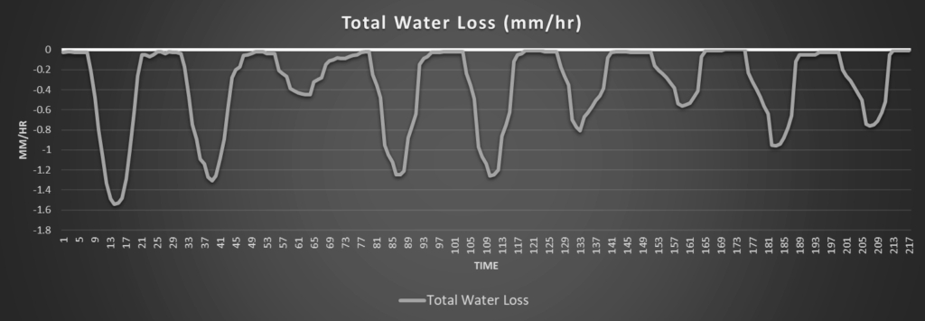
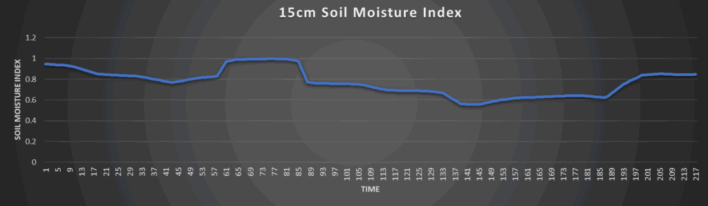
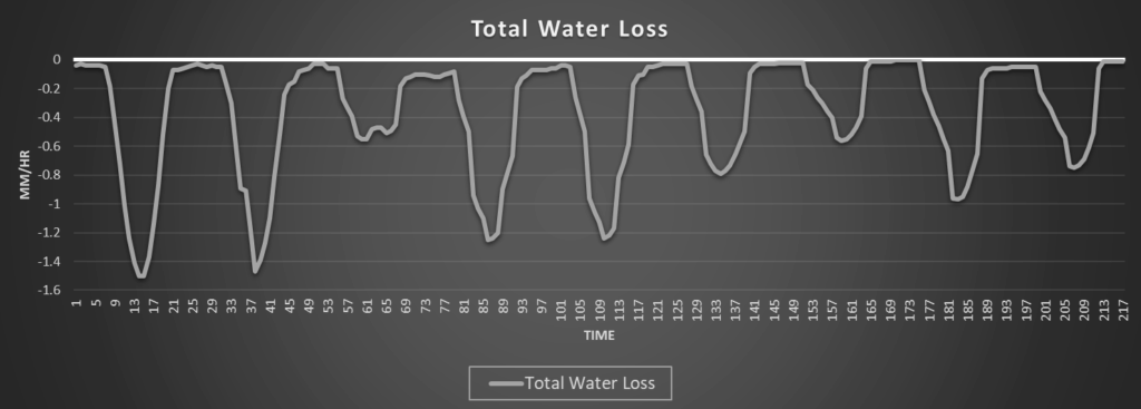
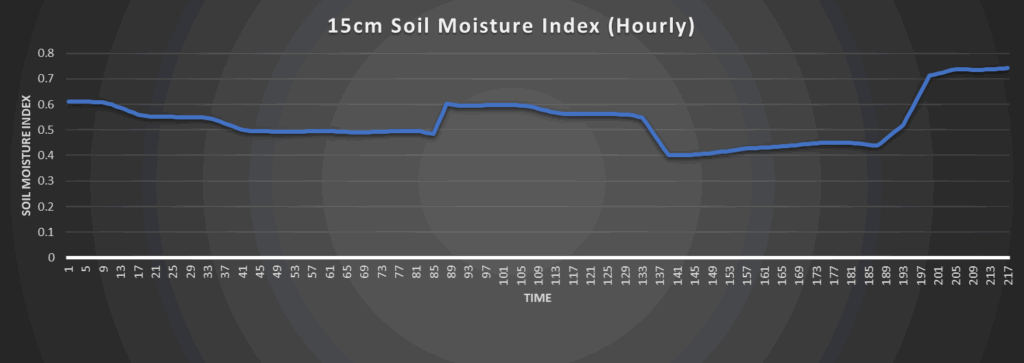
Regional Soil Moisture Outlook
Around Westmoreland

Around Scranton
Around Burlington

Around Altoona