General Central/Eastern Kansas Forecast
Short-Term (Wednesday-Thursday)
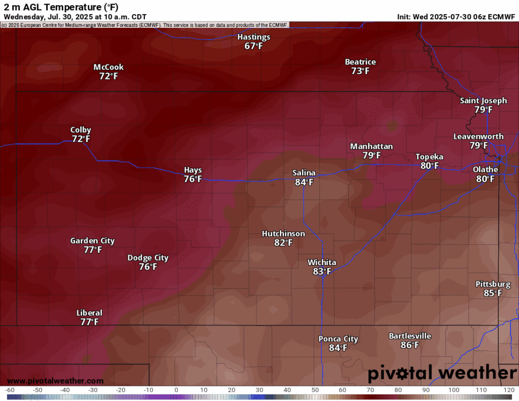
Temperatures will start to feel noticeably cooler today, as a cold front makes its way through the state throughout the day. Highs behind the front this afternoon will only make it to the upper 70s to low 80s (mainly along and north of I-70) but high temperatures south of the front will again make it to the mid 90s. Heat indices in front of the cold front (south of I-70) may reach into the low 100s again today, so caution should still be taken when venturing or laboring outside today. Lows tonight will be cooler than previous nights, dropping down into the upper 60s to low 70s. Winds will be southerly at around 5 mph before becoming northeasterly at around 5 to 10 mph as the front passes.
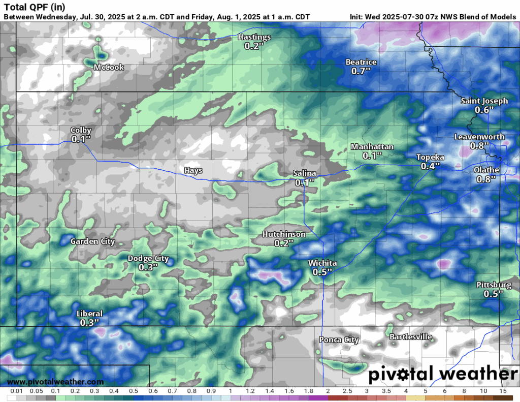
Accompanying this cold front will be an increase in the rainfall potential once again. Scattered showers and thunderstorms will be possible this morning and afternoon across northern Kansas near the state line before potentially more robust thunderstorms develop this afternoon/evening along the cold front (paralleling I-70 to I-335). This thunderstorm activity will generally move east-southeast throughout the evening hours and will persist into the overnight hours. Some of these storms may be marginally severe, with hail and damaging winds (around 60-70 mph) being the main hazards. Localized heavy rainfall is a concern again, with isolated rain totals exceeding 2 inches possible in heavier or training thunderstorms.


Tomorrow, shower and thunderstorm activity will still be ongoing across southern/southeast Kansas (mainly along and south of US-400) through the morning hours but may linger into the afternoon hours as well. Temperatures all across central and eastern Kansas will feel like Spring, only reaching a high in the mid to upper 70s. Low temperatures will generally be in the low to mid 60s, although isolated pockets of upper 50s along the Kansas-Nebraska border can’t be ruled out.
Long-Term (Friday-Tuesday)
Below average temperatures will persist through the late week and into the weekend, as we reside under a weak northwest flow pattern which will keep cooler temperatures coming in. Average temperatures through Sunday will mainly be in the upper 70s to low 80s, much more comfortable than mid to upper 90s. Some isolated rain chances may exist with disturbances within the flow throughout this period, but overall chances remain low. Temperatures by early next week will then look to gradually warm back up closer to our seasonal average in the upper 80s.
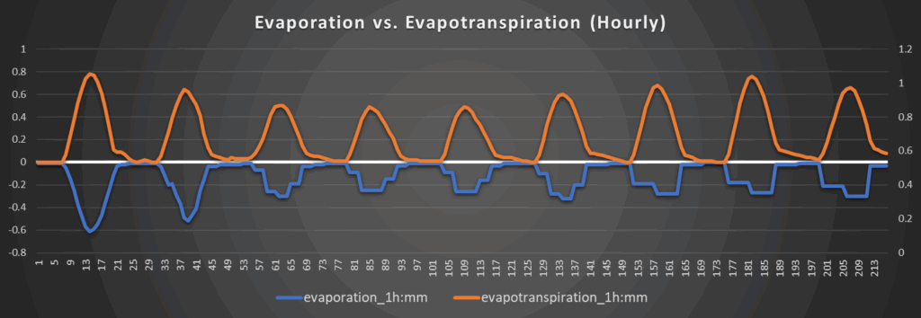
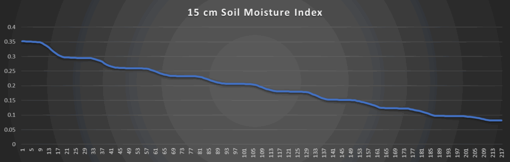
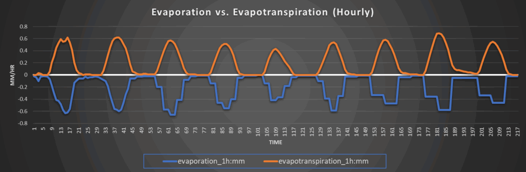
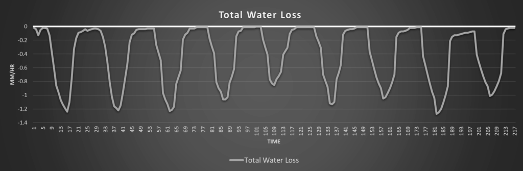
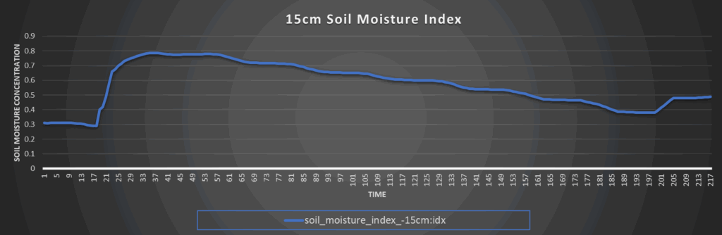
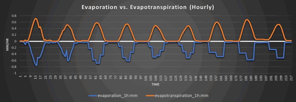
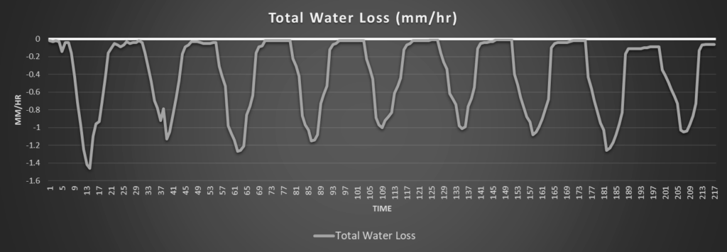
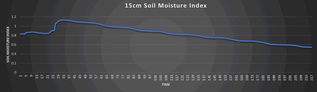
Regional Soil Moisture Outlook
Soils will be in relatively good condition through the forecast period in part due to the incoming showers and thunderstorms and the markedly low temperatures for this time of year. Beyond today, water loss does not look to exceed 1.2 mm/hr until next week. Abnormally dry conditions should be pretty few and far between given these factors and soils should retain water for a lot longer this time given the much lower temperatures.
Around Westmoreland
Around Scranton
Around Burlington

Around Altoona