Hi everyone! The Pacific is still going strong with back to back storms, and strong ones at that. The Atlantic is starting to open some eyes in two areas, with two low chance of development areas to watch.. Let’s look into the details:
Atlantic Basin Setup
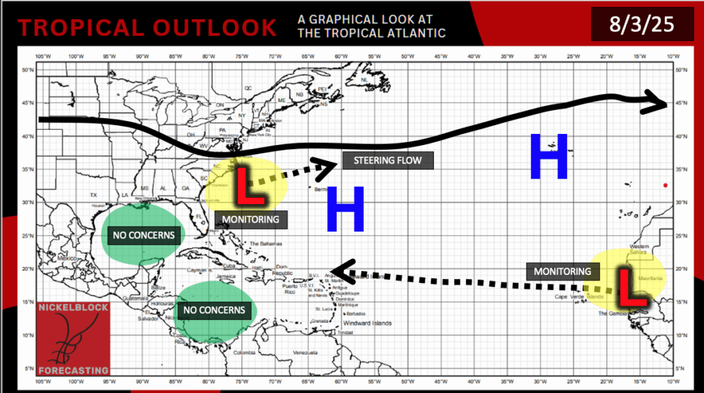
The Atlantic has two areas to watch that we are keeping a close eye out on. Steering flow is promoting out-to-sea tracks for both systems, but a shift is certainly possible. Let’s take a closer look at the situation:
Potential Development – Atlantic
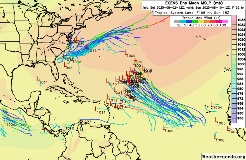
As you can see, the ensemble models are tracking to areas of low pressure forming by next week; one in the western mid-Atlantic off the Caronia’s coast, and one in the Main Development Region (MDR) off of Africa. The NHC has given the mid-Atlantic area a 30 percent chance of development in the next 2 days and 30 percent in the next 7 days. This would very likely follow the steering pattern out to sea, which is great news!
Models have given more of a north and out to sea trend to the MDR disturbance. If it could loop around the Bermuda High, it would travel out to sea and protect the CONUS from any impacts. If the high is too far to the west, it would bring it closer to the Carribean and Florida. We will keep you updated with the latest, but for now, there is nothing to worry about.
Eastern/Central Pacific Setup
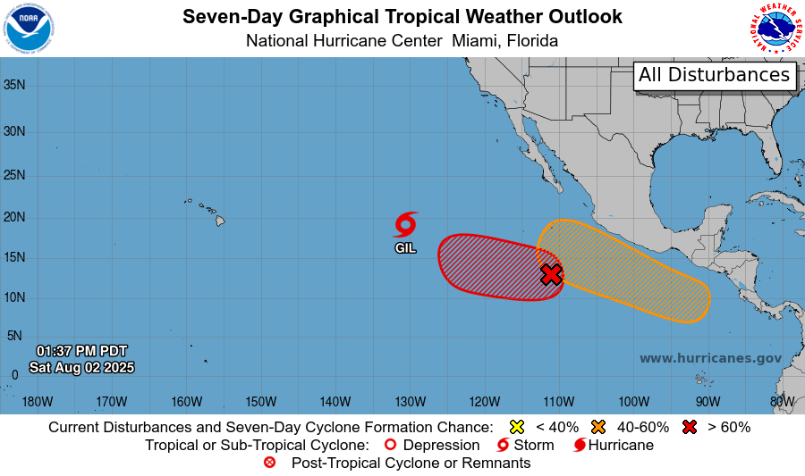
Currently in the Pacific, we have Tropical Storm Gil, an area to watch with a high chance of development, and another area to watch to the east with a medium chance of development. The most concerning one is the one with the medium chance, since the steering flow forces the low pressure close to Baja California.
Tropical Storm Gil – Pacific
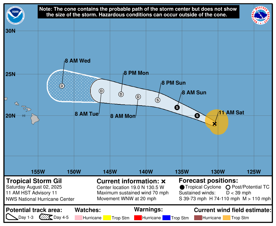
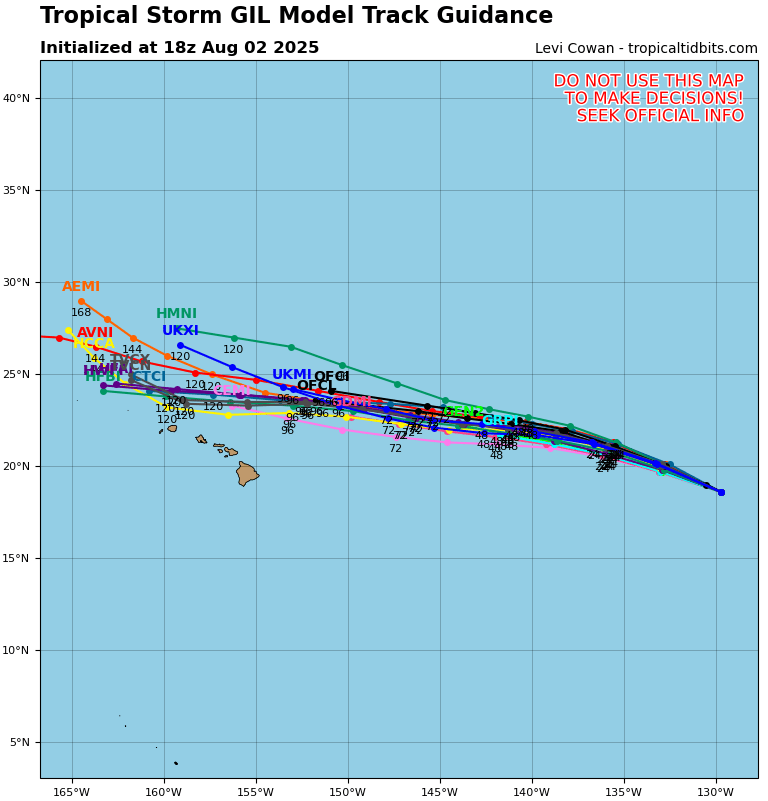
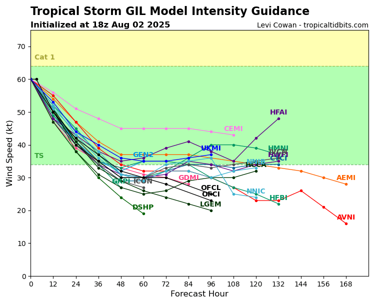
Tropical Storm Gil is weakening and is expected to downgrade to a tropical depression by tomorrow. It does look fairly impressive on IR satellite, but it is slowly losing it’s organization day by day. Guidance is confident in the depression tracking to the north of Hawaii over cooler waters, so the most impact will be some rain, especially in the northern areas of the island chain.
Two Areas to Watch – Pacific
We have two areas to watch in the Eastern Pacific. The first one has a high chance of tropical development (70 percent in the next 2 days and 90 percent in the next 7 days). A tropical depression could form by tomorrow or early this week, but is expected to drift off to sea.
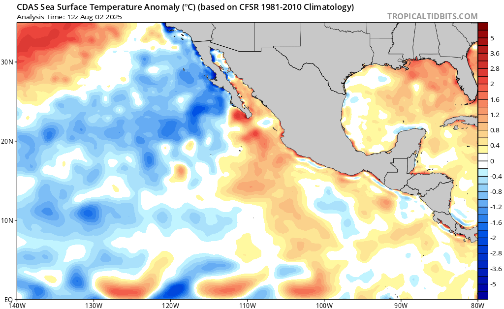
The next one, closer to Central America, has a medium chance of development (40 percent chance in the next 7 days). This one is more concerning if it develops, because current GFS guidance has a potentially strong tropical system traveling close to Baja California. This is far out, but definitely something to keep our eyes on. Sea surface temperatures are above average in the development region and near Baja, so development is certainly plausable.
Continue to check back for the latest updates!


