General Central/Eastern Kansas Forecast
Short-Term (Tuesday-Wednesday)
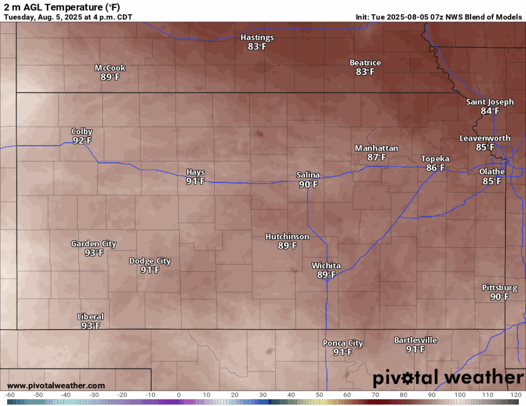
Today looks to be another dry and warm day across the eastern half of the state, as high pressure slowly but steadily builds in. Temperatures will be incrementally warmer than yesterday, reaching the mid to upper 80s this afternoon, with southeasterly winds of 10 to 15 mph. Heat indices today may reach into the mid 90s given relative humidity values around 50-55%. Dew point temperatures will range between the mid to upper 60s, making for a slightly humid day. Low temperatures tonight will bottom out into the upper 60s to low 70s.
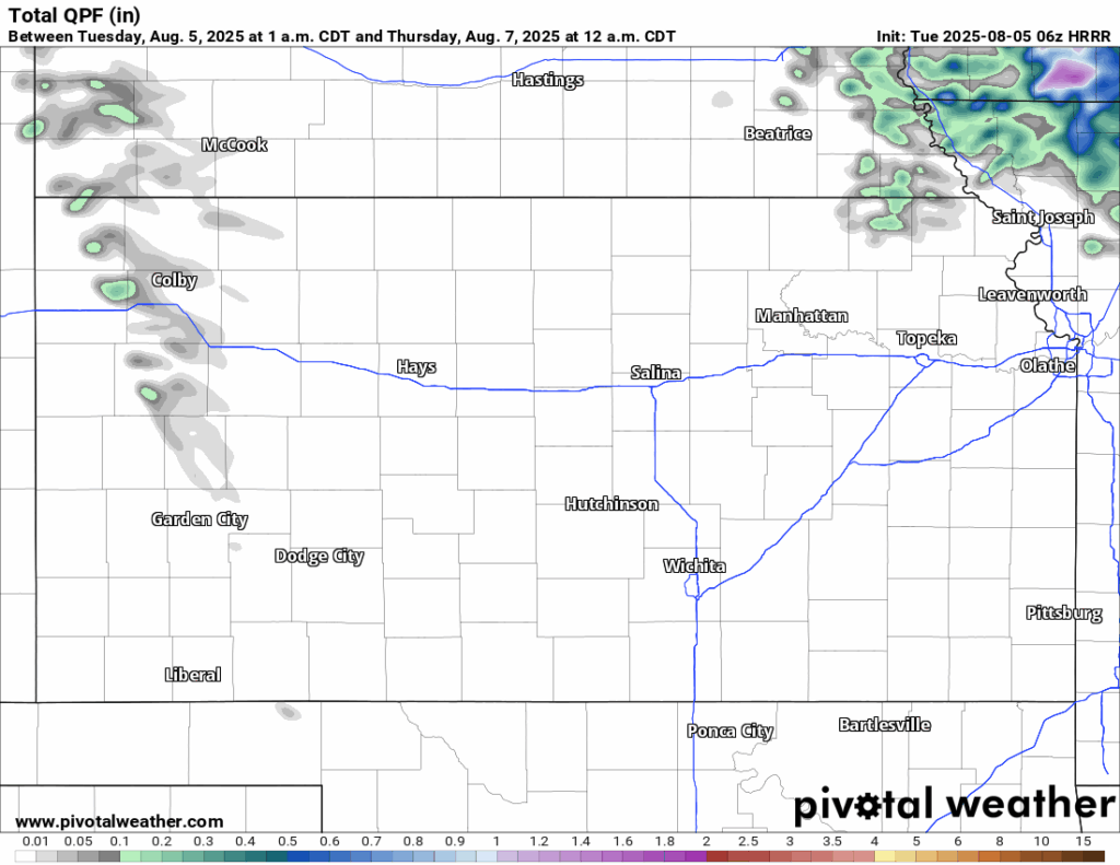
Tomorrow will be dry once again across the region, however, a chance of scattered showers and thunderstorms from a remnant MCS in Nebraska may enter into portions of northeast Kansas in the morning to afternoon hours, with the earliest start being around 5am and the latest start being around 12pm. These storms will move south throughout the day (between US-77 and the Kansas-Missouri border) before fully dissipating by 4-5pm in southeast Kansas. New rainfall totals will generally approach an inch, with higher amounts approaching 1.5-2 inches possible closer to the Kansas-Nebraska border.
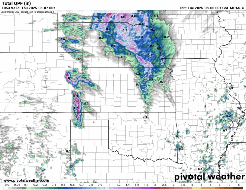
Temperatures tomorrow will be warmer than today, with highs upper 80s to low 90s and winds out of the south at 5 to 15 mph. The humidity will be on the rise again, with relative humidity values between 55-60% and dew point temperatures in the upper 60s to low 70s. This will help our heat index tomorrow reach into the mid to upper 90s by the afternoon. Low temperatures tomorrow night will be warmer from the increased moisture content in the air, dropping into the low to mid 70s overnight.
Long-Term (Thursday-Monday)
Conditions will generally stay dry and warm through the long-term period, but some chances for rain will return by the weekend to early next week, as a strong low-pressure system traversing across the northern tier of the country shoves the high pressure over us to the south and could allow for some regional-scale disturbances to rotate through and initiate development. If precipitation does come, the areas that would have the best odds at seeing this would be in northern Kansas near the border where the flow is the strongest. Otherwise, we will be seasonally warm and dry for the rest of the week and into the weekend, with consistent daily highs in the mid to upper 90s and heat indices possibly reaching the low 100s.
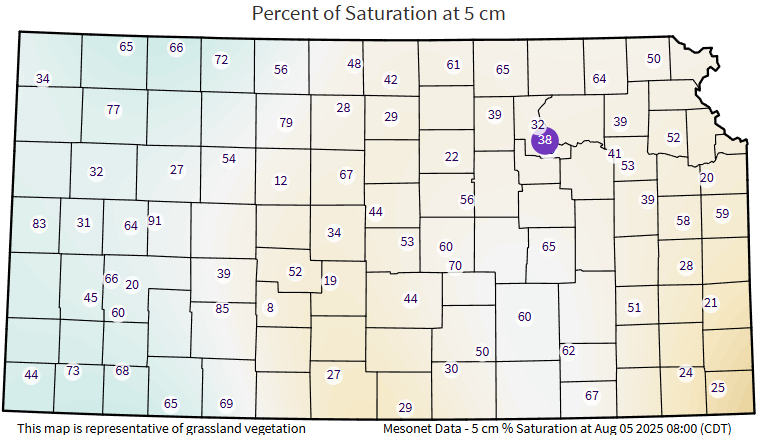
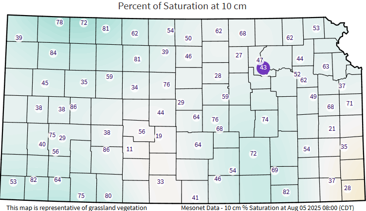
Regional Soil Moisture Outlook
Continued drying of soils is still ongoing as anticipated with the warming temperatures and lack of rainfall. With the potential for rain tomorrow, the areas with the best chance at seeing soil moisture replenishment would be along and north of US-36 or US-24, but some improvements further south of US-24 could be possible depending on how far the rain makes it. Otherwise, continued drying of soils will persist through the rest of the week until we possibly get better rain chances this weekend/early next week.