General Central/Eastern Kansas Forecast
Short-Term (Friday-Saturday)
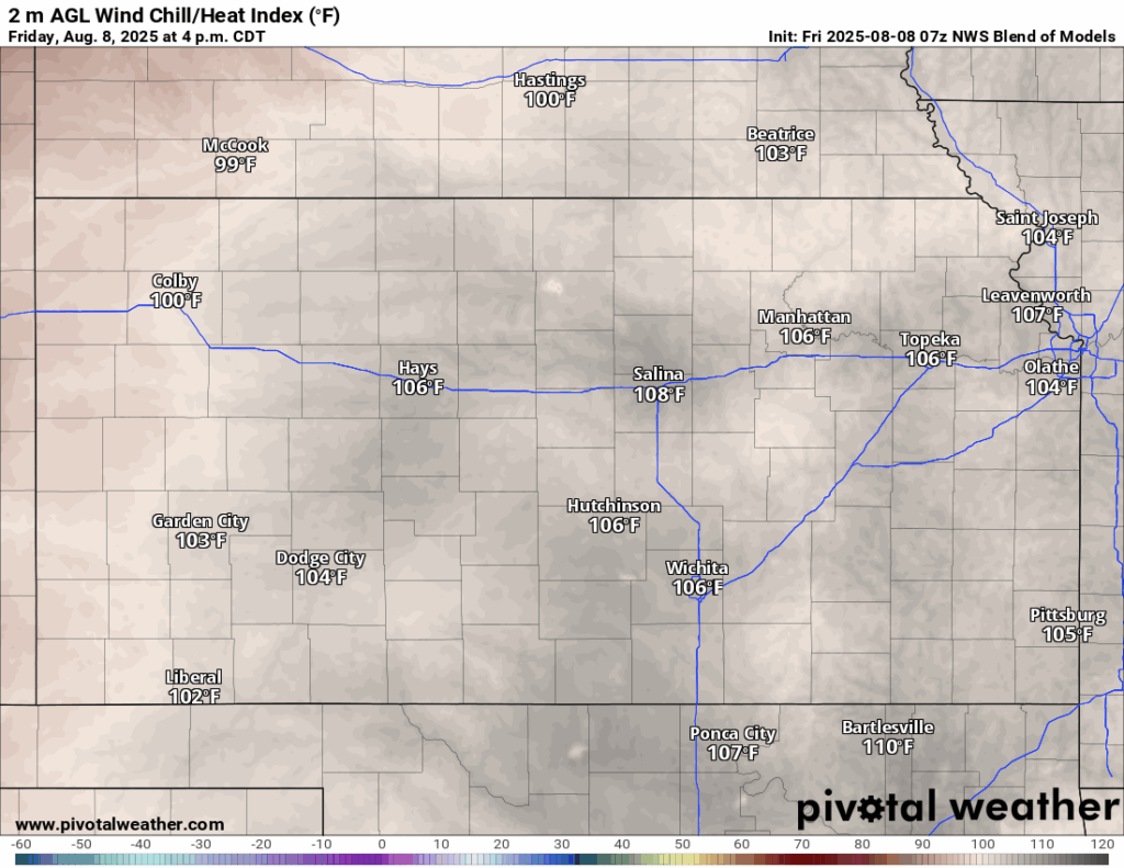
Today will see high temperatures again across central and eastern Kansas this afternoon. Heat advisories have been expanded from yesterday to include all of central and eastern Kansas from 1pm this afternoon to 8pm this evening. High temperatures today will reach the mid 90s to low 100s, with southerly winds of 10 to 20 mph, gusting to 35. Heat indices during peak heating look to reach into the mid to possibly upper 100s. Low temperatures tonight will be rather warm, in the upper 70s to low 80s.
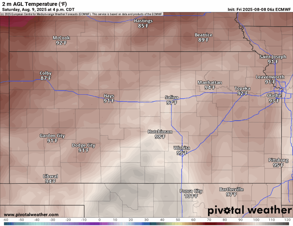
A cold front will begin to advance through the state overnight tonight/tomorrow morning and help provide some relief. Temperatures across northern Kansas behind the front will be in the low 90s, but central and southern Kansas will have to endure the heat for a bit longer, with high temperatures in the mid 90s to low 100s. Winds in front of the front will be southerly at around 10 to 15 mph, gusting to 30, while winds behind the front will be northeasterly at 10 to 15 mph, gusting to 30. Heat indices in front of the cold front will again reach the upper 90s to low 100s, which means continuation of heat advisories are certainly on the table for central and southern Kansas.
Long-Term (Sunday-Thursday)
Rain chances will increase substantially as the front pushes through the state Sunday/Sunday night and into Monday morning. Currently, the best chance for rain will be across northeast Kansas, but scattered showers and thunderstorms will be possible for all of central and eastern Kansas during this time. 1 to 2 inches of rainfall is likely with these storms, but isolated pockets of 3+ inches very possible, due to the multiple potential rounds of thunderstorms and very efficient rainfall. This activity will move off by Tuesday and allow for gradually warming temperatures throughout next week but still will remain around 5 to 10 degrees cooler throughout the week.
Drought Update
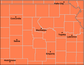
Some change to the drought monitor between last week and this week was noted, with some expansion of abnormally dry conditions across northeast Kansas and far southeast Kansas. Good news is with the rain coming, conditions should improve again next week, especially with higher rain totals and the relatively lower temperatures.


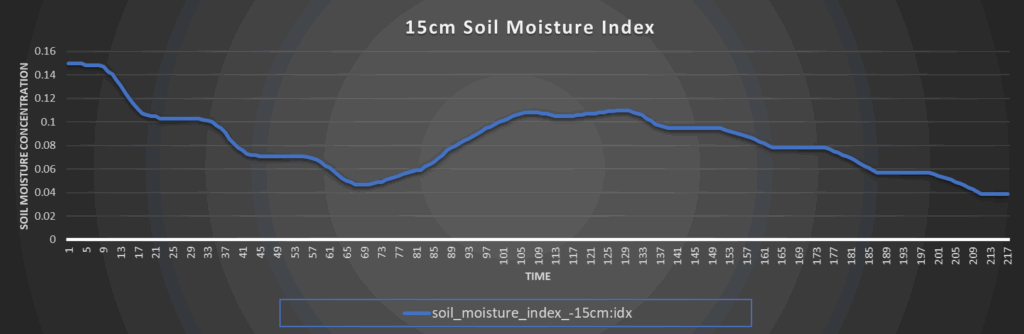
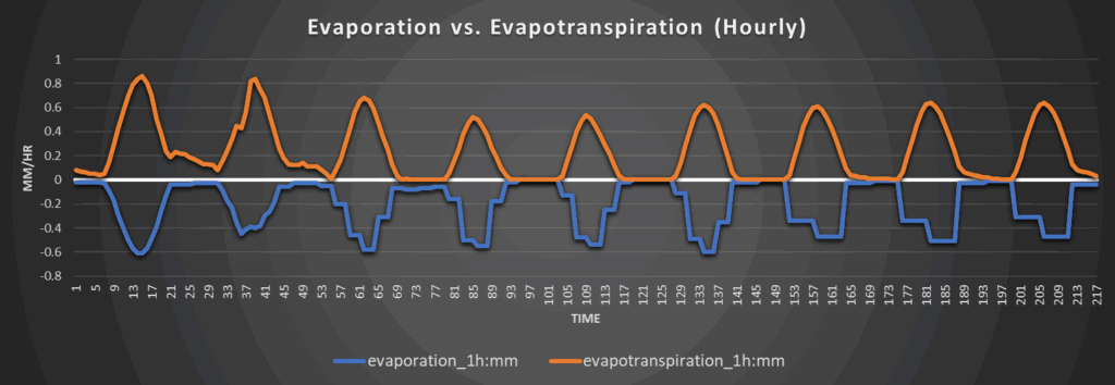
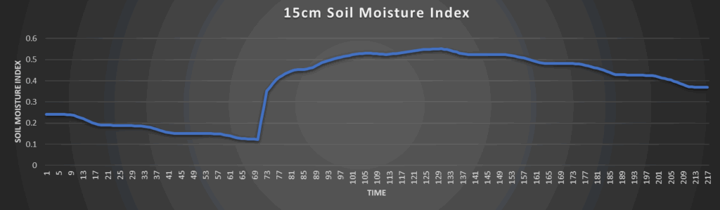
Regional Soil Moisture Outlook
Around Westmoreland
Around Scranton
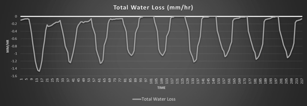
Around Burlington
Around Altoona