Hi everyone! After a nice weekend, we will see some rain come into the forecast for the week ahead. Let’s take a look at what’s going on:
Today’s Overall Setup
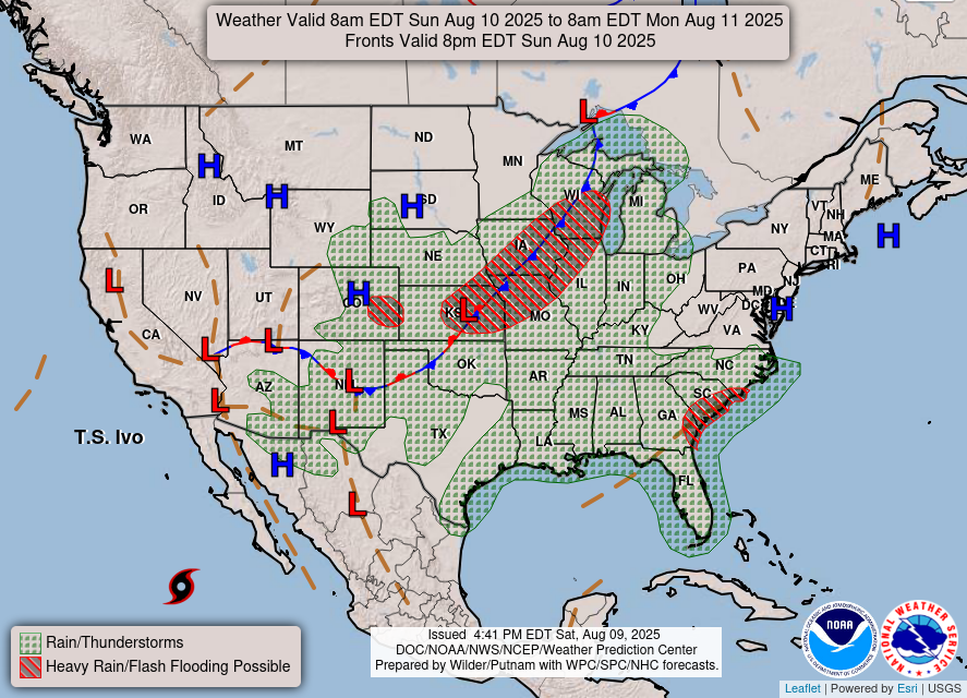
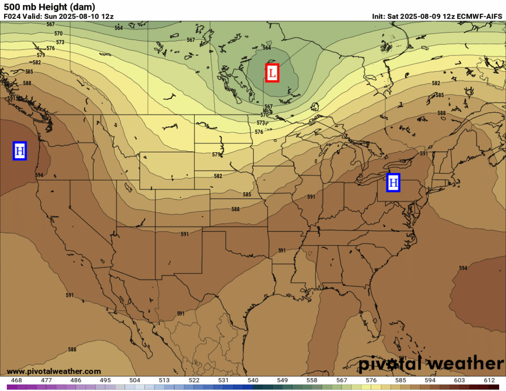
Our setup at the mid-levels of the atmosphere includes a ridge over the northwest, a ridge over the east coast, and a trough over the northern tier from a low pressure system in southern Canada.
At the surface, there is a cold front that stretches down to the southwest from the Canadian low. This is bringing heavy rain and a flash flood threat for the central plains into the upper midwest. A trough over the southeast coast is bringing some rain to the general southeast, with a flash flood threat possible in coastal GA/SC/NC. Our region is not yet being affected by the trough today, but it will slide westward into our region bringing us some rain for most of the week.

Current Conditions

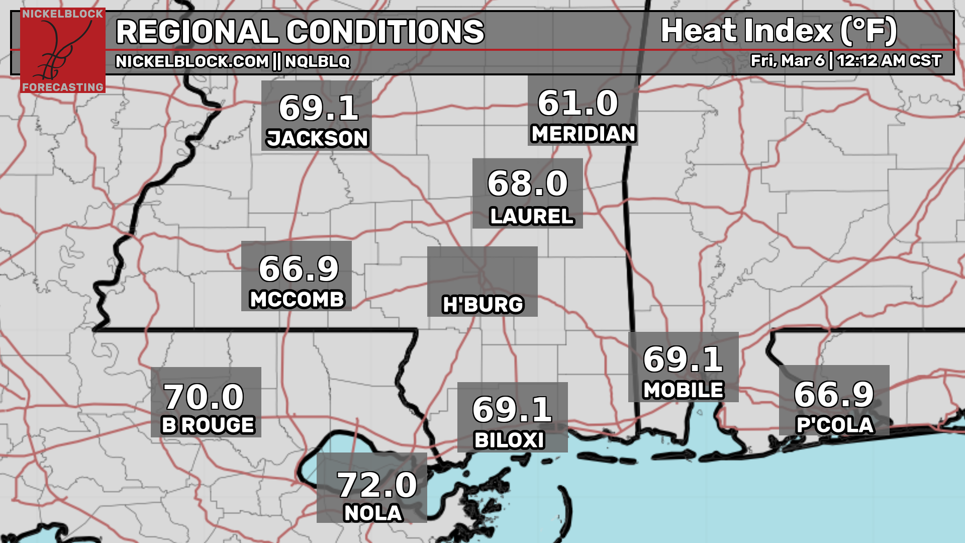
Here’s a look at the current temperatures and heat indices.
Today’s Local Forecast
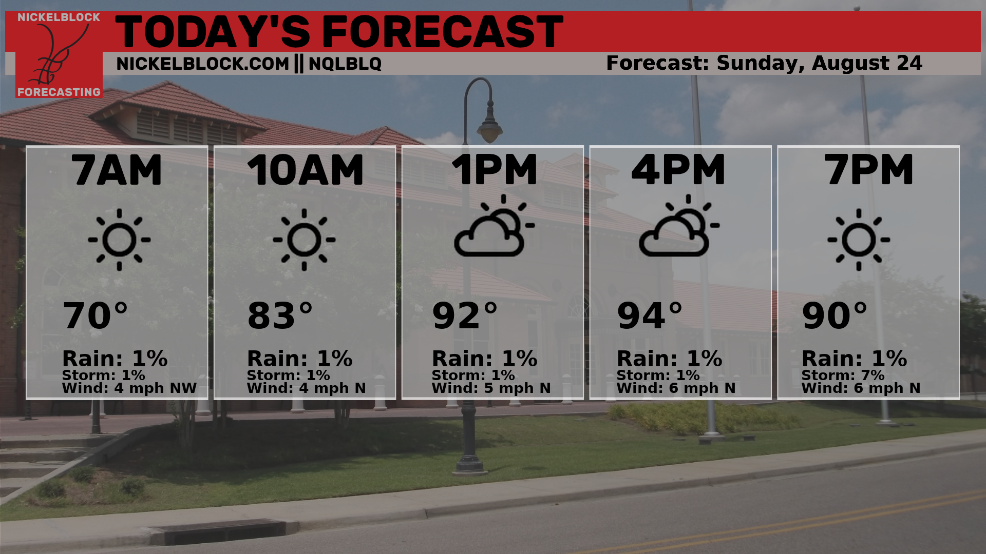
Here’s an hourly look at the forecast for today for the region.
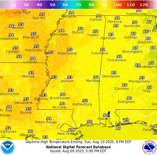
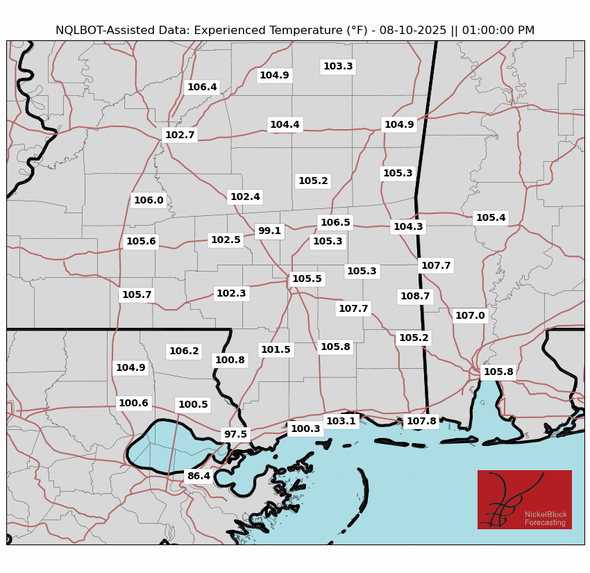
Temperatures today will top out in the low 90s, and you might notice the humidity feels a little less oppressive. That’s because dew points will “only” be in the low 60s, compared to the 75-80 degree range we’ve been dealing with lately. While a 60 degree dew point is still considered humid for most people, it’s definitely more comfortable than what we’re used to. Even so, it will still feel like the 100s during the early afternoon – just not pushing into the 110s this time. We’ll take the small win!
Today, there will be clear skies free of any rain. As the day goes on, you will notice increasing clouds and perhaps a shower or two passing by in the late afternoon and early evening. This is due our area being in the presence of a low pressure trough, which is currently over western Florida. This will move closer to us by tomorrow and Tuesday, which will increase the rain chances.
Monday & Tuesday Forecast
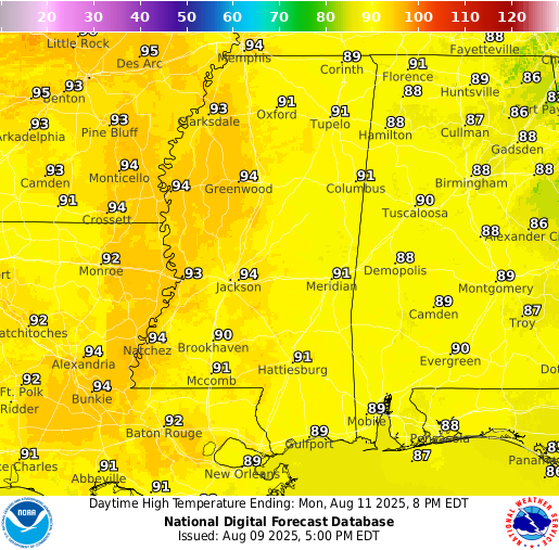
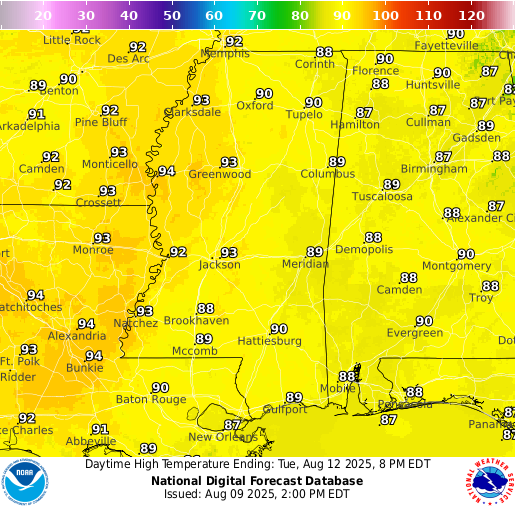
High temperatures on Monday and Tuesday will be in the low 90s for the region.
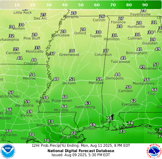
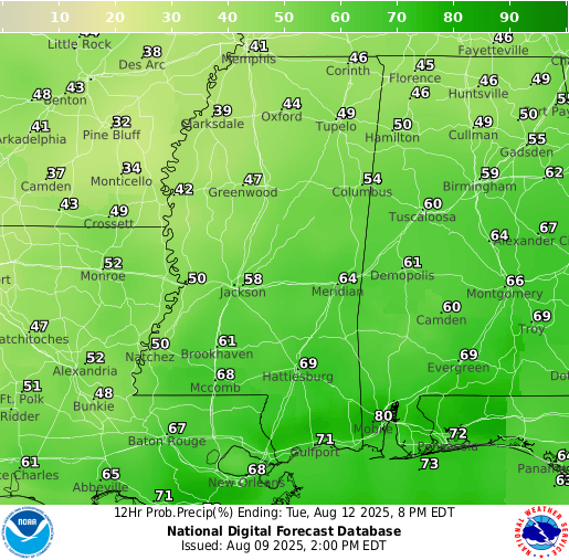
Rain chances will be higher on Monday and Tuesday, with a good 60-70 percent chance of showers and thunderstorms each day. The trough sitting to our east will destabalize the atmosphere, and while it won’t rain all day, expect scattered storms to pop up, especially in the afternoon and evening. Some could bring brief heavy downpours, so keep an eye on the sky if you have outdoor plans for the beginning of the week.
Extended Local Outlook

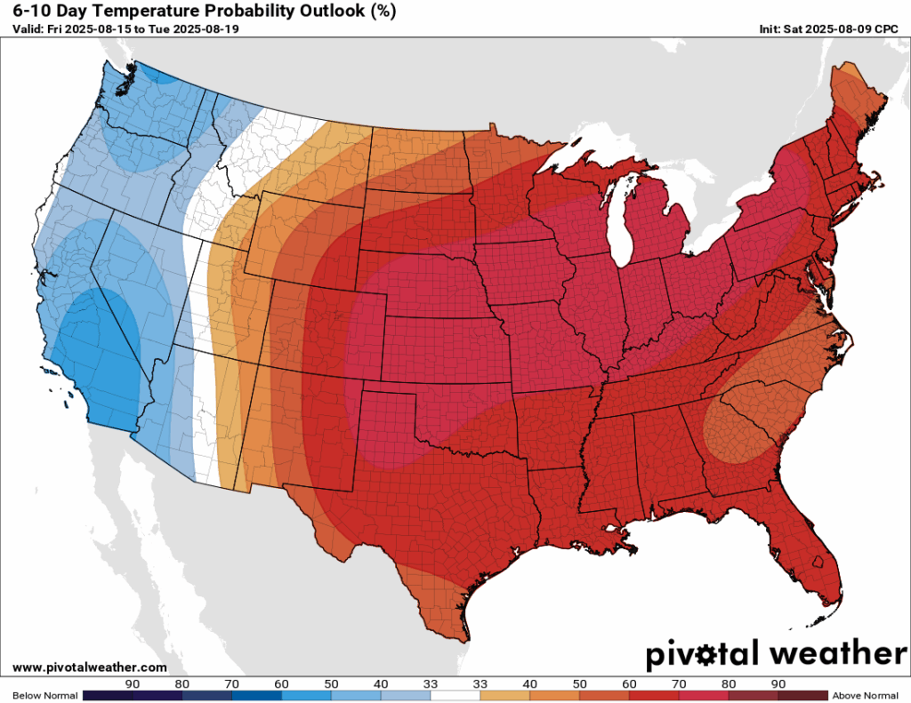
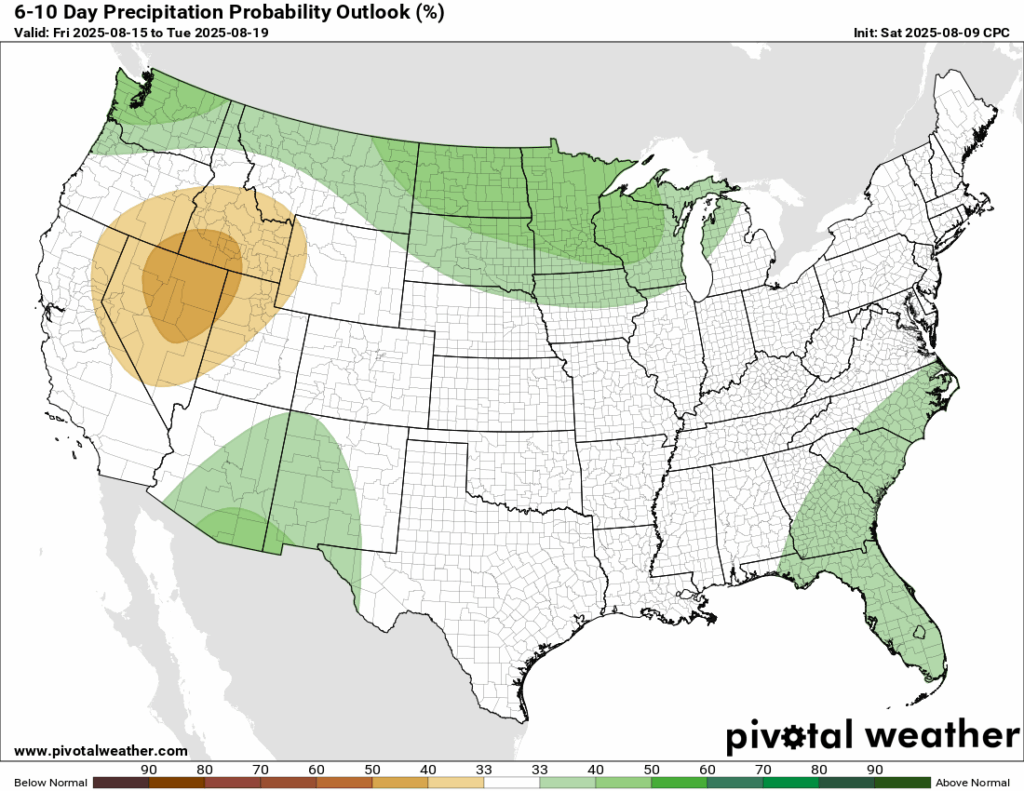
For the middle of this week, we could expect temperatures right around average, with some increased chance of rain. In the 6-10 day period, from Saturday, August 16 through Wednesday, August 20, temperatures are expected to run above normal. Rainfall looks to be near normal for the first time in a while. Since recent weeks have brought wetter than usual conditions, it may actually feel a bit drier. The warmer pattern will be driven by a ridge of high pressure building over much of the central and eastern U.S.
Latest Tropical Update
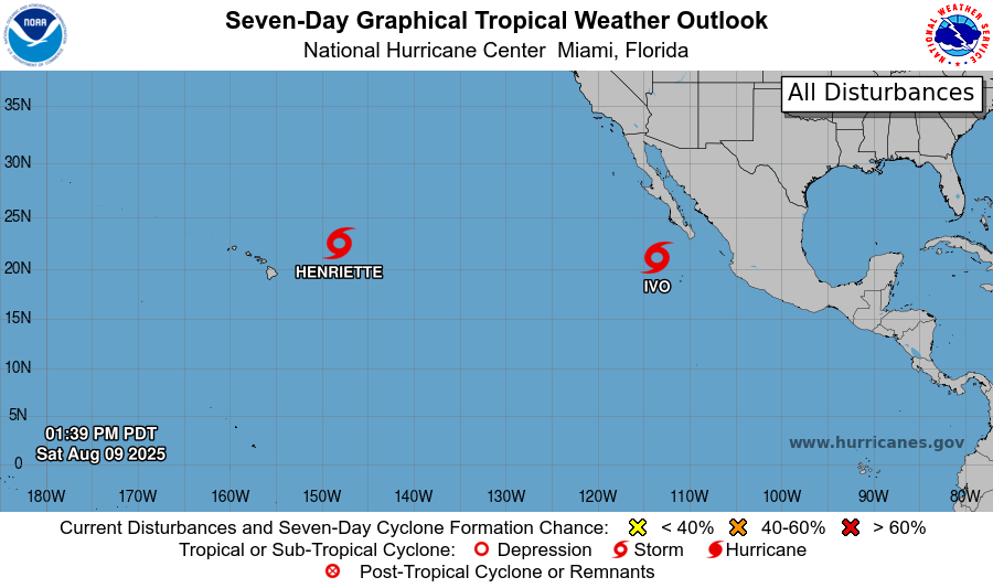
Eastern Pacific:
Tropical Storm Ivo, located off the coast of Mexico, is gradually weakening and is expected to become post-tropical by late Sunday. It’s moving west at about 7 mph with maximum sustained winds near 50 mph. Farther west, Tropical Storm Henriette is tracking west-northwest at around 16 mph with winds near 40 mph. Both storms remain over open water and are not currently expected to impact land.
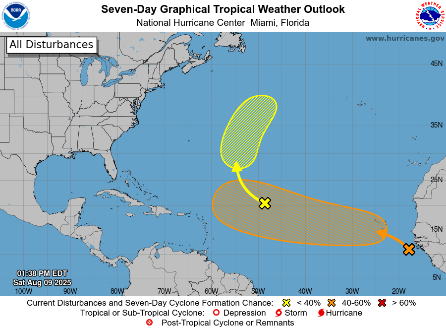
Atlantic:
Tropical Storm Dexter has transitioned into an extratropical cyclone while moving northeast and no longer poses a threat. Invest 96L, located in the central Atlantic, has a low chance of development due to lingering dry air. Meanwhile, a tropical wave off the coast of Africa, now labeled Invest 97L, has a medium chance (50 percent) of developing over the next week as it moves into more favorable conditions. Models have been sort of all over the place with this one – some giving it a more westward track into the southeastern U.S., and others, such as now the Euro and GFS, giving it more of a northwestern track into the northeast, then out to sea. It all depends on the positioning of the Bermuda high pressure. Any change in its positioning could mean a totally different track.
Want the latest details on these systems? Check out our daily tropical updates for more in-depth information on the tropics!
REGIONAL DAY TO DAY FORECAST
Today: Increasing clouds. A chance of showers and thunderstorms after 1pm. Highs in the low 90s. Northeast wind around 5 mph. Chance of rain 30 percent.
Tonight: Partly cloudy. Lows in the mid 70s. East northeast wind around 5 mph becoming calm.
Monday: Mostly sunny. A slight chance of showers in the morning, then showers and thunderstorms likely after 10am. Highs in the low 90s. Calm wind becoming east around 5 mph in the afternoon. Chance of rain 60 percent.
Monday Night: Partly cloudy. A slight chance of showers and thunderstorms before 10pm, then a slight chance of showers between 10pm and 1am. Lows in the mid 70s. Southeast wind around 5 mph becoming calm. Chance of rain 20 percent.
Tuesday: Partly sunny. A slight chance of showers in the morning, then showers and thunderstorms likely after 10am. Highs in the low 90s. Calm wind becoming south around 5 mph in the afternoon. Chance of rain 70 percent.
Tuesday Night: Partly cloudy. A slight chance of showers and thunderstorms before 1am. Lows in the mid 70s. Calm wind. Chance of rain 20 percent.
Wednesday: Mostly sunny. Showers and thunderstorms likely, mainly after 1pm. Highs in the low 90s. Calm wind becoming south around 5 mph in the afternoon. Chance of rain 70 percent.
Wednesday Night: Partly cloudy. Lows in the mid 70s. Calm wind.
Thursday: Mostly sunny. A chance of showers and thunderstorms after 1pm. Highs in the mid 90s. Chance of rain 50 percent.
Thursday Night: Mostly clear. Lows in the mid 70s.
Friday: Sunny. A chance of showers and thunderstorms. Highs in the mid 90s. Chance of rain 40 percent.
Friday Night: Mostly clear. Lows in the mid 70s.
Saturday: Sunny. A chance of showers and thunderstorms. Highs in the mid 90s. Chance of rain 40 percent.


