Hi everyone! Both the Atlantic and Pacific are seeing disturbances that we need to talk about. Let’s look into the details:
Atlantic Basin Setup

The Atlantic is looking quite busy at the moment, with things finally starting to fire up. Starting from the low pressure system highlighted in green off the northeast coast: this system was once an Invest, but has merged with a cold front and ended any chances of tropical development.
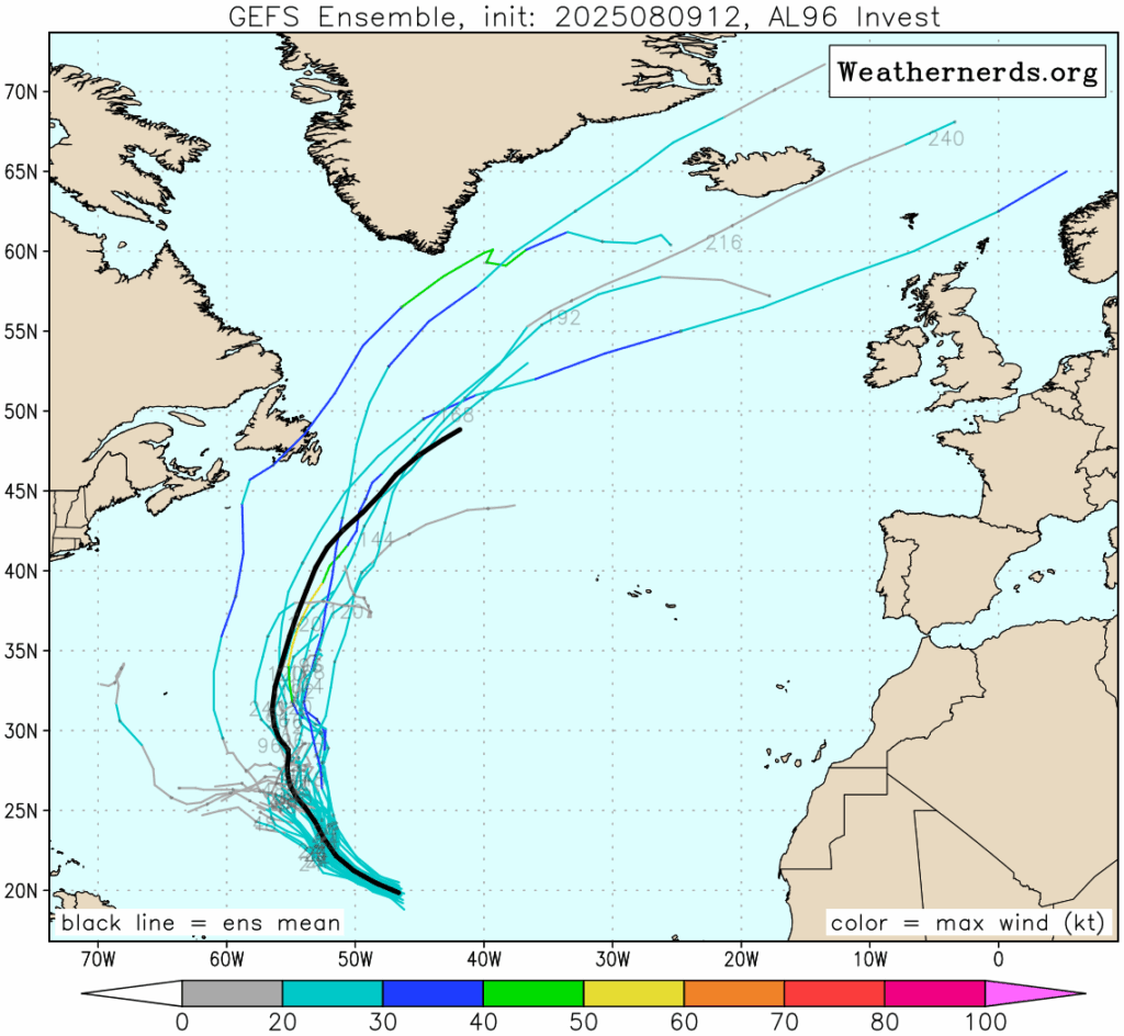
Next, we have Invest 96L, located in the central Atlantic. It has a low chance of development due to lingering dry air. Meanwhile, a tropical wave off the coast of Africa, now labeled Invest 97L, has a medium chance (50 percent) of developing over the next week as it moves into more favorable conditions. Models have been sort of all over the place with this one – some giving it a more westward track into the southeastern U.S., and others, such as now the Euro and GFS, giving it more of a northwestern track into the northeast, then out to sea. It all depends on the positioning of the Bermuda high pressure. Any change in its positioning could mean a totally different track. Let’s look into each disturbance.
Invest 96L – Atlantic
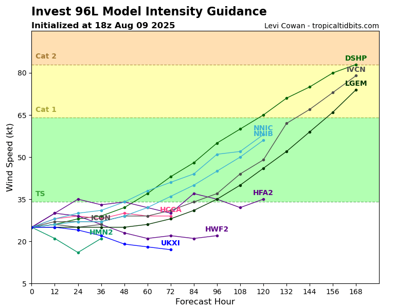
Due to surrounding dry air, Invest 96L will have trouble in the next few days developing into a tropical system. Model guidance is going for a slight strengthening after around 3-4 days from now, but the NHC is going for a low chance with this one. Even if it were to develop, it would not impact anyone besides the fish in the Atlantic!
Invest 97L – Atlantic

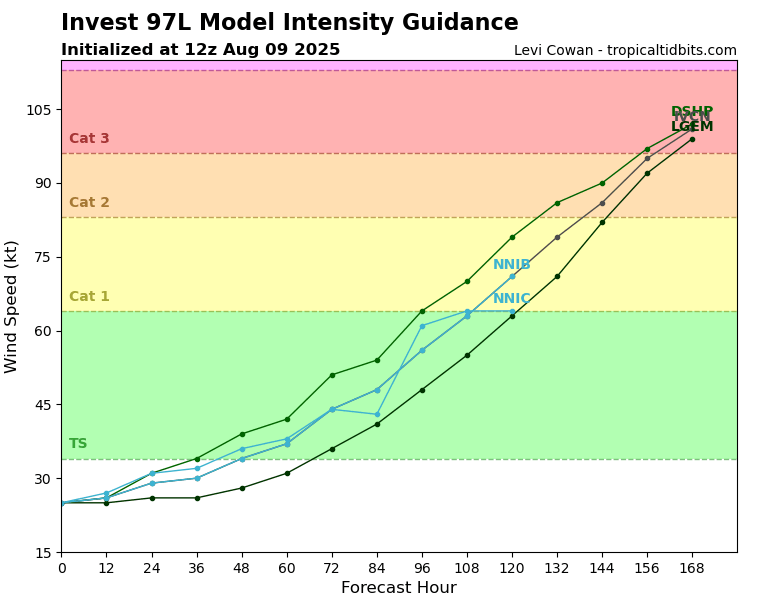
Now, Invest 97L is a little more concerning in nature. The reasoning is that is has a lot of time to develop over very warm water by the later half of the week, which gives it time to organize into something potentially strong. Models have been all over the place with this system, some going for a track into the Carribibean, then going into the coastal Atlantic southeast states, then some going for a slide up close to the northeast. This far out, the model runs will vary darastically, giving some scary results potentially. It’s important to know that no model run is a forecast, but ensure that if you are living anywhere along the east coast, to be extra aware by the end of this week into next week as this system travels to the west.
The main steering flow for this system will be the placement of the Bermuda high, which, if situated further west would bring a more increased threat for the U.S., or if situated further east would track it more out to sea.
Eastern/Central Pacific Setup
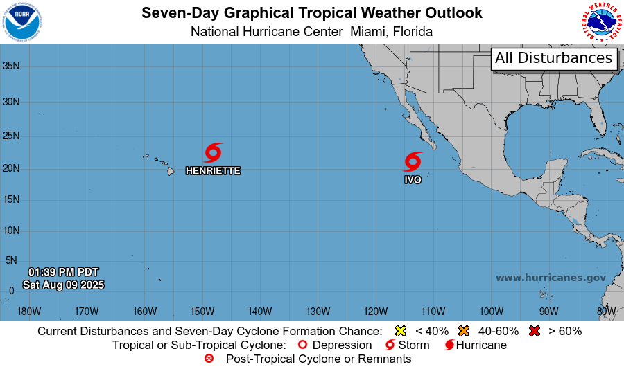
The Pacific still has Tropical Storm Henriette and Tropical Storm Ivo, both of which will weaken over the coming days and not impact any land.
Tropical Storm Henriette – Pacific
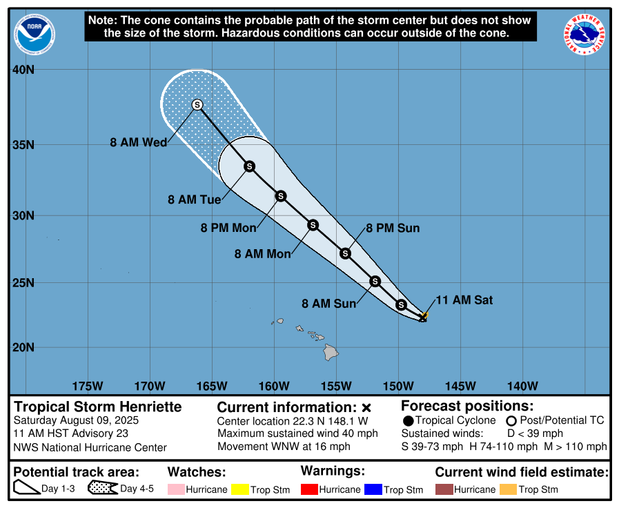
Tropical Storm Henriette is tracking west-northwest at around 16 mph with winds near 40 mph. It is expected to maintain it’s tropical storm status until around Wednesday morning, where it will weaken to a tropical depression.
Tropical Storm Ivo – Pacific
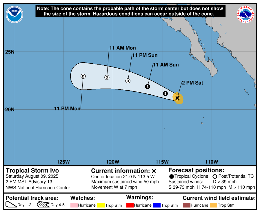
Tropical Storm Ivo, located off the coast of Mexico, is gradually weakening and is expected to become post-tropical by late Sunday. It’s moving west at about 7 mph with maximum sustained winds near 50 mph.
Continue to check back for the latest updates!


