General Central/Eastern Kansas Forecast
Short-Term (Monday-Tuesday)
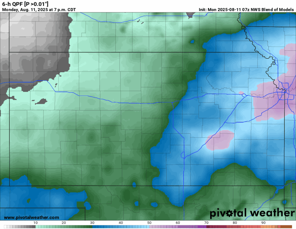
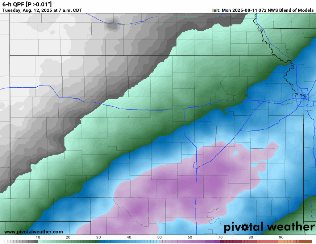
Rain showers will continue through the morning hours before tapering off by the early afternoon. This will give way to mostly dry conditions for the rest of the day, save for some isolated showers and thunderstorms in far south-central Kansas along the Oklahoma border, where thunderstorm activity moving through Oklahoma tonight may cause some further development to the north. Calmer conditions will persist through tonight and into tomorrow before isolated chances for showers and thunderstorms do materialize again in northeast and eastern Kansas tomorrow evening. These storms, if they do develop, will not be as expansive in nature and not last as long as the previous rounds of thunderstorms did.
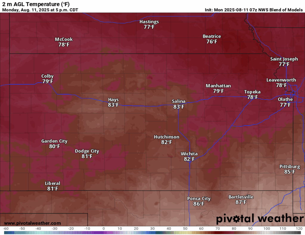
Temperatures today will look to only make it to the upper 70s to low 80s due to the passage of the cold front and cloud cover in place today. Winds will be light today, generally out of the south at 5 mph. Lows tonight will fall down into the upper 60s to low 70s. For tomorrow, temperatures will be slightly warmer but still comfortable, reaching the low to mid 80s, with winds out of the west-northwest at 5 mph. Lows tomorrow night will be a touch cooler, dipping into the mid 60s to low 70s.
Long-Term (Wednesday-Sunday)
Northwesterly flow aloft will help ensure our temperatures stay on the “cooler” side throughout the week before high pressure settles in by the late week and increases temperatures once more. Temperatures look to range in the mid to upper 80s throughout the week before again coming back into the low 90s by the weekend. Rain chances throughout the week will be very low, leaving us warm and dry during this period.
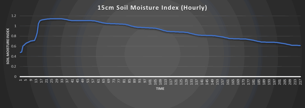
Regional Soil Moisture Outlook
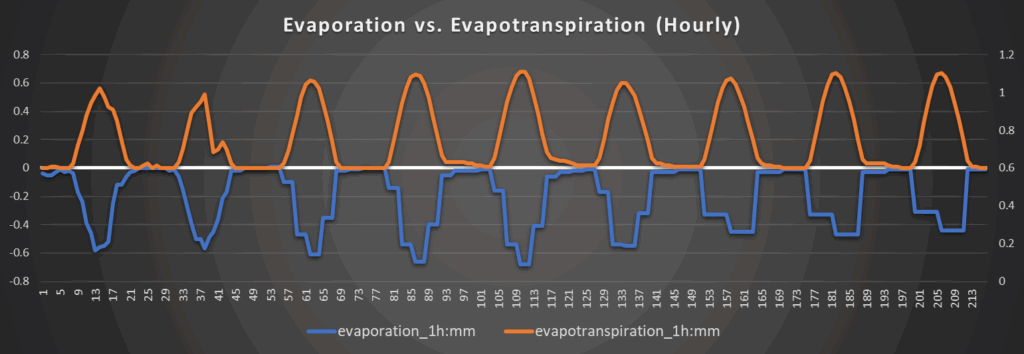
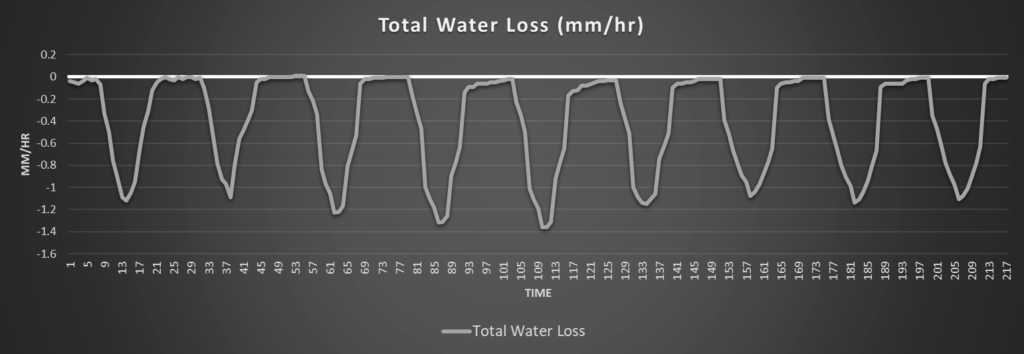
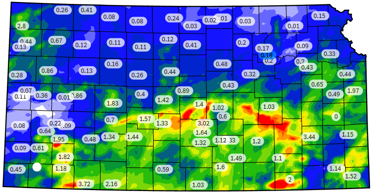
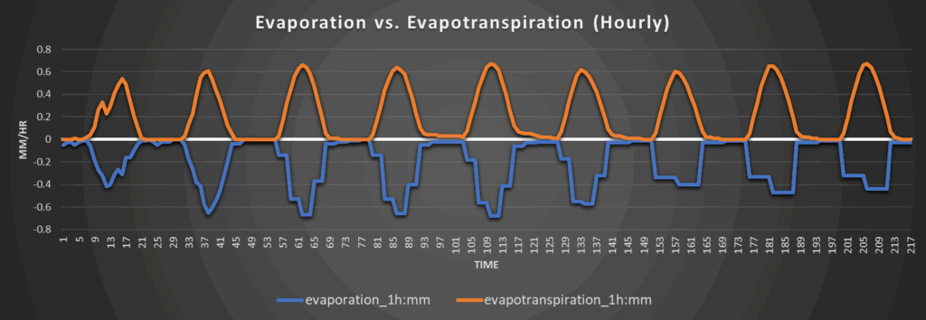
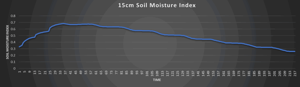
Good soil moisture recovery has occurred from the recent couple days of rainfall, with central/southern Kansas being the biggest winners, with some spots receiving over 5 inches of rain in the last 24 hours. Overall, soils will be in good shape this week with the lower high temperatures and lower water loss rates, generally staying below 1.4 mm/hr daily. Any abnormally dry conditions over the past week should be alleviated by now, or at least have had major dents put into it, and will not likely return for this week.
Around Westmoreland


Around Scranton

Around Burlington


Around Altoona