Hello again! Whether you have seen our tropical updates in the past few days or not, you have probably heard news of Tropical Storm Erin making its way across the Atlantic. There are also two other disturbances in the Atlantic, as well as Tropical Storm Henriette in the Pacific. So, let’s take a closer look at Erin and the rest of the tropics:
Current Setup in the Atlantic
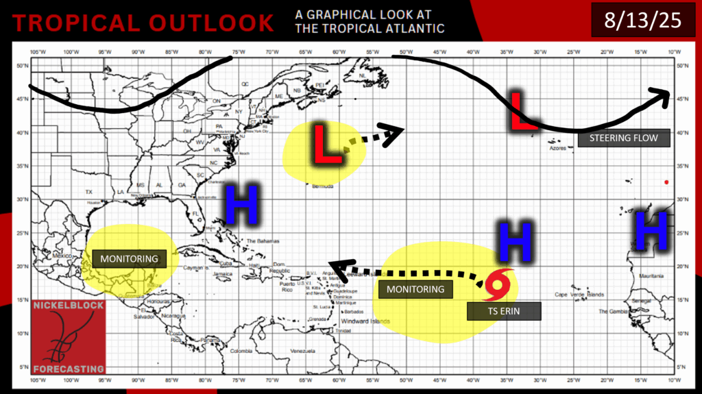
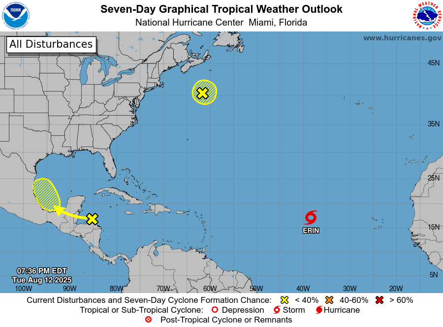
We’re getting busy in the Atlantic now, with the main tropical concern being Tropical Storm Erin. There are two other disturbances as well, which I will go over briefly:
The first disturbance a couple hundred miles south of Nova Scotia is just a cluster of messy showers and thunderstorms at this point. Additionally, the system is already over chilly waters and is moving northward, so it’s chance at development is almost nonexistent. By the time you are reading this, it is likely off of the National Hurricane Center’s radar, and is nothing to worry about.
The second Atlantic disturbance is located off of the coast of Honduras, and is forecasted to move over the Yucatán Peninsula and into the Bay of Campeche by mid-week next week. By that time, the Bay of Campeche is looking pretty dry, so the system would have to get lucky and find a solid pocket of low wind shear to develop in. So, I think this scenario is unlikely as of right now, plus, we are still a whole week away from when this movement is forecasted to occur. This is another case of messy, disorganized storms that are unlikely to get themselves organized by the time they move over land, so the chance of development of this storm is only 20% in the next 7 days.
Tropical Storm Erin:
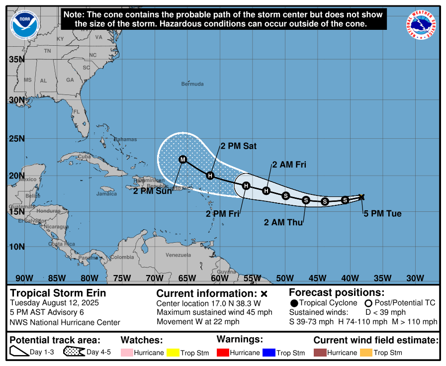
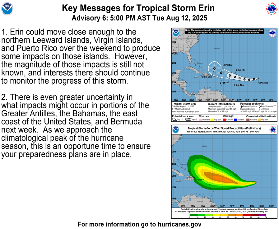
Tropical Storm Erin is currently moving westward at 22 mph, has maximum sustained winds of 45 mph, and a minimum central pressure of 1006 mb. The main on-land concerns as of right now are in the US Virgin Islands, the Dominican Republic, Puerto Rico, and the northern Leeward Islands. Erin may get close to these areas Friday-Saturday evening, and could bring tropical-storm-force winds and heavy rainfall. This is still a few days away, and the forecast could change by this time.
Because Erin is still pretty far out in the Atlantic, is has quite a bit of time to develop, and is expected to make it to major hurricane status (Category 3 or above) in a few days:
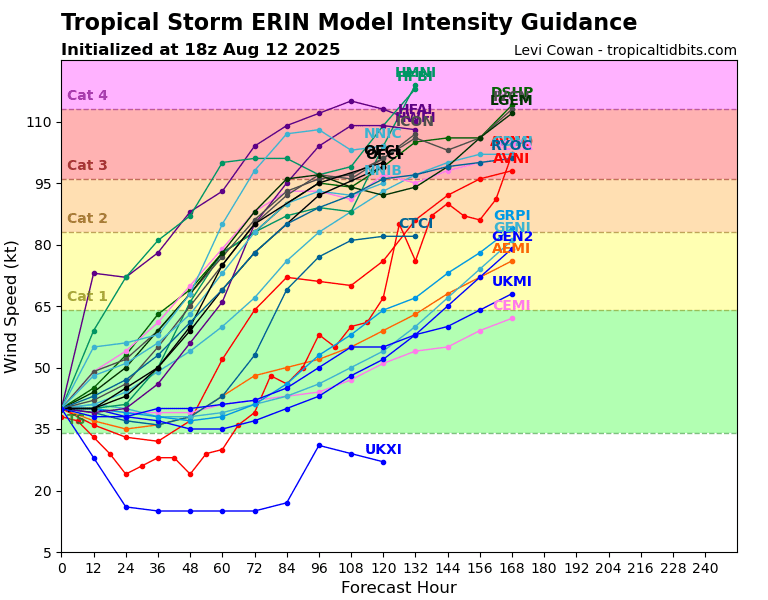
It’s pretty safe to say that Erin will do a good bit of intensifying over the next few days, but the main question being asked is where is this storm headed? Well, let’s look at what the models have to say:
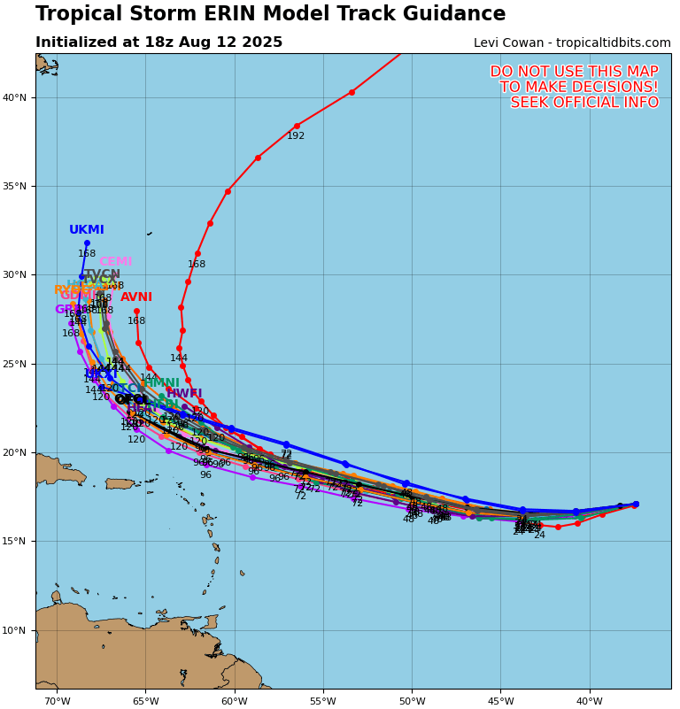
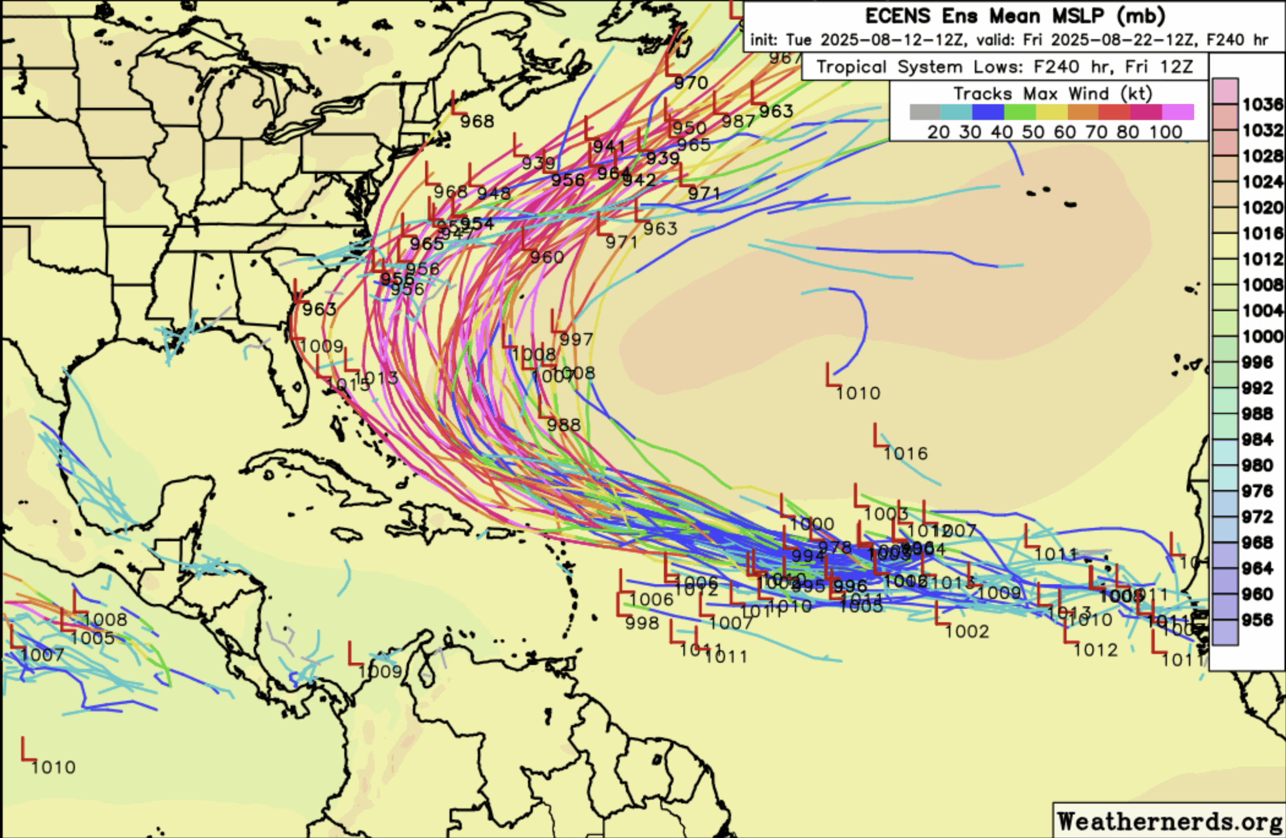
So far, it is looking like Erin will take a turn away from the Caribbean and the United States and stay out into the Atlantic. It seems like the ensemble models are in agreeance of this storm’s path for the most part, and picking out just one of these models, the Euro (which is the image on the right), its members are leaning toward a sharp turn away from landfall. The path of this storm can often be determined by specific weather patterns in the upper-levels of the atmosphere, and sometimes areas of high pressure (which spin clockwise), especially the Bermuda High, can steer these systems away from the US.
It is important to note that we are still a few days away from Erin even encountering the Caribbean, so it is almost inevitable that adjustments to this track will be made as we see how this storm plays out.
The Pacific and Tropical Storm Henriette – A Quick Look
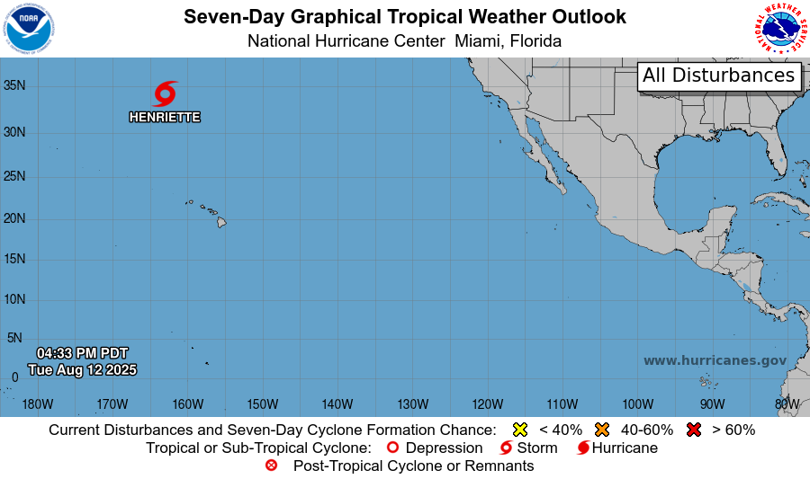
As you can see, the only thing we have going on in the Pacific is the stubborn Tropical Storm Henriette, which had a brief stint as a hurricane but is now back to a tropical storm.
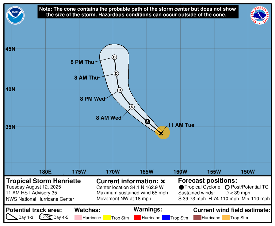

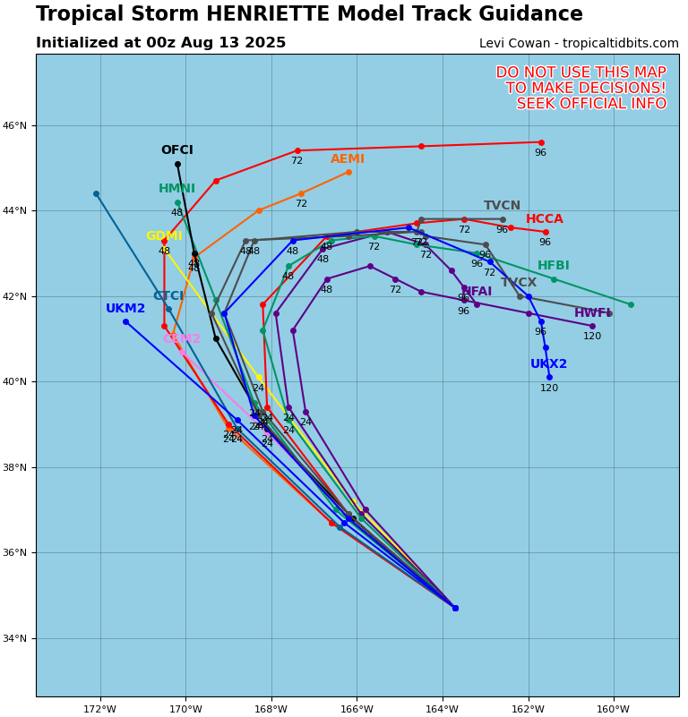
Henriette is still hanging out in the Pacific, moving northwest at 18 mph. It has maximum sustained winds of 65 mph, and a minimum central pressure of 999 mb. Henriette is finally done intensifying, and has started weakening once and for all. By tonight, we can expect Henriette to downgrade into a tropical depression, then further dissipate from there. Because Henriette won’t be lasting much longer and is also forecasted to curve east-southeastward, landfall into Alaska is not a concern.
Please stay tuned for more NickelBlock tropical updates, and keep an eye on the National Hurricane Center and you local authorities for any future advisories on Tropical Storm Erin!


