Hi everyone! We are tracking the latest on Tropical Storm Erin, which is expected to intensify into a major hurricane by this weekend. Let’s look into the details:
Atlantic Basin Setup

Tropical Storm Erin is the main story in the Atlantic Basin, with models generally agreeing with a track out to sea after it nears the Bahamas. We also have newly named Invest 98L in the southwestern Gulf, which has a small chance at developing into a weak tropical storm by tomorrow or Friday.
Tropical Storm Erin – Atlantic
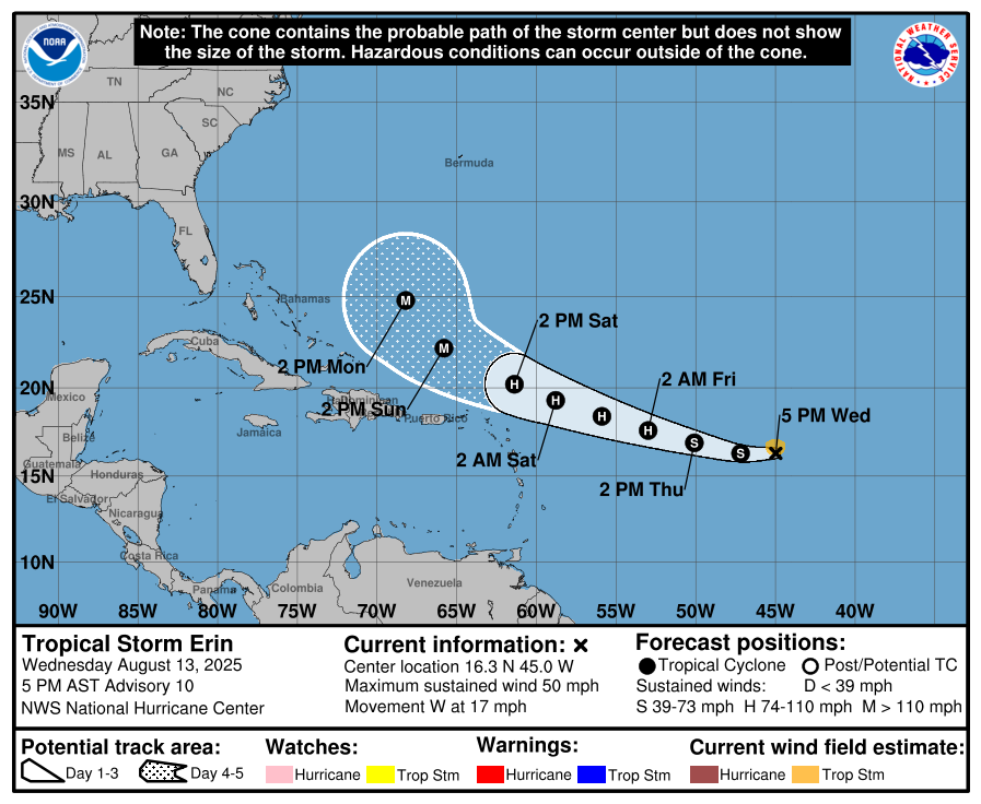
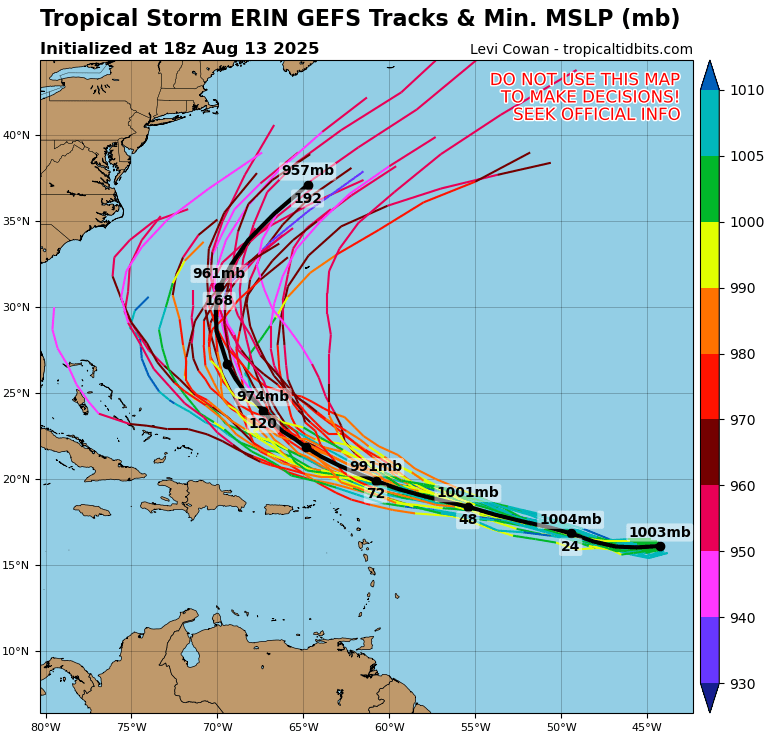
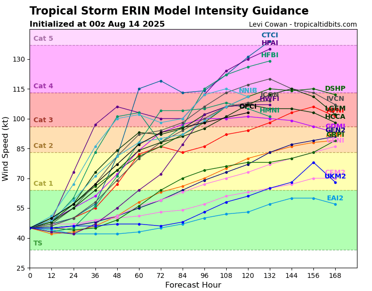
Tropical Storm Erin is currently looking quite healthy, moving west at 17 mph with maximum sustained winds of 50 mph. The latest forecast from the National Hurricane Center shows Erin strengthening over the next few days, likely becoming a major hurricane by the weekend as it approaches the central Caribbean. Model guidance generally keeps the storm on a west to west-northwest track, though there are a few ensemble members that bring it farther west than others. Sea surface temperatures along its path are very warm, and the environment looks favorable for intensification, so we’ll need to watch Erin closely in the coming days. Right now, guidance still points toward an eventual turn out to sea, but there’s some spread in the track models, and any shifts could change potential impacts.
Invest 98L – Atlantic
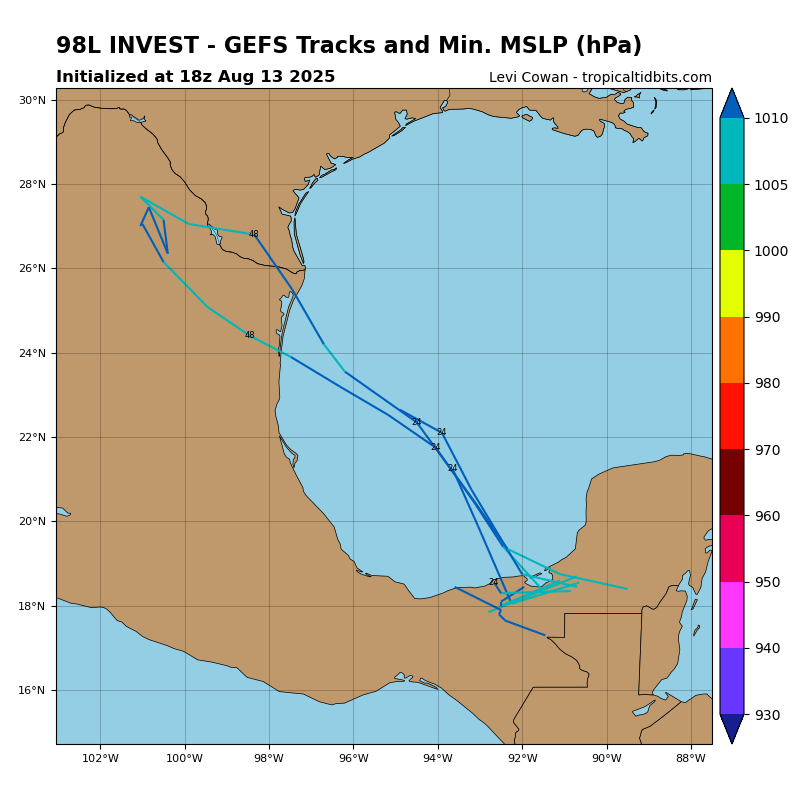
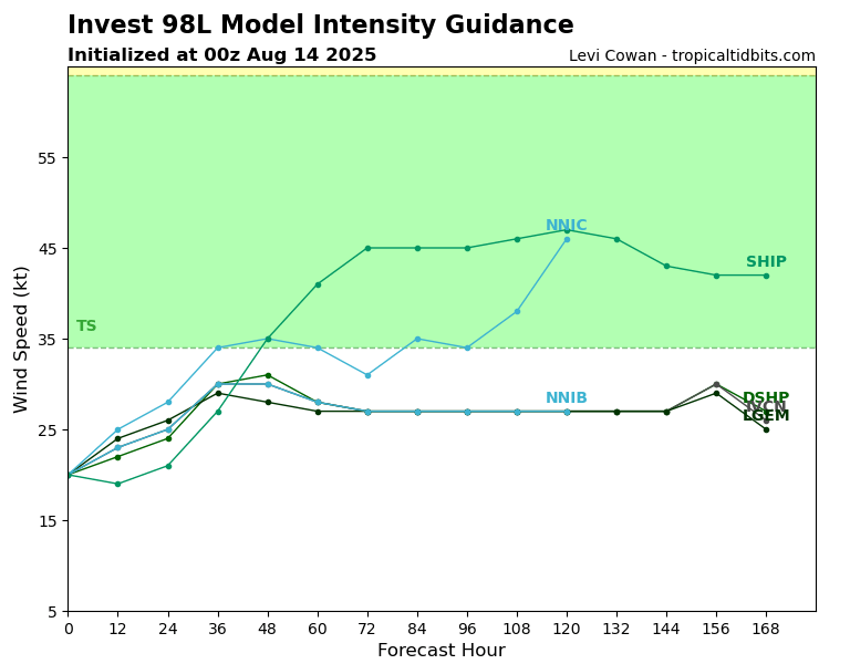
An area of low pressure has formed in the southwestern Gulf and has been assigned the name of Invest 98L. It currently has been given a 20 percent chance of development by tomorrow or early Friday. Conditions are marginally condusive for development during that timeframe, but once the low moves onto land, it will end it’s chance at developing. Models bring it into northeast Mexico or the southern tip of Texas, with a weak tropical storm looking possible – chances are fairly low though.
Eastern/Central Pacific Setup
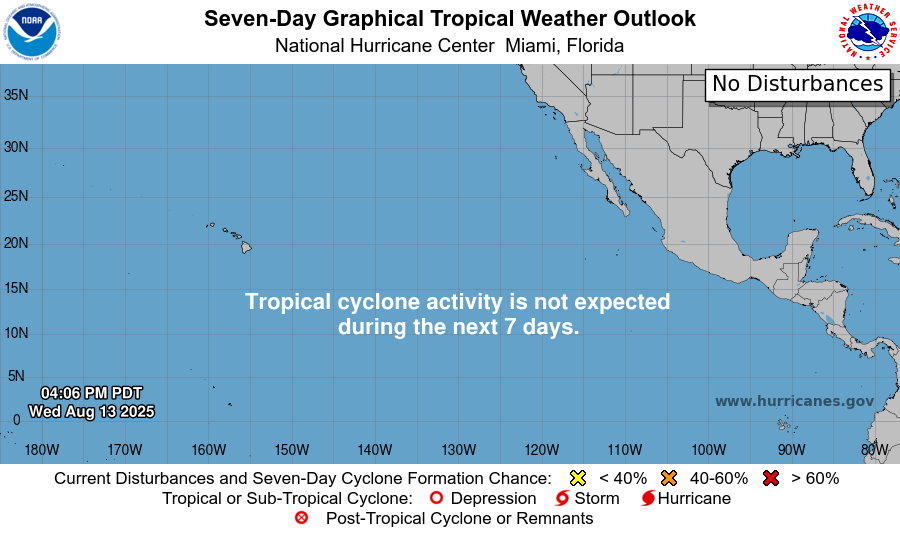
The Eastern and Central Pacific remain quiet, with no tropical cyclone activity expected over the next seven days. It’s been almost nonstop for the past month or two in the basin, so we will take this small lull in activity.
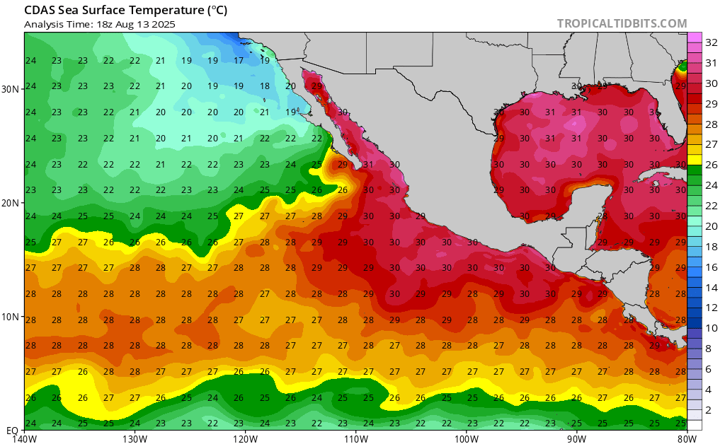
Sea surface temperatures remain very warm in the region, so it’s important to keep a close watch on any storms that develop near the Mexican coast. Warm waters can provide plenty of fuel for rapid intensification, which means a system like this could strengthen quickly and potentially become more of a threat if conditions stay favorable.
Continue to check back for the latest updates!


