It’s August, it’s hot. That’s it. That’s the forecast.
No, just kidding, we have a bit more to talk about than that. We’re beginning to see the mid-latitudes wake up a bit near the end of August as the overbearing heat dome we’re cursed with each year is slowly moving its way west. The surface didn’t quite get the memo, however, so we have some high heat for the next few days. Later on, however, a slow moving front will move in from Canada and the Great Lakes bringing more rain by the end of the week.

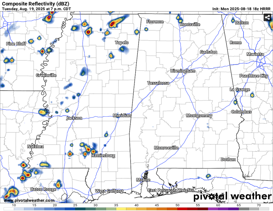
There’s already been several storms that have moved through southeastern Mississippi this afternoon, and there will be more as the evening progresses. These will move from the northeast and rain themselves out by the late evening, so be careful if you’re driving outside, and if you see lightning, head indoors! The heat index is already above 100 across much of the coastal south and the humidity will hang around as we fall into the mid 70s tonight. Tuesday will be another hot one with highs in the upper 90s and heat indices in the low 100s. Storms will likely be a little further west but will still affect much of the Pine Belt and much of central southern Louisiana.
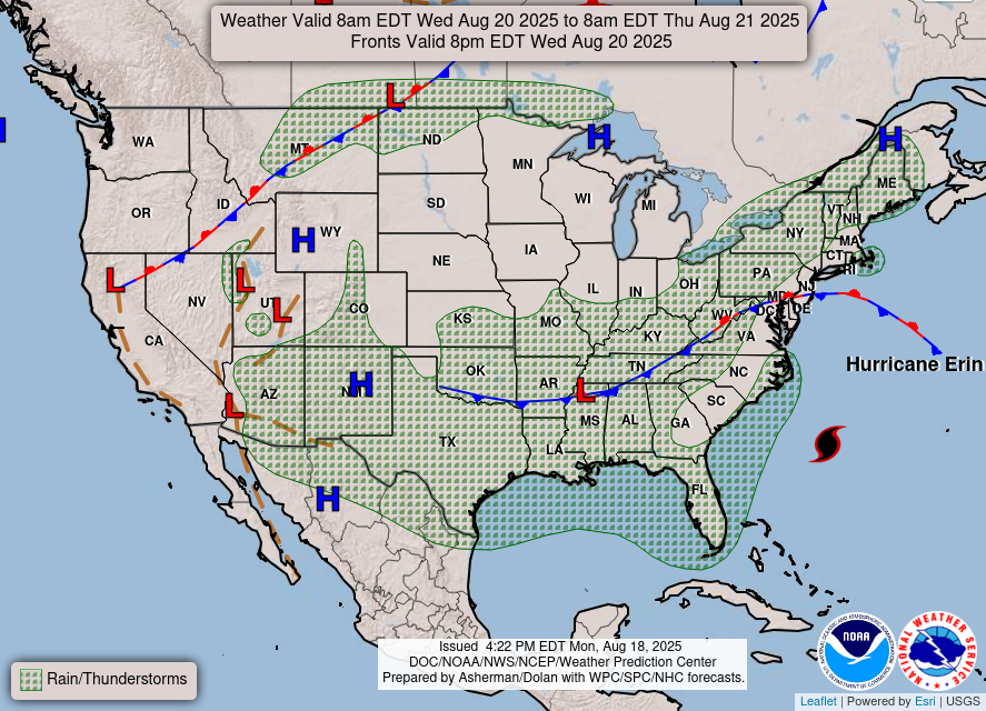
Wednesday is when the rain chances begin to pick up a bit. As you can see with the WPC’s surface forecast to the top left, a stationary front is moving further south while Erin is moving up the north Atlantic. The front will be what we have to deal with. A string of MCS storms and some afternoon pop-up thunderstorms will be our concern from Wednesday to Sunday. Wednesday will be the first taste of it. While we won’t cool down much, we’ll likely see the rain and thunderstorms by the early afternoon with the main line moving in by the late afternoon.
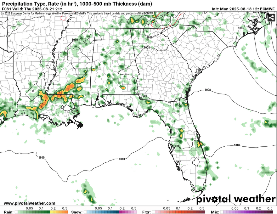
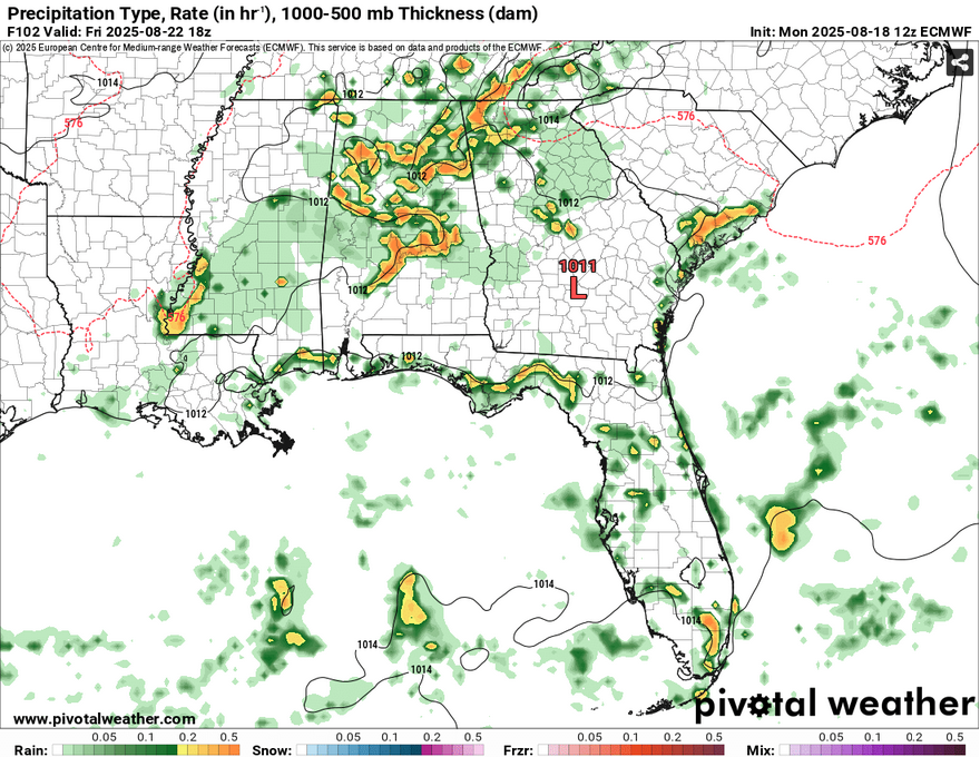
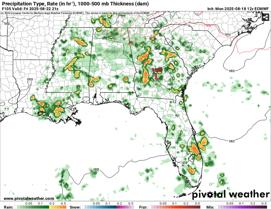
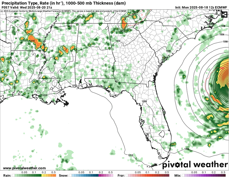
The front moves further towards the Deep South Thursday and Friday increasing the chance of rain. Thursday’s rain chances begin in the early afternoon and hang around to the early evening while Friday has a chance most of the day. Expect thunderstorms, some heavy rain and even a few strong to severe storms. Highs will gradually drop from the mid 90s on Wednesday to the low 90s and possibly even the upper 80s by Friday. Expect more cloud cover by the end of the week as well.
Quick Tropical Outlook
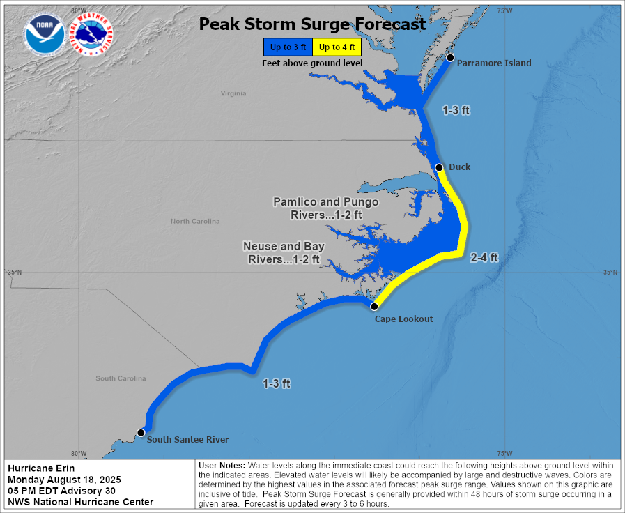
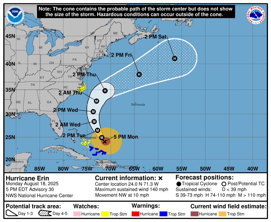
Hurricane Erin has been a monster to say the least. It’s reached Category 5 status already and will continue on with hardly anything to stop it. But, the mostly good news is that it’ll hook right even as it moves up the North Atlantic. Parts of the Bahamas are currently under Tropical Storm watches and warnings as well as the outer banks of North Carolina. Their main concern will be storm surge up to 4 feet in some areas while areas near the hurricane itself may experience up to 40 foot waves!
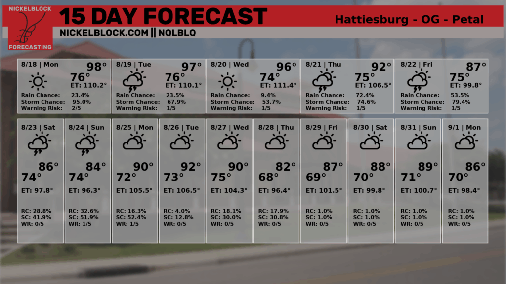
The NQLBOT forecast is running it a little warm for the next few days, but it’s not an understatement to say that it’s going to be hot regardless. Overall, the rain forecast holds and you can see that temperatures may start to take a dive by next week.


