Well, I’m back! Excited to share that I’ll be continuing on with NickelBlock Forecasting as one of Nick’s meteorologists. Looking forward to keeping you all updated with the forecasts!
Overall Setup
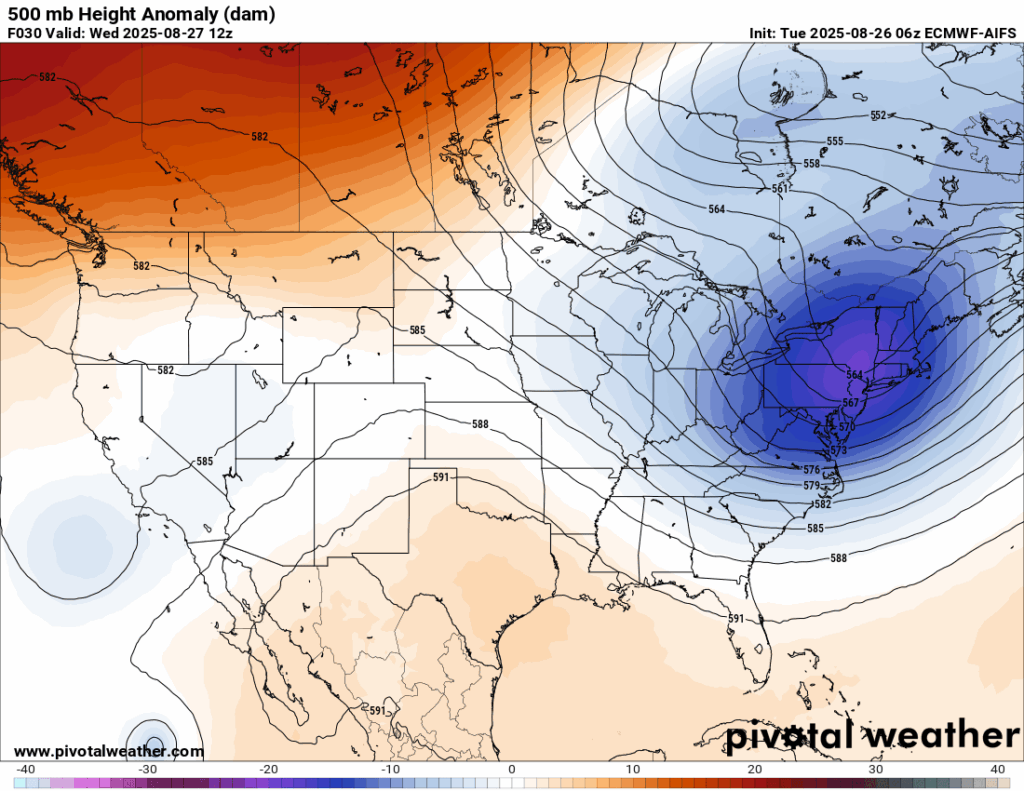
We’ve been seeing cooler weather in the east thanks to a large trough dipping down from Canada. That setup is funneling in fall-like air, keeping temperatures down and humidity much lower. Mississippi sits right on the dividing line between this trough and a ridge to our southwest, so we will see an influence of both airmasses throughout the week. We’ll really see this contrast on Thursday, when persistent rain will bring cooler temperatures in the northern half of the state and the warmer temperatures where only little rain is expected to the south.

Tonight’s Forecast
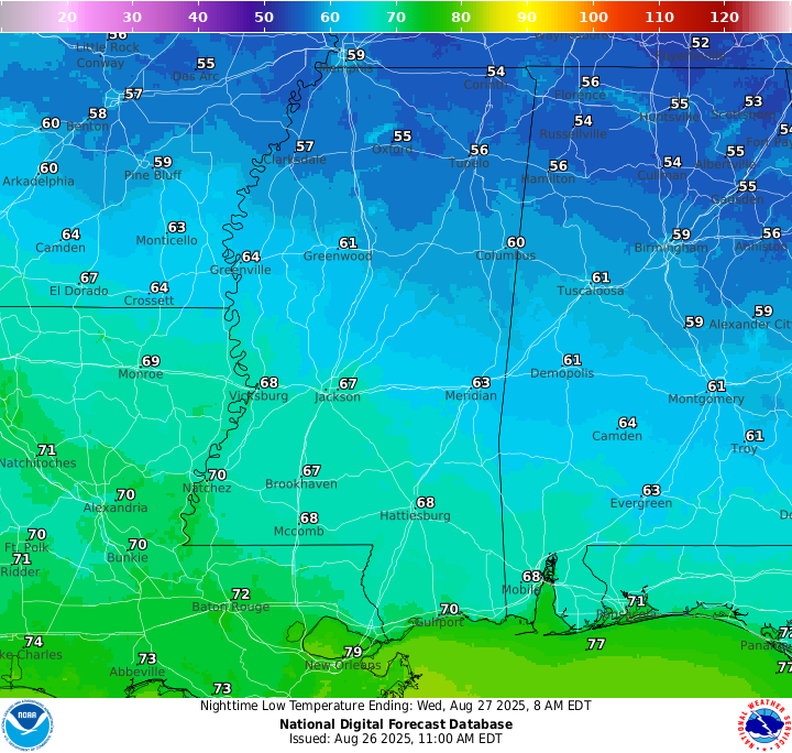
Tonight will be one of the cooler nights we have seen this summer with lows in the high 60s. Those in northern Mississippi will see lows in the 50s! Expect clear conditions to come with the “chilly” temperatures.
Tomorrow’s Forecast
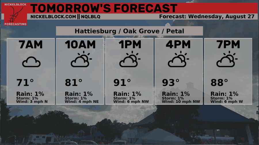
Tomorrow is looking overall dry with a mix of sun an clouds throughout the day. There’s a slight chance of a passing shower, but the chances are low and any shower would be very isolated. Temperatures will be sitting in the high 80s for us but, as usual in the summer, will feel upward of 100 degrees during peak afternoon hours. Stay hydrated and enjoy the nice day!
Thursday’s Forecast
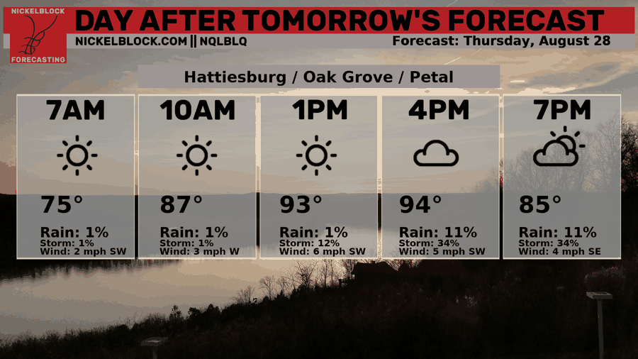
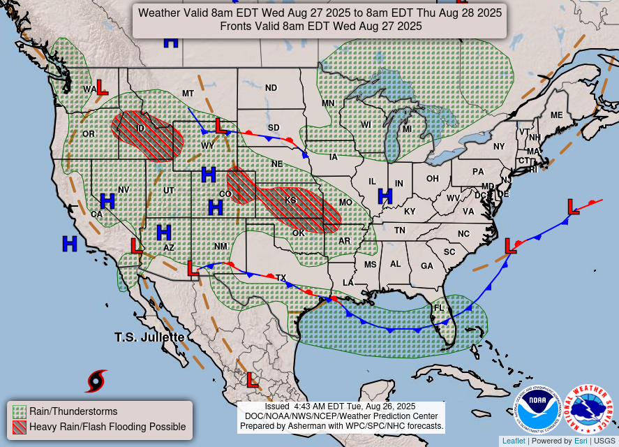
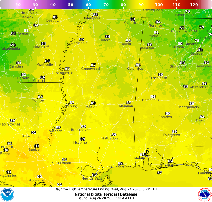
Thursday’s forecast is fairly interesting. There’s a low pressure system that will move from Texas which brings with it a warm front. Northern Mississippi could see a good deal of rain as the front lifts through the region. Thunderstorms will be capable of producing very heavy downpours, and some spots could pick up several inches of rain in a short amount of time. Because of this, the WPC has placed the area under a Slight Risk for flash flooding. The greatest concern will be for low-lying and flood-prone areas if storms repeatedly move over the same spots. Southern MS/AL/LA will mostly be in the clear from most of the rain, but some of it could move a little more south by the evening hours.
You could really see where most of the rain will end up by looking at the high temperature forecast. The state is essentially cut in half with the southern half seeing highs in the lower 90s and the northern half seeing highs in the 70s and 80s! Temperatures tend to cool down when it is raining, so that is what is causing this contrast!
Extended Local Outlook
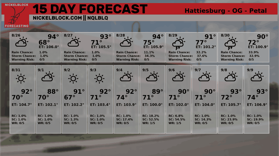
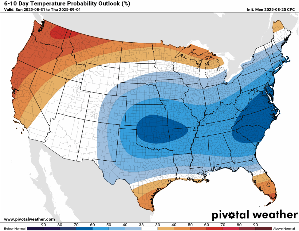
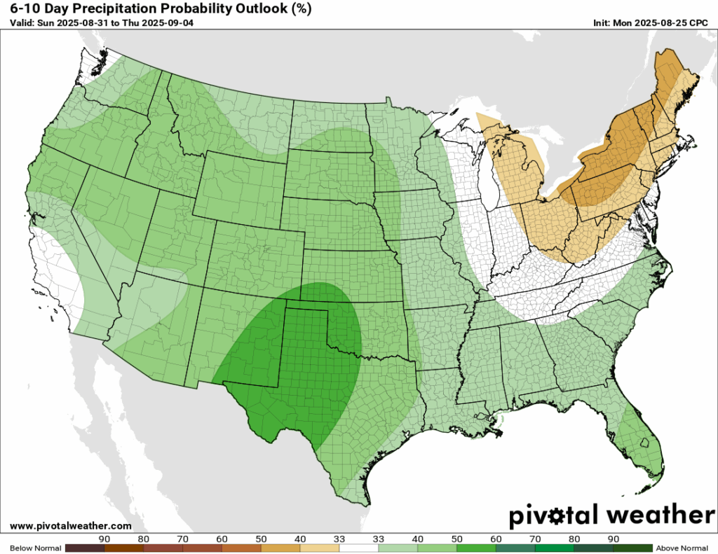
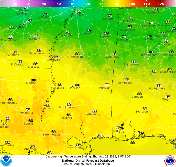
More of that troughing pattern is expected to stick around through the weekend into next week, bringing up the chances for below normal temperatures for our region. Don’t get me wrong, it’s still going to be hot, but maybe a few degrees below the normal. We are looking around average for our rainfall, with a small chance at above normal rainfall for this time period due to the increased troughing.
Latest Tropical Update
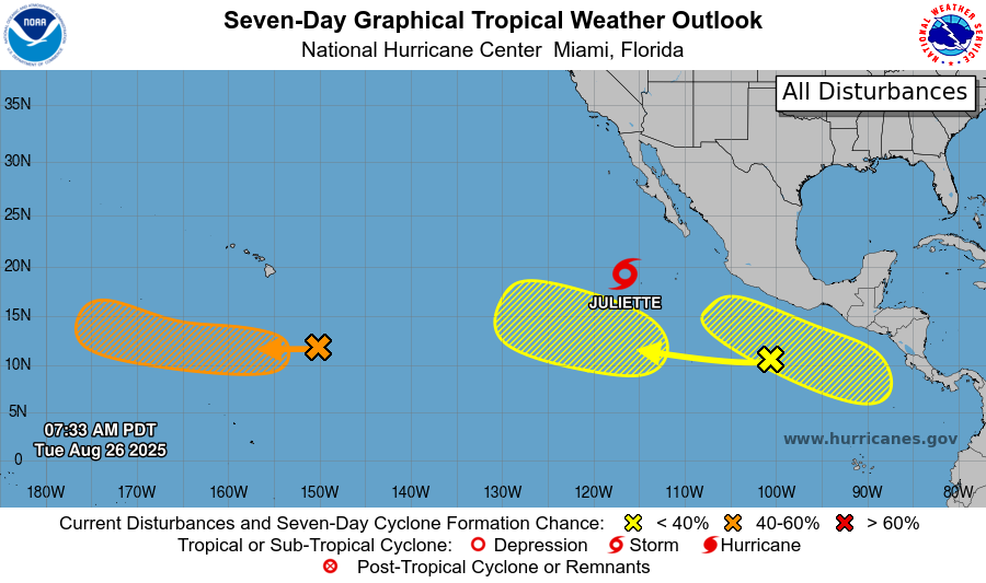
Eastern/Central Pacific:
Tropical Storm Juliette is moving to the northwest in the East Pacific and will dissipate by Friday, affecting no one. There are two areas to watch with low chances of development in the same general area as Juliette, but those should move out to sea if they do develop. South of Hawaii, there is an area to watch with a medium chance at development, and like the others, will move out into the open waters, only affecting the fishies!
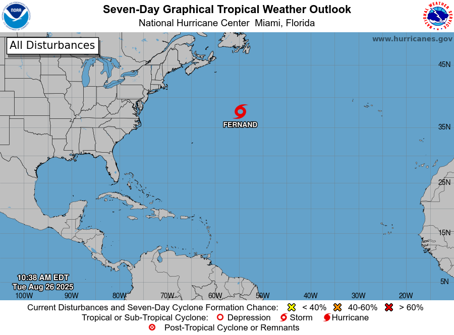
Atlantic:
The Atlantic is looking quiet in terms of any areas of concern in the next week or so. Tropical Storm Fernand is moving off to the northeast and will continue to be a fish storm!
Want the latest details on these systems? Check out our daily tropical updates for more in-depth information on the tropics!
REGIONAL DAY TO DAY FORECAST
Tonight: Mostly clear. Lows in the upper 60s. North northeast wind around 5 mph becoming calm in the evening.
Wednesday: Sunny. An isolated shower or two is possible. Highs in the upper 80s. East northeast wind around 5 mph. Chance of rain 10 percent.
Wednesday Night: Mostly clear. Lows in the mid 60s. Calm wind.
Thursday: Mostly cloudy. Highs in the lower 90s. Periodic heavy rain in northern MS, with spotty showers in the southern areas. Calm wind becoming west around 5 mph in the afternoon. Chance of rain 60 percent.
Thursday Night: Partly cloudy. A slight chance of showers and thunderstorms in the evening, then a chance of showers after 10pm. Lows in the upper 60s. Southeast wind around 5 mph becoming calm. Chance of rain 30 percent.
Friday: Partly sunny. Showers and thunderstorms likely, mainly after 1pm. Highs in the mid 80s. Calm wind becoming north northeast around 5 mph. Chance of rain 60 percent.
Friday Night: Mostly cloudy. A chance of showers and thunderstorms. Lows in the upper 60s. Northeast wind around 5 mph becoming calm in the evening. Chance of rain 40 percent.
Saturday: Partly sunny. A slight chance of showers in the morning, then a chance of showers and thunderstorms after 1pm. Highs in the mid 80s. North northeast wind around 5 mph. Chance of rain 40 percent.
Saturday Night: Partly cloudy. Lows in the upper 60s.
Sunday: Partly sunny. A 30 percent chance of showers and thunderstorms. Highs in the mid 80s.
Sunday Night: Partly cloudy. Lows in the upper 60s.
Labor Day: Mostly sunny. A 30 percent chance of showers and thunderstorms. Highs in the upper 80s.


