It’s been a rainy past 24 hours across the Deep South and it looks like it’s just about over. The slow-moving front is almost at the coastline, but as slow as it’s moving, it’ll still leave us with some lingering showers and storms. As we head into next week, another stationary front from the central Rockies will descend and bring another chance of rain into the middle of next week, but afterwards we’ll have a few dry and not as hot days ahead.
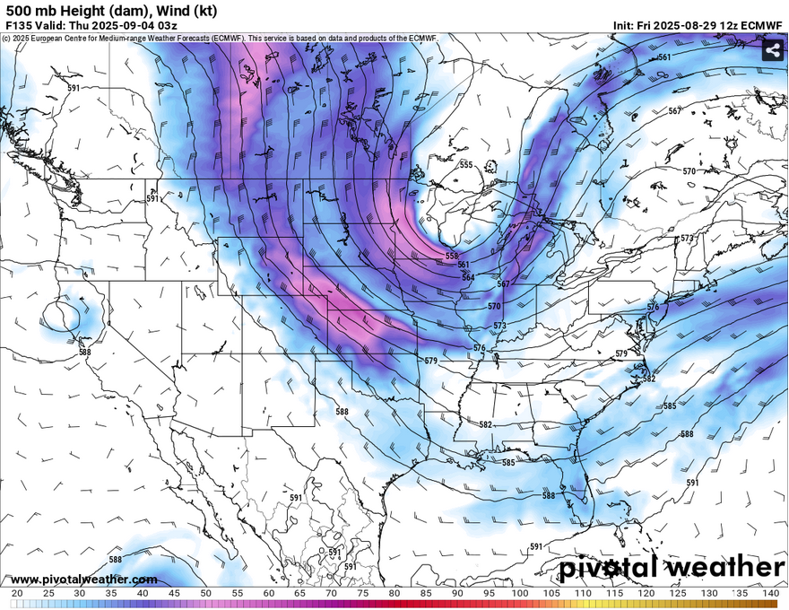
The upper levels are currently churning a bit and developing more prominent shortwave troughs and ridges across the US and Canada. The weekend and early part of the week are dominated by a large ridge over the southwestern US and troughing into the central and eastern US. The trough will begin to dissipate and a Pacific Northwest ridge will allow for more meridional flow (north to south). A large shortwave trough will move in across the Great Lakes and move east. What this means is that the heat dome is pretty much gone, but now we’ll have more frequent fronts moving in soon.

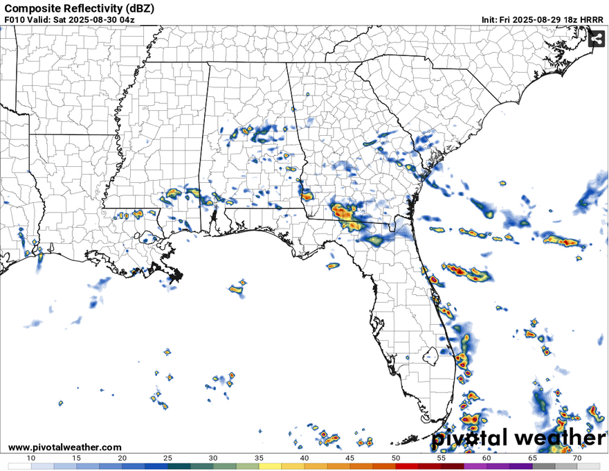
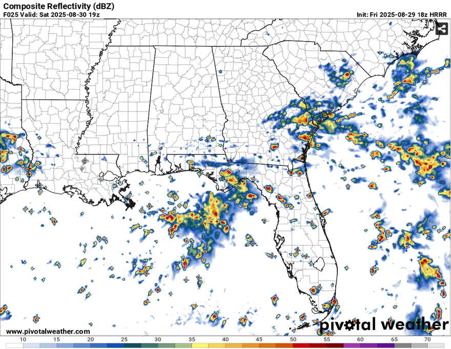
Tonight, expect more cloudy skies and a few storms across the Pine Belt and the coast. Most of these should develop before midnight and hang around until the early morning. We’ll have a slight break before a few isolated thunderstorms around the afternoon hours. Otherwise, clouds will begin to wane and we’ll see the sun by the afternoon. Lows will fall around 70 overnight and we’ll see highs in the mid 80s which will be very welcome! Sunday will be a similar story with an isolated thunderstorm or two, but more than likely partly cloudy skies and highs in the mid 80s.
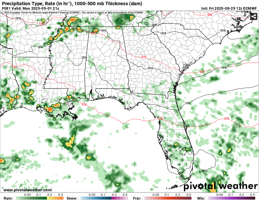
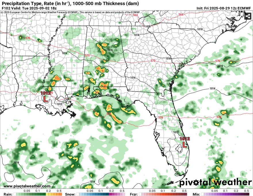
As the front begins to dissolve, Labor Day will be a warm one with some thunderstorms possible around the coast and southern parts of Louisiana. These will likely hit around the mid afternoon and rain themselves out. As we roll into Tuesday, the front I mentioned earlier from the Rockies will move in bringing another chance of scattered storms across much of the tri-state area starting in the early morning to afternoon hours.
Wednesday and Thursday will be a little more pleasant as the cold front moves past us and we get a couple of dry days. It’ll be a little warmer as temperatures will climb into the upper 80s, but we’ll have some cooler nights ahead as lows fall into the low to mid 60s. Hooray!
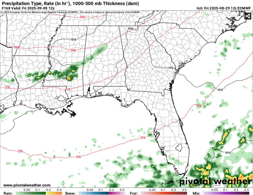
Remember that big trough I mentioned earlier? Well, just branching off of it is a small MCS that will roll into the Deep South by Friday. This doesn’t look to be severe and just a tail of that system. Expect a small line of showers and thunderstorms Friday and a fairly dry and warm weekend afterwards.
Tropical Outlook and Hurricane Katrina
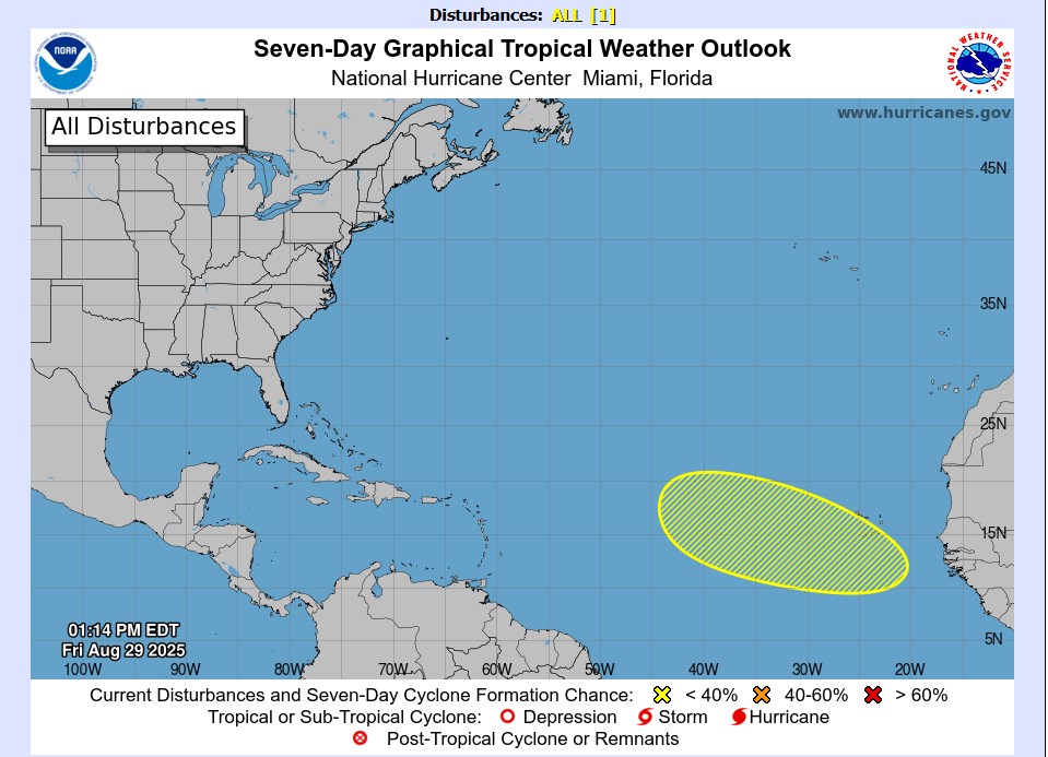
So far, the National Hurricane Center has an eye on a tropical wave that’s developed south of the Cape Verde Islands. So far, it’s a pretty broad wave, but has a low chance of developing into something more. It’s something to keep an eye on. Even though we’re moving into a season of more mid-latitude systems moving out to sea, hurricane season is currently at its peak, and we’ll have to keep close watch on many of the tropical systems that move in for the next few months.
It’s also the 20th anniversary of Hurricane Katrina and its effects on Louisiana and Mississippi. As a 10 year old kid who just moved to Mississippi 8 months before Katrina hit, I’ll never forget how powerful it was. Even 60 miles inland, there were so many snapped trees, destroyed houses, and power outages that lasted for a couple of weeks. I remember going between my house and my Grandma’s, just listening to the winds howl and the rain beat on my face.
That’s nothing compared to those who lost their lives, homes, and businesses, however. There was a lot to process and a lot of loss. Many places never recovered, a lot of people never saw their loved ones again, and for that, we continue to remember.
Regional Day-to-Day Forecast
This Afternoon – Showers and thunderstorms possible. Mostly cloudy, with a steady temperature in the mid 70s. South southwest wind around 5 mph. Chance of precipitation is 70%. New rainfall amounts between a tenth and quarter of an inch, except higher amounts possible in thunderstorms.
Tonight – Showers and thunderstorms possible into the overnight hours. Patchy fog after 11pm. Low around 70. Calm wind. Chance of precipitation is 80%. New rainfall amounts between a quarter and half of an inch possible.
Saturday – Scattered showers, with thunderstorms also possible in the morning and afternoon. Partly sunny, with a high in the mid 80s. Calm wind becoming northeast around 5 mph in the morning. Chance of precipitation is 40%.
Saturday Night – Isolated showers and thunderstorms before sunset. Partly cloudy, with a low in the upper 60s. Northeast wind around 5 mph becoming calm. Chance of precipitation is 10%.
Sunday – Isolated showers possible in the afternoon. Partly sunny, with a high in the mid 80s. Northeast wind around 5 mph. Chance of precipitation is 20%.
Sunday Night – Isolated thunderstorms before sunset. Mostly cloudy, with a low in the upper 60s. Northeast wind around 5 mph becoming calm in the evening. Chance of precipitation is 10%.
Labor Day – Scattered showers and thunderstorms possible in the afternoon. Partly sunny, with a high in the mid 80s. Calm wind becoming east around 5 mph in the morning. Chance of precipitation is 30%.
Monday Night – Isolated showers and thunderstorms before midnight. Partly cloudy, with a low in the mid 60s. East wind around 5 mph becoming calm. Chance of precipitation is 20%.
Tuesday – Scattered showers and thunderstorms in the afternoon. Mostly sunny, with a high in the upper 80s. Calm wind becoming east southeast around 5 mph in the afternoon. Chance of precipitation is 40%.
Tuesday Night – Scattered showers and thunderstorms before midnight. Patchy fog between 2am and 3am. Otherwise, partly cloudy, with a low in the mid 60s. Chance of precipitation is 30%.
Wednesday – Isolated showers and thunderstorms. Sunny, with a high in the upper 80s. Chance of precipitation is 20%.
Wednesday Night – Mostly clear, with a low in the mid 60s.
Thursday – Sunny, with a high in the upper 80s.


