Overall Setup
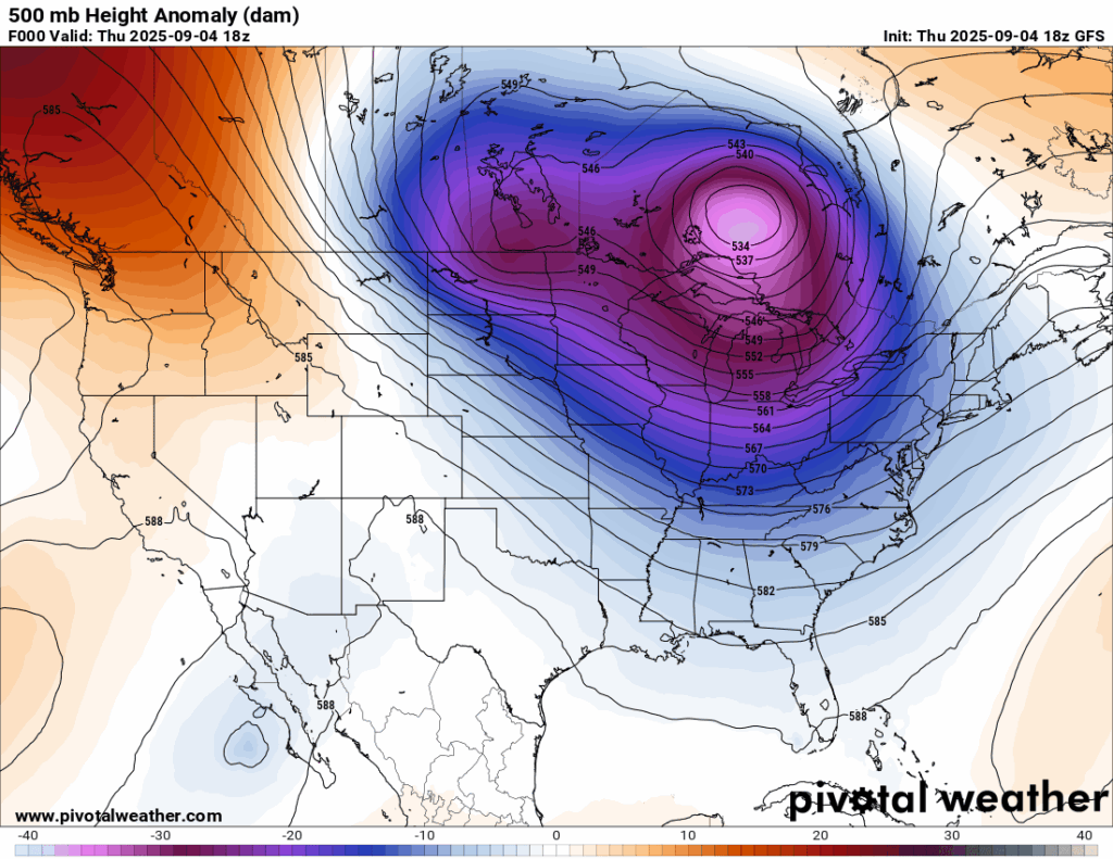

Look at that pink shading! That represents a deep trough bringing heavy rain to areas in its path, tied to a low pressure system and its cold front. It’s also delivering much cooler than average temperatures across the Midwest and Northeast. In our region, though, we’re not under its influence, so temperatures are holding near average. The trough isn’t dipping as far south as earlier expected, which explains why we missed out on the major cooldown here.
The National Forecast Chart shows us in a general Rain/Thunderstorm risk for today, but not much is expected, as I will get into below.

Tonight’s Forecast
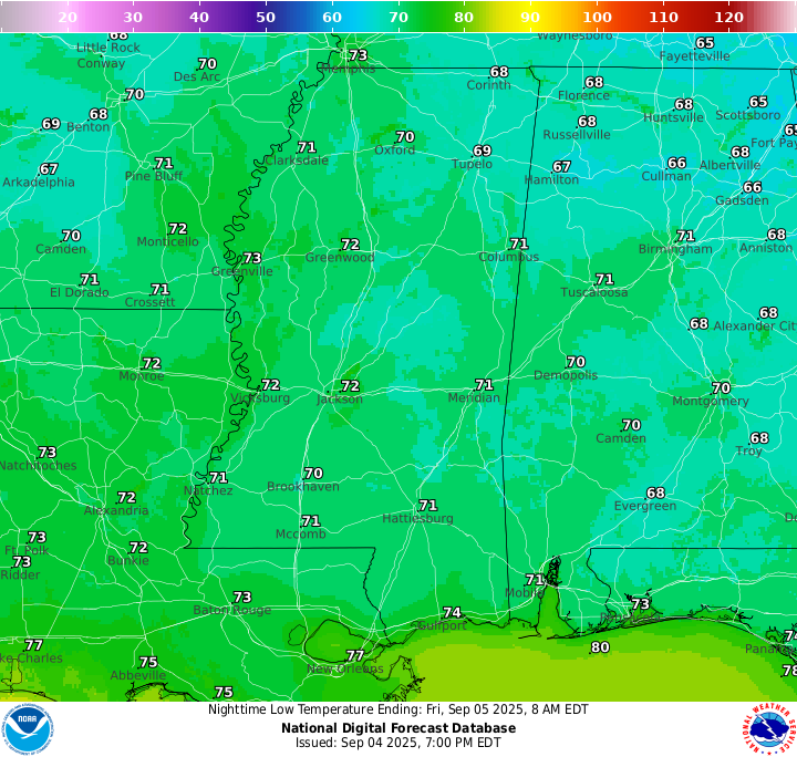
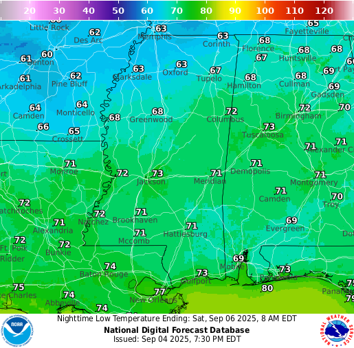
Tonight, you can expect temperatures to drop into the lower 70s and a mainly clear sky. A beautiful night if you ask me!
Tomorrow’s Forecast
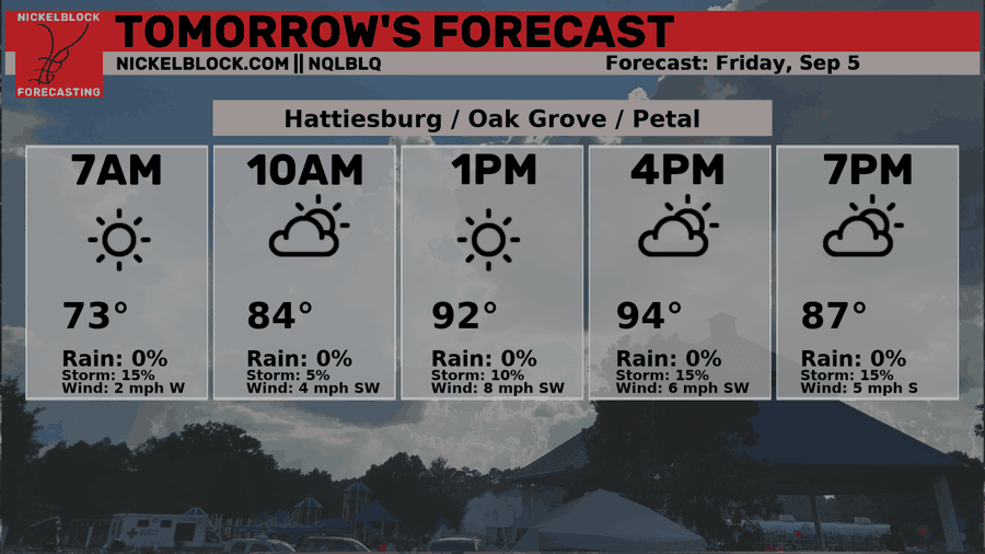
Tomorrow, temperatures will rise back into the mid 90s again, with most areas seeing around 95 for their high. Some areas of patchy fog will burn away after sunrise and will lead to a nice day with mainly sunny skies. A few very isolated thunderstorms are possible after 4pm, but it’s not looking widespread at all. Enjoy the start of the weekend!
Saturday’s Forecast
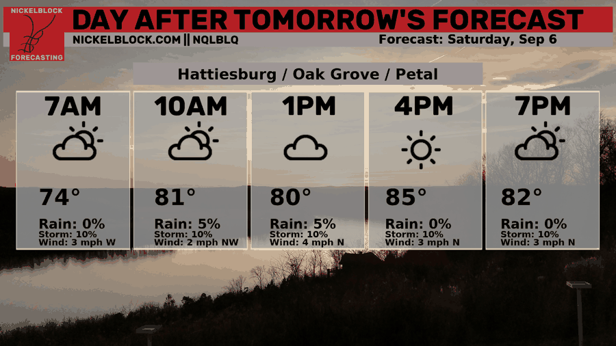
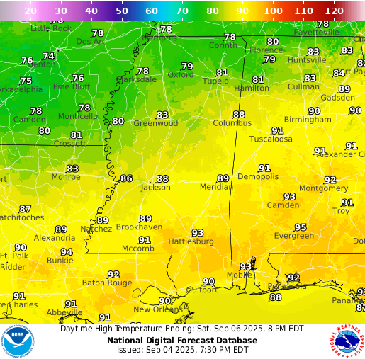
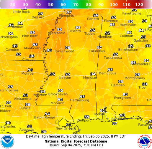
As a cold front approaches on Saturday, temperatures differ in the southern parts of our region from the northern parts. You can see that high temperatures in northern Mississippi and Louisiana sit in the high 70s, while the southern half sits in the high 80s and low 90s. The front could bring some rain, with models bringing a few rounds of showers and potentially thunderstorms in the overnight on Friday into Saturday morning. The general idea is a clear rest of Saturday, but a few lingering showers are not completely out of the question.
Extended Local Outlook
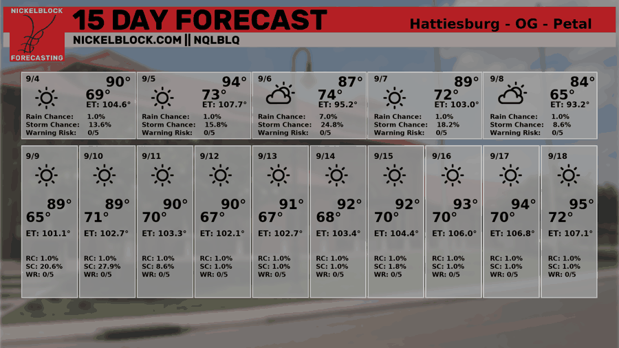
Hot and dry look to be the main story for the next 6-10 days because of a pattern shift from the troughing we’ve been seeing to a nice ridge of high pressure. During this time, temperatures will feel summerlike, back into the mid 90s and less frequent afternoon thunderstorms. Look at all that sun on the 15 Day forecast!

Latest Tropical Update
Atlantic:
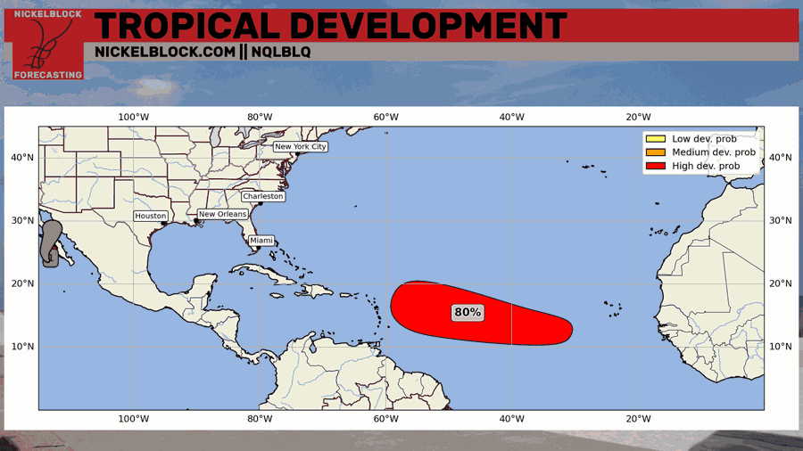
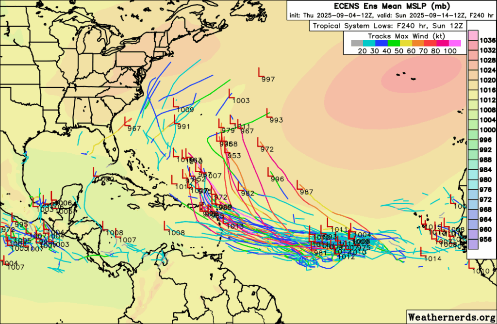
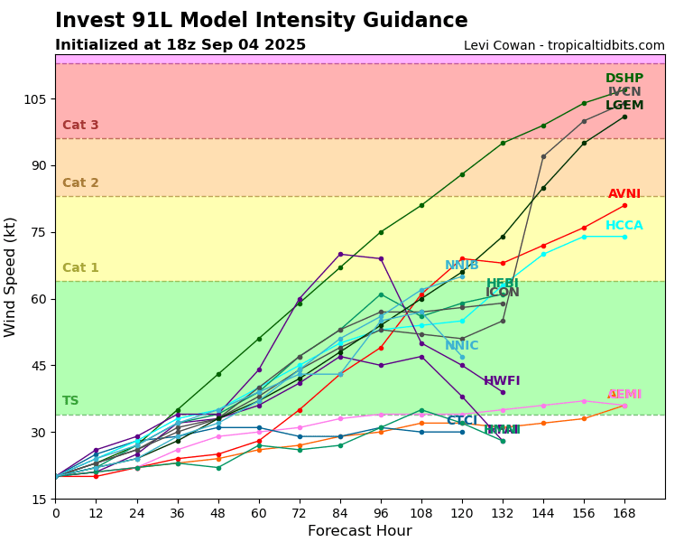
Chances of development for very likely to be Gabrielle have gone up to now 90 percent in the next 7 days. It has been recently named Invest 91L as the models start to get a better look at the disturbance and throw out their spaghetti models. The models have been trending more south the past few days, which usually means a weaker storm, but also means a track towards the Carribean and potentially the United States. There are still a bunch of the models bringing Gabrielle out to sea, so it’s not definitely a threat to the US.
It’s nothing to worry about right now, but something to keep an eye on as we get closer. Timing is still looking to be the end of next week by the time it makes its way across the Atlantic. Models are fairly confident that this could intensify to a Tropical Depression or Tropical Storm by this weekend and become potentially a Major Hurricane a few days after.
Eastern/Central Pacific:
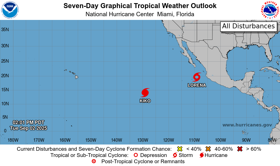
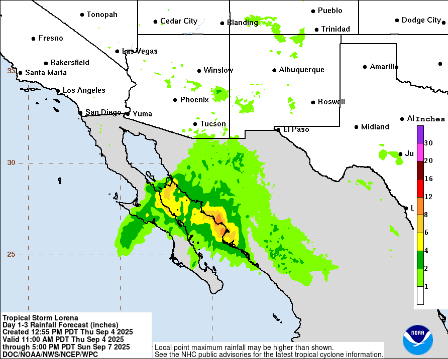
Convection has completely fallen apart from the center low pressure for Tropical Storm Lorena, due to lots of hostile wind shear and cool ocean temperatures shutting down the power, essentially, to the storm. The forecast is still for up to a foot of rain to fall in western Mexico when things are all set and done, which is bringing a high risk of flash flooding and even mudslides in those mountainous areas. Moisture from Lorena will move into Arizona and New Mexico and cause the threat of flash flooding there as well.
REGIONAL DAY TO DAY FORECAST
Tonight: Mostly clear with lows in the low 70s. South winds around 5 mph, becoming calm after midnight.
Friday: Patchy fog early. Otherwise, sunny and hot with highs in the mid 90s. Chance of a popup afternoon thunderstorm. Winds light, becoming south near 5 mph in the afternoon. Chance of rain 20 percent.
Friday Night: Patchy fog late. Otherwise mostly cloudy with lows in the low 70s. South winds around 5 mph, becoming calm overnight.
Saturday: Mostly sunny with a slight chance of showers or thunderstorms in the afternoon. Patchy fog early. Highs in the low 90s. Winds light, becoming north around 5 mph in the afternoon. Chance of rain 20 percent.
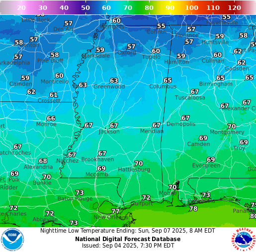
Saturday Night: Partly cloudy with lows near 70. North northeast winds around 5 mph, becoming calm.
Sunday: Mostly sunny with highs in the upper 80s. North northeast winds 5 to 10 mph.
Sunday Night: Partly cloudy with lows in the mid 60s. North northeast winds around 5 mph.
Monday: Sunny with highs in the upper 80s. North northeast winds near 10 mph.
Monday Night: Mostly clear with lows in the low 60s. North northeast winds around 5 mph.
Tuesday: Sunny with highs near 90.
Tuesday Night: Mostly clear with lows in the mid 60s.
Wednesday: Sunny with highs in the upper 80s.
Wednesday Night: Mostly clear with lows in the mid 60s.
Thursday: Sunny with highs near 90.


